ncjoaquin
-
Posts
1,468 -
Joined
-
Last visited
Content Type
Profiles
Blogs
Forums
American Weather
Media Demo
Store
Gallery
Everything posted by ncjoaquin
-
Still 92.3 here at 6:21.

-
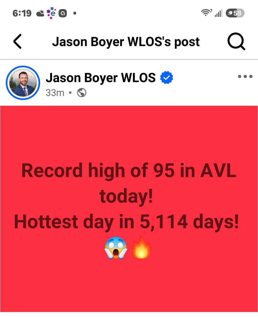
97.3 freaking degrees so far at my house today! Stupid hot.
-
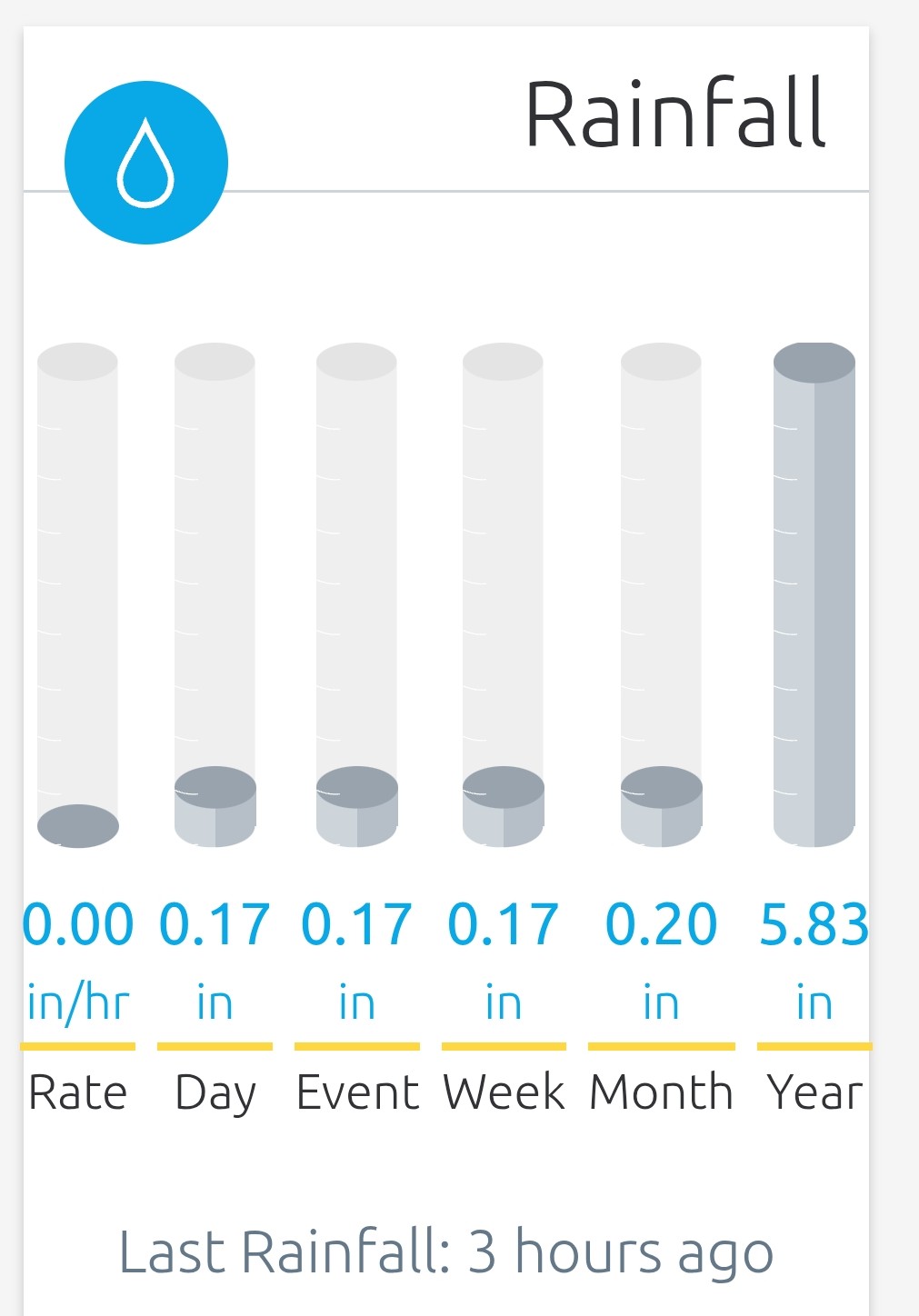
A surprising .56 here today! Very welcome.
-
.09 inches of rain total. .95 month to date. It's a struggle to get rain here right now.
-
.39 here, but better than nothing. It is a beautiful day out there today! Glad that you guys cashed in.
-
Nice! I am glad that it rained anywhere. We all need it. Boyer showed it hammering in South Buncombe too.
-
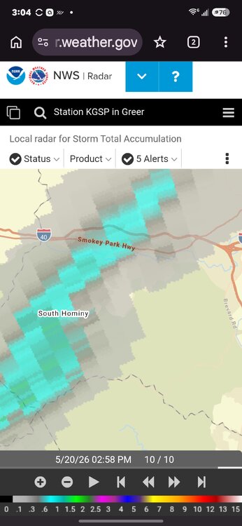
I thought I would get nailed by Met's storm, based on the radar. It just skipped right over. Not even a drop! I heard plenty of thunder after it went by.
-
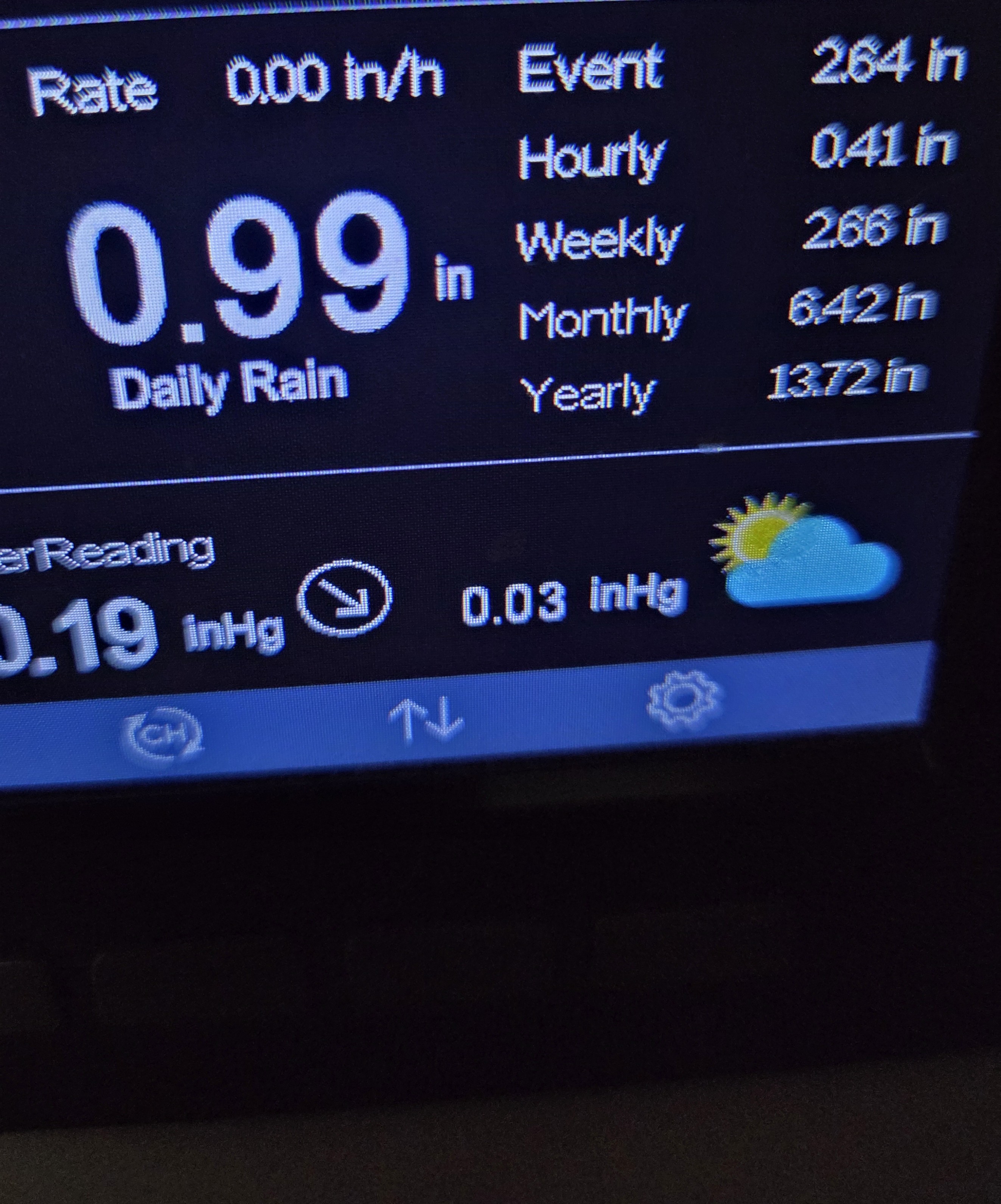
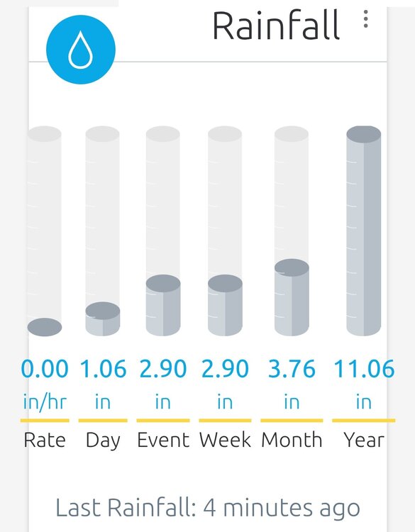
Not Rainforest level, but still a ton of rain! An inch today.. so far. 6.42 inches for the month.. so far.

-
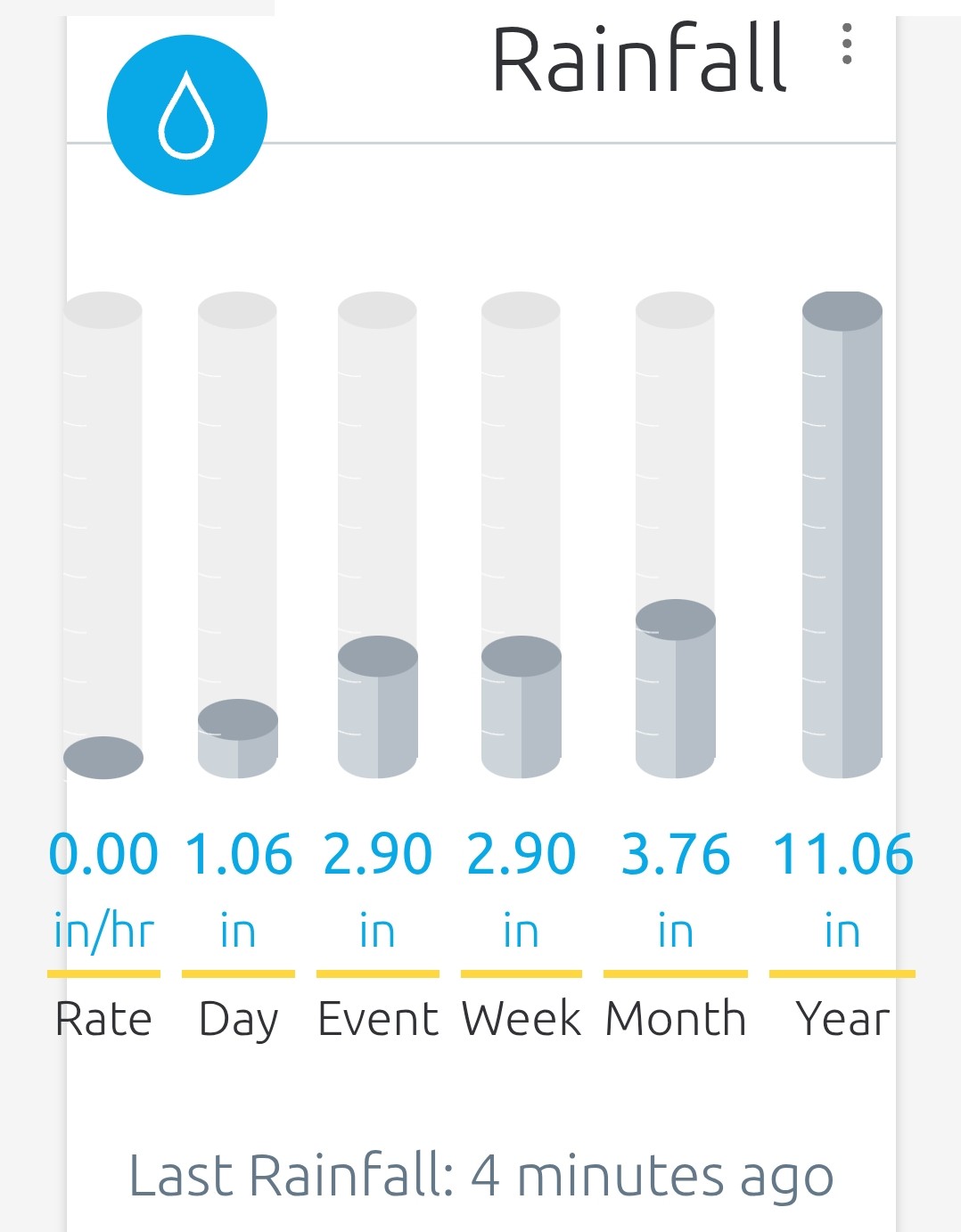
Almost made it to 3 inches for the 3 days. Just need a tenth more. Amazing how much rain there has been after being so dry for so long.
-
Over 2 inches now for the total, and still raining.
-
Another .75 inch here. 1.5 for the last 2 days. I have been in a good spot. I am sure that I will move out of the good spot eventually.
-
.63 so far today. .75 in 2 days. Great start!!!
-
Scratch that. Raining now for the 1st time in 13 days!!!!!! Hallelujah!
-
Plenty of thunder and lightning. No rain, though. Not even a drop. Just barely west of me. Looks like at least an inch on the radar estimate.
-
34.3 this morning. Crazy for May 15th. Not unheard of, but still crazy.
-
.86 inches of rain here. Not as much as forecasted, but still appreciated.
-
NWS looks good.
-
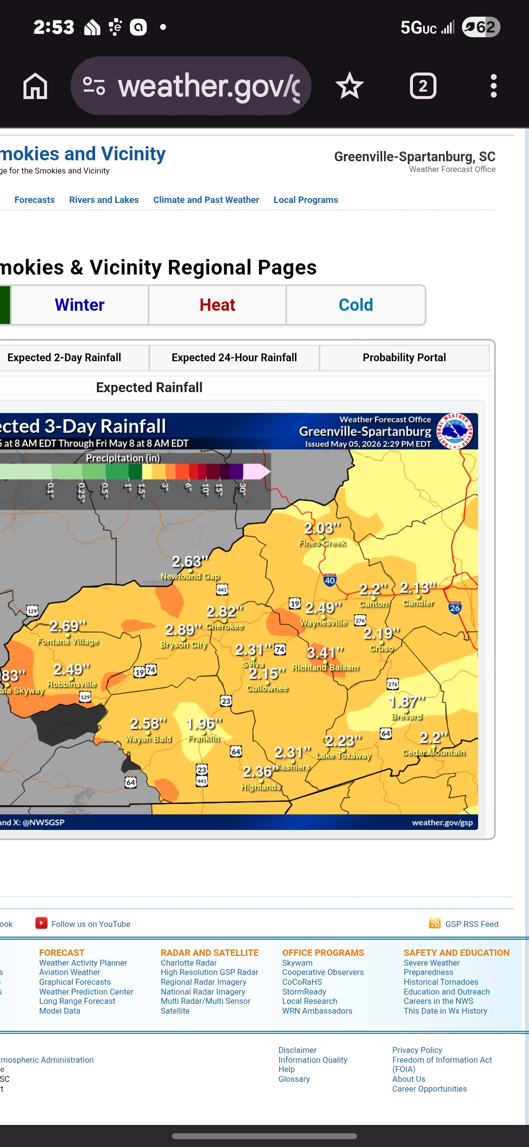
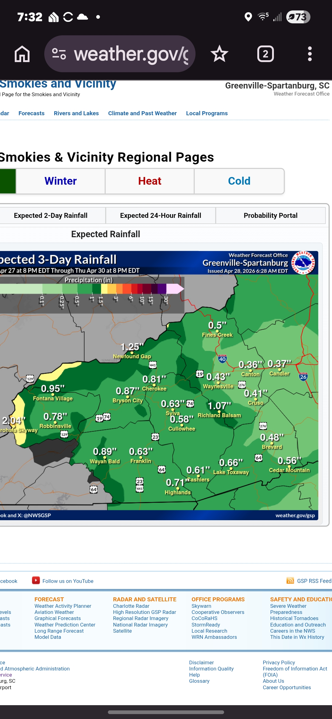
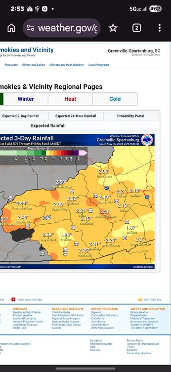
GSP forecast from this morning through Thursday evening below. .37 for all 3 days. My ACTUAL rain just this morning only and just so far: .82 I love me some over performing!
-
January '98 had a 16 inch snowstorm at my house. It was warm before and after though. https://products.climate.ncsu.edu/weather/winter/event/?e=196
-
Me too! I had to look it up. I had no idea.
-
Wetter in the winter. Drier in the summer. ". For much of the southeastern United States during the summer of an El Niño event, the climate is usually warmer and drier. " https://climate.ncsu.edu/learn/the-el-nino-southern-oscillation/
-
He did! There was another recent guy who is on Weather Nation. His name escapes me.
-
I definitely remember it. One of my favorite snowstorms ever!
-
I was living in Boone at the time. It was epic. It didn't matter that it was April. Here is write up from Gary Stepenson, who worked at WLOS. https://spectrumlocalnews.com/nc/charlotte/weather/2022/03/17/the-surprise-snow-storm-of-april-1987
-
Rainforest almost matched my yearly amount in one event.