forkyfork
-
Posts
30,704 -
Joined
-
Last visited
Content Type
Profiles
Blogs
Forums
American Weather
Media Demo
Store
Gallery
Everything posted by forkyfork
-

Extended summer stormlover74 future snow hole banter thread 23
forkyfork replied to BxEngine's topic in New York City Metro
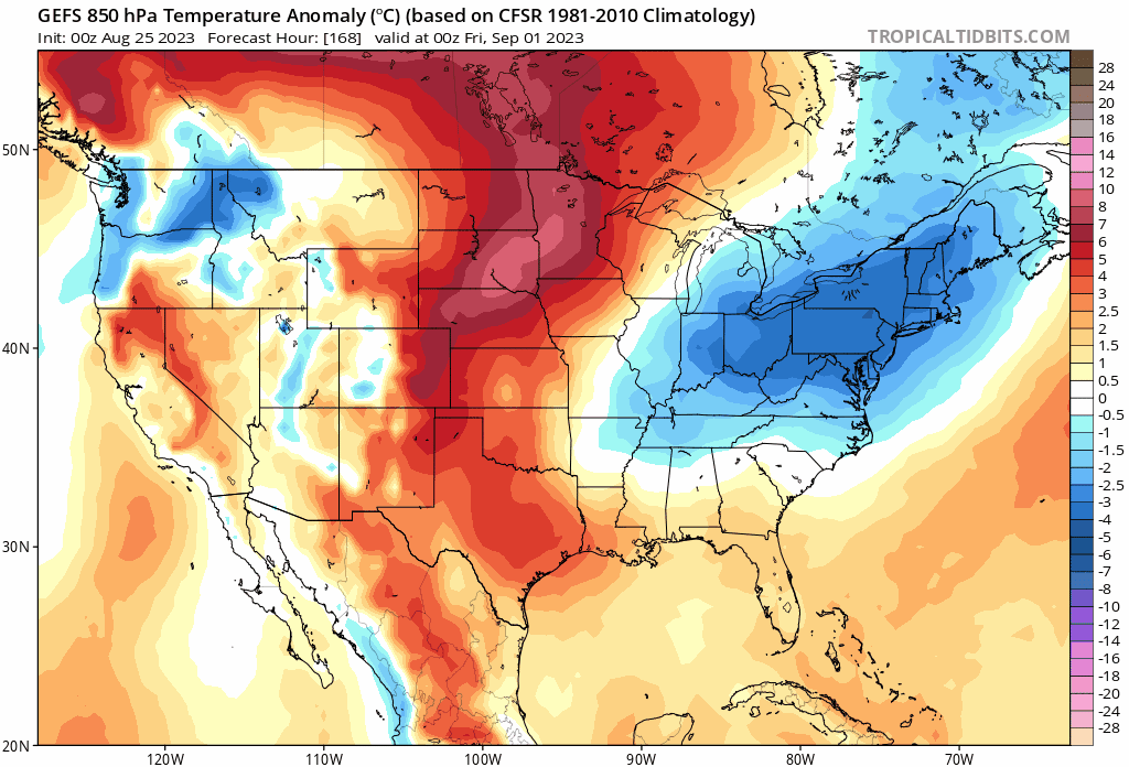
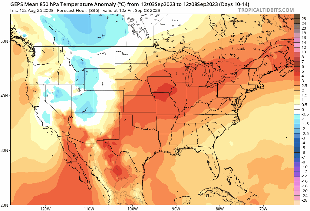
it's funny how I post 5 day ensemble means showing extreme warmth across more than half the country and people interpret it as one day of 90 -
it's in a bigger area of lower pressure
-
brrr
-
canadian ensemble trending in that direction

-
this is pretty nuts for an ensemble mean
-
Extended summer stormlover74 future snow hole banter thread 23
forkyfork replied to BxEngine's topic in New York City Metro
let's get a floyd, irene, henri, and ida in the same month -
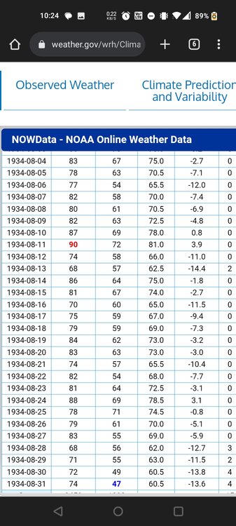
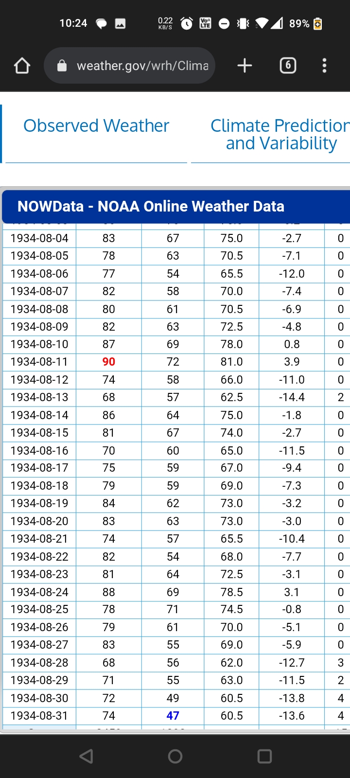
13 lows below 60 that month. ewr has yet to have one so far
-
this is what a cold august looks like
-
Extended summer stormlover74 future snow hole banter thread 23
forkyfork replied to BxEngine's topic in New York City Metro
it's fun when you get a juicy one -
against inflated 1991-2020 normals
-
80s with high dewpoints and lows in the 70s. brrrr
-
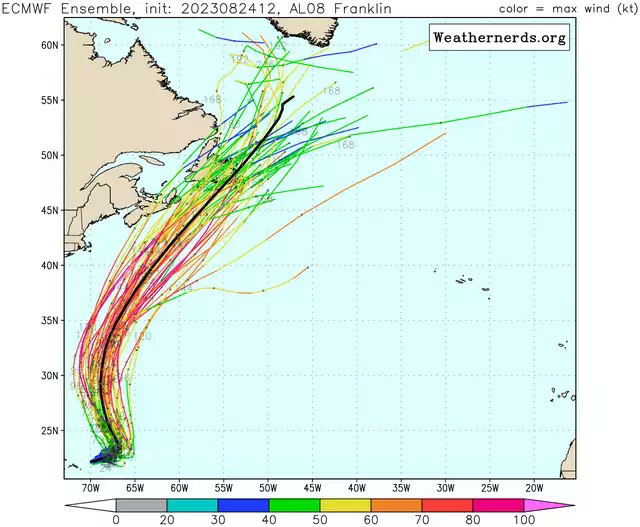
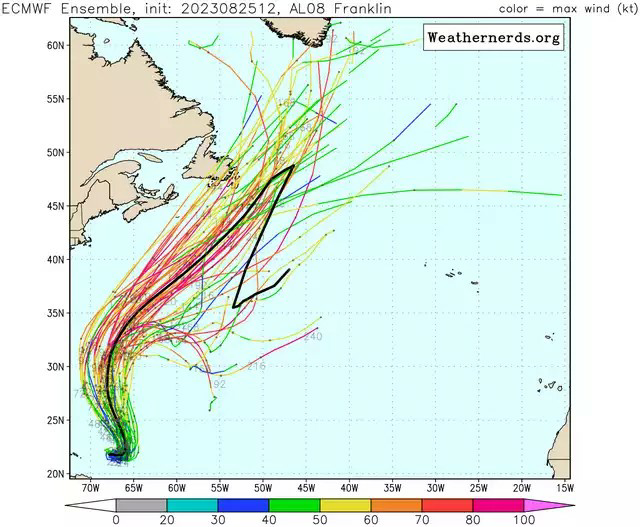
franklin helps reinforce the +nao
-
there's always a huge blue blob over the himalayas too
-
oops i guess summer isn't over

-
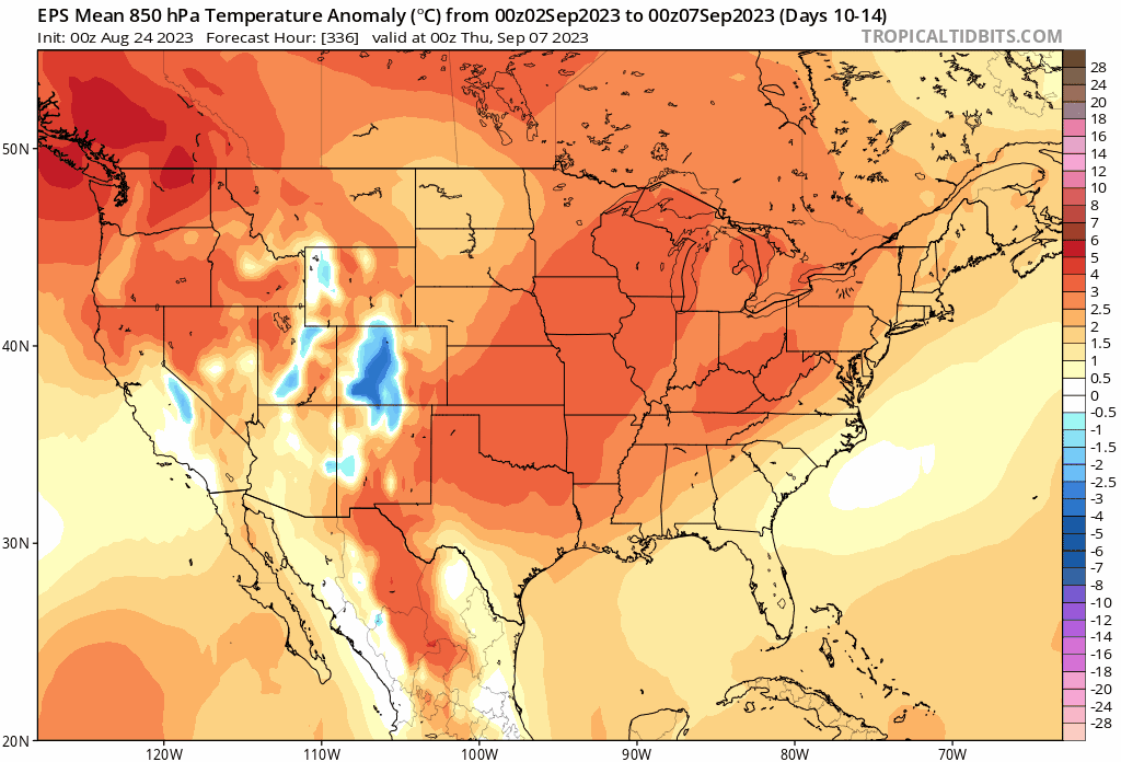
every ensemble mean has that pattern and they all trended warmer. cope
-
the trend is your friend

-
franklin's later, less intense phasing is probably contributing to less troughing
-
Extended summer stormlover74 future snow hole banter thread 23
forkyfork replied to BxEngine's topic in New York City Metro
amwx in 2035: this is the coolest summer since 2023 -
womp womp
.thumb.gif.ce3b58947774a092adbb9afa5c5926cb.gif)
-
growing signal
-
you mean a lot better
-
was away for a few days so i hadn't been checking the models. nice!
-
another delayed fall
-
dodging a bullet

-
you all need to stop caring about snow


.gif.3a21d386b15f30b3697c3dcb6448ad81.gif)