

kayman
-
Posts
544 -
Joined
-
Last visited
Content Type
Profiles
Blogs
Forums
American Weather
Media Demo
Store
Gallery
Posts posted by kayman
-
-
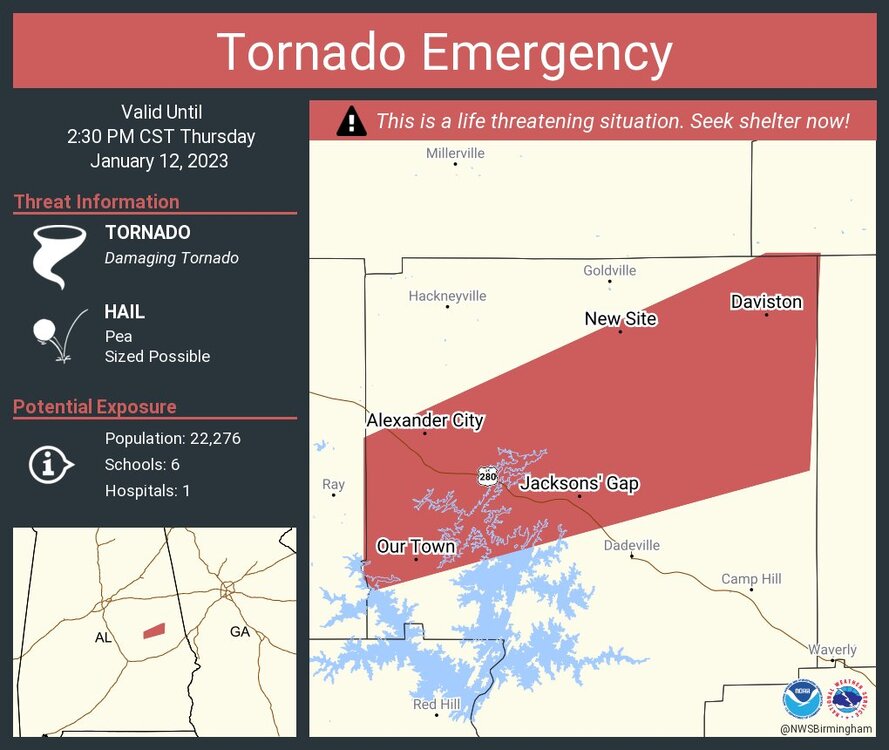
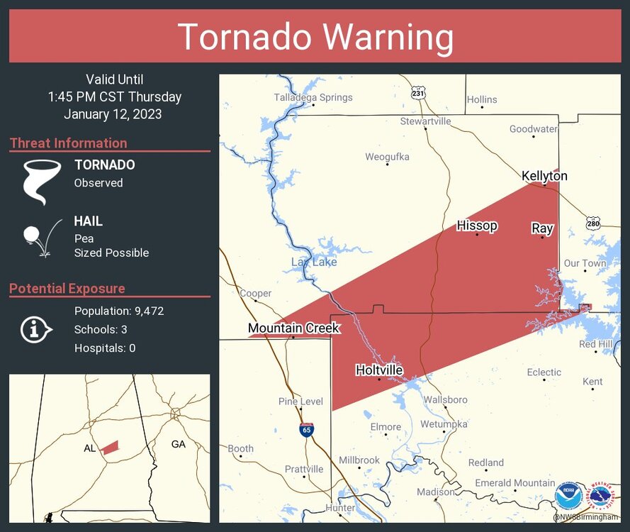
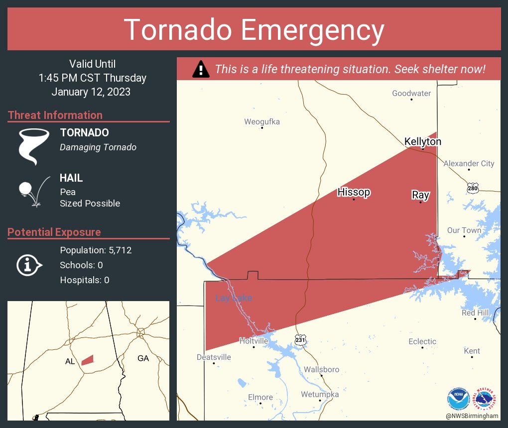
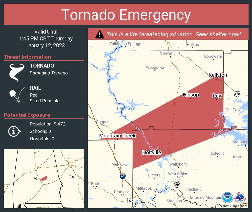
Tornado Emergency for Alexander City, AL
-
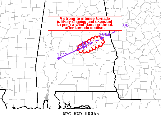
Mesoscale Discussion 0055
NWS Storm Prediction Center Norman OK
0100 PM CST Thu Jan 12 2023
Areas affected...central AL
Concerning...Tornado Watch 18...
Valid 121900Z - 122000Z
The severe weather threat for Tornado Watch 18 continues.
SUMMARY...A strong to intense tornado (~EF3) is likely ongoing
across central AL and after tornado demise, a wind-damage risk will
likely continue into east-central AL.
DISCUSSION...KBMX radar imagery shows an intense low-level
mesocyclone moving through an adequately moist/moderately buoyant
airmass across central AL. SPC data analytics indicates a
strong/intense tornado is likely ongoing across Autauga County, AL.
The area VAD/s show large hodographs with 300 m2/s2 0-0.5 km
effective SRH. The strong shear/buoyancy will likely aid in
sustaining the supercell after eventual tornado demise once the
squall line overtakes the supercell. Nonetheless, a significant
wind-damage threat and some tornado risk will likely continue into
eastern AL through the mid afternoon.
..Smith.. 01/12/2023
...Please see www.spc.noaa.gov for graphic product...
ATTN...WFO...BMX...
LAT...LON 32638663 32998588 33028569 32888557 32778559 32488627
32508662 32638663
-
Now the NWS BMX saying the long-tracked tornado is headed towards Alexander City, Alabama in Tallapoosa County, AL
-
There's a hook echo on BMX NEXRAD with this storm

-
https://rumble.com/embed/v22i32z/?pub=4
As the tornado that hit Selma approached I-65
-
-
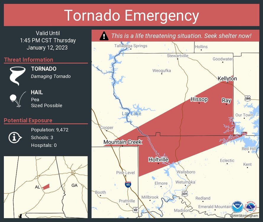
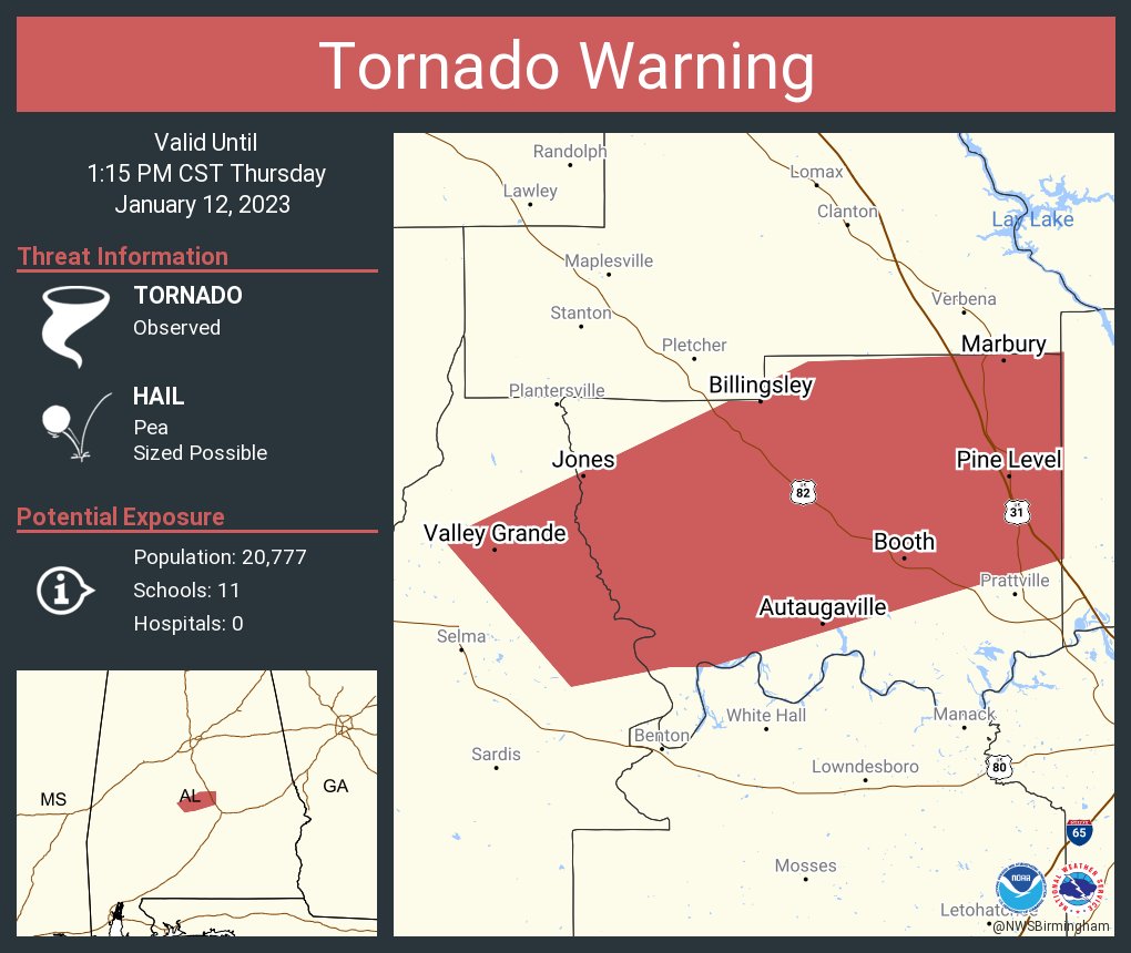
Continuation of Tornado Emergency for a confirmed tornado that just crossed I-65
-
It's a pretty strong tornado

-
Photo of the Selma tornado from James Spann
https://twitter.com/spann/status/1613604830575984670?t=UjdaDx8JpDpduj3GGGtPEA&s=19
-
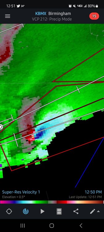
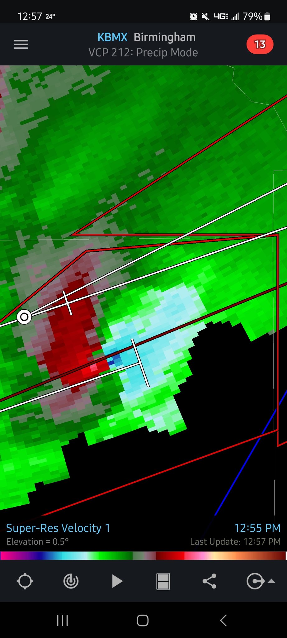
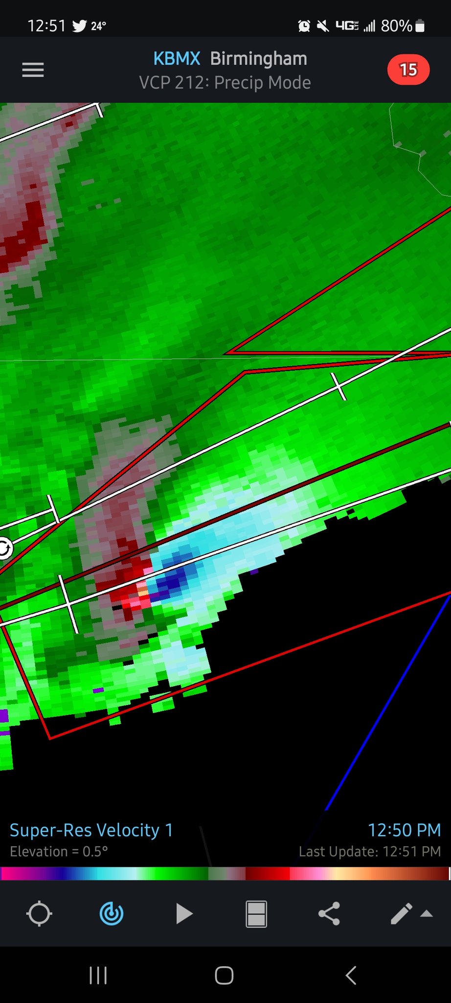
BMX NEXRAD velocity of Autauga County storm
-
 1
1
-
-
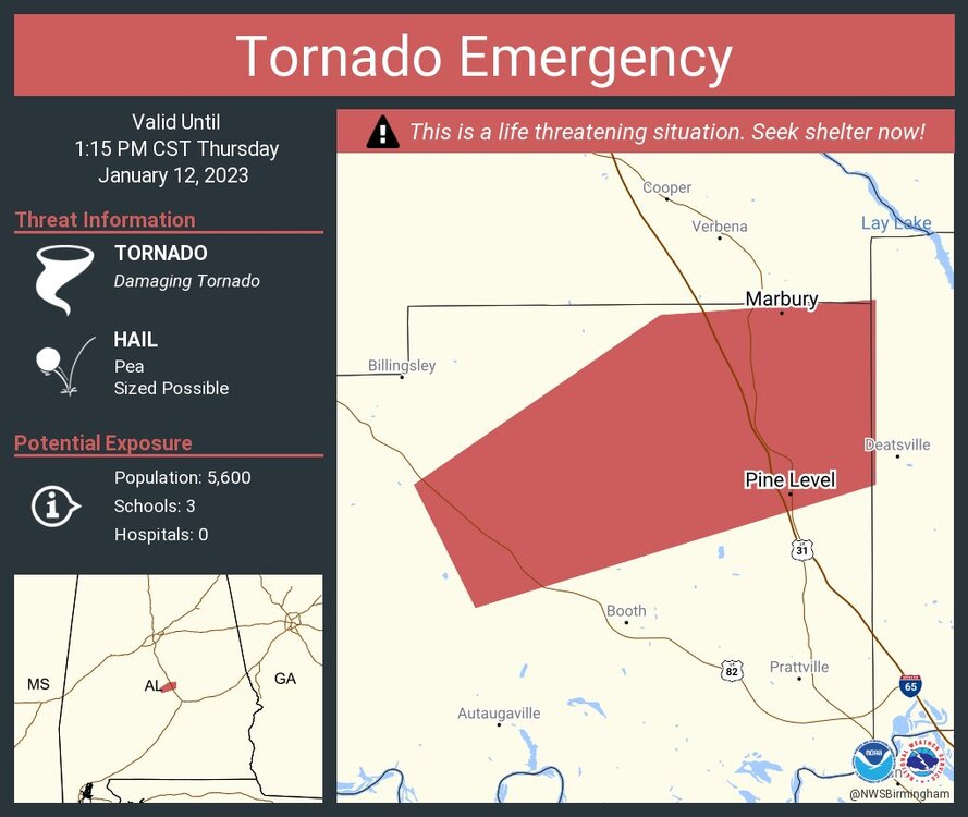
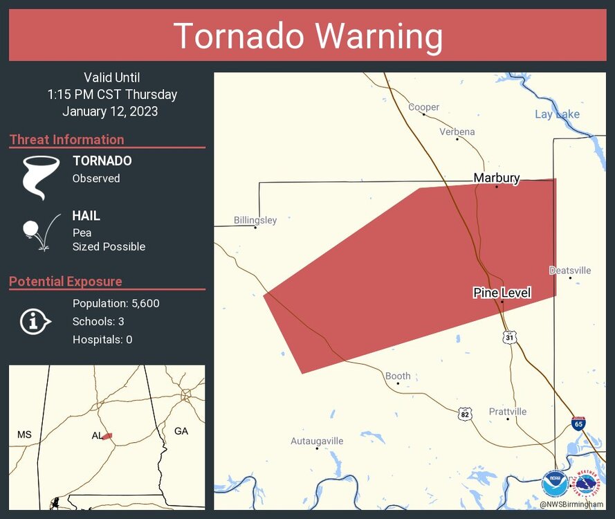
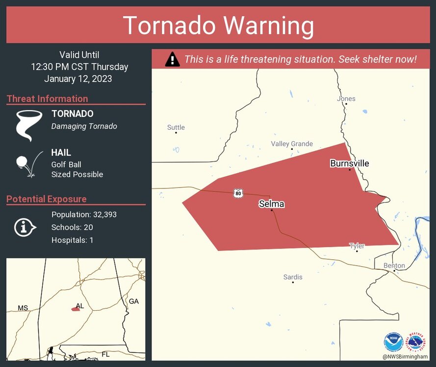
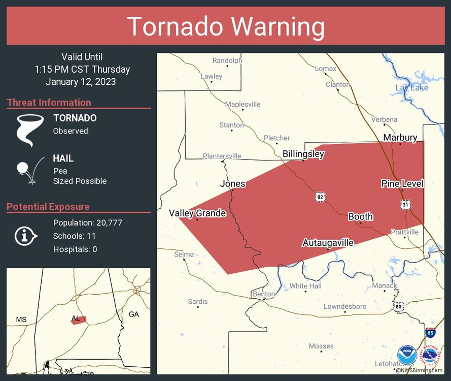
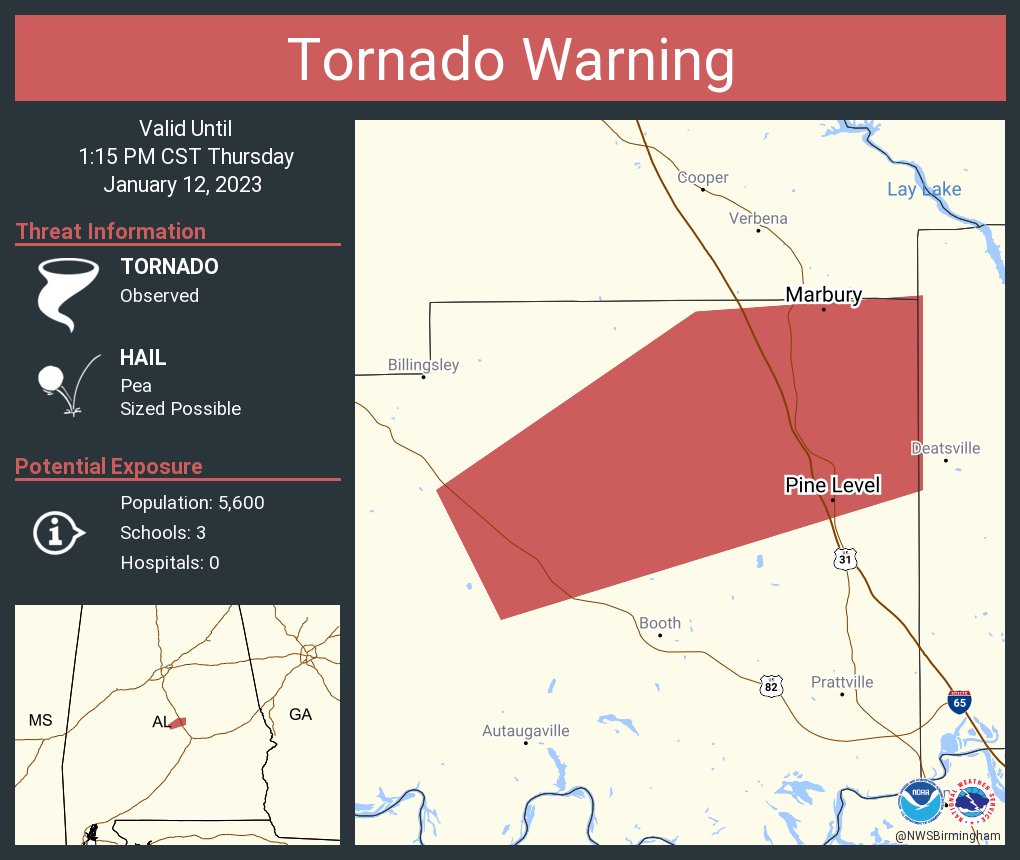
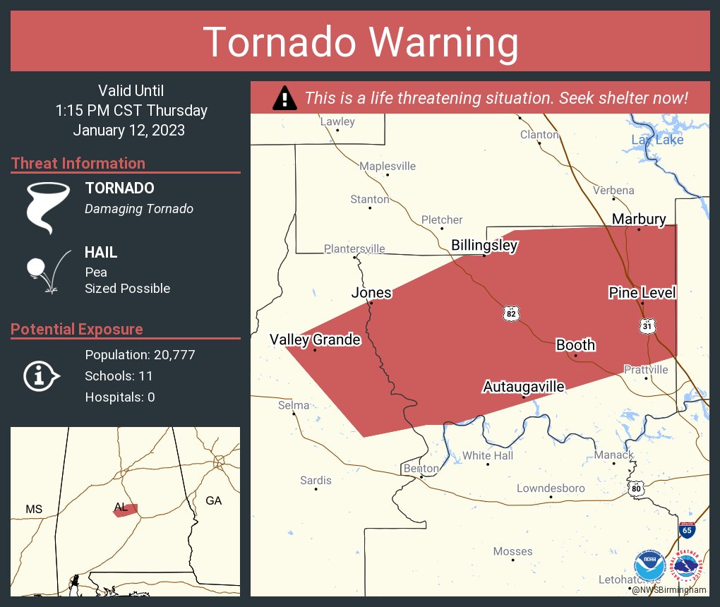
Tornado Emergency for Autauga County, AL
-
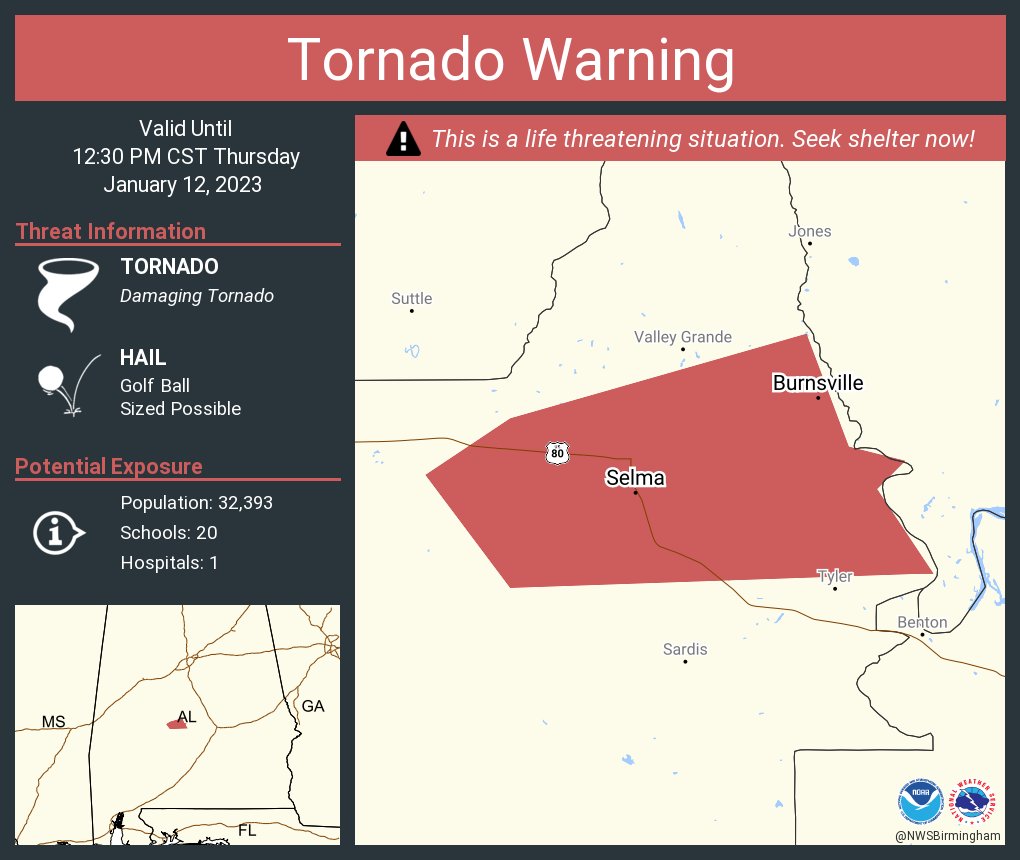
Selma damage
-
 1
1
-
-
1 minute ago, kayman said:
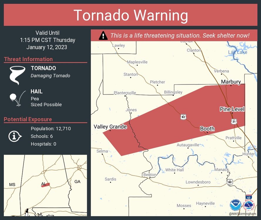
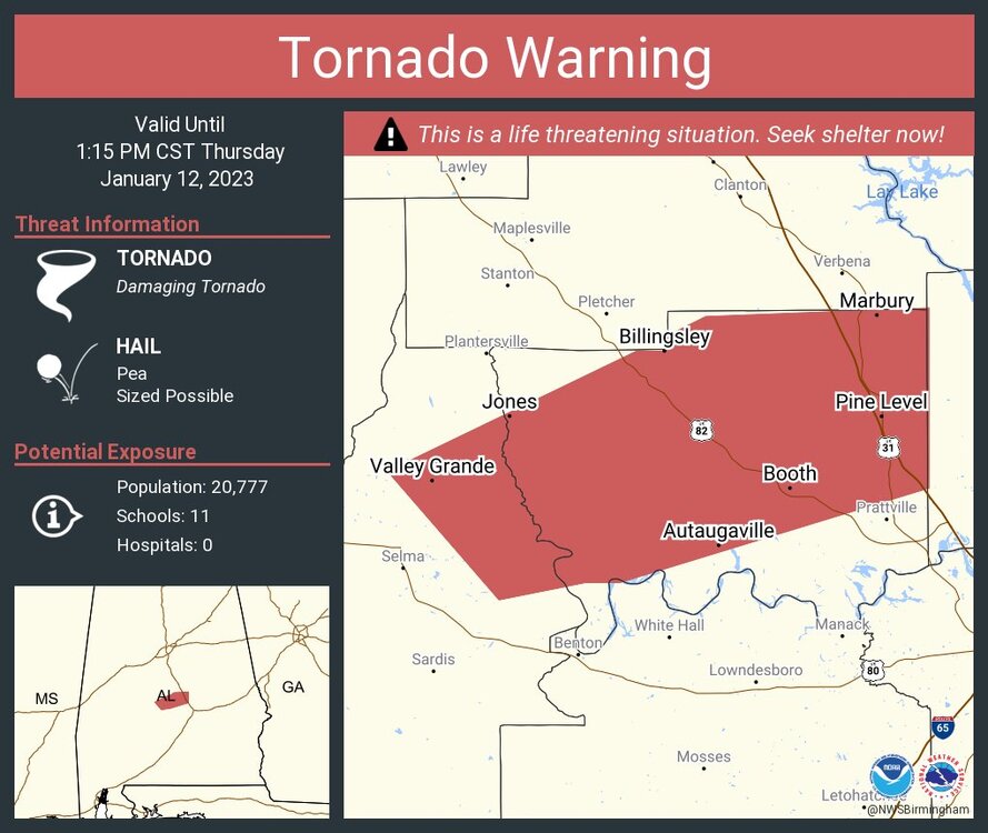
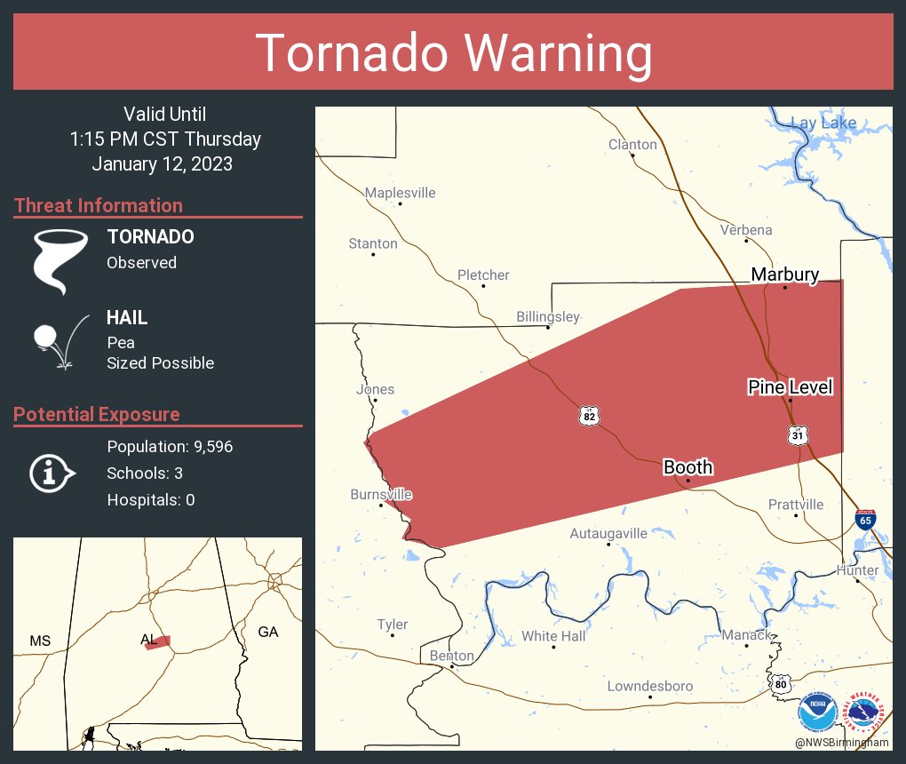
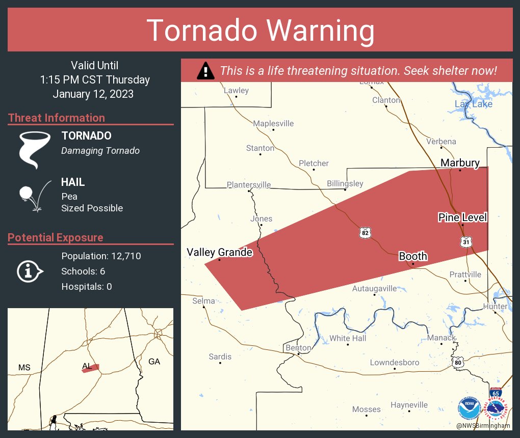
Per wx chat, Autauga County tornadic storm is still on the ground near White City, AL headed towards Marbury, AL
-
7 minutes ago, kayman said:
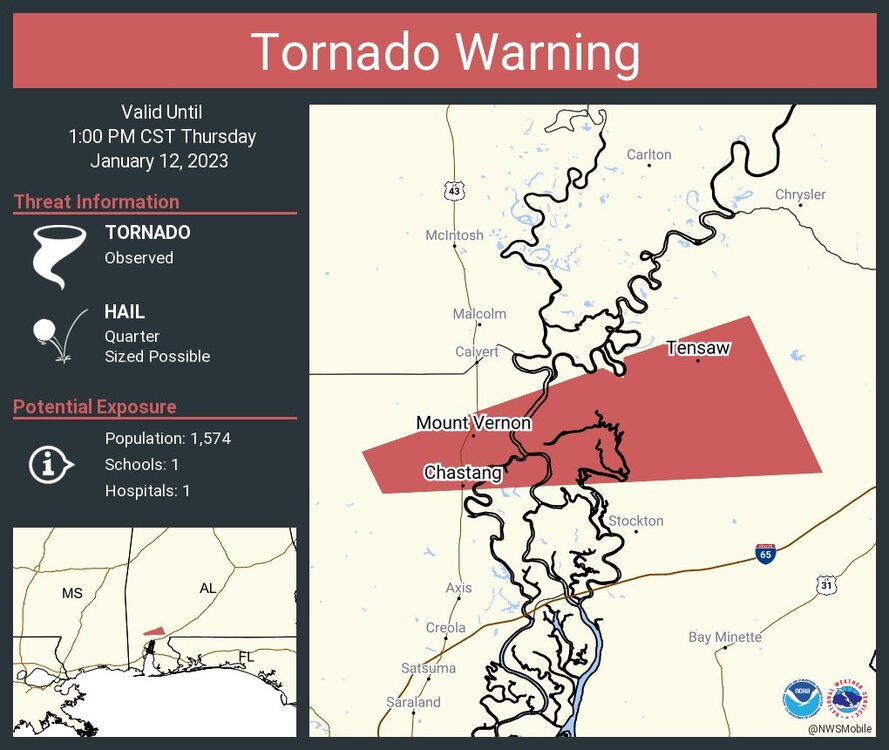
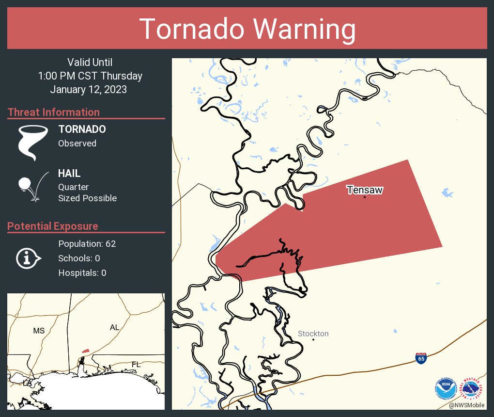
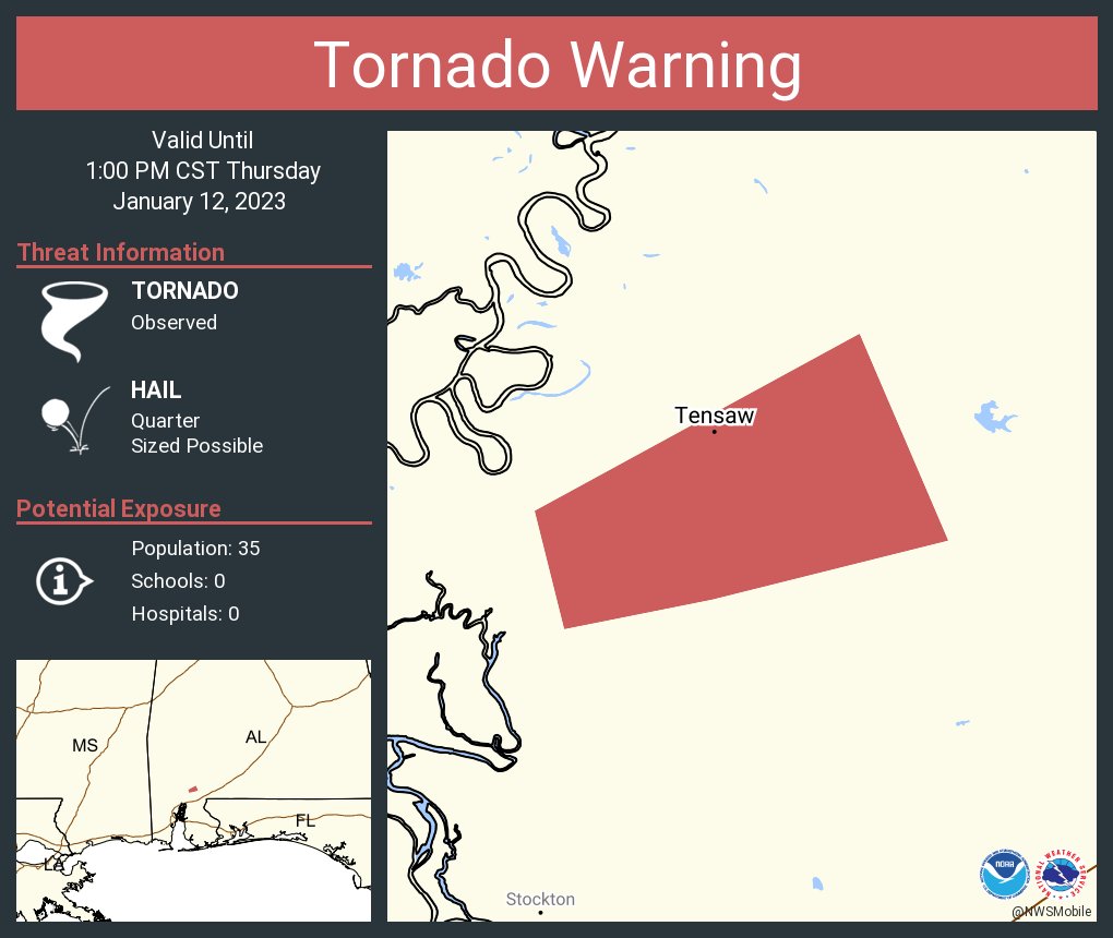
Confirmed debris ball signature over the Alabama/Mobile River basin headed into Baldwin County. Per Mobile NEXRAD
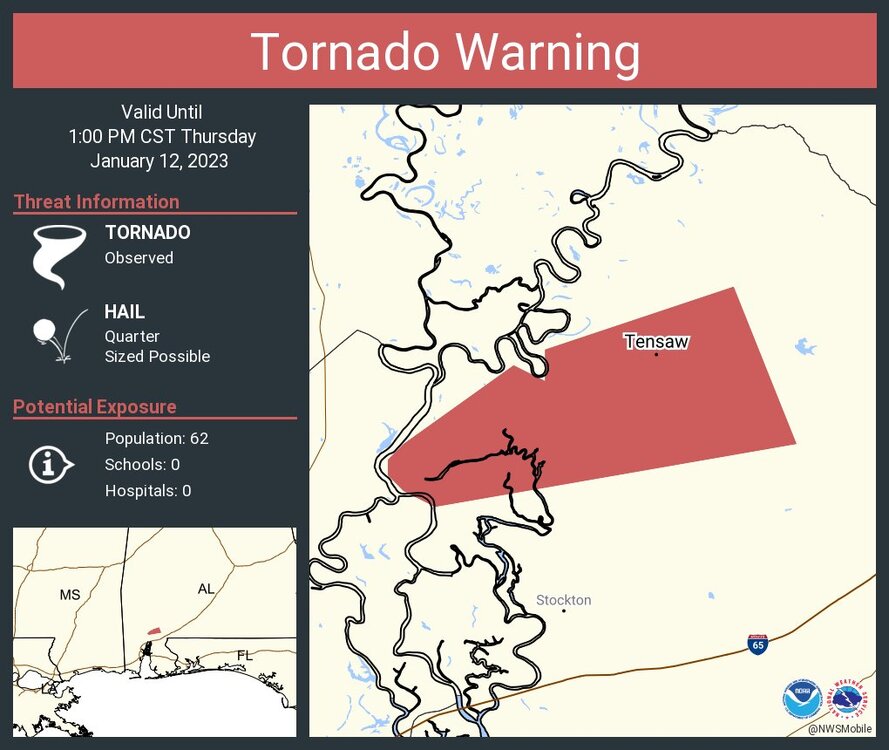
Debris ball still on Mobile NEXRAD
-
Per wx chat, Autauga County tornadic storm is still on the ground near White City, AL headed towards Marbury, AL
-
Confirmed debris ball signature over the Alabama/Mobile River basin headed into Baldwin County. Per Mobile NEXRAD
-
Selma has very significant damage per the NWS BMX. They (NWS BMX) are headed out to the scene now to look at the damage. Several buildings are destroyed around the path of the suspected tornado.
-
-
Dallas/Autauga County tornado is near Burnsville and Statesville, AL
-
6 hours ago, LithiaWx said:
Here in the heart of the enhanced risk. On the Dallas/Kennesaw area of northwest Atlanta.
The sun has been out across North Georgia and West Georgia. Parts of the line is coming through Anniston/Oxford and Talladega at the moment have signs of rotation. It can use the primed environment across the region
-
1
-
-
Just now, buckeyefan1 said:
That's a pretty nasty debris sig
Yeah it's on the BMX NEXRAD I'm trying to follow it
-
1
-
-
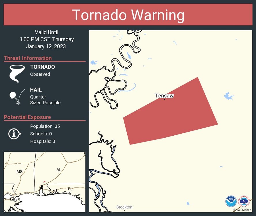
Confirmed tornado continues over Northern Mobile County near Mount Vernon, AL
-
Confirmed tornado has caused significant damage in Selma. Continues to Autauga County near Autaugaville, AL
PDS Tornado Warning
-
PDS Tornado Warning for Dallas County, AL for the confirmed tornado includes Selma
Autuga County, AL is now warned for the same storm


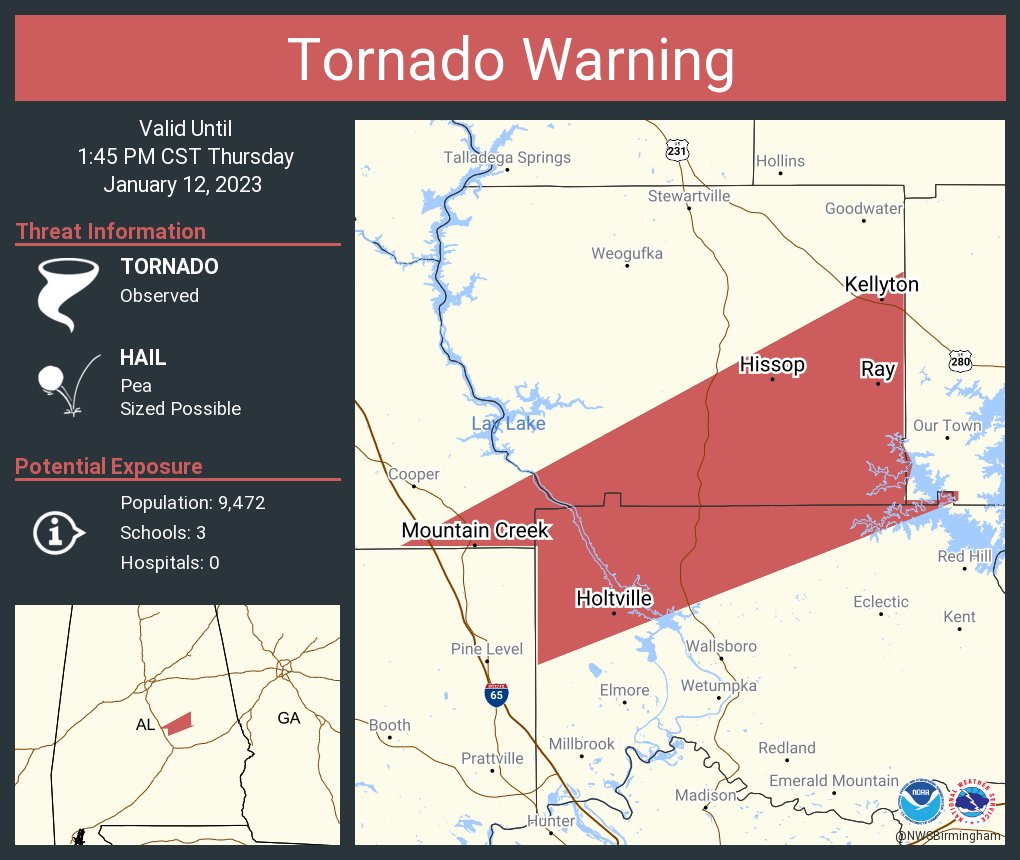

January 12th 2023 Enhanced Severe Threat
in Southeastern States
Posted
Velocity from Maxwell AFB Radar
Coefficient from Maxwell