

kayman
-
Posts
584 -
Joined
-
Last visited
Content Type
Profiles
Blogs
Forums
American Weather
Media Demo
Store
Gallery
Posts posted by kayman
-
-
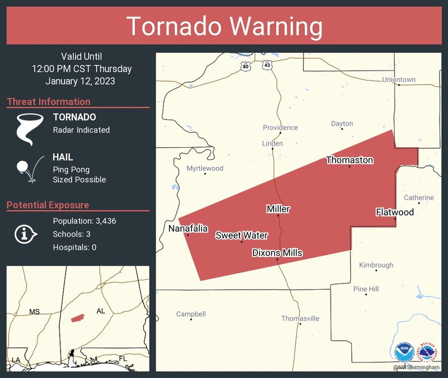
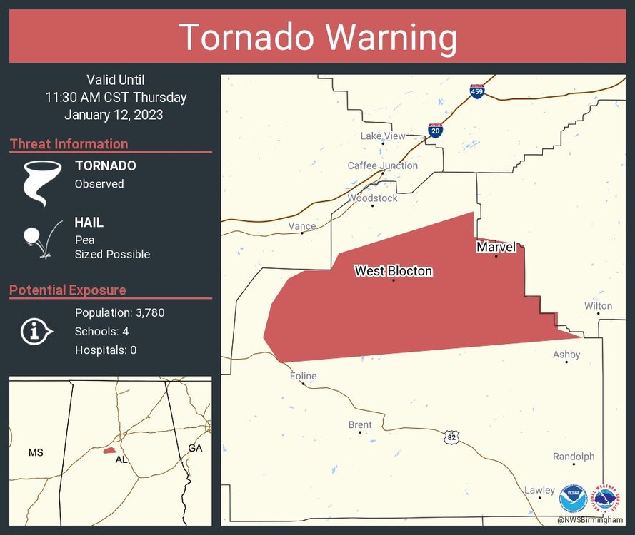
It's over Talladega National Forest but it's headed towards northern Chilton County which is populated.
-
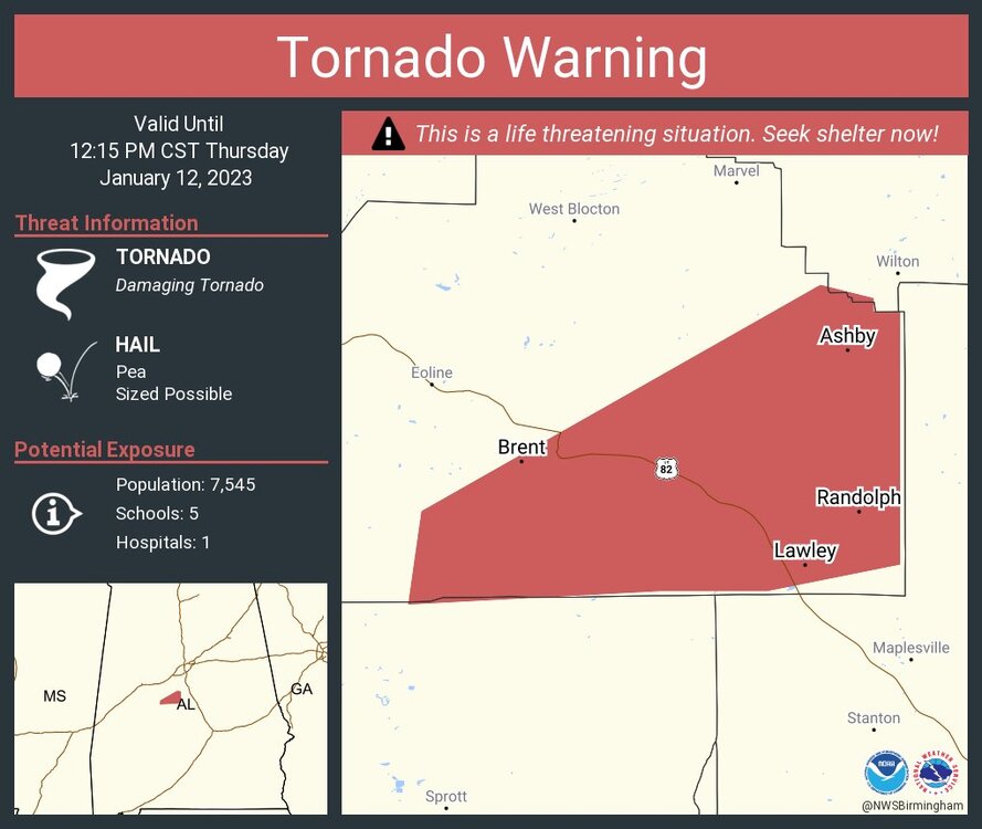
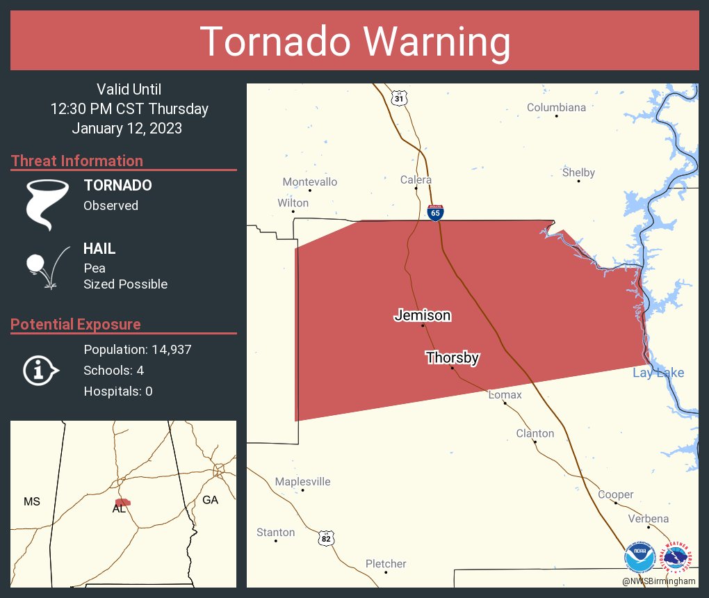
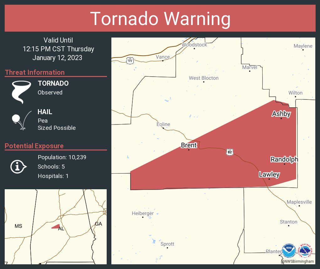
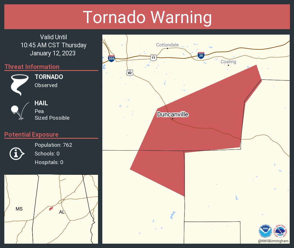
The new Shelby County/Talladega County storm near Vincent, AL has a Svr. T'Storm Warning. However it's showing signs again rotation. It's a QLCS looking storm. It's the storm cluster that did produce the confirmed tornadoes near Duncanville, AL.
-
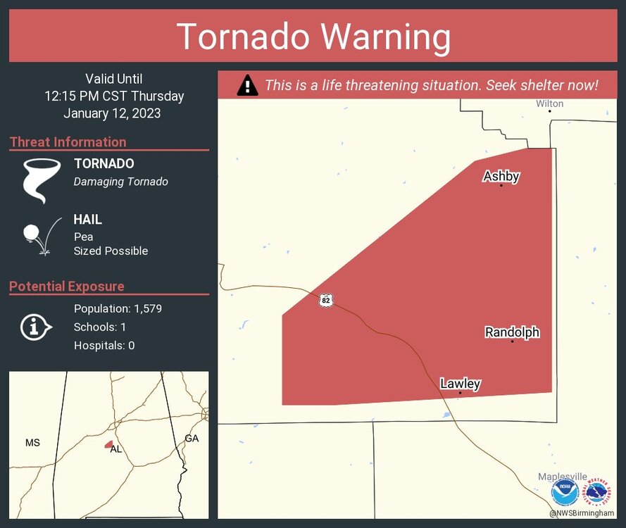
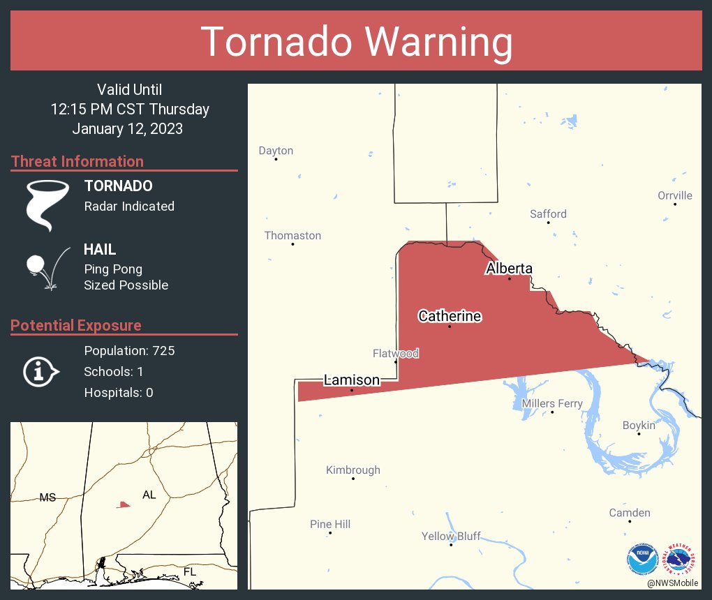
Tied to the Bibb/Perry County confirmed tornado into Chilton County, AL

-
PDS Tornado Warning for the Bibb/Perry County storm by NWS BMX
-
These strong cells within the line is breaking up into individual supercells. This one further south

-
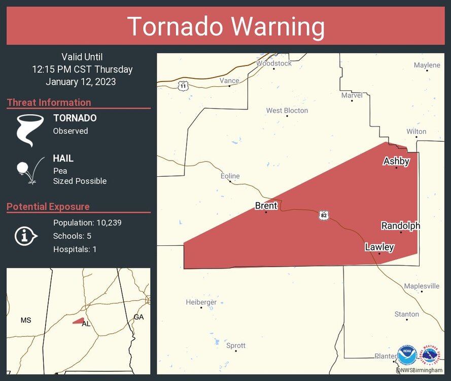
Confirmed again by the NWS BMX

-
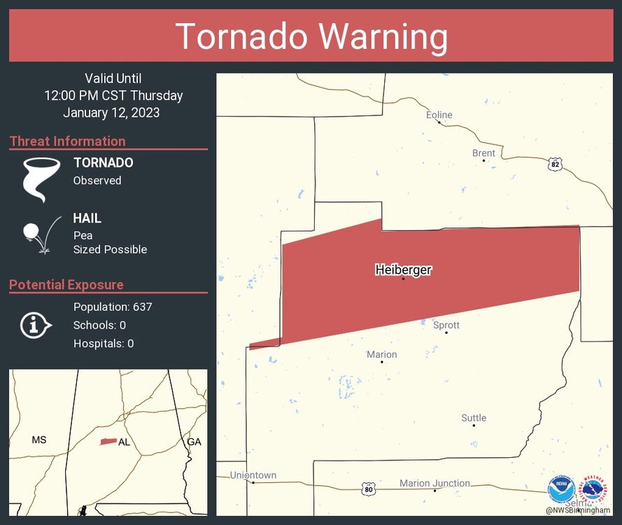
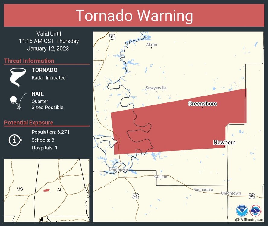
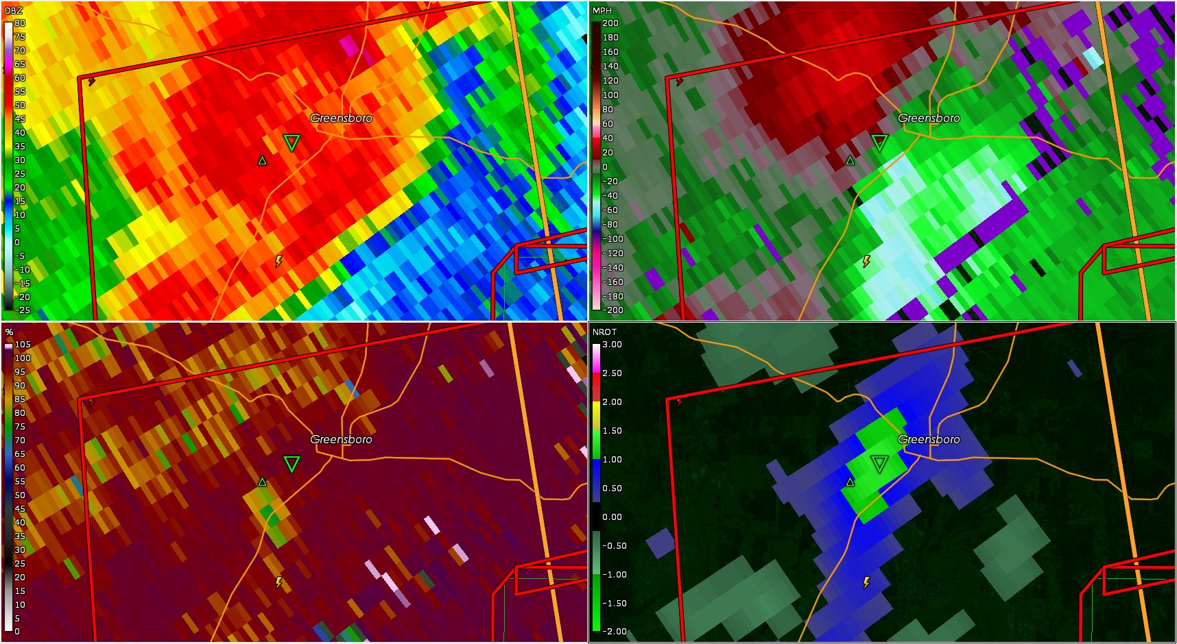
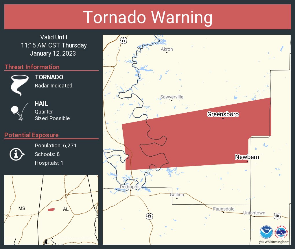
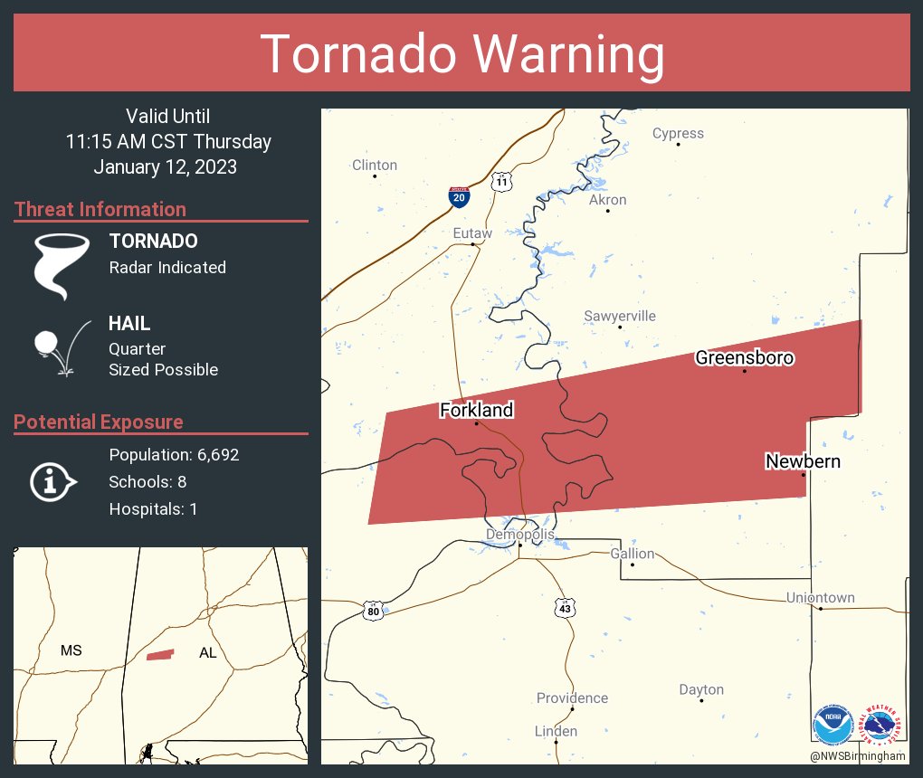
The wx chat is stating the storm that went through Greensboro, AL is cycling but still has very strong rotation in southern Bibb & northern Perry counties, AL.
-
The Greensboro, AL storm is shifting more north than east though it's still confirmed by NWS BMX
-
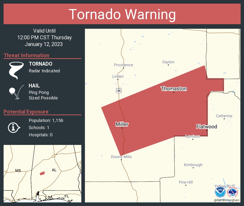
Another one, this one has a very large hail potential
-
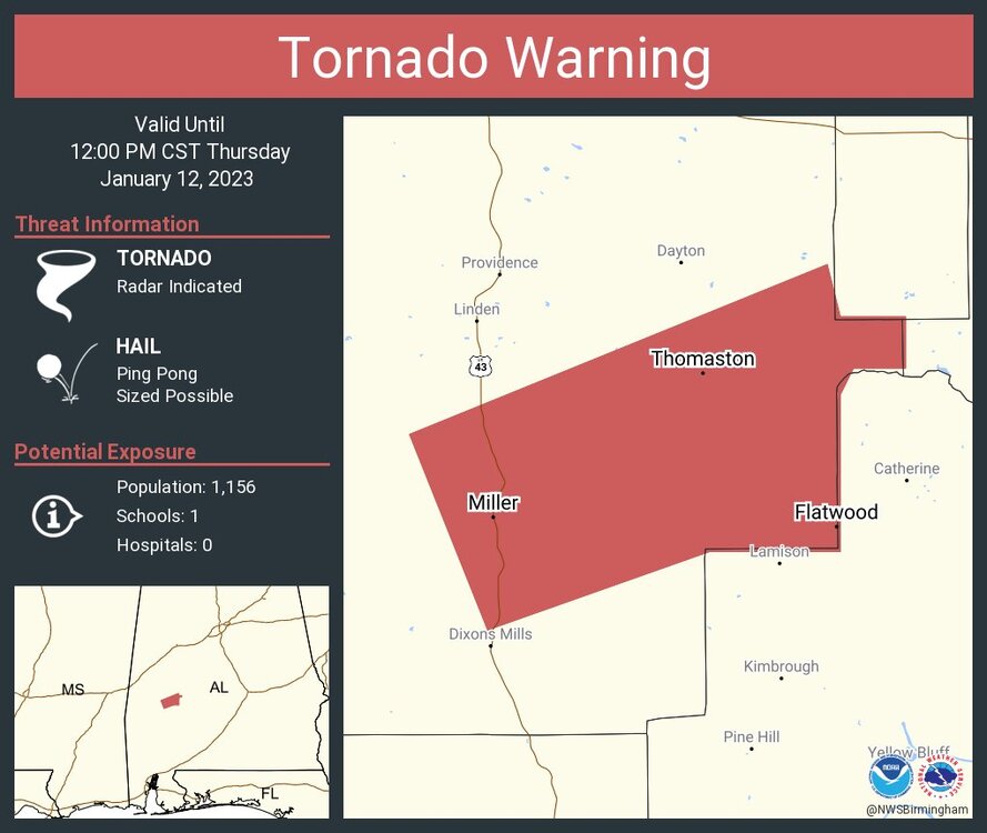
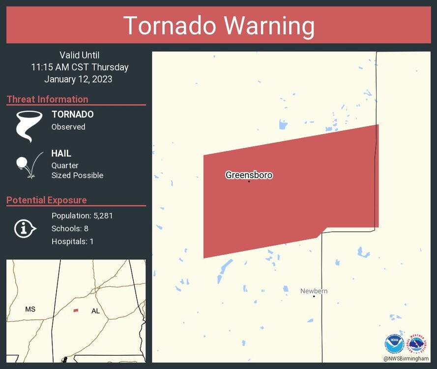
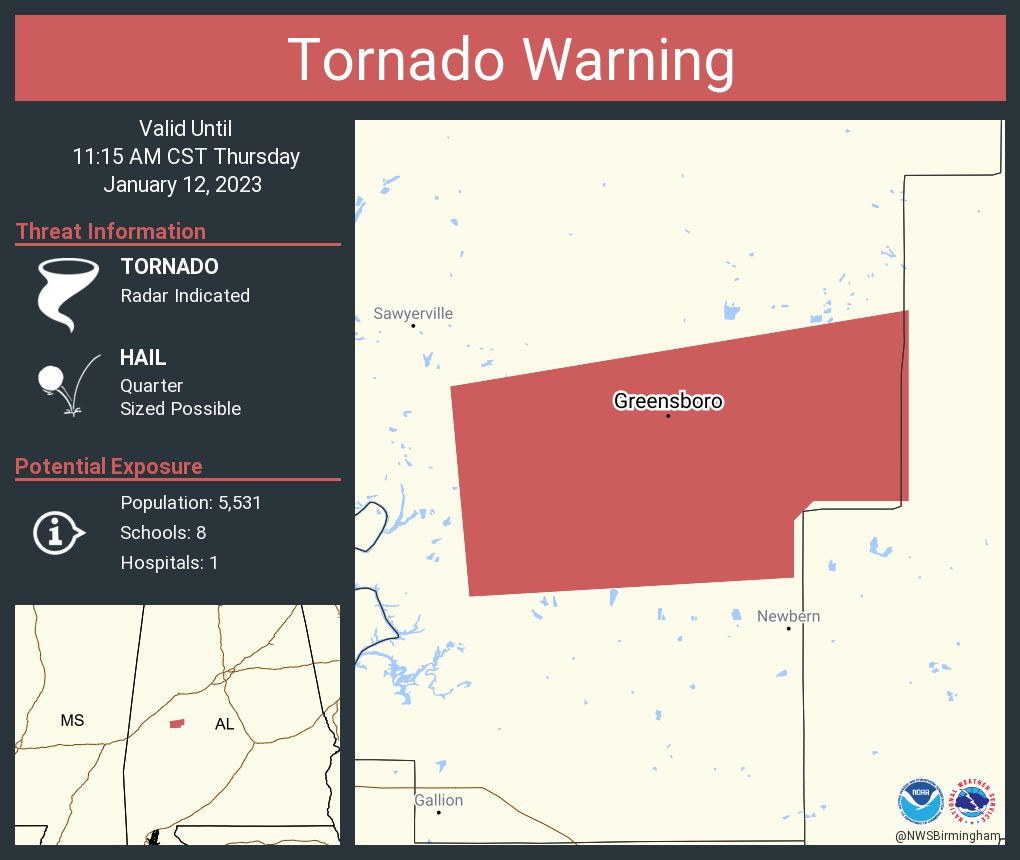
Storm that passed through Greensboro, AL still has a debris signature via BMX NEXRAD
-
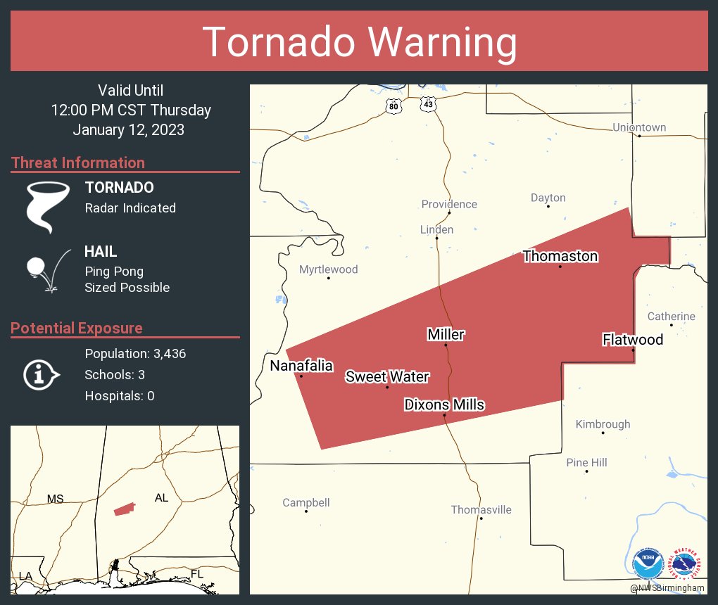
Greensboro, AL confirmed storm

-
 1
1
-
-
Confirmed by NWS BMX NEXRAD
-
Confirmed tornado in Greensboro, AL by the city officials
-
Mesoscale Discussion concerning Metro Atlanta
QuoteMesoscale Discussion 52 < Previous MD 
Mesoscale Discussion 0052
NWS Storm Prediction Center Norman OK
1052 AM CST Thu Jan 12 2023
Areas affected...east central Alabama and western Georgia
Concerning...Severe potential...Tornado Watch likely
Valid 121652Z - 121745Z
Probability of Watch Issuance...80 percent
SUMMARY...Tornado threat continues along the eastern advancing line
of storms which is expected to move into east central
Alabama/Georgia later today.
DISCUSSION...A line of thunderstorms continues to advance eastward
through northern Alabama. Within this line, transient circulations
have been noted on radar. Ahead of this line, the KMXX (Maxwell Air
Force Base) VAD profile depicts 0-1 km storm relative helicity
around 150-200 m2/s2. 15z RAOB from BMX indicates upstream 0-1km SRH
around 300 m2/s2. The wind field over eastern Alabama/Georgia is
expected to increase through the afternoon as flow aloft increases
in the next few hours. RAP analysis shows 850 mb winds increasing to
around 45-50 kts by 19-20z. Surface objective analysis indicates
surface based CAPE around 1000-1500 j/kg across this region and the
convective inhibition is reduced. This environment will continue to
be conducive to tornado development within the line of storms, with
the threat gradually spreading east through the afternoon. A Tornado
Watch downstream of WW17 will likely be needed for portions of
eastern Alabama and western Georgia this afternoon.
..Thornton/Guyer.. 01/12/2023
...Please see www.spc.noaa.gov for graphic product...
ATTN...WFO...FFC...BMX...
LAT...LON 32228624 32468645 32848643 33418613 33928581 34258553
34608500 34648467 34618443 34608431 34468395 33988408
33708415 33468428 33308438 33058449 32698472 32508486
32178529 32108566 32118601 32228624
-
-
-
Another one
-
Just now, buckeyefan1 said:
I've got breaks here in the upstate as well. That usually doesn't bode well for those to my east. CAE and south should keep their eyes open
Yeah I think SC will be under the gun. Brad P of WCNC has been hinting at something since last night. It's going to be a surprise event for many today.
-
1
-
-
2 minutes ago, buckeyefan1 said:
I was watching this and I'm sure it will continue to cycle
The atmosphere is getting volatile in east central & south central Alabama and western Georgia right now due to the breaks in the cloud cover & sunshine.
The helocity and CAPE values are increasing. Metro Atlanta needs to watch this
-
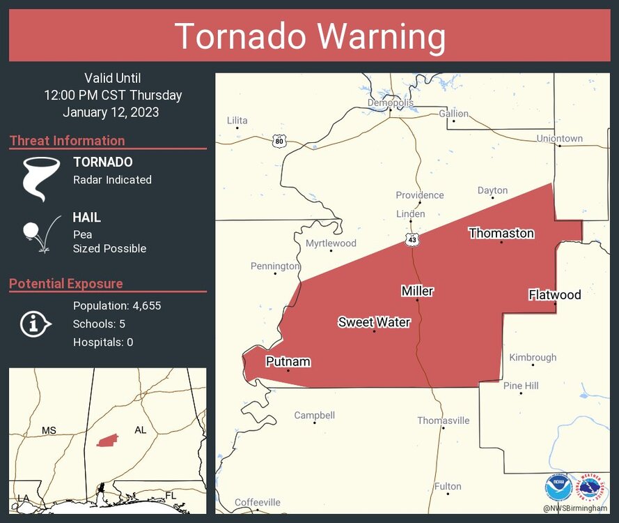
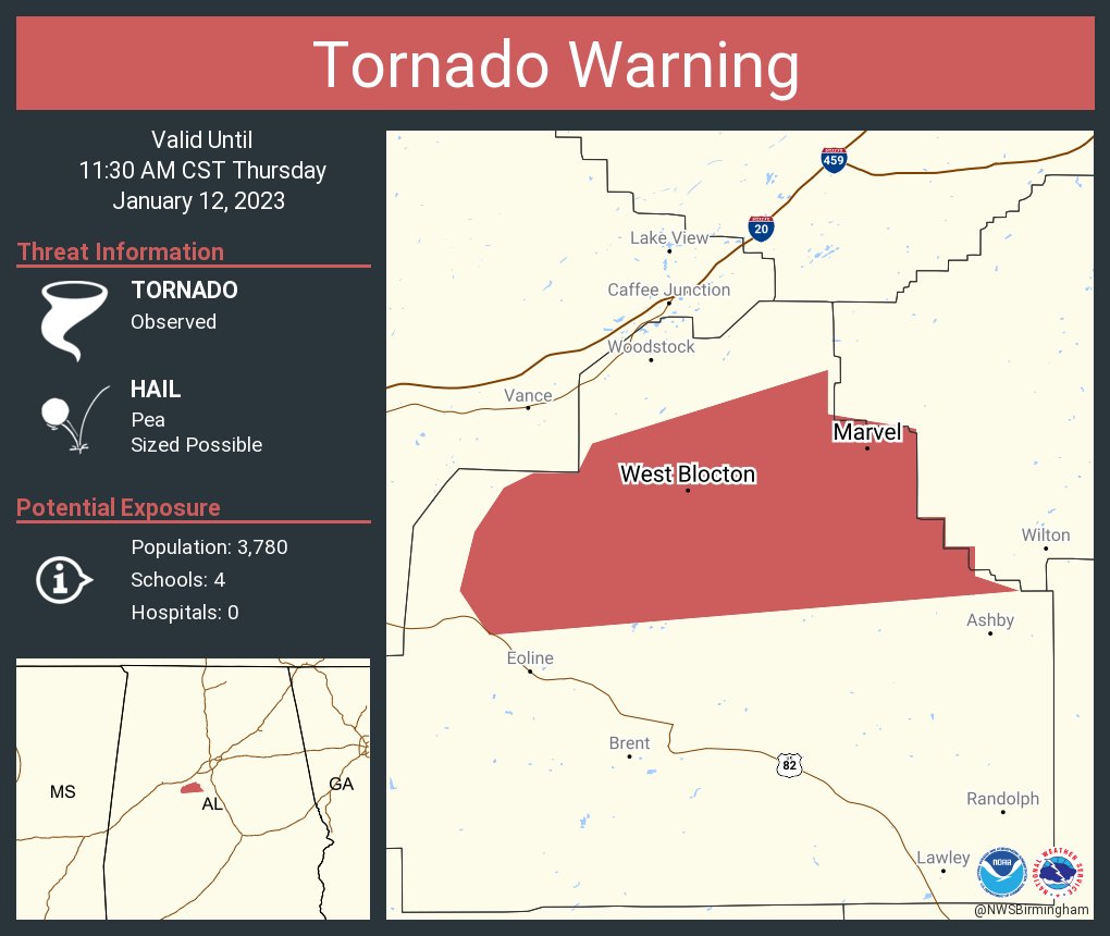
A large debris ball signature within this supercell continues towards West Blocton, AL.
-
This storm is continuing as well
-
The debris ball signature within the tornado warned storm in southeastern Tuscaloosa County east of Duncanville is large on the BMX NEXRAD. It's headed towards the Southern suburbs of Birmingham in Shelby County.
-
-
Again confirmed by the NWS BMX


January 12th 2023 Enhanced Severe Threat
in Southeastern States
Posted
The other storm below the confirmed tornadic storm