

kayman
-
Posts
544 -
Joined
-
Last visited
Content Type
Profiles
Blogs
Forums
American Weather
Media Demo
Store
Gallery
Posts posted by kayman
-
-
A large wedge tornado with this storm
-
This is bad.

-
Still going

-
Just now, cheese007 said:
That storm is ridiculous
Yeah it won't stop. It's been spinning since southeast Arkansas near Pine Bluff
-
Ominous looking storm via radar and velocity couplet
-
1 minute ago, kayman said:
Still observed
-
Still observed
-
-
6 minutes ago, kayman said:
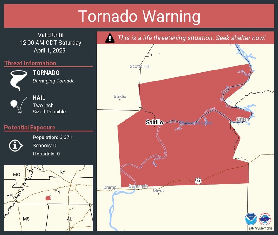
Like clockwork it's now confirmed
It appears to have a negative echo region, i.e. a donut hole in the radar reflectivity and velocity couplet. It is definitely on the ground
-
Like clockwork it's now confirmed
-
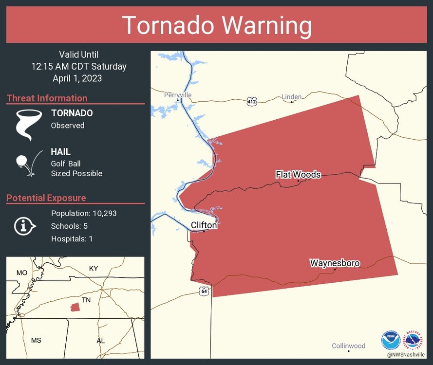
This rotation appears to be on the ground with a confirmed tornado

-
1 minute ago, cheese007 said:
Mesoscale Discussion 0421
   NWS Storm Prediction Center Norman OK
   1023 PM CDT Fri Mar 31 2023

   Areas affected...northern Mississippi

   Concerning...Tornado Watch 97...99...

   Valid 010323Z - 010530Z

   The severe weather threat for Tornado Watch 97, 99 continues.

   SUMMARY...Severe risk continues. Tornado environment is becoming
   more favorable across northern Mississippi.

   DISCUSSION...A broken line of storms moving across the
   Arkansas/Mississippi border is tracking eastward into an environment
   becoming favorable for strong tornadoes. VAD profiles from DGX
   (Brandon, MS) and GWX (Columbus Air Force Base) show low-level shear
   has increased to around 400-700 m2/s2 as the nocturnal low-level jet
   has strengthened. Surface objective analysis indicates SBCAPE around
   1000-1500 J/kg ahead of the advancing line of storms. Expect the
   storms moving in from the west to organize with increasing threat of
   strong tornadoes over the next few hours.

   ..Thornton/Edwards.. 04/01/2023

   ...Please see www.spc.noaa.gov for graphic product...

   ATTN...WFO...MEG...JAN...LZK...

   LAT...LON   33879128 34389079 34879013 35008961 34978912 34958876
               34798849 34428840 34188847 34018860 33788872 33548894
               33408922 33308955 33318984 33349025 33359060 33499103
               33579118 33879128
.png.2bfa324538e03fa7e00278d0c1a915bf.png)
I kinda suspected things would continue overnight but expected the mode would have shifted towards QLCS tornadoes rather continued discreet super cells in broken lines
-
-
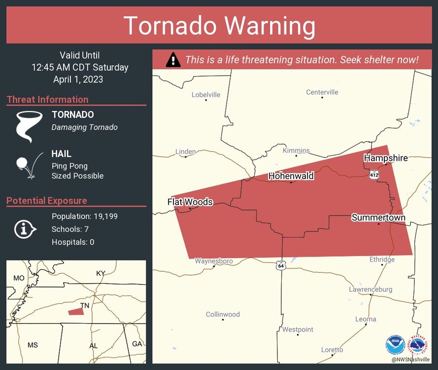
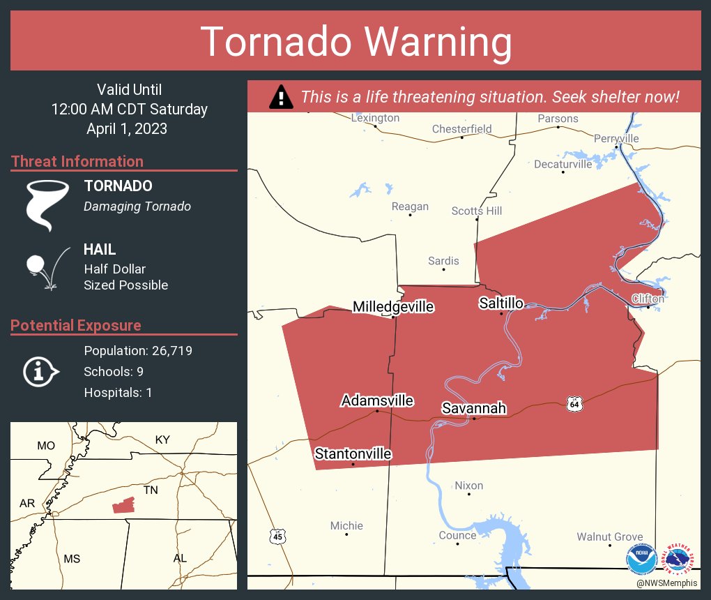
It's still kicking and with a confirmed tornado per radar
-
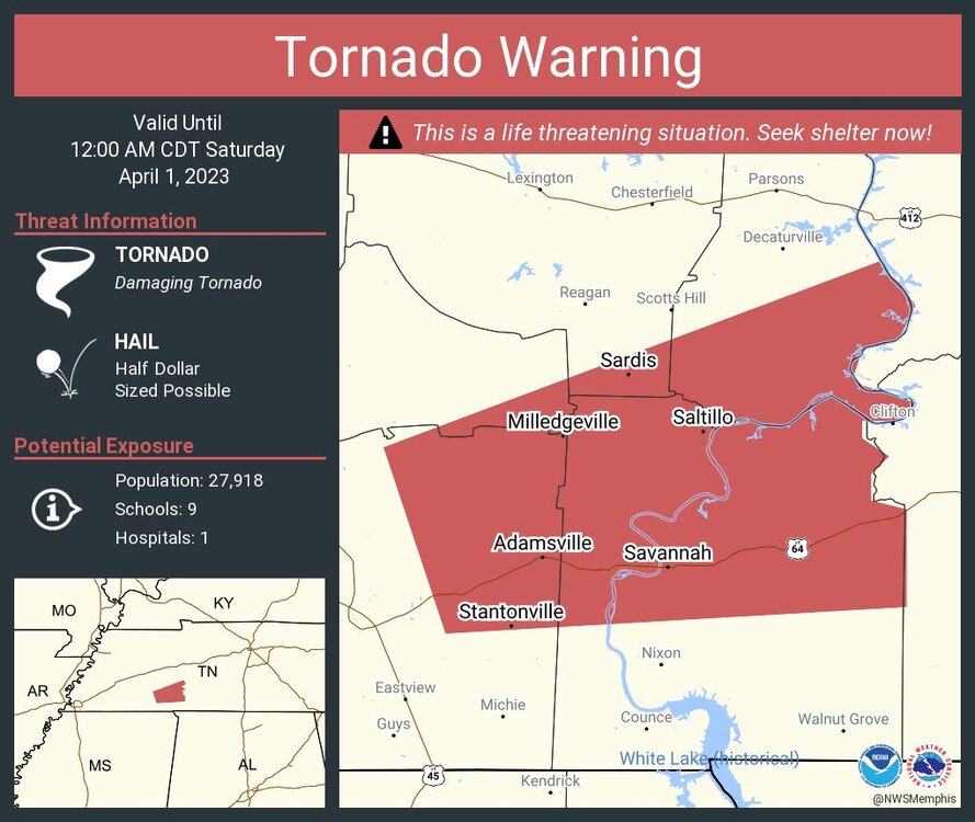
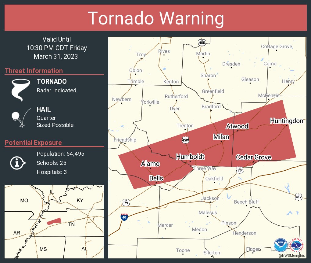
The rotation near Alamo is the strongest within the tornado warning
-
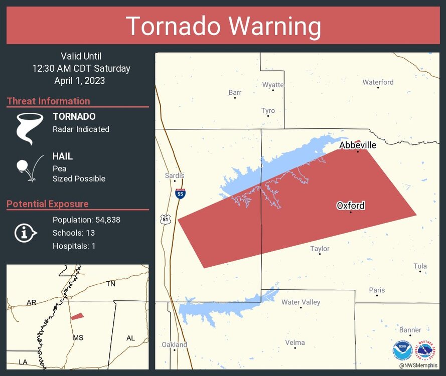
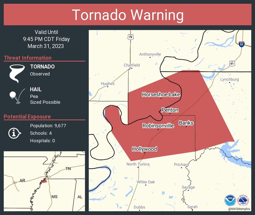
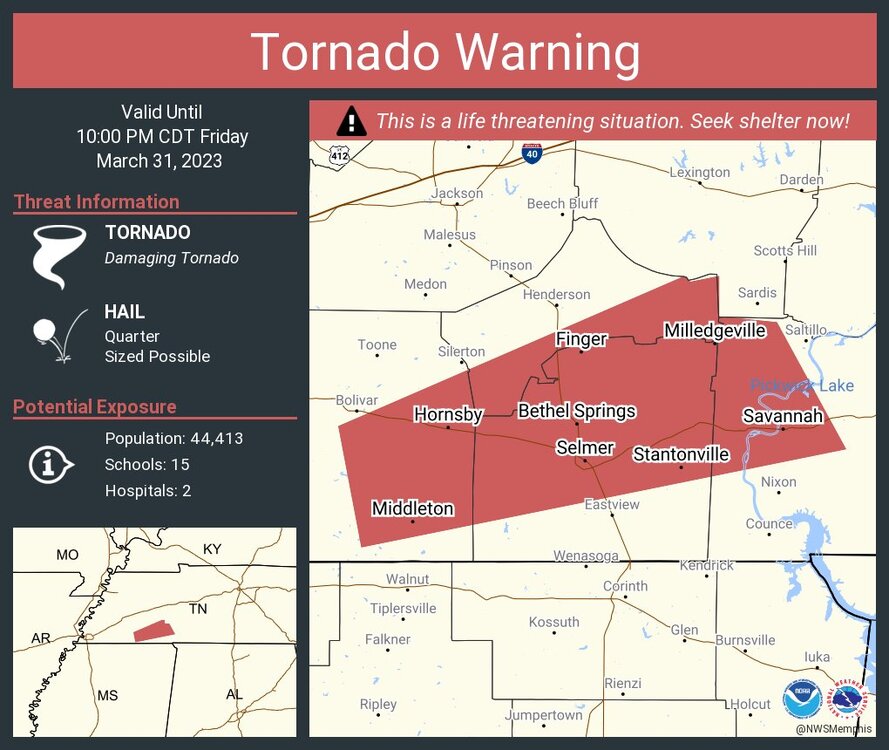
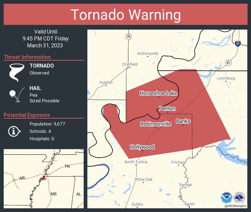
Another TOG near Tunica Resorts/Robinsonville, MS and headed towards Horn Lake and Southhaven, MS
Mississippi suburbs of the Memphis metro area are in the path!
-
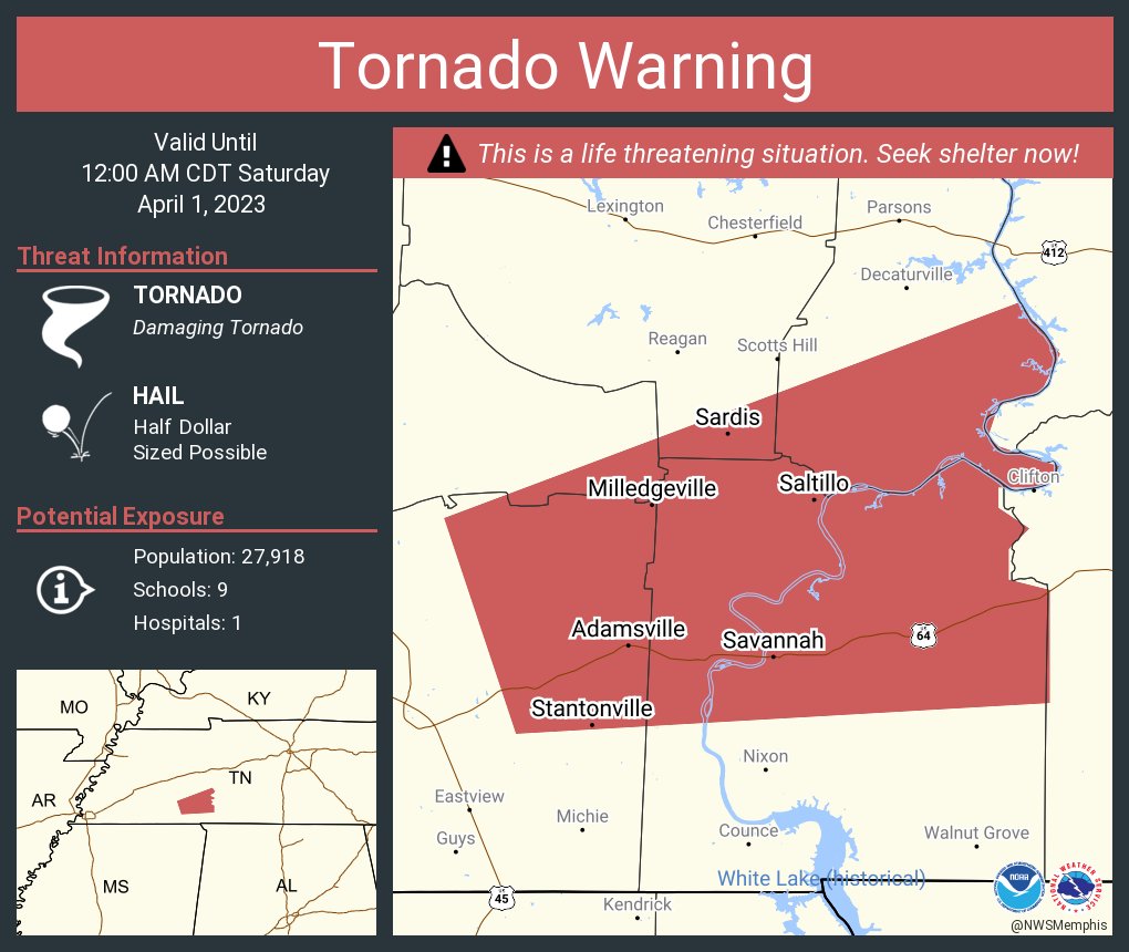
Continuation of the long-term supercell that traveled through the Mississippi suburbs of Memphis
-
-
Many of these storms are in a high wind shear environment as the front has caught up with the dry line that will allow more spin up supercell tornadoes along it
-
Just now, Amped said:
Another cell wants to spin up in S TN between the other two. They're keeping the spacing well.
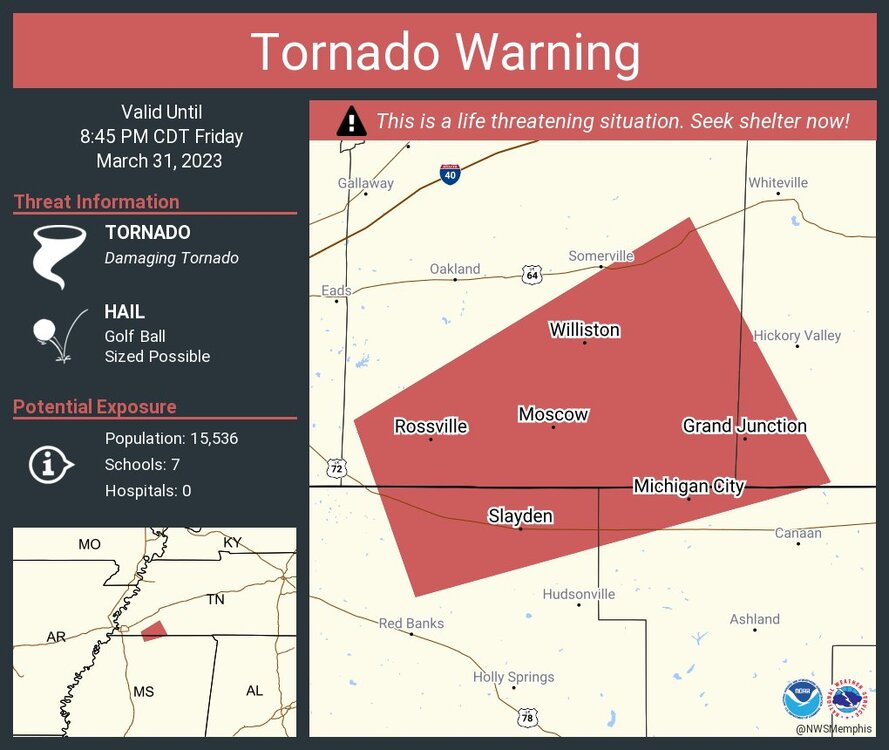
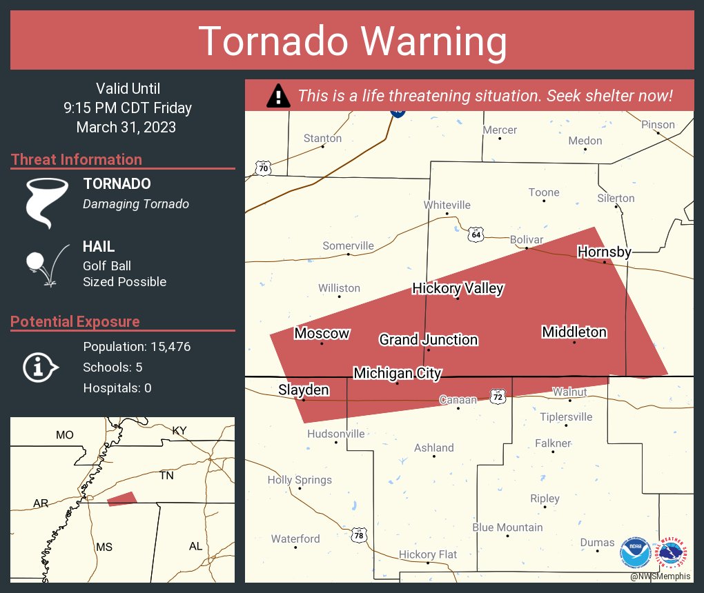
Yeah that storm in Southeast Shelby County near Collierville just formed from nowhere. It'll be in Fayette County in moments
-
7 minutes ago, Amped said:
Another cell in eastern ARK looks like it's got a couplet forming.
Edit NW of Marvell Ark needs a warning
It's tornado warned now.
-
-
-
Tornado Confirmed with the storm near Early Grove, MS; debris ball on radar


Severe Weather 3-30-23 and 3-31-23
in Central/Western States
Posted