BullCityWx
-
Posts
8,924 -
Joined
-
Last visited
Content Type
Profiles
Blogs
Forums
American Weather
Media Demo
Store
Gallery
Everything posted by BullCityWx
-
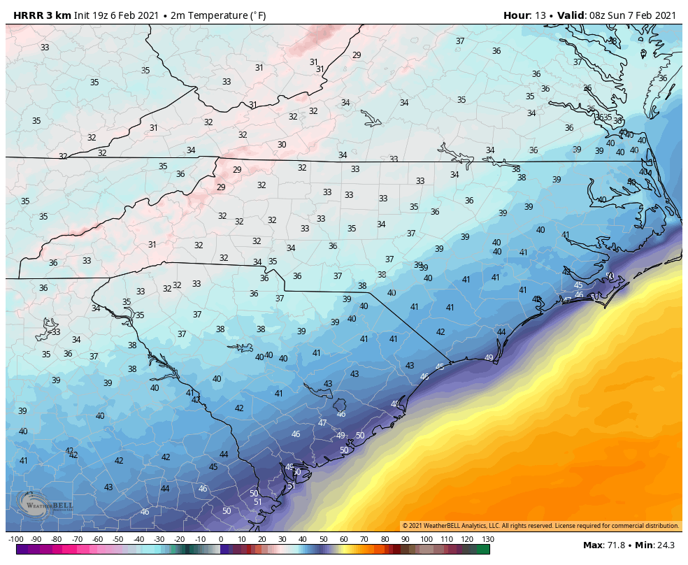
HRRR wet bulbs GSP at 32.
-
I don’t get it. The models are looking like that and are obviously too warm due to initialization errors.
-
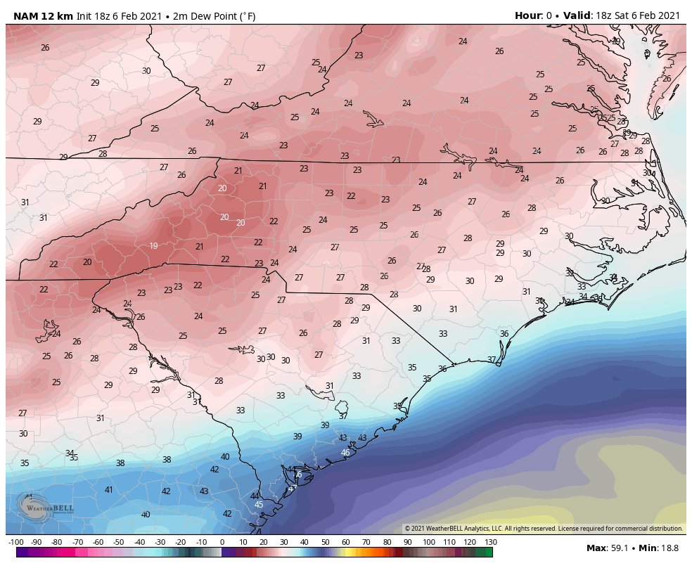
3K NAM is even further off with dew points 10-13 degrees too high.
-
eight degrees too high at GSP.
-
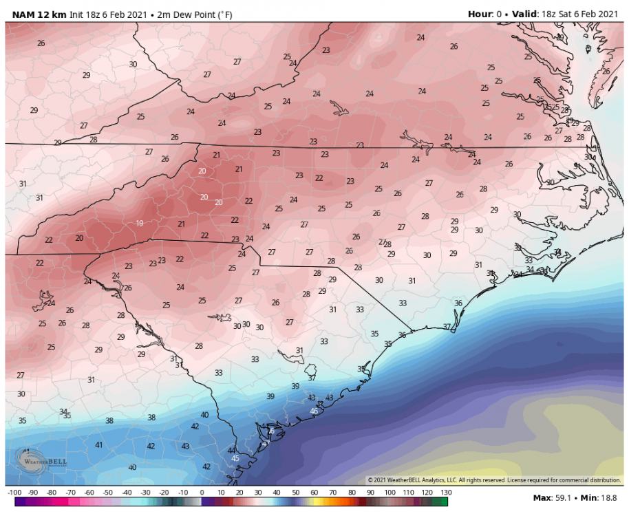
18z NAM dew points are still too high on initialization.
-
NAM dew points are ten degrees or more off
-
It would be the biggest bust since 1/23/03.
-
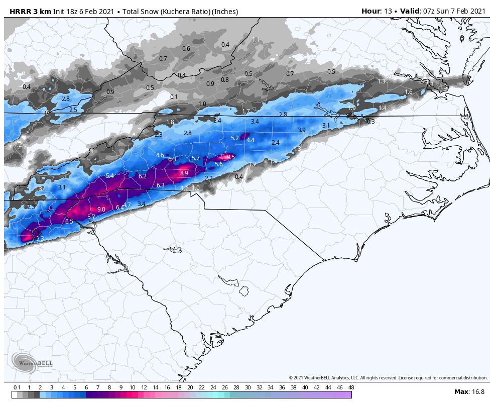
I don’t think the HRRR ever had anything but sleet or snow that run west of Charlotte.
-
HRRR having a nice run for Greenville-Spartanburg up through Cleveland County up to Lincolnton.
-
-
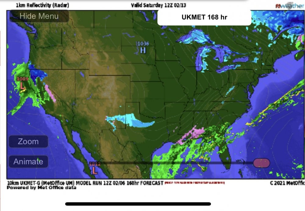
You know it seems like the UKMET has been the one most on top of the trends lately.
-
People have to realize that maybe this isn’t a sleet or snow event but the extracted data on BUFKIT shows Greensboro very close to a n ice storm disaster at 12z. What do we know about ice events? They almost always trend colder.
-
We do this every storm. Usually the same People.
-
We need a 100 mile shift 130 hours away for a major ice event.
-
Yep, it’s a tale as old as time on this side of the mountains.
-
It was 51 degrees the day before the last event in places that received almost half a foot.
-
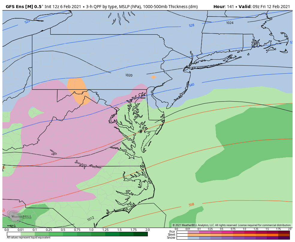
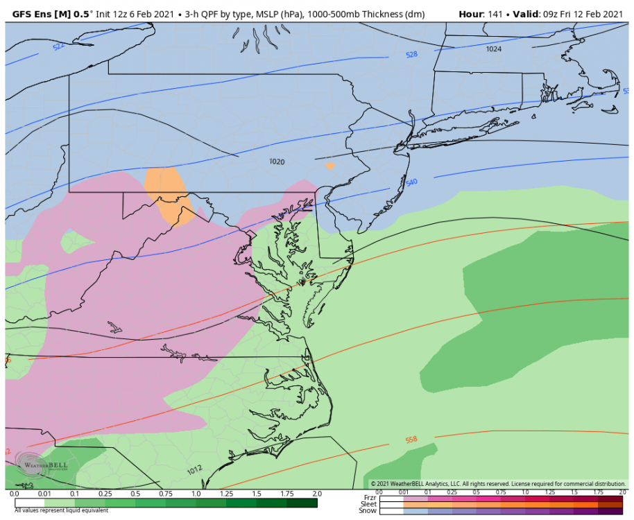
Yeah not bad trends at all. Day 7.5 snow as well for much of NC.
-
Our warm nose has been around 700MB
-
This run would get me to the previous 30 year mean so
-
Little bit better run this time for the NW Triangle.
-
YOU SIR HAVE A DEAL
-
This is insane.
-
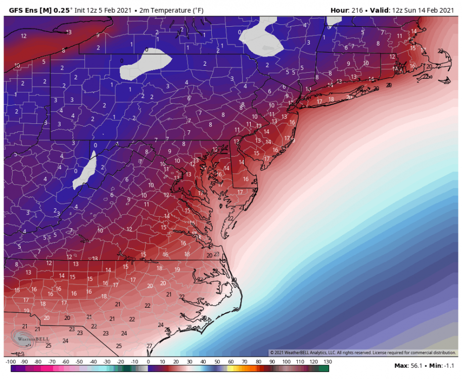
I dont know if I've ever seen a nearly 20 below normal MEAN: