BullCityWx
-
Posts
8,924 -
Joined
-
Last visited
Content Type
Profiles
Blogs
Forums
American Weather
Media Demo
Store
Gallery
Everything posted by BullCityWx
-
Pretty strong signal on GEPS that reflects the RGEMs solution.
-
Last frame of the UKMET is 12z Sunday. It's -5 in Nashville, -11 in Louisville and 6 degrees in Huntsville. The arctic front is crossing NC with some arctic front snow.
-
Canadian, in my back yard, looks like sleet/freezing rain 28-30 degrees.
-
I feel like that Friday storm might be the one. I have a feeling it's gonna take while for the GFS to catch up fully and potentially the Euro.
-
In the immortal words of Blizzard24: Winter uncancel.
-
Last frame of the ICON, it's 20 degrees and snowing in LAKE CHARLES.
-
If it's a mostly snow event then you may be right. I think Friday has some real zr/ip potential.
-
Well, you're starting the damn thread if it happens
-
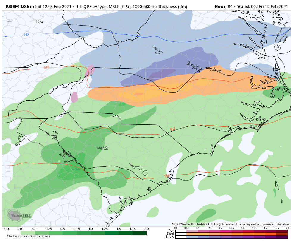
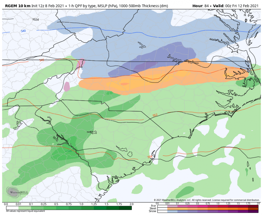
Yep. If it trends hold, I'd almost expect that RGEM map with freezing rain along the edges from GSP to Johnston Co.
-
Absolutely. I'm surprised the NAM hasnt yet. This sort of scenario is where the GEM shines.
-
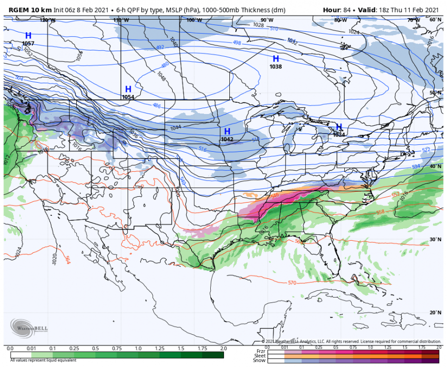
Well, you've got a decently strong high pressure(1036MB) centered over snow covered land plus it's close to some very cold air. It's a pretty classic look. I could see this trending colder and colder.
-
Actually wasnt far away for the border counties with VA to being all snow. Edited to show snow at Roxboro, Yanceyville, Reidsville in the last frame:
-
RGEM is a huge sleet storm.
-
1034 is more than enough for freezing rain. I’ve seen significant events with weaker highs.
-
-
Friday is looking like it has potential to be icy
-
Control run had an ice storm for north of 40
-
Light snow first thing this morning
-
We have a dusting of sleet.
-
33.5 Sleet and Rain
-
What part of the metro?
-
Saw a video from there and it was pouring
-
Mecklenburg county is one zone as far as I know
-
Starting to see slush on the patio and deck here. Heavy sleet with some flakes mixed in.
-
Waiting on the bright banding near Hillsborough to get here. I have a decent enough gut feeling about it