
Radtechwxman
-
Posts
2,105 -
Joined
-
Last visited
Content Type
Profiles
Blogs
Forums
American Weather
Media Demo
Store
Gallery
Posts posted by Radtechwxman
-
-
19 minutes ago, buckeye said:
Have to disagree. Overall a slight step in the wrong direction with stronger hp and flatter look. Ggem same trend.
Well it gives me more snow so I'm happy. Lol. Guess we need to root for nam. But yes I see what you mean. It is pretty flat. Nam has that southern vort really wrap up
-
0z gfs def came north with heavier accumulations. Nothing like nam but a step in the right direction
-
Yea I'm not getting my hopes up at all. But maybe nam is sniffing out an earlier phase?
") one can dream right?
one can dream right?
-
Man 0z nam is really something. Is it on crack or into something? It isn't in it's good range so not sure I believe it's very amped/moisture laden solution. But man this would be awesome. Large area of warning criteria snow
-
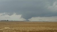
This deformation band fell apart relatively quickly. Sooner than I expected. Think I may be on the lower end of my snow totals but still a nice storm. Had periods of blizzard conditions and insane snowfall rates
-
13 minutes ago, cyclone77 said:
Thought we would have a foot by now when I went to measure a bit ago, but not quite. Up to 11.8". Rates have really slowed in the last hour or so. Picked up 0.8" in last hour and a half. Sure wish those 2"/hr rates could have lasted a little while longer lol.
You and me both! Just had this absolutely wicked band come through here. Easily rates of 2in/hr and wind gusts of 45mph+. Visibility was half to quarter mile. It went through way too fast. Was hoping it would park over me
-
21 minutes ago, janetjanet998 said:
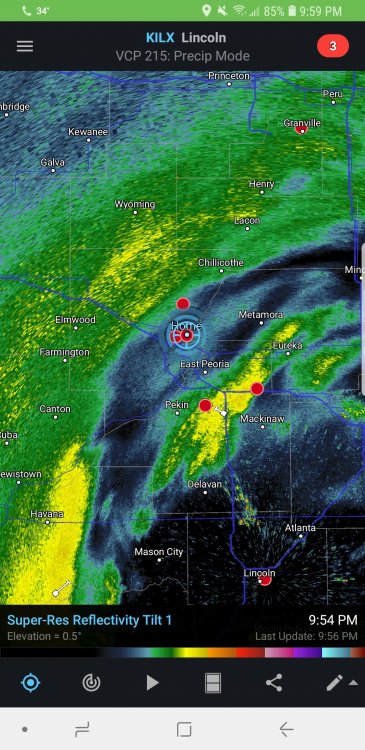
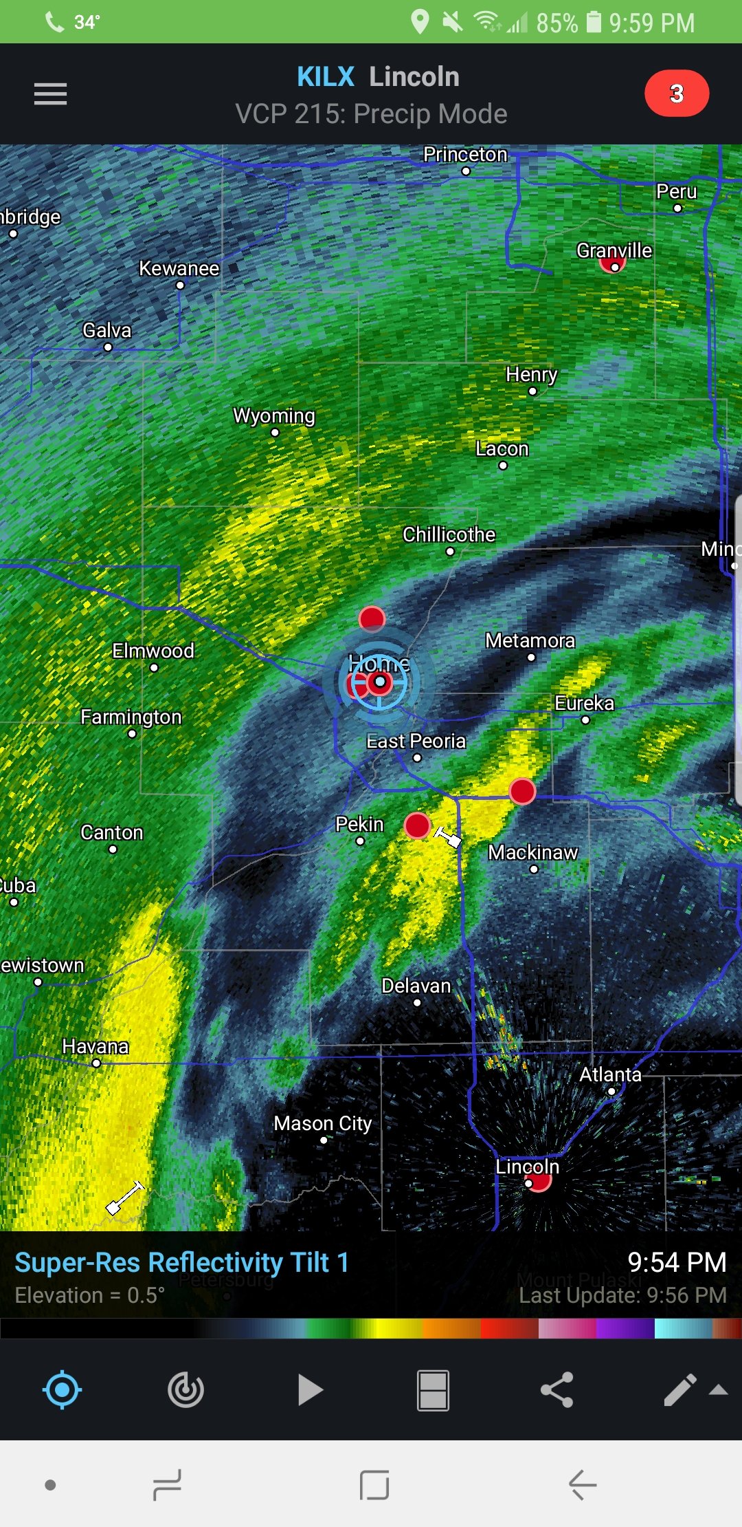
there might be 8-10 inches in extreme NW Peoria county now...north eastern Knox has 8.5 a couple hours ago....likley a dusting SE portions of the county..I got 1.5 to 2 inches here of wet slop on the NW side
of the city
the band would work its way through here shortly ..but the duration won't be long
Yea hasn't panned out how I hoped. Probably will be on lower end of forecast totals. But still has been nice seeing near white out conditions at times
-
My proximity to the dry slot and subsidence from this death band to my west is killing snow bands pivoting into my area. If this doesn't improve my totals are going to be cut in half or more
-
Euro's consistency is pretty remarkable. Def can't be ignored. Seems like models finally honed in on a low track near I70. Slightly better for my area. Blizzard conditions are looking pretty set in stone with 40-50+ gusts coinciding with an insane deformation band. Only thing that may keep blizzard warnings from being issued would be the time criteria needed but I still think DVN and LOT and nw portion of ILX need to upgrade. This is going to be high impact for hours. Looks like my snow will all be after dark which will be good for better ratios. Mon morning commute is going to be treacherous for many
-
7 minutes ago, Jackstraw said:
Don't know how accurate it is but the 00z Euro on weather.us starting to show lightning up into N. Central Illinois.
How did you see lightning on there?
-
Can you post the map further south?
-
2 minutes ago, Stebo said:
Another tiny tick south and it will be almost all snow here!
Where do you view this model?
-
21 minutes ago, ConvectiveIA said:
Me too. Right in the transition zone between a foot and nothing. Only the north-y 00z GFS places is square in the heavy snow axis, giving us over a foot, and I can’t trust it. The official forecast is 1.5-3 inches, but most models place us in that transition “gradient” with 2-5 inches predicted
Well at this point I'm more inclined to believe the more northerly models. Before it looked like the low would track right along I70 but now it's looking closer to I72 which is terrible for me
-
 1
1
-
-
39 minutes ago, CheeselandSkies said:
Wow I am literally right on the line of potentially not seeing a flake while 10 miles to the SE gets several inches.
Sent from my SM-G955U using Tapatalk
In the exact same boat as you. I feel your pain
-
1
-
-
The cutoff for this is pretty unreal. Has warning criteria in nw portion of my county and nothing se. I'm like in the middle. Lol. This is going to be a nail biter
-
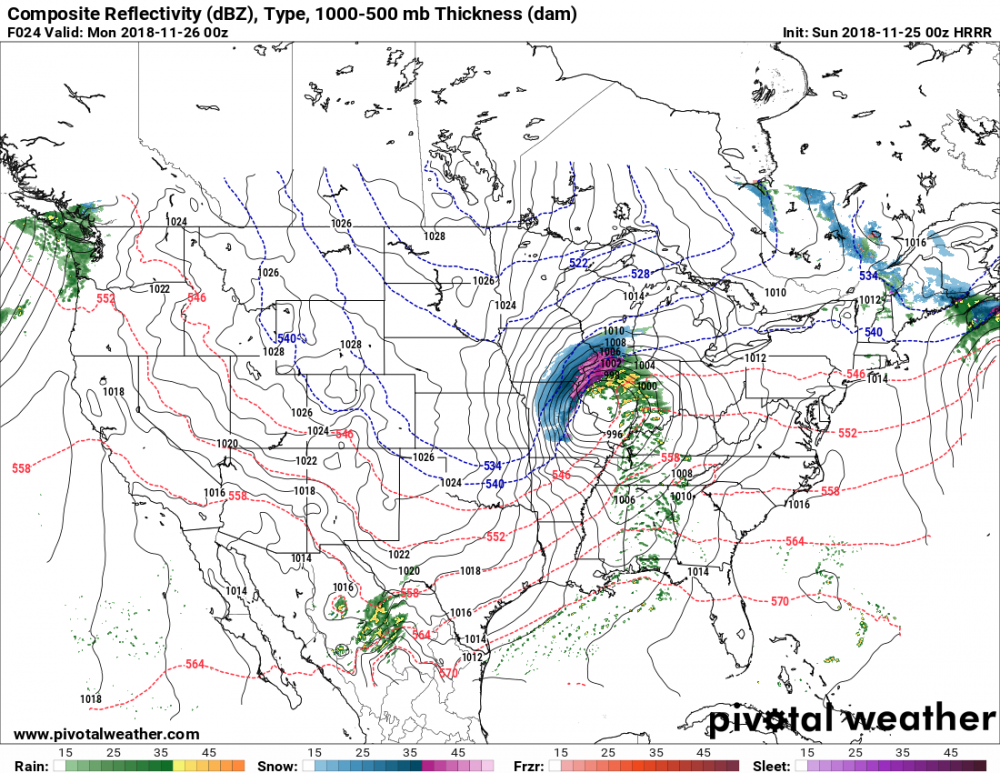
Seems like we have a stronger, slower solution showing up now. Definitely a notable slowing trend. Currently our low is 993mb in far SW Kansas. Strongest pressure falls occurring across the KS-OK border and spilling into OK. Seems like it should keep a mostly east course. Where it starts turning more ne will be critical to areas further east (central IL, Chicago) changing over sooner or later
-
5 minutes ago, CoalCityWxMan said:
I don’t think what you’re referring to is mixing, it’s just heavy snow.
That would be some mix. Sleet, snow. Not solid snow. Esp given where it tracks the low near I72. One thing I have noticed, even with HRRR, is that it tends to miss how rapid dynamic cooling can take place. Changeover could be quicker than it shows. Do you think the low will track that north? My gut has always been on I70
-
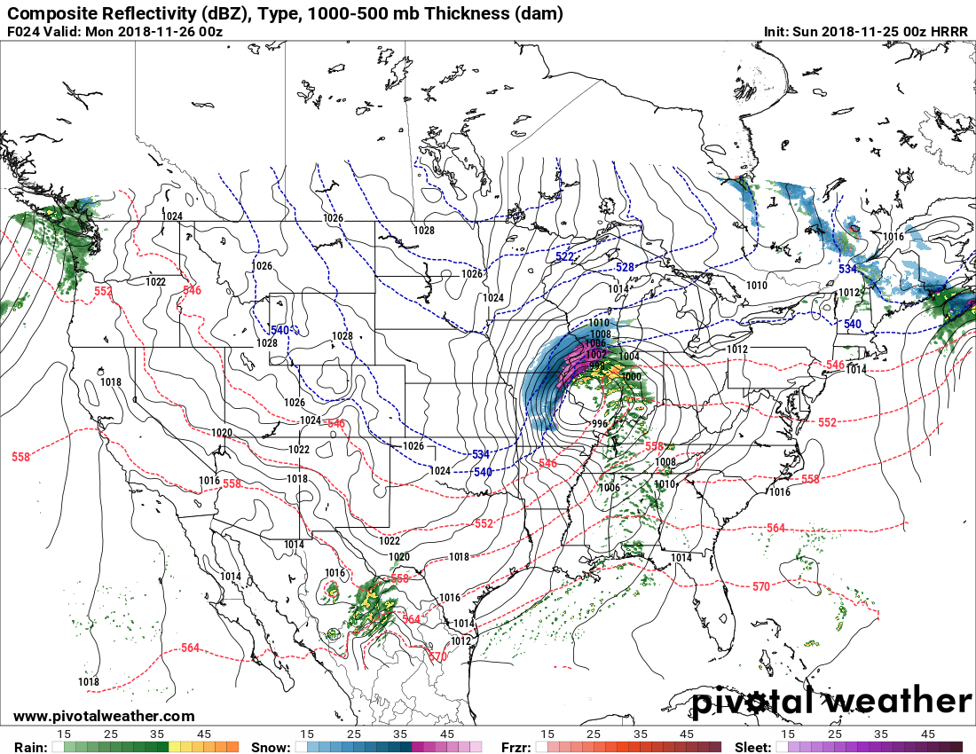
New HRRR. 0z run is very amped up with the low and has the track very north. It has mixing issues pretty much all day Sun in IL all the way to the MS. Except far northern IL
-
11 minutes ago, Hoosier said:
Seems to me like the 18z Euro shifted north a little
Not sure it shifted. It just has a wider jackpot zone. Also not as brutally sharp cutoffs. Probably not realistic though as the mesoscale bands will have brutal cutoffs
-
 1
1
-
-
Anyone know what 18z euro showed?
-
I'm mad jealous. Literally the extreme nw portion of my county could see warning criteria while the se portion sees nothing. Unbelievable. Hoping for a slight southward shift
-
Well I never really been in the heart of this. Always been on edge. So any north shifts and I'm out of it. Euro has been the only one hammering my area but seems to be on it's own. Really need that low to track along or preferably south of I70
-
5
-
-
Models need to make up their mind. 12z goes south and gets me excited then 18z goes north and screws me. I don't know what to expect at this point
-
1
-
-
Euro has been remarkably consistent the last several runs. I trust it more than GFS. Euro looks like it pretty much tracks the low right along I70. Would feel more comfortable if that was a touch south but still better than GFS which is north of I70 by a good bit
Winter Storm!? Jan 12-13th, 2019
in Lakes/Ohio Valley
Posted
WPC has the high positioned pretty north on their forecast maps. But if that high ends up further south I agree it will make its presence felt with major dry air and hold that precip shield south. Whoever is on the northern fringe of that shield is going to see a sharp cut off