
Radtechwxman
-
Posts
2,099 -
Joined
-
Last visited
Content Type
Profiles
Blogs
Forums
American Weather
Media Demo
Store
Gallery
Posts posted by Radtechwxman
-
-
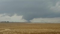
Man that deformation band evaporated faster than my last relationship. Getting some nice winds now and mood flakes though.
-
 3
3
-
-
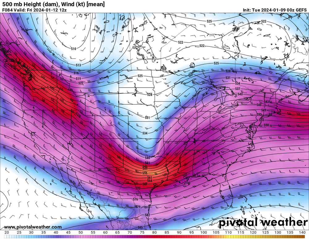
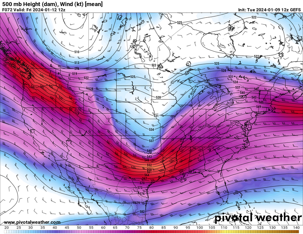
Nam doing nam things. I get this thing could pull up a big slug of warm air with it but where nam has the low placement I just don't buy rain this north that long or maybe even period. Thermals seem wonky on it. It is doing strange things with the 500mb low.
-
18z gfs continues to be stubborn as a mule. But does serve a nice waa wing of snow. Just no deformation zone snows here. Models all over the place.
-
Team Euro. Ride or die. @Chicago Storm we need back your Ke$ha certified snow maps. Those always reeled these in.
-
1
-
-
17 minutes ago, andyhb said:
Decided weaker/east shift on the GEFS. Historic storm off the table there.
Lovely. Hopefully it trends back but feel like it won't. This first storm trended nw so makes sense this trends se. Can't win here. Ha
-
4 minutes ago, andyhb said:
How is that in comparison to the OP? I haven't had time to dive super deep into this one yet.
-
Well ICON, Ukmet, GDPS, and somewhat nam/euro all look good for this. GFS did pretty well with this current system. Is it going to be right and be a miss se for us?
-
8 minutes ago, A-L-E-K said:
take a peak around 850, the somewhat overstated cold for this system comes a bit later or just in time depending on timing/how u look at it. the antecedent isn't great, certainly nothing those kind of 850 winds can't handle and i don't see some snowpack moving that needle anyways
it's mostly a timing game as always
Yeah all valid points man. I haven't dove deep into this setup because I figured models will be flip flopping till this first system moves out. I was guessing the issue was aloft but still surprised the isotherm gets above 0C this north with where the low tracks. But it is a powerful system and models often underestimate WAA. I definitely think the snowpack could set up a nice baroclinic zone for the next system to follow. I anticipate it will track further south than this ongoing storm.
-
Kinda surprised models like NAM and Euro are showing precip type issues so north with this. Thinking after models resolve this current system and its snow pack it may resolve those issues better.
-
 1
1
-
-
1 hour ago, Stebo said:
Definitely don't like the Euro overamplified look, but I will say it was overamplified with the current system at this junction too. The GFS is probably a more reasonable solution just because the rarity of getting a low as strong as the Euro that far south and the GFS did pretty well with the current system where as a lot of other models had the low further north.
Hoping it won't end up more suppressed like the 06z gfs run and miss a lot of the nw subforum. Need a nice spread the wealth storm for us.
-
Some cam guidance not as gung-ho as earlier about accumulations in the deformation zone but imo looks to be shaping up nicely on radar
-
06z gfs was not a fun run but trend is your friend. Just one run. Overall it's been very amped. Esp the ensembles
-
1
-
-
43 minutes ago, Sciascia said:
That dry zone looks fairly large. Hopefully it fills in as it continues to move.
It's starting to fill in some by STL
-
Euro odd though with thermals. With as south as it tracks, it has rain for quite a bit before changeover here. Bit skeptical of this based on colder air available for this system.
-
Some nice rippage here right now. Best rates so far.
-
10 minutes ago, Chicago Storm said:
Nearly all guidance had some sort of lull swinging through during the late night/early morning.
Not quite this early. I agree towards morning for sure. Back edge is on my doorstep unless it starts filling back in.
-
No model handling this dryslot well right now I feel. It has really punched north and east. Models I feel never get a good handle on this. Looked like it was going to snow well into the night before but now looks to be ending early
-
5 minutes ago, fluoronium said:
It switched back to snow here (near Metamora) and it's sticking pretty well now. Hopefully it can stay this way for the rest of the night.
Yeah it's snow here now. But back edge of precip doesn't look super far away. Hopefully it keeps filling in.
-
That dryslot is really punching north in MO. Curious how this will impact the event. Most cams fill back in the dryslot as the sfc low lifts closer and upper dynamics approach area.
-
1
-
 1
1
-
-
14 minutes ago, fluoronium said:
Precip started as snow here, then switched to a mostly rainy mix. Models had all snow for me at this point

I'm having the same issues so I feel this
-
A lot of mixing issues here thus far. Longer than what models depicted. Definitely getting nervous totals going to bust here tonight.
-
This snow better increase in intensity and size or this won't pan out nicely out. Kind of struggling so far. Marginal temps I'm sure aren't helping.
-
Though I am liking trends on hrrr I am a bit confused on its se trend given the low is 991mb now and it initialized it around 996mb. To me I would think it would end up more nw if it's stronger than it's depicting.
-
DVN being very aggressive with their snow forecast. Higher than most guidance. Also a very strongly worded afd. Meanwhile ILX sounds awful. Lol. Talking about mixing issues here tonight which I totally disagree with. That will be issue tomorrow.
Jan 11-13th Blizzard
in Lakes/Ohio Valley
Posted
Given how poor nam looked days out with current storm with its far nw sfc low track and taking the 500mb low very far west I wouldn't trust it. Seems like nam is usually late to the party to catching on to other models. Also not sure it has resolved current system's snow pack.