cyclone77
-
Posts
18,656 -
Joined
-
Last visited
Content Type
Profiles
Blogs
Forums
American Weather
Media Demo
Store
Gallery
Everything posted by cyclone77
-
Today's setup ended up being a dud for this area, with only 0.20" of rain. Was nice to see the storms erupting overhead though. Definitely a lot better than a withering blob of Iowa crapvection in the late evening.
-
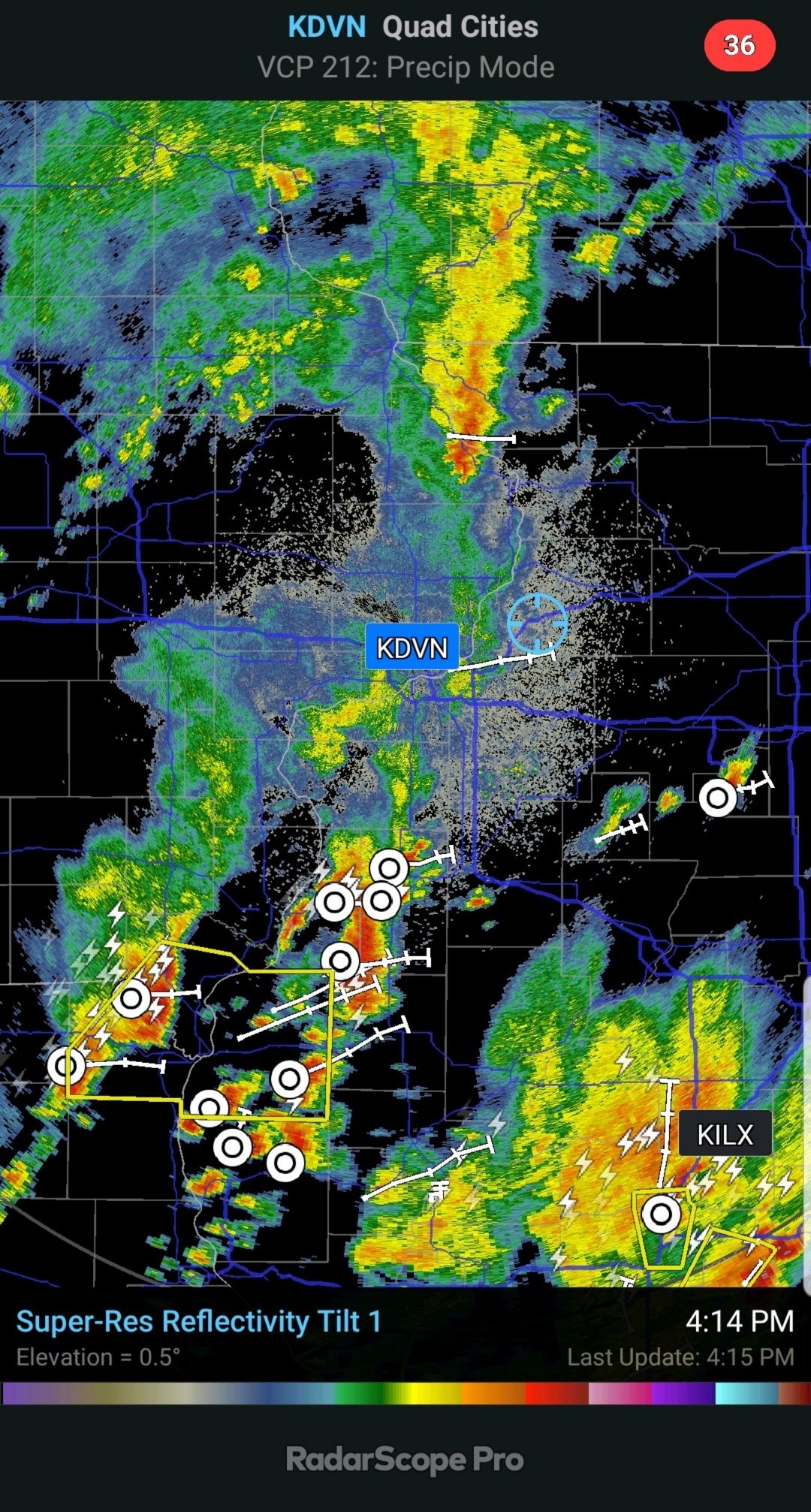
That area eventually did grow/organize, and is now the severe storm cluster southeast of Sterling.
-
Had a brief period of 35-40mph wind gusts from the cell that passed just south a short while ago. If that did that, then I can imagine there's some pretty good wind potential underneath one of the severe ones.
-
In sort of a convective hot spot at the moment. Towering cumulus filling the sky, with a large thunderhead just about to move in from the southwest, and another nice one in the northeastern sky. Getting bursts of very large rain drops from passing showers underneath some of the updrafts. This whole area is likely to fill in and organize as it heads east and through the rest of IL as the eve goes on.
-
Wish that sounding was complete to see what the cape was lol. AFA convective temp I'd guess the mid-level speed max and nearby MCV should help lower that a bit.
-
Some nice towers in the northern/northwestern sky. Looks like an extension of the cells that have already taken off, and are severe warned southwest of Rockford. So that looks to unzip southwestward towards the Clinton Iowa area, and possibly further west if it keeps unzipping. Sitting at 83/72 here with a robust southwest breeze. Edit: 53kft tops on the big warned cell northwest of Oregon IL.
-
Man, Broyles is everywhere. What, does he work like 70hrs a week? lol
-
Timing looks pretty decent for the DVN cwa with this. This doesn't look to be another case of withering Iowa sloppy seconds.
-
Yeah I'm digging it. As I've gotten older I've grown less fond of the humidity on a daily basis anyway. Still appreciate the extreme 80 degree events, and of course love the humidity when there's a decent convective setup. Other than that it can stay in the 50s all summer as far as I'm concerned lol. Corn crops around here are looking fantastic. Most fields are waste/stomach high now, with only some areas of retardation where there was standing water back in May/early June. As long as we get regular moisture the rest of the growing season it should be an excellent crop around these parts.
-
lol

-
Can see rock hard looking towers/thunderheads on the eastern/southeastern horizon from here. Looks like a nice event for areas to the east.
-
.33" here this morning. Lots of clouds in place limiting instability so I'm not optimistic we'll see much today.
-
Some nice towers bubbling up this afternoon. Nice little pulsers popping now and again. Working outside on a project this afternoon, feels a little muggy with little to no wind and dews pushing 70. Some outflow from one of the cells would be a plus.
-
Finished with 0.04" for the day.
-
Apparently we got in trouble and NCEP took our toy away. Attention User: Update (6/20/2020): NCEP has stopped transmitting HRRRv4 data until further notice. For further information, check the following twitter accounts for periodic updates on product generation status and website improvements; @CoDWXData and @CODMeteorology. Your feedback is always appreciated, so feel free to respond to tweets or send us an email using our Feedback page.
-
Looks like a shot at a storm in the next few hrs. Rains have shut off lately. No measurable rain since Jun 10. Needed to dry out though so it worked out well
-
Thundered earlier from a pulser that passed southeast. Temps the last few days failed to hit 90 as clouds have been an issue.
-
Corn around here is looking great (except in fields where there was a lot of standing water) and is running ahead of normal. Most of the corn is knee to thigh high already.
-
It can snow in <4 months.
-
zzzz
-
Another afternoon with dews in the 40s and a fresh east breeze. It can stay like this all summer as far as I'm concerned. Very boring weather from an enthusiast standpoint though I guess.
-
These dews are crazy low for mid June. Dipped into the 30s over a large part of the sub, with some upper 20s as well as pointed out by madwx. Someone must have tripped over a cord at HRRRv headquarters. Model hasn't updated since Thursday.
-
Temps overachieved again in this area. Made it to 88 here, 87 at MLI. Backdoor CF almost here. Only low 70s tomorrow.
-
Temps overachieved today, as we made it to 81 here, and 83 at MLI. Loving these 50 degree dews.
-
DVN FTW!!