

nwohweather
-
Posts
3,525 -
Joined
-
Last visited
Content Type
Profiles
Blogs
Forums
American Weather
Media Demo
Store
Gallery
Posts posted by nwohweather
-
-
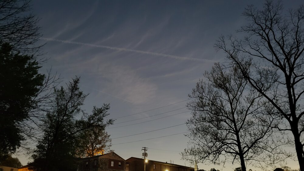
Not much of an event here in the Toledo area. Looks like the LCL put a bit of a lid on things, instability and shear weren't enough to drop anything truly severe
-
 1
1
-
-
12 minutes ago, largetornado said:
There is a dry slot right out in front of these storms. Wonder how much that plays into it. Nothing to the east or south of existing storms has been able to sustain
NW Ohio has a much better environment. LCL's likely need to come down a few hundred meters though
-
Might just need a little more humidity for this to really get going. The atmosphere is solid at the moment, I'm shocked nothing is really taking off
-
Tornado Watch going up shortly in west Ohio
-
Little rain overnight is all that's left over. To be honest, I'm not sure why they aren't going ENH, the atmosphere is going to be absolutely primed across the region today.
-
Pretty solid environment over in IA/MO at the moment. All key parameters seem pretty high at the moment, just a little capping to erode still
-
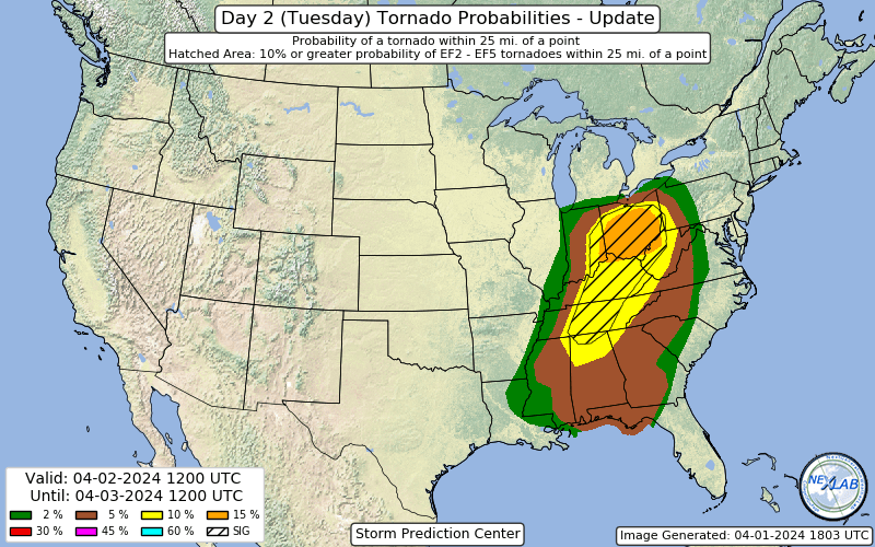
FYI, I opened a thread for the next few days
-
With a Day 1 ENH and a possible one tomorrow as well, I figured I'd start this up instead of using the short range thread.
-
16 hours ago, Floydbuster said:
Here's the 00Z HRRR lightning map. Much less and way south, almost all in West Virginia. I don't see any reason why the SPC will keep such a higher risk, and especially not as far north as it was this afternoon.

After last week's MDT they really need to tone it down a bit, this isn't WWE. Everything is socked in with rain at the moment, I wouldn't have anything above a slight.
-
2
-
-
Overall lets be honest, Zaxby's is the best chain.
On 4/10/2024 at 12:53 PM, nrgjeff said:Wow most of us really lucked out on the decreasing clouds. I had to react thank-you to the satellite pics. We stationed in Arkansas, but most of my posts (and every detailed one) is here. So if you don't mind, I'll share my account here in G. Lakes / Ohio Valley. This is where I will come back to reflect on the eclipse, and our shared experience. I still do so in the Tennessee Valley 2017 thread.
Sunday I went to Memphis to meet my usual storm chase partner there. Monday as we rolled through Jonesboro, AR it was evident our sky would remain clear. We stopped in Black Rock, AR. Set up in a little park across the street from a Mt. Vernon Baptist Church. It's on!
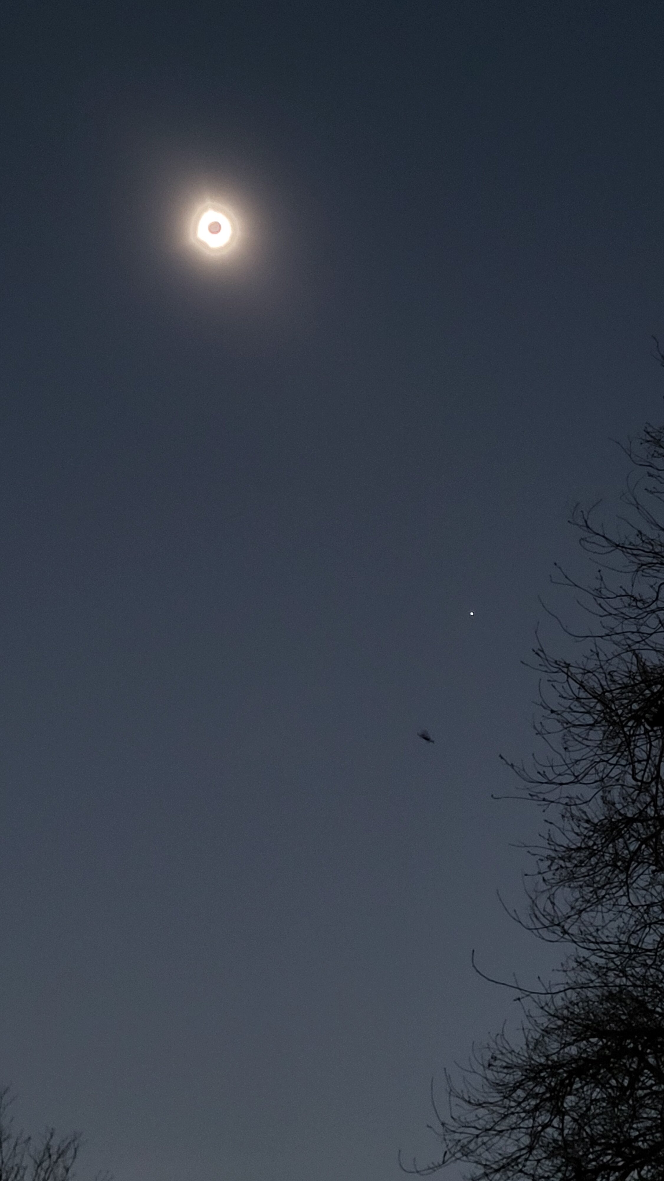
Partial phase begins with little fanfare as always. Two guys are already there. A family joins. Local neighbors wave and greet us. Soon the crescents are under the trees. Deeper into partial the light gets weird. By 70% it's quite obvious. Contrast ramps up, deeper shadows. Colors change a little bit. By 95% it feels like we're on another world. No shadow bands at our location (we did 2017). Too early in the season for cicadas. However, a cat fight happens at about 98%; not sure if related, we just hear it somewhere. We get a classic eclipse breeze, beyond just cooling off. Wind flips 180 degrees to emanate from upstream totality. Oh yeah with 30 seconds to go the western sky gets deep navy blue or purple. It's not a sharp shadow, but it's obvious. It's something between a curtain and a paint job. I don't feel like it's eerie; it's majestic. We are about there!
Totality arrives like someone turned off the lights. Remaining cirrus looks like noctilucent clouds (they're not). I catch the diamond ring going in. Careful rehearsal (unlike 2017) pays dividends. Right as the eclipse glasses go dark, naked eye the diamond ring. The moon is darker than I'd imagined. Intellectually I know it'll be black; but wow, it's black alright. Black button sits over the most gorgeous white light I've seen since 2017. 5-6 filaments stick out from the corona fairly evenly spaced around, two are more dominant. Smaller pink/orange prominence is visible at the bottom. Corona has that solar maximum power feel like it just wants to explode! In questionable judgement I naked eye two Bailey's Beads coming out. C2* (going into totality) is relatively safer because our eyes are sun adjusted. C3* (coming out) is risky because our pupils are wide open. Well two days later I can still see. C3 happens quicker than I'd anticipated despite my eclipse timer. Bailey's Beads are bitter-sweet; so beautiful, but totality is over.
Umbral shadow fascinates me. Per rehearsed routine I just watched the umbra coming into totality. C2 goal was the diamond ring. One has to plan a little bit so we don't miss everything happening in such a short time. C3 is the time to photograph the departing umbral shadow, which can be done reasonably easily compared to the actual corona display. Ditto 360 deg. sunset/rise, which we do.
* Official guidance is never to look at the sun directly. They say even the diamond ring and Bailey's Beads are not safe to look at with naked eye.
On the way out we reflect on the powerful emotional experience. 2024 was a classic total solar eclipse. Corona was the power display in my opinion, near solar maximum. 2017 we were near a solar minimum. Corona was less wound up. 2017 was asymmetrical but more delicate with 3 longer streamers leaping across the sky relative to 2024 filaments. However 2024 was darker and filaments still incredible. I feel like 2024 was the classic dark total solar eclipse. @vpbob21 and @Floydbuster I figure the high clouds scattered some light your location in 2024. Your sky looks like our 2017 where the moon was farther and totality shorter, smaller shadow.
Photos don't do it justice. While a picture is worth 1,000 words, our imagination is worth 1,000 pictures. Ask a professional photographer layering this thing. I have elected writing and just cell phone photos. We did not attempt technical photos. Elected minimal gadgets for maximum viewing. I double checked myself with two other eclipse accounts. Don't want to forget anything.
Bob Berman. The Sun's Heartbeat. Totality; the Impossible Coincidence chapter
Mabel Loomis Todd. Total Eclipses of the Sun. Description of a Total Eclipse chapterUmbra shadow, 360 sunset/rise, Totality

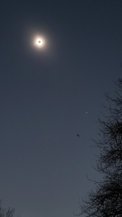
Great post, and you really detailed this well. I will say with Bailey's Beads, that's a fair point. You could only see it for a couple of seconds before needing to throw the goggles back on. Also, the cool down was remarkable to feel in person. Noticeably we lost 5-6 degrees in a handful of minutes, from a weather perspective that's really shocking to feel.
-
2
-
 1
1
-
-
39 minutes ago, Stebo said:
I took a video of the 360 degree sunset at my location, I was down in Marion OH. Absolutely worth the trip even with the mess of traffic in Toledo that took me 2 hours to go 25 miles.
As a Toledo resident I can confirm that's the worst I've ever seen this city. Folks were taking every road possible that led to Michigan, apparently in Sylvania it was so bad that yards were being drove through.
-
Flood Watches dropped already for tomorrow night thru Friday morning for northeast IN, northwest OH. I'm surprised they issued the Watch, although rivers are pretty full. The ground isn't saturated at the surface, thanks to the breezy conditions and sunshine today, but I guess it won't take much rain due to subsurface soil being wet.
Ran the tiller today. Can confirm the ground is pretty moist-
2
-
-
Surprisingly pricy though.
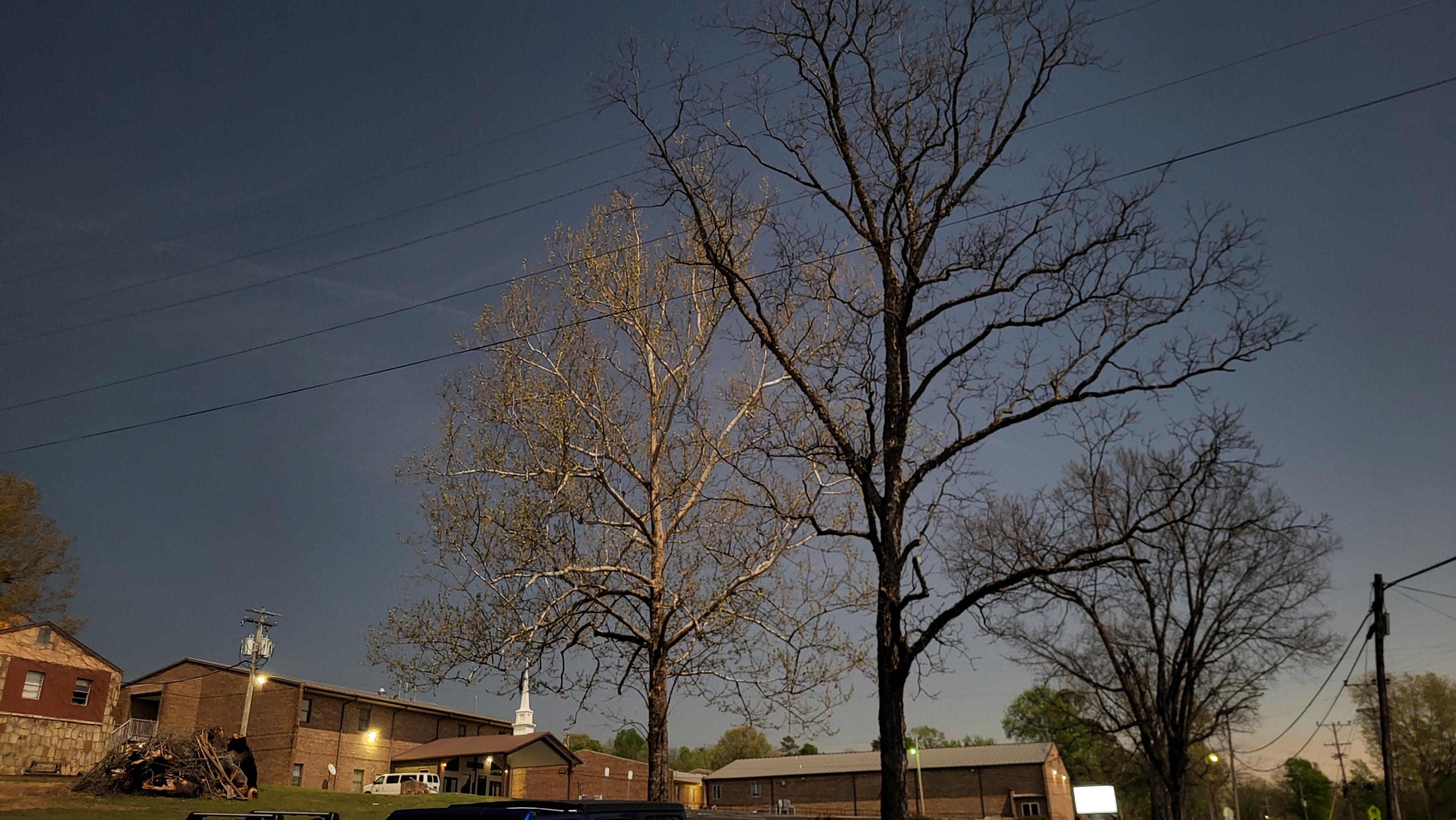
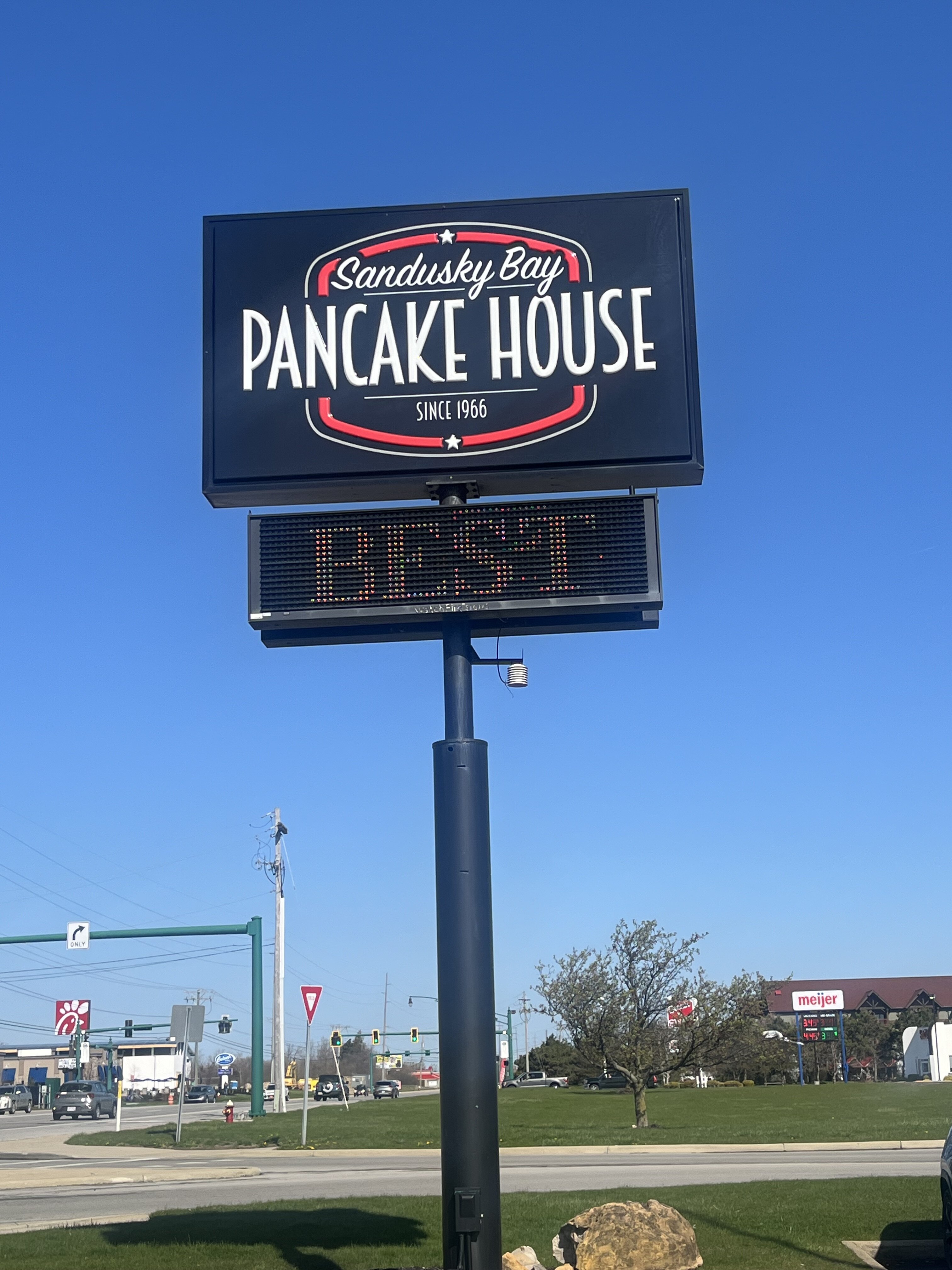
Yeah but to be fair it’s a cool place in a tourist area. Anyways, here are my photos from west of Fremont, Ohio at the family farm.


-
8
-
-
Sandusky is my spot today

Really good place to eat!-
1
-
-
Had a heavy grauple and sleet shower this afternoon that whitened the ground briefly, 0.1", however, it melted quickly. Popcorn showers dotted the area today
So glad we went South for vacation. Just seems like brutal weather this week up there-
1
-
1
-
-
Bust of a moderate for sure. Simply too many storms firing up on top of each other and too much rain this morning in OH/IN for severe north of Cincy
-
Significant tornado in progress in central WV.
Also its 71/64 with a south wind at Covington KY (Cincinnati metro) rn. Anyone calling bust/counting out at least SW OH for later needs to take a step back.
I’d agree that Cincinnati and Columbus are still well under the gun. But, the way everything is going mostly linear concerns me more than the instability -
Just wonder if there’s too much forcing aloft. Those storms are all crowding each other in Indiana pretty hard.
If instability keeps growing though, you’ve got an environment very supportive of strong tornadoes-
1
-
-
WOW
Of course I’m out of town too. Would’ve posted up in Van Wert for sure -
3 minutes ago, Lightning said:
The eclipse is way too far away to have a forecast with that level of definition. I am sure next week a thread will be going for it. I am also waiting to narrow it in what I will do.
You don't have to lurk. It is mostly friendly bantering with a bunch of weather geeks here.
I'm excited to follow the SPC mesoanalysis as well to monitor the shadow on the satellite and surface obs.
-
1
-
-
I'm glad to hear that your family made it through but am sorry to hear about the house you grew up in. I was a little curious to see if that may get an EF-4 rating. It seemed like the only damage truly in question was the Taco Bell...the expected wind speed for that damage indicator (complete destruction of a small retail building) is 167 MPH (EF-4) but they went 165 MPH (EF-3). I had seen one or two pictures of what looked like actual bolts ripped from the foundation (which would be proper construction) but also saw several more pictures where it appeared to just be straight nails holding the building to the foundation (which will give way much quicker and don't support an EF-4 rating). I'm curious if they found legitimate construction issues with the Taco Bell (i.e. anchored with nails and not bolts) and kept it an EF-3 for that reason (perfectly valid) or if they thought the Taco Bell was well-constructed but kept it an EF-3 due to a lack of other EF-4 damage indicators (which I have more mixed feelings on, especially in a multi-vortex tornado where the strongest winds will occur in very small suction vortices). Right or wrong, it's seemingly very difficult to get a higher tornado rating if it's just one damage indicator that supports it unless the one DI is very solid, and there were other structures around the Taco Bell that weren't really in consideration for the higher rating. I try not to get caught up in the rating debate too much because ultimately it's the people who lost loved ones and/or had their lives turned upside-down that really matter, but there's uncertainty in a lot of stronger tornado ratings...I feel like the burden on proof for a higher rating is placed on the tornado when they decide the final rating when there’s uncertainty and could go either way (if that makes sense).
Really appreciate the in depth minute by minute analysis. Really interesting to hear what the beam heights are on a county by county basis. The remarks about I-75 is a bitter pill to swallow, high beam heights and the airport radar out of Detroit are covering the heart of a 650K metro area. Really highlights the importance of trained spotters in the Toledo area -
9" report coming out of Rockford within the band
Currently at ORD on my way back from the Canadian Rockies. Solid snow rates at the moment-
1
-
-
There were several photos and eyewitness reports of a tornado east of Findlay, north of Vanlue and into Seneca County near Alvada and southwest of New Riegel. Finding damage has been difficult in that area. Stay tuned for some sort of final assessment of that area.
But yes, the confirmed EF-1 in southwest Hancock County was with the next cell that came in behind the tornado warned cell.
How difficult was tracking this in the office? Findlay/Tiffin are in a bit of a radar hole and until they got a little more easterly it wasn’t the easiest rotation to discern -
Re. the SPC outlooks yesterday, took a hindsight look at yesterday's 12z HREF plus the Nadocast Twitter feed.
A good case can be made that SPC should have issued a 10% hatched tor in the general vicinity of the area affected by strong tornadoes, by the 1630z or 20z update.
Plenty of boxes were checked environment wise in the HREF mean fields, plus some of the neighborhood and paintball UH probs.
The 24-hour STP based calibrated tornado probs had a spot of 10% right near one of the strong tornado tracks.
Since they had a slight with 5% tornado probs, it wasn't an egregiously underdone forecast. 8/24/16 is a much better example of that when doing hindsight assessment of the day's SPC mesoanalysis fields.
Sent from my SM-G998U using Tapatalk
Well said. If I’m not mistaken they were anticipating storms lining up, which never happened. Also, I believe instability and shear were all considerably higher than modeled in the morning.
Still, I’ll admit I didn’t expect to see multiple long track supercells. The Wapakoneta Storm was tornado warned from Indiana to Columbus-
1
-
April 16-17 Severe Weather Event
in Lakes/Ohio Valley
Posted
Not a bad storm reports day at all, definitely warranted the slight risk. Shocked to see some of the damage reports on US-127, it did not seem like the line was that strong at the time it went through there