-
Posts
10,256 -
Joined
-
Last visited
Content Type
Profiles
Blogs
Forums
American Weather
Media Demo
Store
Gallery
Posts posted by paweather
-
-
1 minute ago, Ruin said:
so between 3 local news channels I have had 2-3 1-2 and 3-6 lol so bet on 1-6 inchs
Good range.

-
2 minutes ago, Bubbler86 said:
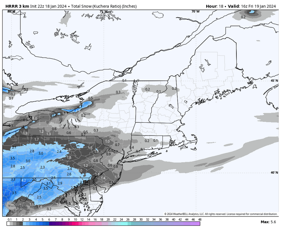
It lowered south PA a bit. Did get a few spots closer to 3.5. Big difference is to our south where it is 5-6". But for us not a big change. Maybe 2-4 is a better than 1-3 as a statement for the Lsv. A little extra snow at the end.
Yeah, Thanks.
-
7 minutes ago, Bubbler86 said:
The 0Z HRRR is going to be 1-3" LSV with maybe some areas a littler over 3....higher totals well to our south. FWIW.
Looks the same to me but what do I know.
-
-
-
1 minute ago, Bubbler86 said:
If Euro confirms the MA party, it is going to get happily raucous down on that board. They are super happy when I looked an hour ago.
That’s good for them and us
-
24 minutes ago, Itstrainingtime said:
I think his last day is tomorrow?
It is although they want him to stay
-
Kyle Elliott on with Joe Calhoun
-
Pretty much models stayed the course 2-4” as CTP indicates. I’m ready for tomorrow.
-
4 minutes ago, Bubbler86 said:
Nah, but my yard is snow covered and caved.
? so is mine. But mine didn't cave.

-
2 minutes ago, Bubbler86 said:
Not even Friday yet and my yard has already caved.
You snowing? Good deal.
-
 1
1
-
-
3-4" for Lebanon county now I am thinking 8-12"

-
5 minutes ago, Bubbler86 said:
That is a great run for PA.
-
 1
1
-
-
Still 29 here and Cloudy.
-
-
Updated CTP Forecast:
FridaySnow, mainly after 7am. The snow could be heavy at times. High near 32. East wind around 7 mph becoming northwest in the afternoon. Chance of precipitation is 100%. New snow accumulation of 2 to 4 inches possible.-
 1
1
-
-
Nooner 28 and Cloudy.
-
12 minutes ago, Bubbler86 said:
Icon a quick mover....1-3" on Pivotal for almost all of Eastern PA.
Forget the globals we are well within the Nam range.
 J/K.
J/K.
-
8 minutes ago, sauss06 said:
read this morning, weather concerns again for the KC/Bills game this weekend
Sunday looks dry for them but cold.
-
21 minutes ago, mahantango#1 said:
From JB this morning: The clipper could still bomb out near the coast Friday night, but it looks like a large area of 20:1 ratio snows from the northern Plains to the M-Atlantic. It is going to be followed by the coldest weather of the winter for the East, but not the Plains, as they will start to warm
JB and DT both are in the 4-6, 4-8" side of us.
-
 1
1
-
-
-
-
2 minutes ago, Blizzard of 93 said:
I’ll take DT’s 4 to 6 in my yard & for the Harrisburg area.
I'm with you!
-
1 minute ago, Blizzard of 93 said:
Over performing!
Yes and in the NAM range!


Central PA Winter 23/24
in Upstate New York/Pennsylvania
Posted
Yep Lebanon went to 3-5”