

paweather
-
Posts
11,625 -
Joined
-
Last visited
Content Type
Profiles
Blogs
Forums
American Weather
Media Demo
Store
Gallery
Posts posted by paweather
-
-
I don’t want to leave this board due to health but now it’s time due to this dumbass Micky. See you all, good luck with any storms hopefully snow. It’s been fun for a long time!
-
6 hours ago, MickeyTim6533 said:
Just ignore him folks that’s all. Wow the cold over the past couple of weeks have been impressive. We look to warm up a bit finally but making the storm track more active with mix weather events and then IMO end of month a big dog comes.
-
 1
1
-
-
47 minutes ago, AllWeather said:
 Ridge axis over IdahoHudson Bay high50/50 low in ideal positionDecent high latitude blockingSub-trop disturbance
Game on.
.Good to see you Allweather
-
3
-
-
Snowing again
-
1
-
-
Just now, mitchnick said:
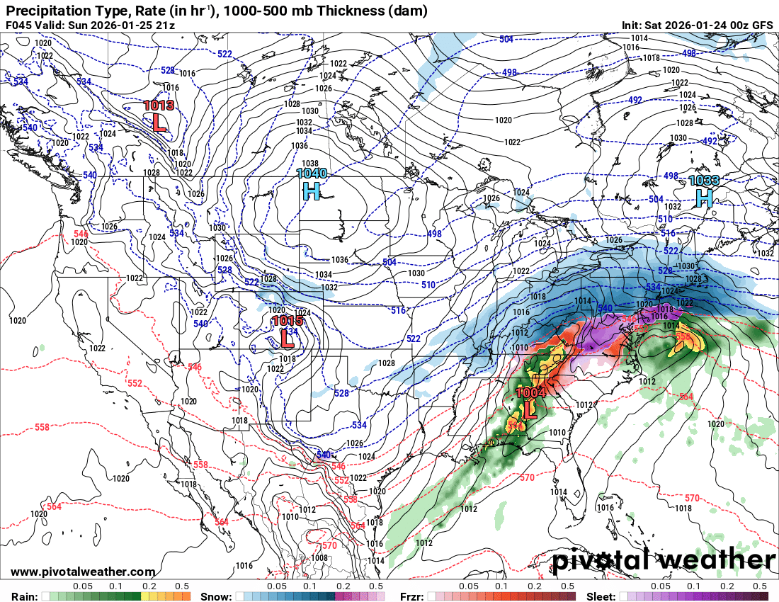
Still getting a decent amount of snow mixing in especially with heavier bursts. You guys near Harrisburg should get a lot of mix and then switch back to all snow with accumulations. If I switch back, it'll be more a novelty than accumulating.
Yep snow sleet still accumulating
-
Still snow in Palmyra
-
1
-
-
2 minutes ago, AccuChris said:
Long range HRRR is definitely walking a razors edge with the mix line between Route 30 and 76

.Major dry slot
-
1 minute ago, Blizzard of 93 said:
21z tomorrow by 4 pm mix to around turnpike.
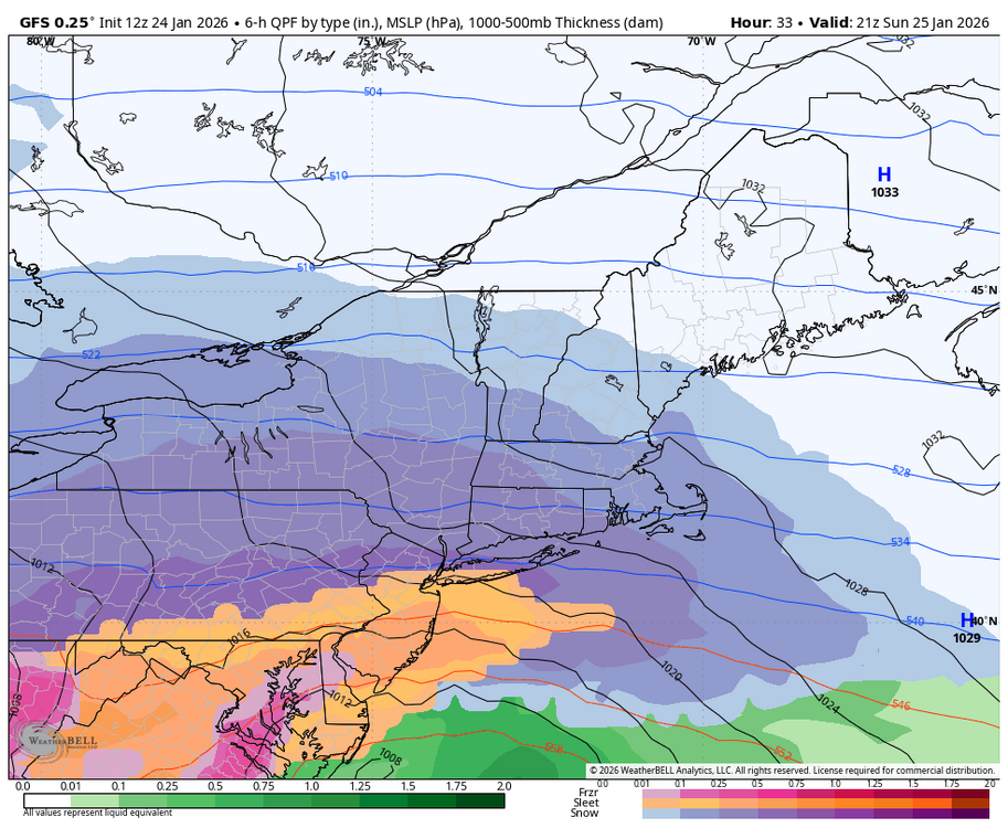
If you have heavy rates you got snow
-
-
WGAL sticking with their original forecast good for them!
-
4
-
-
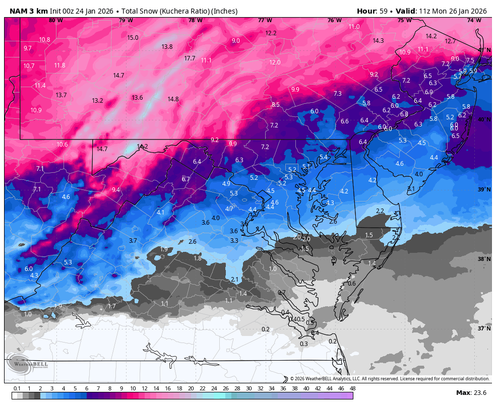
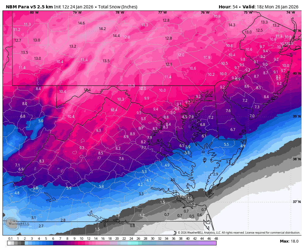
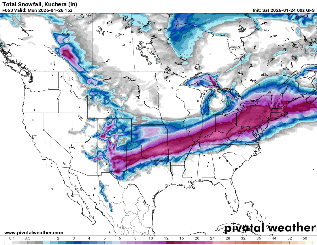
Still staying with 16” in my area
-
Not very organized down south yet hope things look better this afternoon/evening
-
OH and CTP still over a foot lol
-
Isn’t great to see these meterooogists CTP now lower amounts they don’t know either. The output overnight was great. Why lower no need until you had to today if models were showing lower amounts. Back to fun let’s bring this home!
-
Just now, pasnownut said:
and because we know its pingers and not ZR, I personally dont really care. Its the ultimate pack densifier/retention agent. Especially with cold that is to follow.
Just like my wife always tells me, I dont need too much...just enough.
with that I say gnight.
Talk tomorrow have a good night
-
1
-
-
93 Superstorm had the same type of results sleet at times mostly snow.
-
3
-
-
-
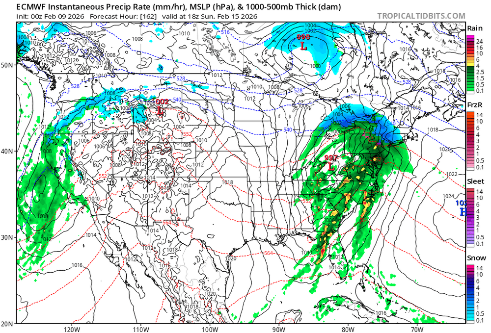
GFS 7pm Sunday all snow coastal took over
-
-
CTP hasn’t touched amounts yet in my area
-
3K NAM: don’t give up
-
2 minutes ago, AccuChris said:
Sadly the 0z rapid refresh wasnt much better


.Never used this model
-
2 minutes ago, pasnownut said:
I hope all the jumpers read this twice.
Exactly!
-
1
-
-
2 minutes ago, WmsptWx said:
I think that's the least of their concerns. A large bust given our current social environment where the people have just gotten more and more toxic, and you're going to have public emergencies when something actually does occur because we're crying "Wolf" too much.
There is no bust yet


Central PA Spring 2026 Discussion/Obs Thread
in Upstate New York/Pennsylvania
Posted
Hey everyone,
I just wanted to check in to let you know I’m very sorry towards the way I acted to everyone earlier last year. I know I have no excuses but I’m going through a terrible health issue that will require a transplant and it stinks. If all of you are OK with it I’ll check in at times. The laughter and frustration we had during the years I’ll never forget. Thanks and have an enjoyable spring and summer may god bless everyone.
paweather