

LongBeachSurfFreak
-
Posts
9,274 -
Joined
-
Last visited
Content Type
Profiles
Blogs
Forums
American Weather
Media Demo
Store
Gallery
Posts posted by LongBeachSurfFreak
-
-
Nice sunny day at the beach after some morning clouds. Sea breeze is cranking right now. Going to stay dry here as expected.
-
 1
1
-
-
Just now, jm1220 said:
Yep. Looking forward to seeing NJ/Hudson Valley get nailed again and it hitting the Hudson River brick wall. Sprinklers are staying on.
The timing is just off. This is one of those scenerios where New Jersey gets crushed today, decaying showers cross the western island overnight only ramp back up and slam the east end and southern New England tomorrow. It’s always amazed me how that timing always seems to play out.
-
And…. We will be lucky to crack a tenth on the island.(south shore mainly)This looks almost entirely instability based and with no focusing mechanism the usual suspects are prime.
-
1
-
-
8 hours ago, ChescoWx said:
So great to see young professional Meteorologists getting time on major networks to help start to turn the tide on the old climate alarmist fake narratives on simple cyclical weather events!!
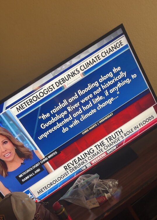
Paid. END. OF. STORY. This is dangerous, and the exact reason people die needlessly. It’s simple physics….
-
 1
1
-
-
Just now, winterwarlock said:
How are the Mets continually getting this wrong
Honestly I think this is just a local issue with the super high dews And water temps being in the mid 70s. Easily reaching 100% humidity.
-
1
-
-
Sheet drizzle and fog at the beach this morning. So much for the great beach weekend…
-
 1
1
-
-
26 minutes ago, WxWatcher007 said:
Why am I supposed to care what people say on another weather board? If you want to argue over their forecast, do it there with them.
I haven't seen anybody here seriously argue that 2013 is walking through the door. There's ample evidence that it is not.
But the 2004 and 2024 comparisons don't seem apples to apples, and I definitely don't expect something on the order of near 200 ACE when 2024 barely crossed the hyperactive threshold. But if you want to use 2024 as an example, in addition to the historic backloaded season that occurred and historic early season long track category 5, there was also an unprecedented period of virtually no activity right through the late August and mid-September peak.
It's indisputable that there are mixed signals. That's not cope lol, it's fact.
Despite the SST configuration which lends itself toward more stability in the tropical Atlantic, we have very low SAL as Lowry notes in his recent post. Mixed signal. Though I do think that the changes we're seeing in the tropical Atlantic could lend itself toward less stability if it continues. But I need to see what early to mid August looks like in the MDR. If there's an iron lid, especially toward mid-August, that will not be a good sign IMO. If however, stability isn't an issue in August, that would strongly lend itself toward an active MDR in September.

This is the climatological peak of SAL, so even though it's near record lows it's still there for now. Anyone arguing that we're running toward a BN season based on the observed conditions thus far has forgotten that climatology is the definition of quiet through this part of the season. We're still 3/0/0.

This look closes off much of the MDR, but look at the homebrew region off the U.S. coast. Unlike past years where the entire basin was being suffocated, the western Atlantic doesn't look abnormally dusty. Mixed signal.
Yes, the tropical Atlantic and MDR are warming up, and doing so above the climatological average. That's a big deal in a neutral ENSO state. In our active Atlantic period I think it yells above average more than it did a month ago for sure. That puts me at least right back to where I've always been--lean AN.


But these temperatures are nowhere close to 2023 or 2024 and while these configurations may suggest that we see more named storms they definitely aren't the arbiter of what the basin can do with major hurricanes.
Remember, it's easy to get a NS, harder to get a H, and very hard to get a MH. For a MH you need enough runway with +SSTa, -wind shear, and a deep reserve of warmth.
Whereas 2024 and prior seasons had that in spades, the biggest difference between 2025 and those years is OHC. It's not even close.
This was June 2024

Now look at today

To be clear, this is closer to normal. Yeah, there's a lot less heat, but we still can and will get MH out of these. But the reserve of heat is not on the level of other years.
2017
 2020
2020

2023

2024

2025

So yeah, the signals are mixed. But the current mix of observations and forecasts still suggest that this is an AN season. I don't think hyperactive is truly on the table, but check back August 15.
Biggest take away is the near record OHC off the east coast specially around 35n. Any storm threating the east coast will have ample fuel.
-
1 hour ago, BarryStantonGBP said:
now, let’s talk about models. these are the same clowns who had 2013 going ape and then it flatlined, or 2017 where everyone spent July 2017 crying about “weak storms” and then irma/maria/harvey dropped a fat deuce on the entire basin (see the screenshots from the s2k doomers). you’d think by now they’d have learned — but no, they’re still here, hiding behind their “professional” tag and “seasonal skill” copes

even the bloody rainfall precip was predicted in July 2017 to be dry as me neighbour's Yorkshire roast for ASO, exactly where we are in July 2025, low precip for ASO

and this 2013 analog nonsense? complete delusion. 2013 had a cold mdr, positive 850mb westerly anomalies, and a torchy subtropics, literally the opposite of what’s in play this year. pull up the 2013 ssta screenshot (dylan’s post) — you can see it’s dogshit for the mdr, pure wall-to-wall stability. not even close to 2025.
sst anomalies: July 2013/2017/2025


muh cold mdr
muh cold caribbean
now, look at the july 2025 sst anomaly - the last pic: basically a 2017 repeat, except the cold tongue is even further north, which is what you want for majors, not a “brick wall” like 2013. your own receipts prove you wrong
now we compare canary current and the eastern atlantic; 2017 vs 2025


(last pic was 11th July 2025 right in the middle of this bloody heatwave)
so what do you get if you actually pay attention to the analog?
-
every major driver (sst, heights, low-level wind, monsoon) matches 2004 almost perfectly
-
caribbean rainfall lag is just a may artifact, always flips by mid-july, see the weeklies
-
s2k forum doomers and stormiest types were all saying “mixed signals” in 2017 and it still went nuclear
-
models only matter if you pick the right analogs — otherwise, you get “mixed signals” and clown forecasts
tl;dr:
-
composites = cope, blend the signal to mush
-
actual analog (2004) = almost identical to 2025, except 2025 is even more bullish
-
caribbean dryness is timing, not structure — mjo pulse already on the horizon
-
anyone invoking 2013 as an analog is just admitting they never looked at the actual sst structure
-
receipts don’t lie, so keep them handy for august when the boomers and the pro-mets get mogged
oh, and the last screenshot? go compare the july 2025 sst to 2017. both have the mdr blazing, none of the cold brick 2013 energy the doomers want you to see. it’s all there in the images. keep coping with your “composites,” but the real hurricane season is going to trump your averages off the map.
I’m definitely liking the water temp
configuration more now. What I’m really looking forward to is any storms that make into the subtropics. Given good shear profiles we could see some record far north majors.
-
 1
1
-
-
2 hours ago, Brian5671 said:
looks done. models show little to nothing and sun is starting to poke through in some places
Yep, should have watered the veggies.
-
4 hours ago, doncat said:
93/72 temp split for Wednesday...with all the potential last three days, have picked up just 0.21" rain .
Meanwhile just to our south massive flooding. If it were an ocean stabilization issue we wouldn’t see eastern New England blowing away our rainfall totals. Something about the geography of the NY bight destroys convection.
-
1 hour ago, LibertyBell said:
ugh I was going to do some landscaping work in my yard tomorrow lol.
when you said sea breeze minimal I thought you meant it was going to be hot lol
From what I looked at, it's going to rain both Thursday and Friday and cloudy Saturday, so no sunshine after today until Sunday?
When the sea breeze is minimal and we have a another focusing mechanism we can get heavy rain right to the beaches. Weekend looks like a perfect summer weekend.
-
2
-
-
43 minutes ago, Brian5671 said:
NAMS coming in wet for some areas tomorrow-likely a continuation of what we've seen the haves and have nots
Sea breeze looks minimal tomorrow. Should allow the coast to rain. Sorry liberty, weeds, mosquitoes and allergies are coming.
-
1
-
-
6 minutes ago, FPizz said:
I'm talking about real stations, not personal ones. But, you even just pointed out, Newark at 100 was still the hottest. When a station is the hottest nearly 100% of the time and to pretend there isn't an issue is just plain silly. Many times this is how Sacrus' 90 degree days look. Every time EWR is at the top. Sometimes NYC is at the bottom, but more often than not it is in the mix with other stations. I can give 2 craps about NYC though since they don't care and same with Newark. The only people that care are the handful of posters here and elsewhere. If people have been pointing out issues for what 20 years now and they don't do anything, you just have to accept it and move on.
EWR: 95
TEB: 91
LGA: 90
New Brnswck: 90
PHL: 90
TTN: 88
NYC: 87
JFK: 86
BLM: 86
ACY: 86
ISP: 85I’m trying to move on. But it annoys the crap out of me when tv Mets report the high temp for the region using the park.
-
1
-
-
2 minutes ago, crownweather said:
Agreed. It's complete crap. None of the dates listed so far have verified in terms of activity. The dates leading up to the 4th is when we had Chantal, which occurred in the Carolinas, not the TX/LA coasts.
Also, there is NO peer reviewed papers (or any papers at all) on how Lezak comes up with this numbers. If you ask him (I have), he either brushes you off or blocks you.It’s an every dog has its day strategy. Just simply using climatology you are likely to be right. When you’re right you pump it out to social media. When you are wrong, deny, block and move on.
-
1
-
 1
1
-
-
15 minutes ago, BarryStantonGBP said:
Gary Lezak >>>>>> mainstream forecasters and models. I give up with the models
https://futuresnow.co/hurricane-forecast-2025/

I’m sorry but this is crap. No one can predict landfall locations more then a week out better then climatology. Even with AI.
-
2
-
1
-
 1
1
-
-
21 minutes ago, jm1220 said:
I think it was 2 summers ago where it was just comical the difference between my neighborhood in Huntington Station and Long Beach when I visited. Long Beach looked completely parched and in the midst of extreme drought but once north of the Southern State it became lush with greenery everywhere. LI's microclimates are always fascinating.
Absolutely. Growing up in south wantagh it was always “it never rains in the summer”. So it’s certainly not a new phenomenon. If you look at the prominent historical tree species you can see the micro climate. The south shore had plains and pitch pine and oak forest. While the north shore had a fully developed climax deciduous forest. Some of that is soil related but precip patterns also played a role. Water temps have skyrocketed to the mid 70s and that’s when the island as a whole tends to score its biggest precip events. Maybe tomorrow produces.
-
59 minutes ago, jm1220 said:
Thankfully the Rockaways to Long Beach did get maybe a half inch from the storms that grazed the barrier islands, but seen it happen many times. Can be boring as hell for months behind the seabreeze in the marine layer.
Yeah I was in the screw zone in between heavier rains north and south.
I’ll elaborate as to why I care so much. It’s more then just about my vegetable garden. I’m am a land scape designer and the majority of my work is on the south shore. I did several large installations this spring. One was the entire front of the house I rent in. My landlord hasn’t completed hooking up the irrigation system and promised to hand water if it got dry. While he has watered occasionally the garden looks like shit. Hydrangeas are burned. It would be a simple fix if culturally we accepted native plant gardens. As they are adapted to big swings in precip. But when people want that “wow factor” I have no choice but to use temperamental plants.-
1
-
-
1 hour ago, Intensewind002 said:
Picked up a whopping 0.11" here, so much for the flood watch
About the same here. Didn’t even make it through the trees. Grass is browning. The south shore summer flash drought is a real thing. People who do not live here just do not get it. It’s a micro climate seasonal desert.
-
1
-
-
If the NE bowing segment over central Jersey maintains we could eek out a thunderstorm southern metro. Has just enough of an ENE component. Looks similar though slightly weaker then the one on 6/19
-
5 minutes ago, SnowGoose69 said:
My main concern yesterday was the greatest instability was largely south. Despite the fact we did get well into the 90s there was still indications that north of TTN less activity would develop
Exactly. Writing was on the wall. Other then the areas north of the sea breeze front that saw some heavier rain this is going to be a pretty big fail for the rest of us. May even go completely dry in spots.
-
1
-
-
I’m going to laugh when this broken line of showers comes through and drops .01” on the south shore. I mean, I’m not a degreed met but I could easily forecast the lack of rain based solely off watching the weather here for 20 plus years. Just cancel the flood watch.
-
1
-
-
3 minutes ago, LibertyBell said:
More like 6 pm to 7 pm here, the earlier time frame will be for inland areas. The storms along that front will get here around 6 and will move through quickly between 6 and 7.
Storm forming on the sea breeze front right now near the LIE. You can see the anvil starting to go up from here in lynbrook. South of the front nothing will happen if anything until after 5.
-
1
-
-
26 minutes ago, Sundog said:
I'd like to know how bad things have to get before people are like fcck it just do the stratospheric aerosol injection.
I would have already dropped planetary temperatures down to pre industrial levels if I was king of the world.
To be fair, I would also be massively transitioning to clean energy and simultaneously be slowly easing off the aerosols over time.
I would have a second Manhattan project but for fusion. Problem solved.
-
2
-
-
7 hours ago, jm1220 said:
Yep, could be a scenario where it’s bone dry on the south shore but 5 miles inland a deluge.
Yup. Sunny all day at jones beach. Sea breeze is currently about 20 knots.
-
1
-

OBS-Discussion Flash Flood rainfall potential through 4AM Tuesday 7/15/25, especially I95 corridor
in New York City Metro
Posted
South shore getting a nice batch of rain currently adding to the .5” from yesterday. I’ll take it.