

CoraopolisWx
-
Posts
2,918 -
Joined
-
Last visited
Content Type
Profiles
Blogs
Forums
American Weather
Media Demo
Store
Gallery
Posts posted by CoraopolisWx
-
-
11 hours ago, Ahoff said:
Picked up another coating overnight.
Seems like it stuck to everything.
Made for a surprisingly nice scene this morning. -
1 hour ago, dj3 said:
I was pleasantly surprised how well we maintained snow pack during the days leading up to Monday night. Overcast and cold temps makes a difference for sure. I'll still enjoy lighter events if we get them in March but if we're not tracking a big storm I wouldn't be upset about a quicker flip to spring.
That freezing drizzle Saturday night put a nice crust on the pack, maybe it survives until the next cold stretch.
-
42 minutes ago, Burghblizz said:
I’m not sure places north and west did that great, even into western Ohio and New York State. Seems like a lot of low ratios and quick moving. I didn’t really look until now, but wanted to see what we missed out on.
From reading the other threads, you had to be close to Indiana for decent amounts. Most of the Ohio and WNY posters were disappointed.
-
If nothing else, we now have a nice protective shell over the snowpack.
-
16 minutes ago, PghPirates27 said:
Weather Chanel now has no snow at all starting as mix all rain by 8pm
Unfortunately those forecasts seem to be automatically generated based directly from model they use.
-
7 minutes ago, MikeB_01 said:
Could see some awesome rates that close to the line.
.No doubt, if we can squeeze out some heavy rates before the changeover, that would be a small victory.
Would help keep the ice off the pavement for work tomorrow morning. Lol
-
4 minutes ago, RitualOfTheTrout said:
Coming down nicely right now, I’ll just enjoy this as I whistle past the graveyard with regards to round 2.

Love the rare daytime heavy snow.
Keep on padding the stats.-
 1
1
-
-
Won’t have to shut the blinds for this storm, because luckily being night they’ll already be shut. Lol
-
28 minutes ago, RitualOfTheTrout said:
Yeah won't make any friends here, looks like it brings the low further north... See if the Euro does the same.
It's almost agonizing seeing that bitter cold air so close and not being able to tap into it.
With 50" in the books, I can almost laugh at the latest GFS snow totals.
MAG over in Central PA mentioned this is more of a baroclinic track, were the system doesn't create it's own cold air.
So what ever sets up in the beginning, is what the majority of the storm will produce.
-
1 minute ago, Rd9108 said:
We are probably going to get more snow from the Thursday deal at this point. Off topic but in hearing there is a ton of accidents all over the city. Don't drive if you don't have to.
Was surprised to see nothing on the county twitter page. Usually they mention something.
-
Taking a break from Monday night, we have some very slick conditions developing this evening.
Glad they issued a WWA. This freezing drizzle is sometimes worse because it accrues more efficiently.
-
Foggy misty February afternoon on top of a solid snowpack.
Classic.
-
9 hours ago, north pgh said:
I think right now we are in a good spot. 6-12 with winter storm watches going up late tomorrow afternoon for Monday Monday night. Worst case scenario 4-6 but could still go either way.
Yeah, we're still winning with a high end advisory at worst.
-
37 minutes ago, Rd9108 said:
Idk something in my gut tells me this is the type of storm that jackpots Youngstown. We haven't seen one of those this season yet. We still maybe get a few sloppy inches but the euro isn't backing down.
Always nice to have the Euro on our side, although it seems this season, it's had larger run to run swings than in years past.
-
32 minutes ago, Ahoff said:
I don't like the Euro. It makes me nervous that it is the one showing ice and rain mostly, still time though. GFS looks great.
But would the High to the north allow the low to cut like that? We'll see I guess.
No doubt it's gonna be close. How much surge the 850's make is the key.
From what I've read on here, sometimes these highs aren't all built the same, with regards to how deep or shallow the below freezing column is.
-
9 minutes ago, Rd9108 said:
Accidents everywhere in the city. It is very slick out. Already had to deal with somebody who slid into a telephone pole. I wouldn't be venturing out if you don't have to.
Just had to run a quick errand, and the roads are already snow packed.
Definitely a quick starter tonight, may have caught folks off guard. -
Southside flats getting some love this morning. Good for them, usually they're a bit less than other locations.
-
18 minutes ago, Burghblizz said:
Parkway East taking a beating already
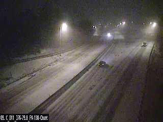
Oh yeah, roads have caved quickly. Unfortunately not all the cameras are working and or showing a live feed. SMH
-
4 hours ago, Ahoff said:
NWS basically says we get nothing this weekend. First miss of this "great" pattern.
Lol. Yeah really.
Although IMHO, our best pattern is no pattern. Meaning no major dominant features driving the atmosphere.
The slightly negative AO/NAO has helped though in keeping the warm surges in check so far this winter.-
1
-
-
Wouldn't be surprised if headlines are needed overnight. The ground seems colder than expected, especially the sheltered hollows and ravines around the city.
Roads could be slick in spots tonight.
-
How much of that precip shield along the NY/Canada border survives into our region ?
Definitely playing the long game here.
-
1 hour ago, Ahoff said:
2.5" yesterday. 7" total for the storm...so far.
A couple lake enhanced snow bands is not out of the question today and tonight. So my 8.7” call still has a chance to verify. Lol
-
1
-
-
1 hour ago, Ahoff said:
What's the officially NWS total? I heard 4.5" as of midnight for yesterday, but they haven't given a more recent total, at least that I've seen.
They didn't identify themselves, but they're 1 N Carnot-Moon. 5.7" Officially so far.
-
Curious to see how far west the heavier bands make it today.
Canadien had them in our area yesterday.-
1
-
Western Pa / Pittsburgh area Winter Discussion ❄️☃️
in Upstate New York/Pennsylvania
Posted
Top 10 in the eastern region is really good, considering all the perennial powerhouses to contend with.