Mark McIntyre
-
Posts
94 -
Joined
-
Last visited
Content Type
Profiles
Blogs
Forums
American Weather
Media Demo
Store
Gallery
Everything posted by Mark McIntyre
-
OBS only thread winter event Jan 29-30, 2019
Mark McIntyre replied to wdrag's topic in New York City Metro
Currently 41° with Td of 39° along with some very light rain. T850 appears to have remained the same compared to a few hours ago, although those isotherms have tightened a bit...T925 has warmed ever so slightly. Would be happy if the HRRR verified with its 9-10PM changeover. -
January 30, 2019 Snow Squall Observations Thread
Mark McIntyre replied to bluewave's topic in New York City Metro
Yep the persistent (albeit light) southeast wind is not a friend to us coastal folk. -
OBS only thread winter event Jan 29-30, 2019
Mark McIntyre replied to wdrag's topic in New York City Metro
Staten Island is 40° with a Td of 36° as of 3:15PM. I remember over the weekend that the later start for NYC was depicted by the short-range guidance, which seems to be verifying. The brief bursts of flurries early this morning were a cruel tease. -
OBS only thread winter event Jan 29-30, 2019
Mark McIntyre replied to wdrag's topic in New York City Metro
Another tiny area of precip appears to be blossoming on radar just SW of Edison/Plainfield - let's see if I get clipped with any drizzle/flurries. NYS Mesonet sensor at CSI reporting 40° with Td of 35°. 850 hPa & 925 hPa temps are both subzero, it's just the surface that's cooked. -
OBS only thread winter event Jan 29-30, 2019
Mark McIntyre replied to wdrag's topic in New York City Metro
Staten Island is at 38° with Td of 32°. Any flurries that were falling seem to have stopped for the moment as best returns look to be over Boonton now. -
OBS only thread winter event Jan 29-30, 2019
Mark McIntyre replied to wdrag's topic in New York City Metro
Now at 35° with a Td of 30°. -
OBS only thread winter event Jan 29-30, 2019
Mark McIntyre replied to wdrag's topic in New York City Metro
Radar "looks" good for Staten Island right now, but all I have are just a few lightly falling flurries. NYS Mesonet site at College of Staten Island has us at 33° with a Td of 27°. -
OBS only thread winter event Jan 29-30, 2019
Mark McIntyre replied to wdrag's topic in New York City Metro
Had a brief round of flurries about 10 minutes ago on Staten Island (currently in Richmondtown). Looking at radar, just across the Arthur Kill River, are nicer returns just west of the Turnpike -
All teleconnections looks great going forward. If the Pacific jet relaxes we'll be in business.
-
January 2019 General Discussion & Observations
Mark McIntyre replied to Rtd208's topic in New York City Metro
Was it this one? The 06z Sat run?
-
January 12-13th Cold Smoke Obs and Nowcast
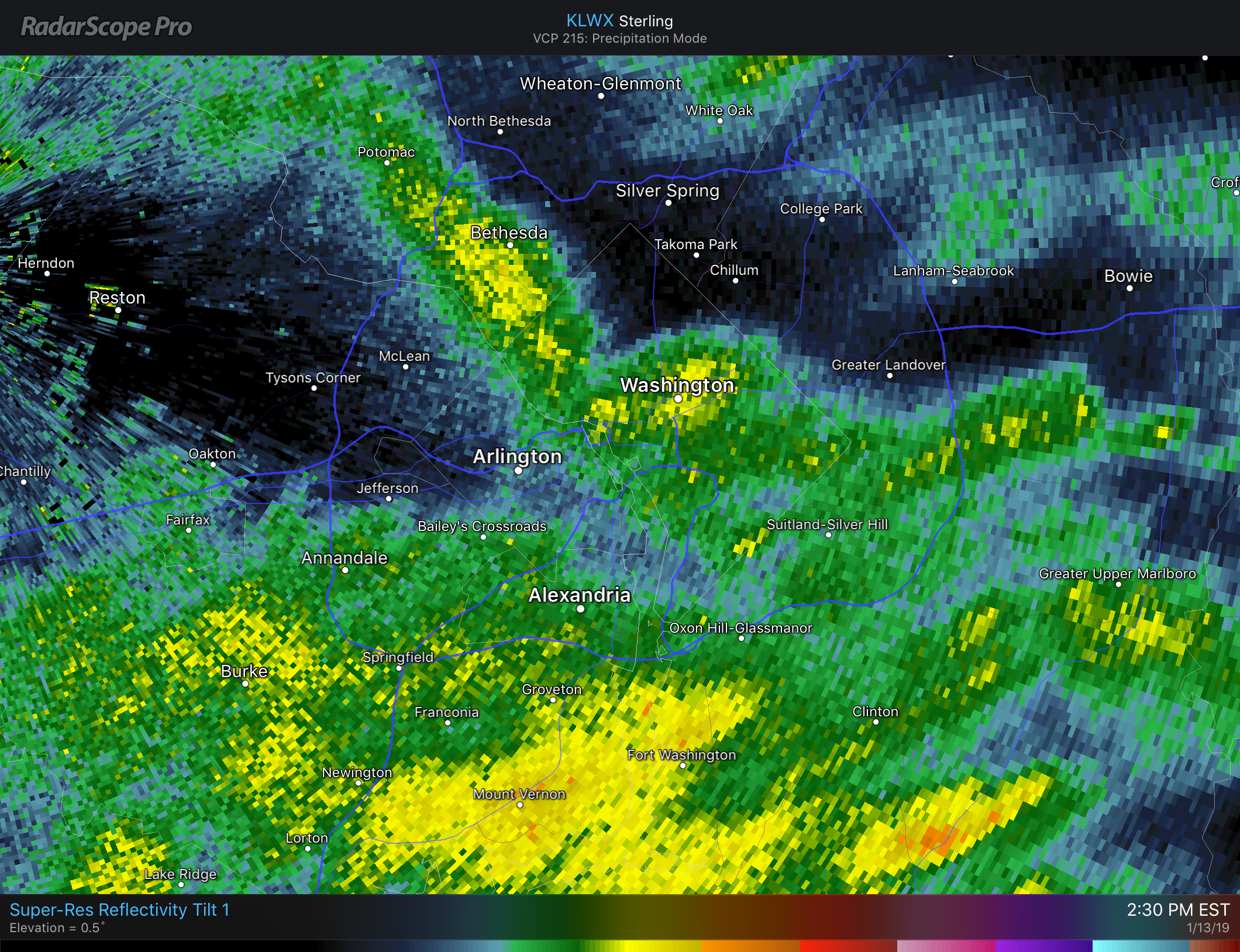
Mark McIntyre replied to Bob Chill's topic in Mid Atlantic
Yep DC gonna get shlammered
-
January 2019 General Discussion & Observations
Mark McIntyre replied to Rtd208's topic in New York City Metro
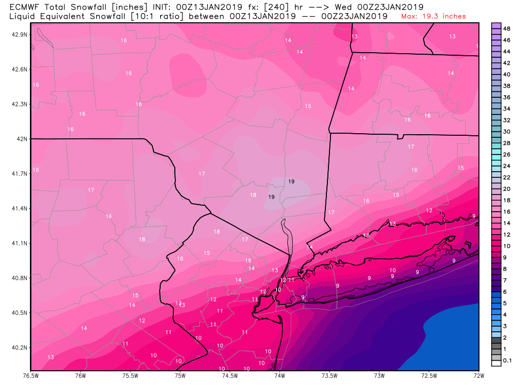
Really digging this look on the Euro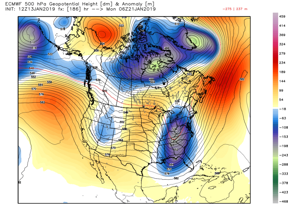
-
January 2019 General Discussion & Observations
Mark McIntyre replied to Rtd208's topic in New York City Metro
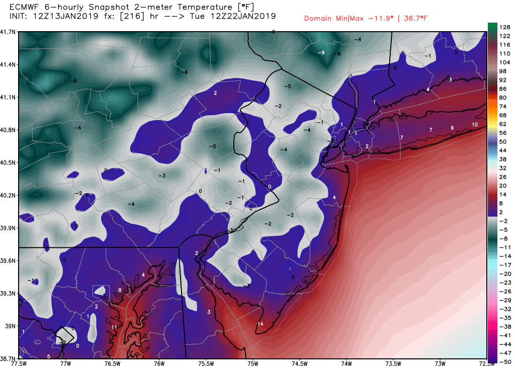
And again brutally cold behind the storm, although just ever slightly less so compared to 00Z
-
January 2019 General Discussion & Observations
Mark McIntyre replied to Rtd208's topic in New York City Metro
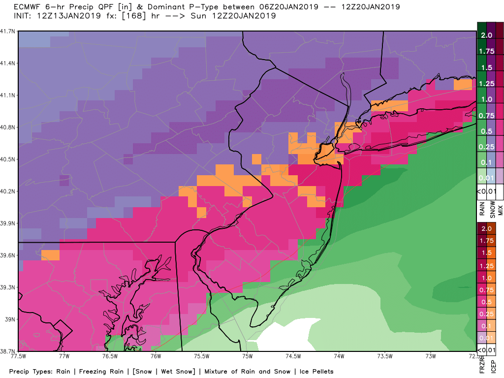
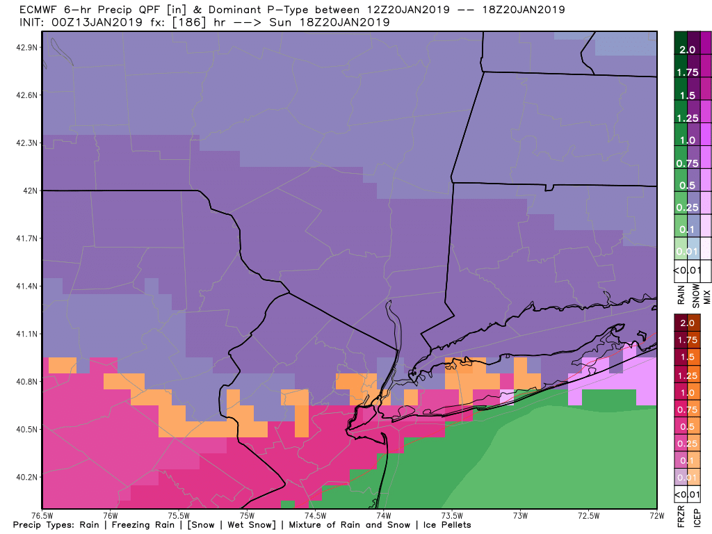
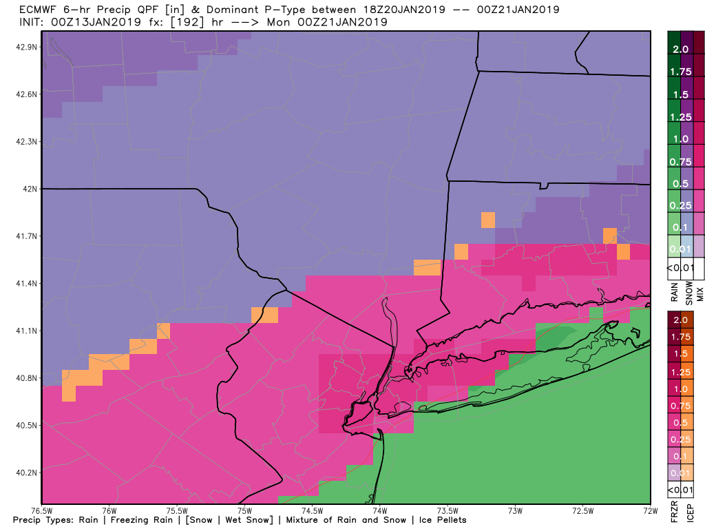
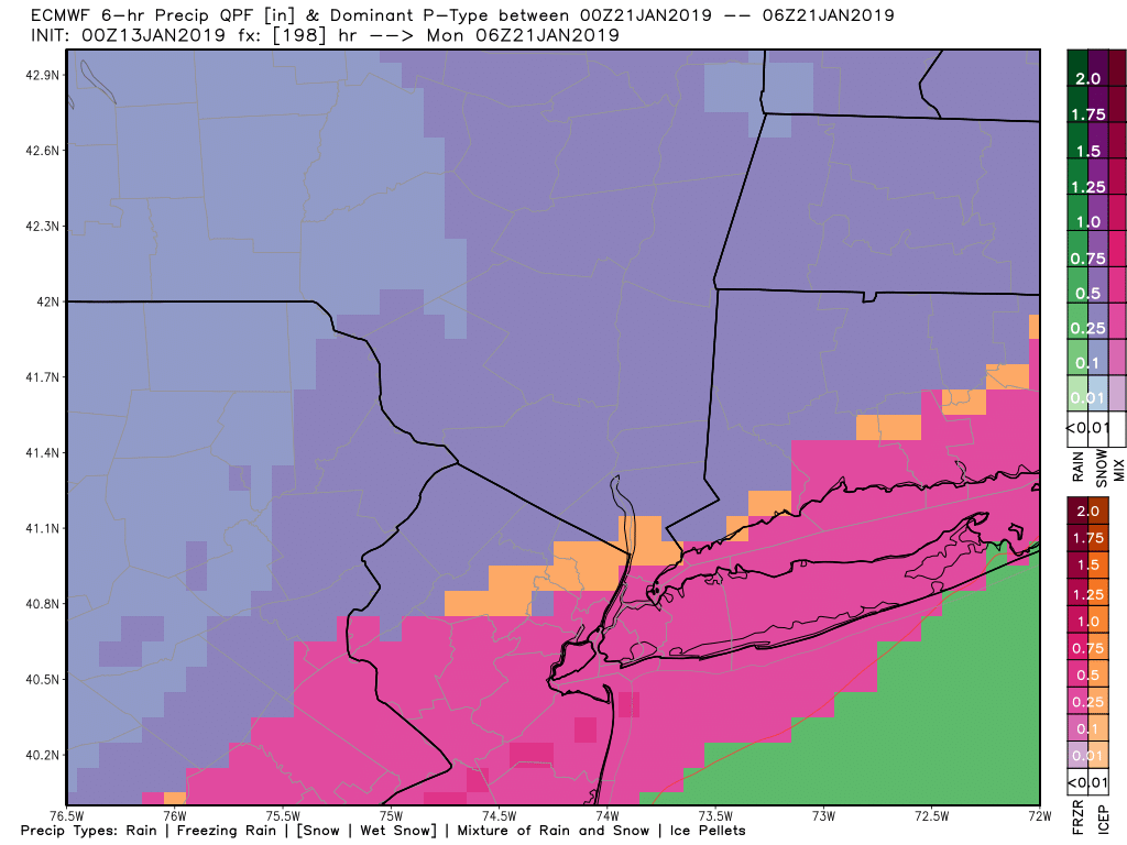
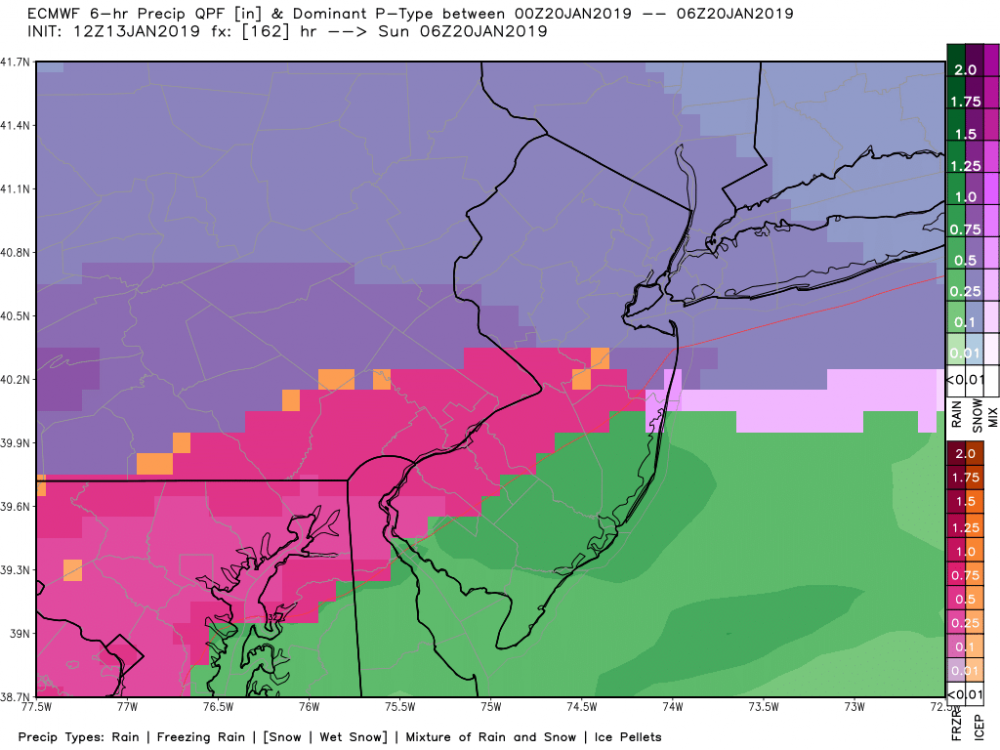
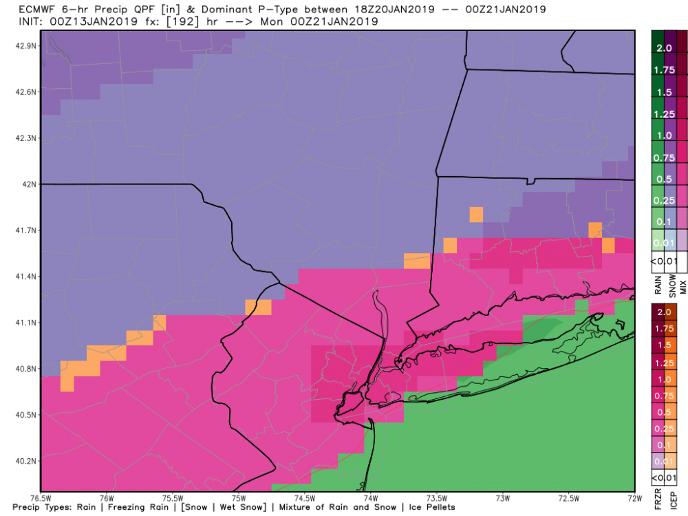
Appears the max ZR shifted southeast but would still be absolutely devastating for much of area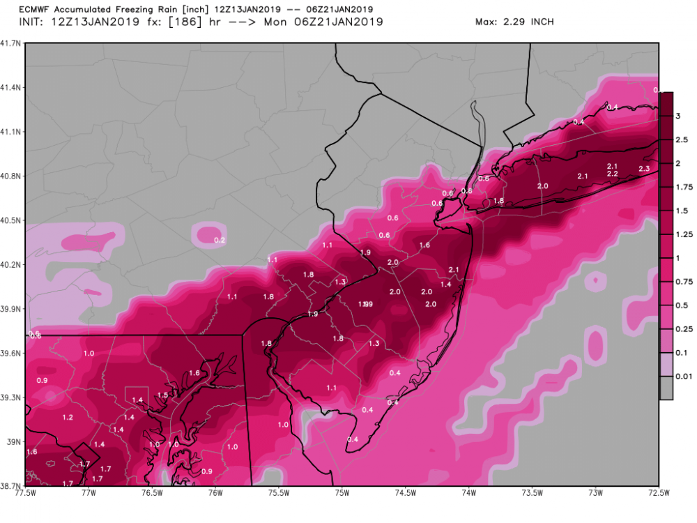
-
January 2019 General Discussion & Observations
Mark McIntyre replied to Rtd208's topic in New York City Metro
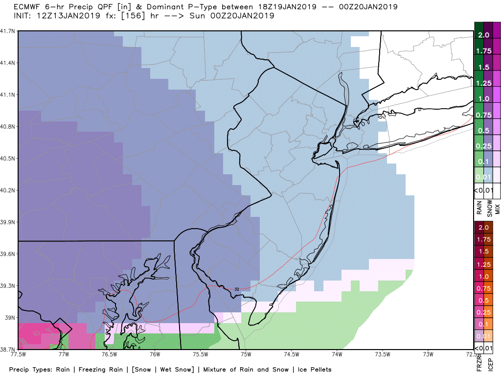
New Euro coming out...gets ugly again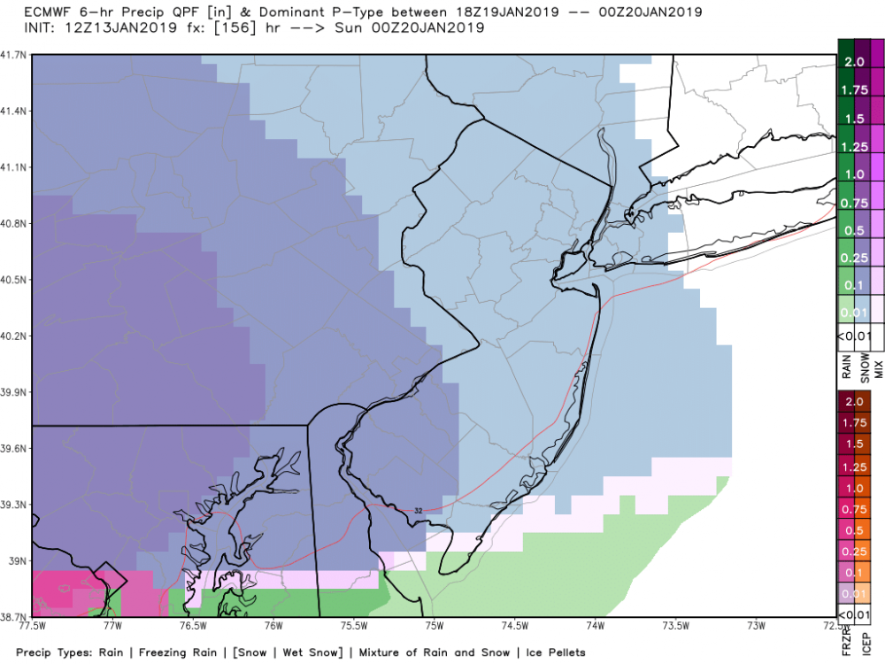

-
January 2019 General Discussion & Observations
Mark McIntyre replied to Rtd208's topic in New York City Metro
Did wake up late and saw that I had received a coating here on Staten Island, my street was covered and of course car tops were too. All gone now even without full sunshine -
January 2019 General Discussion & Observations
Mark McIntyre replied to Rtd208's topic in New York City Metro
So painfully, painfully close. You can see that northern stream culprit over Maine & New Brunswick spoiling the party.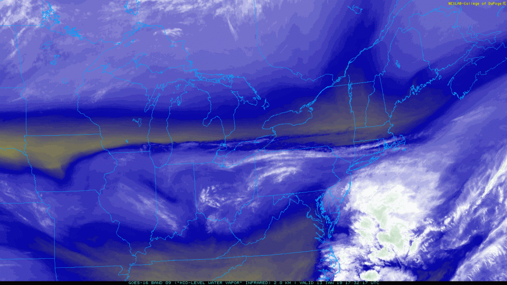
-
January 2019 General Discussion & Observations
Mark McIntyre replied to Rtd208's topic in New York City Metro
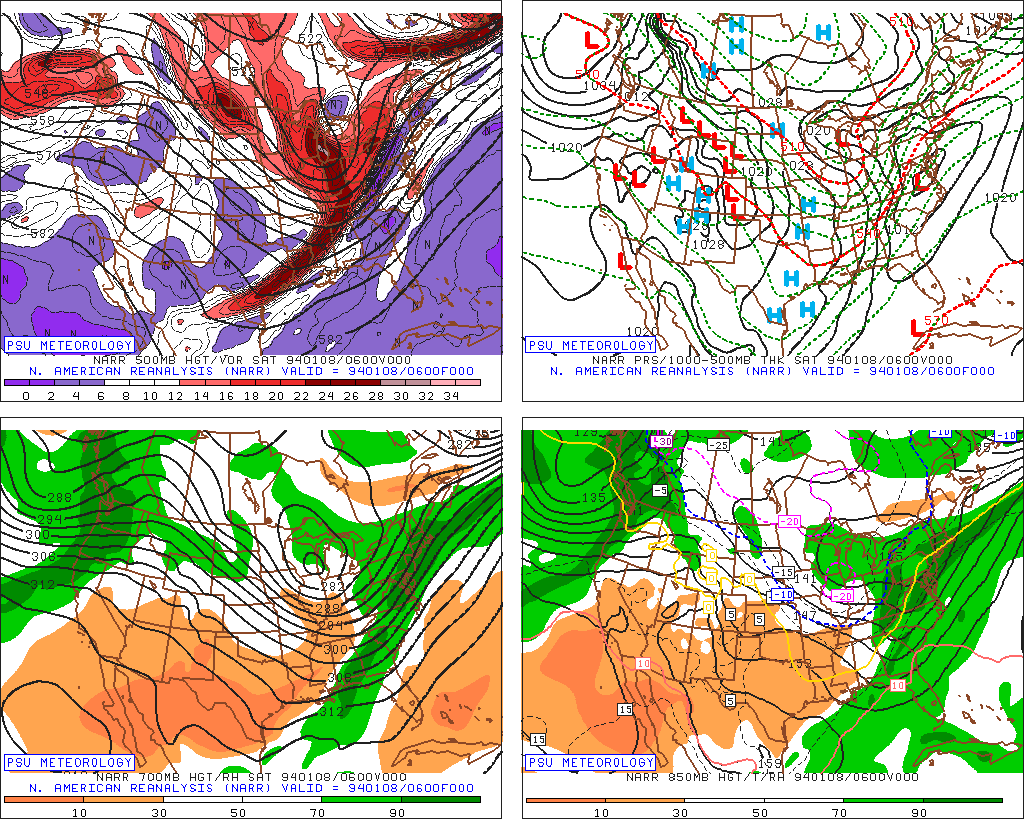
Think this is the storm you're talking about. Trying to dig up surface obs but Plymouth State & Iowa State don't go back far enough.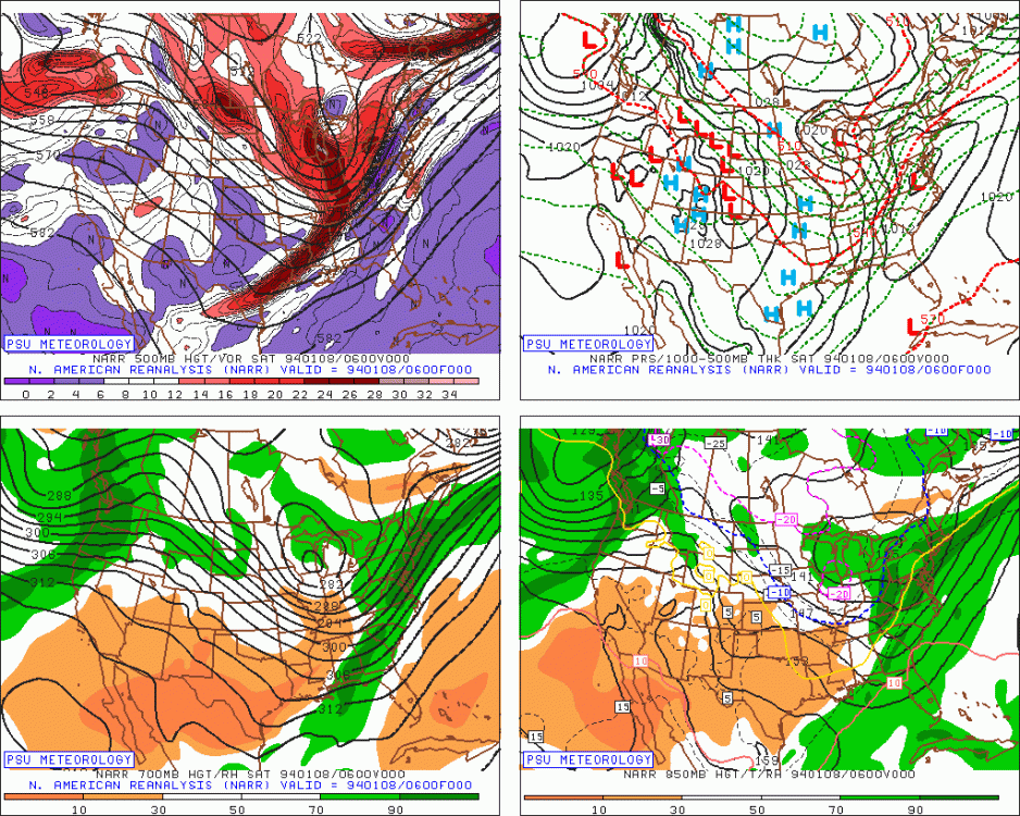
-
January 2019 General Discussion & Observations
Mark McIntyre replied to Rtd208's topic in New York City Metro
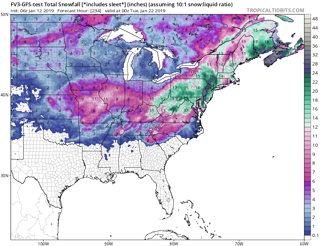
It's funny I don't remember that 1994 ice storm but I remember the 1993 Superstorm. As for this Euro run, it does go back to big snow totals with next weekend's storm. Please forgive me but I can't remember if this particular output includes sleet/ice pellets in the snow accumulation.
-
January 2019 General Discussion & Observations
Mark McIntyre replied to Rtd208's topic in New York City Metro
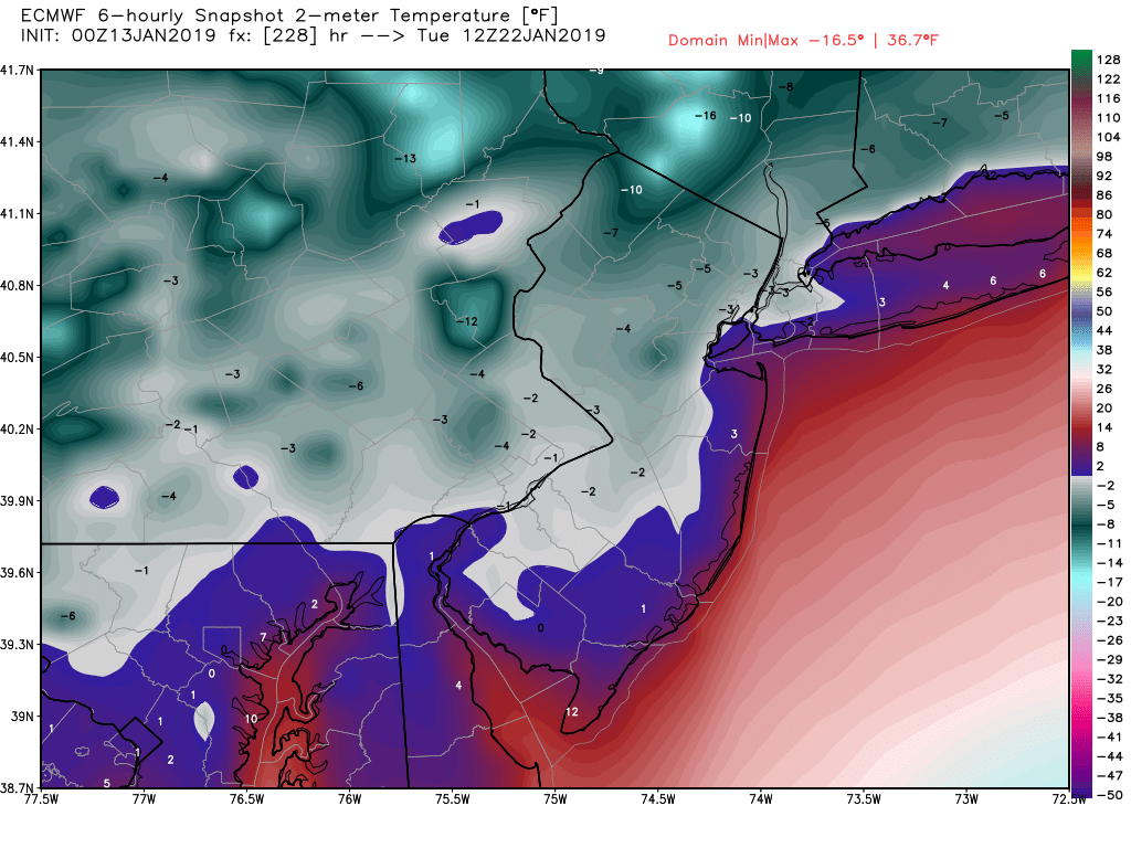
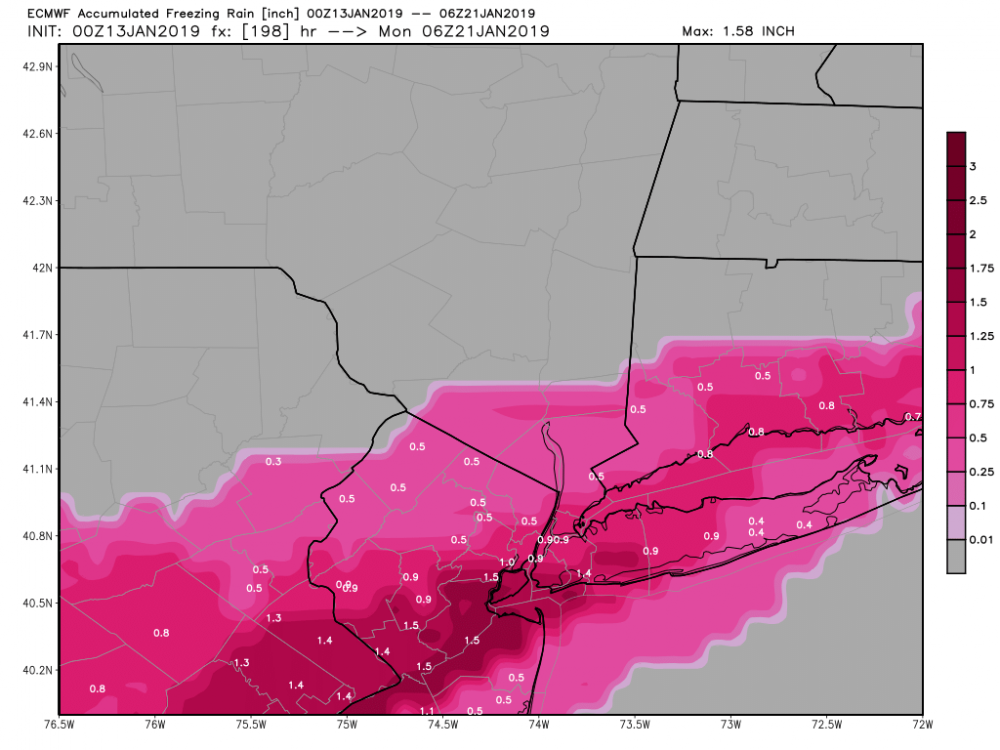
Yep verbaitm EURO is a devastating ice storm. I went through the December 12th 2008 ice storm in Albany. Don't want to get anywhere close to that again. It then wants to take temps subzero right after the storm.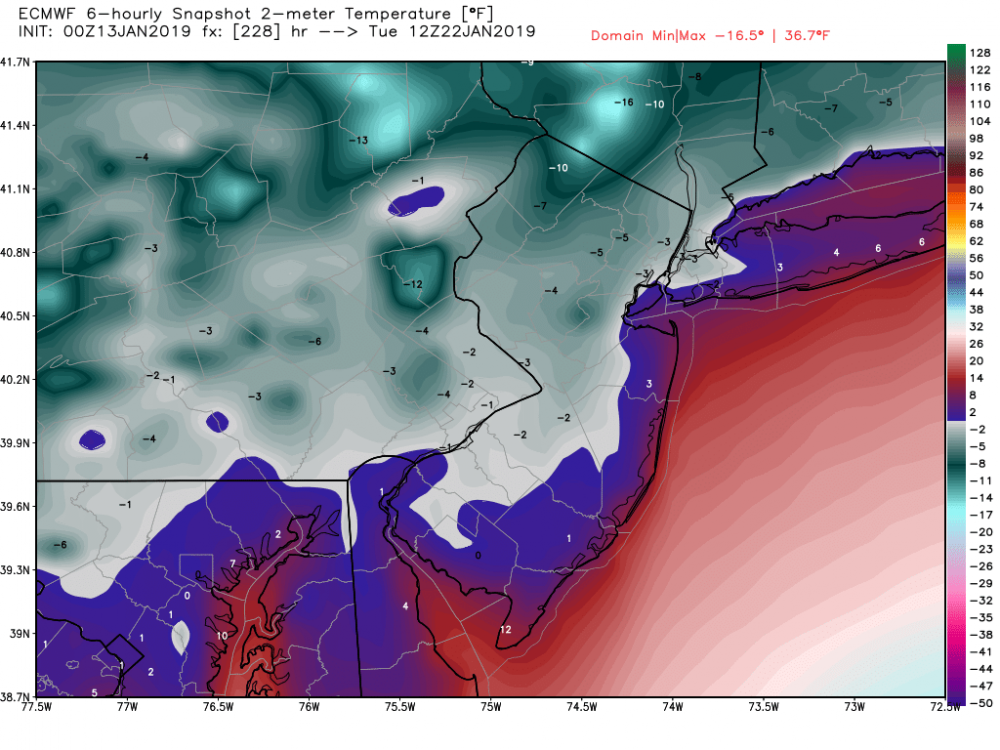
-
January 2019 General Discussion & Observations
Mark McIntyre replied to Rtd208's topic in New York City Metro
Welp the 00Z Euro is back to a zany solution. Slower and way more amped. Also gives nearly 1.0" of ice to NYC.

-
January 2019 General Discussion & Observations
Mark McIntyre replied to Rtd208's topic in New York City Metro
Got home an hour ago from a double shift in Manhattan - noticed the clouds and the smell of snow in the air. SI should be the place to be as far as NYC is concerned for this storm -
January 12-13th Cold Smoke Obs and Nowcast
Mark McIntyre replied to Bob Chill's topic in Mid Atlantic
Sitting here at home on Staten Island, after a double shift on forecasting a "non-storm" for NYC but knowing SI stands best chance...congrats on getting NAM'd. Hope you all have enough beer! -
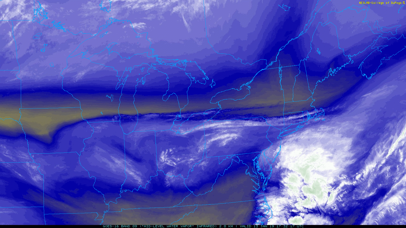
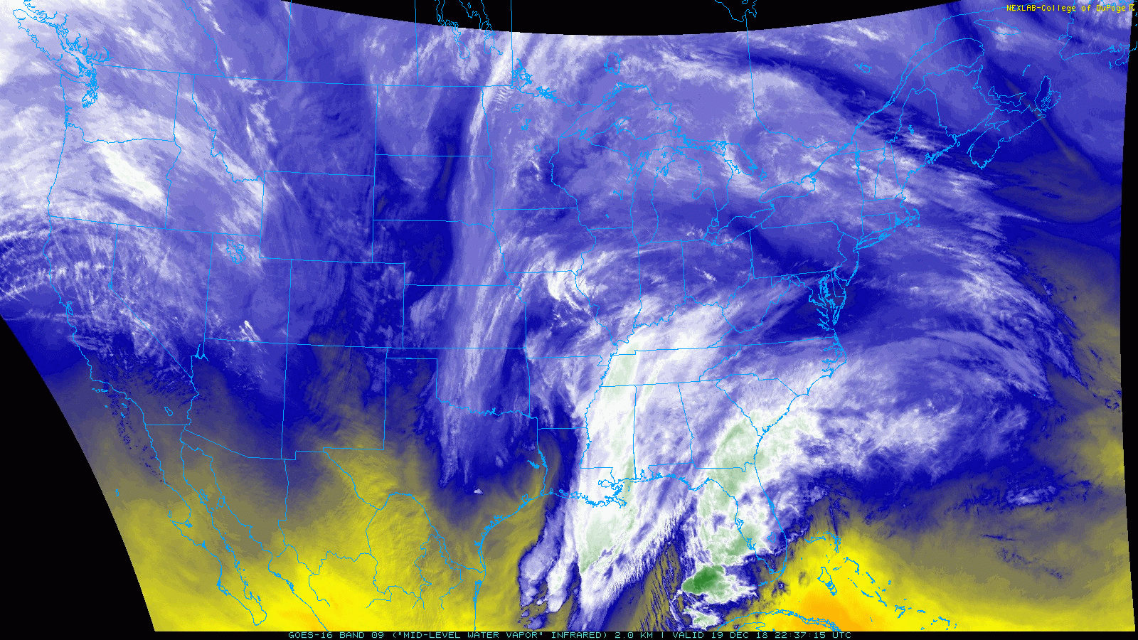
GOES-16 water vapor loop already getting better by the minute