jpeters3
-
Posts
736 -
Joined
-
Last visited
Content Type
Profiles
Blogs
Forums
American Weather
Media Demo
Store
Gallery
Everything posted by jpeters3
-
I'm going sub-900. 895.
-
This ^^^ There were storms all the way into January in 2005.
-
lol, raw T up to 7.7...
-
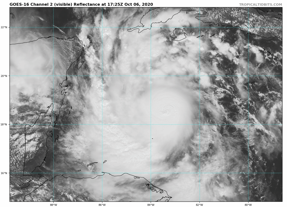
For reference, recon is about 33% of the way there, with 2-2.5 hours to go. The storm is ~ 60-70 miles from shore, moving WSW at 9 mph. So roughly 6-8 hours before landfall.
-
Latest Raw T in at 7.4
-
Felix???
-
Just looked it up. Looks like it's a C-130. I guess they attached the rocket booster.
-
Is the AF aircraft a C-130?
-
That should shave off an hour from my estimate! Satellite presentation is the best so far, supported by Raw T values. FWIW: T 7.1 as a post-processed value would equate to a 140 kt cat 5.
-
Raw T just jumped to 7.1
-
Cruising speed of these aircraft are ~320-340 mph. They have about 1200 miles to get there, so roughly 4 hours. Might be enough time!
-
Ok, I'll admit it. No recon sucks.
-
Right, i mean even I do. But people on this forum act like it's a massive travesty to science and forecasting that is going to cost lives. In reality, it's just a weenie travesty.
-
Relax people, life will go on if a recon doesn't get into the storm before landfall. It's not like we don't know where it's going, and that it's probably going to be a shitshow on the ground underneath where it makes landfall. It's also not like a few missing recon missions will crush future research efforts into TCs. So relax....
-
touche.
-
contrary to what you might all think, I'm sure recon missions aren't cancelled to piss off weather weenies. There is probably a totally legitimate reason for this decision.
-
raw T up to 6.9, up from ~ 5.0, over the course of an hour.
-
Wow, impressive indeed!
-
Clearly you missed the whole epic battle about whether the weak south side of Laura was or was not due to radar attenuation
-
Can we talk about the ET transition predicted by the GFS? GFS consistently showing an extratropical low near Iceland with a central pressure < 930 mb...
-
I second the Ike comparison.
-
attenuation
-
Models are suggesting that shear will not abate until after landfall. Accordingly, they mostly hold at the current intensity. So I think the show is over in terms of RI prior to landfall. But sub 900 is still possible, right???
-
Motion of the cirrus to the east of the system suggests continued easterly shear. This seems to be reflected in the RAMMB shear analysis, which shows about 15 kt currently.

-
It's about #156,000 on the list of most important/relevant knowledge to my career. But I appreciate the "metfan" advice.