Allsnow
-
Posts
26,462 -
Joined
-
Last visited
Content Type
Profiles
Blogs
Forums
American Weather
Media Demo
Store
Gallery
Everything posted by Allsnow
-
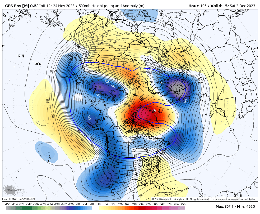
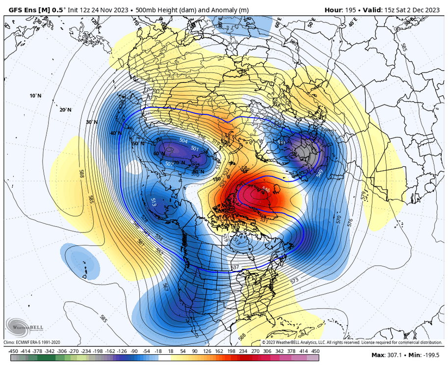
Would be a better airmass but the trough is pretty far east
-
The flow is off the west coast as the ridge isn’t poleward to bring a better airmass into Canada. You will be blocking pac air
-
There is no cold air source on that map. The cooler 850’s is probably from active rainy/stormy pattern
-
Ugly pac
-
That’s pac air coming into the conus with +epo. the ridge out west is way to flat
-
Euro has upper teens low 20’s for the area Tuesday morning
-
12z euro over .50 now
-
It’s all speculation at this point… Let’s finally see some pac improvements to help our snow chance or this -nao will just become another waste
-
Eggnog too strong?
-
Meh. When has the mjo ever raced through the warm phases?
-
PAC goes to crap quickly once we enter December. Blocking definitely looks to form but won’t work with the state of the pacific. Ensembles show improvements in LA LA land around the 10th but that’s just something to keep an eye on for now.
-
Got down to 33 Tuesday morning under less CAA then tonight… I think NYC will do it tonight but the harder freeze will wait until Tuesday morning
-
That was a early meltdown by @SnoSki14
-
-
Yup. NWS 30 degrees with Nw wind 5-10 miles
-
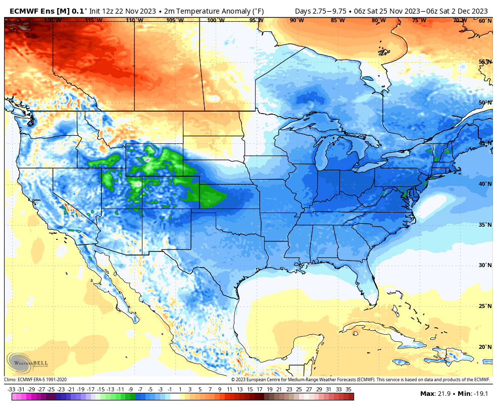
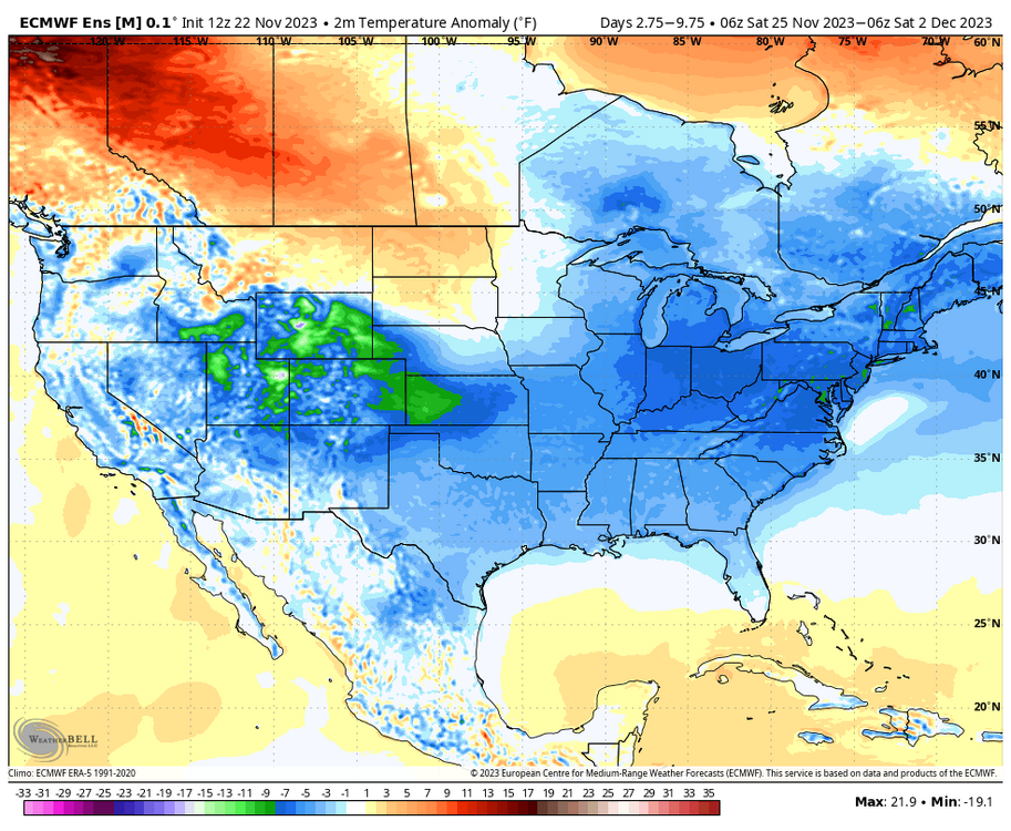
Looks cold next week. Models just rushed it a few days
-
Outside one cold shot earlier this month the conus has not had much artic air.
-
45 with a brisk wind makes for perfect thanksgiving weather
-
Happy Thanksgiving Everyone
-
If we don’t have a good pacific it’s worthless
-
Beautiful pictures
-
Don’t want to go down this rabbit hole but that temp sticks out from ewr today
-
Max was 58. while nyc max was 54 Teterboro was 53 Ewr 4-5 degrees warmer then everyone else today
-
Really? high of 52 here today
-
It’s been cloudy all day. Temps were forecasted to approach 60