

SchaumburgStormer
-
Posts
5,215 -
Joined
-
Last visited
Content Type
Profiles
Blogs
Forums
American Weather
Media Demo
Store
Gallery
Posts posted by SchaumburgStormer
-
-
9 minutes ago, WestMichigan said:
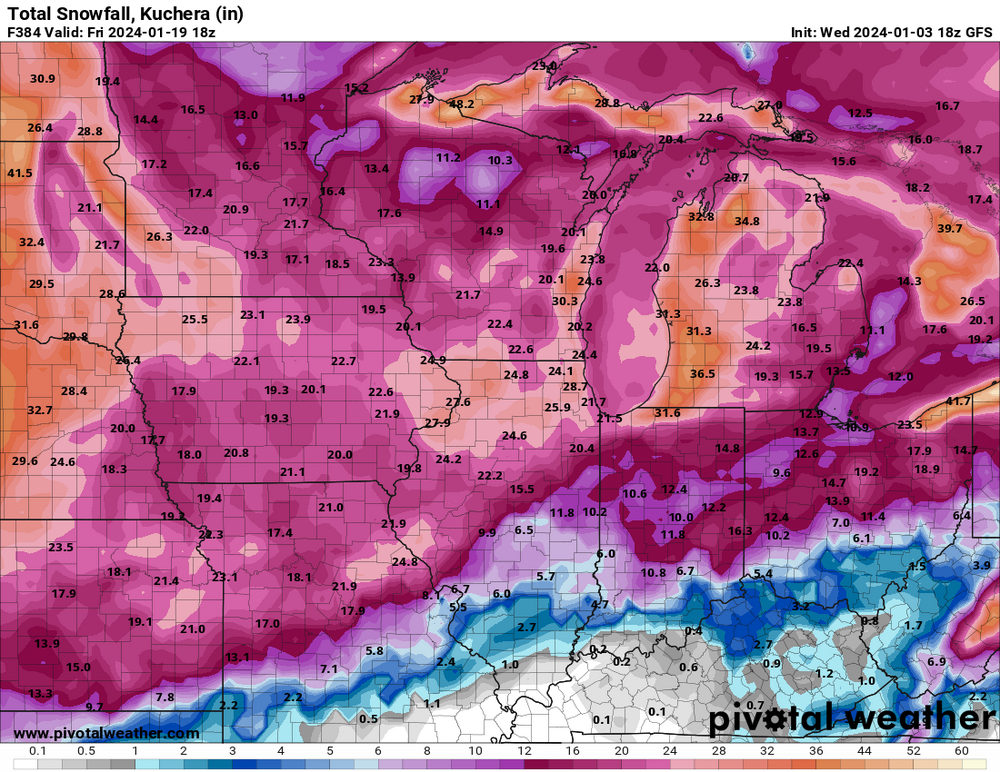
18z GFS is about as good as it gets for the next 2 weeks for a good chunk of the subforum. Pretty good spread the wealth with the exception of maybe the far northern parts of Minnesota and Wisconsin.
Yep. For having maps that had no snow through the entire run, this is a solid look.
-
 1
1
-
 3
3
-
-
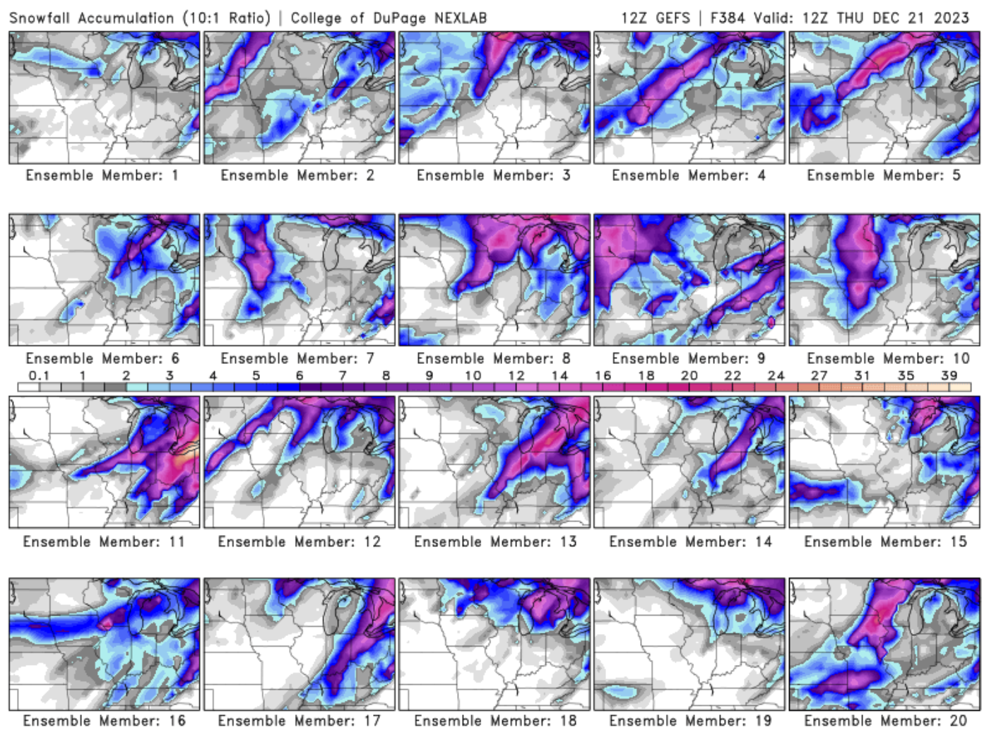
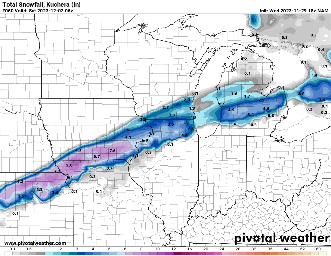
18z GFS would have I-55 and north under a foot of snow by a week from Friday. Talk about a pattern switch.
-
1
-
-
GFS tossing more drool worthy stuff for IL. I would love to get this one, like the old times, where the NAM is throwing us just stupid clown maps within 24 hours.
But again, we’ve seen this game before. If we follow the multi-season trend, we have about 48 more hours of model enjoyment before every post becomes “south/flatter/weaker”.
-
2
-
 4
4
-
-
1 hour ago, Sciascia said:
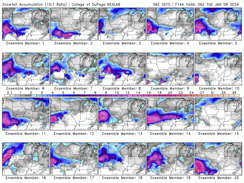
Pretty good representation of all the OP run solutions we have seen over the past few days.
-
Euro would have alek posting the eurythmics while SE Iowa to NW IL get smoked. Most of LOT would do solid.
Models have been rug pulling for so long that it’s tough to buy in at this range, agreement or not.
edit- forgot the image

-
1
-
 1
1
-
1
-
-
4 hours ago, Chinook said:
a year ago


Was CRUSHED with 1.7” out of that WSW
-
1
-
 2
2
-
-
9 minutes ago, Chicago Storm said:
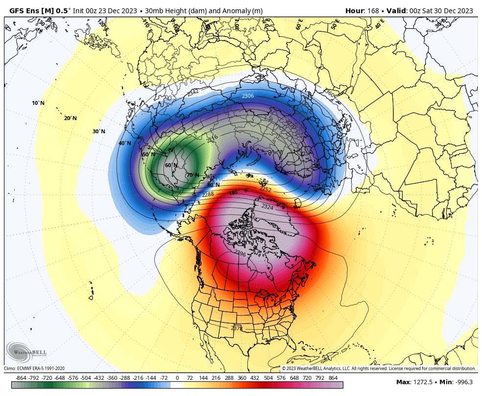
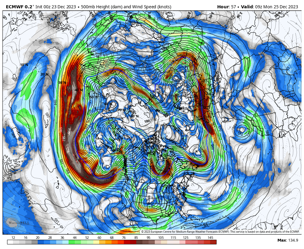
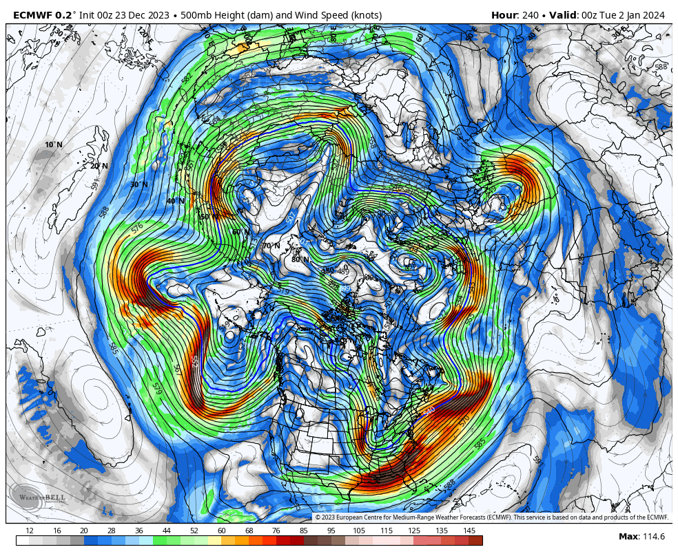
As has been mentioned, we are heading into a significant pattern change. Changes on the large scale really start to appear this weekend and into the beginning of this upcoming week. This new pattern, which may very well evolve over time, will extend through the first 1/3rd of January, and quite possibly the first 1/2 of January.
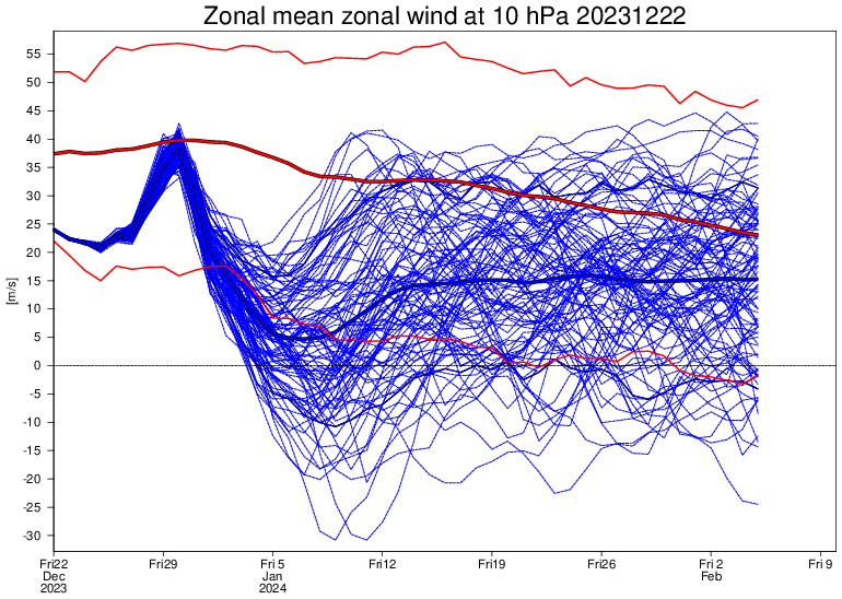
Two big changes that we are seeing right off the bat and that have already begun are a progression of the MJO into the colder phases and a stratospheric warming event. The MJO recently entered the COD, after being in low-amplitude warmer phases from the very end of November through the first 2/3rds of December. The trip through those warmer phases is one of several reasons (Raging Pac Jet is another) that we have been stuck in a consistently mild (Sometimes very mild) regime. The MJO has now entered a colder phase, low amplitude phase 8, and is expected to make a trip at lower amplitude roughly through colder phases 1-2 over the next 1-2 weeks. Another thing that we will be watching unfold is stratospheric warming. This event is expected to disrupt the main SPV placement and strength during the potentially 1-3 week event. As is usually the case, any effects of the SSWE will not be seen right away; that is something to keep an eye on from around week 2 in January through early February.
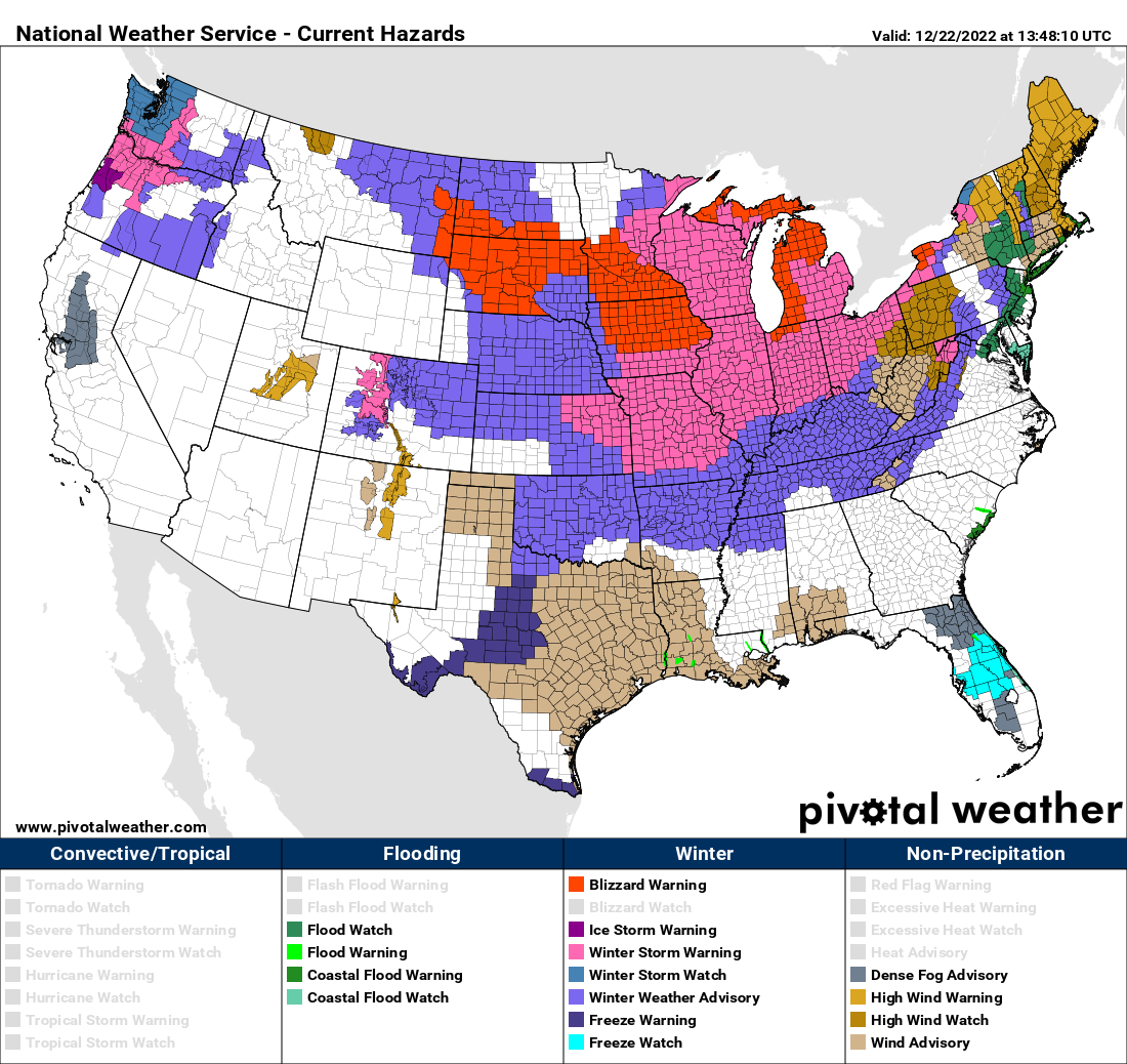
.png.3a89226efde1d366c1eaa9979c7493ee.png)

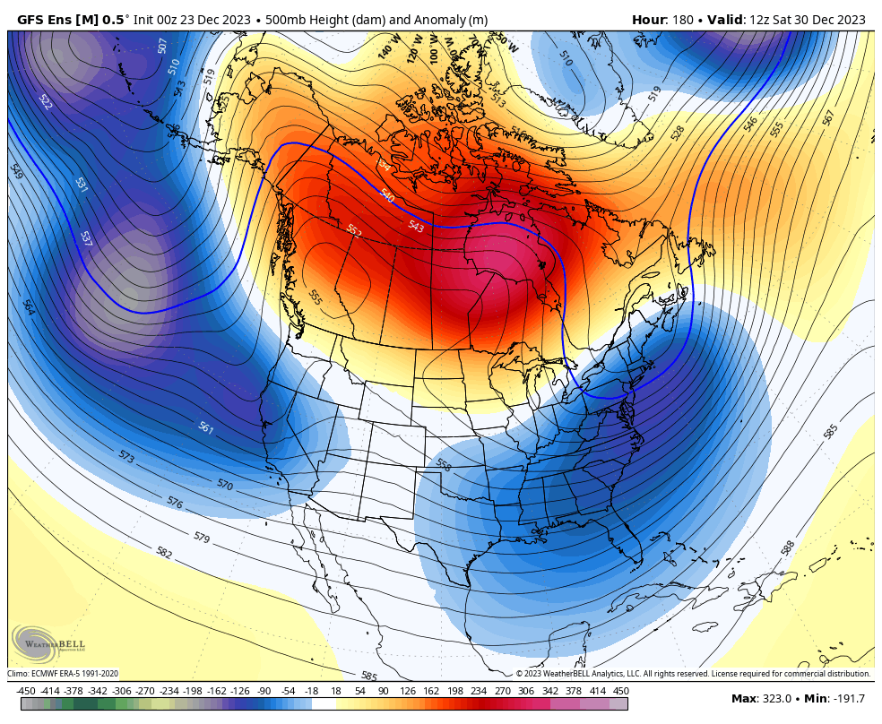
As mentioned above, there are a few reasons we have been seeing consistently mild (Sometimes very mild) conditions over the past several weeks. The raging Pacific jet is one of those bigger reasons. The Pacific jet is expected to break down soon, with increased troughy-ness (Wave breaks) developing. Canadian ridging, which will retrograde from Central to Western Canada and eventually Alaska, will also tend to lower Pacific influence as well.

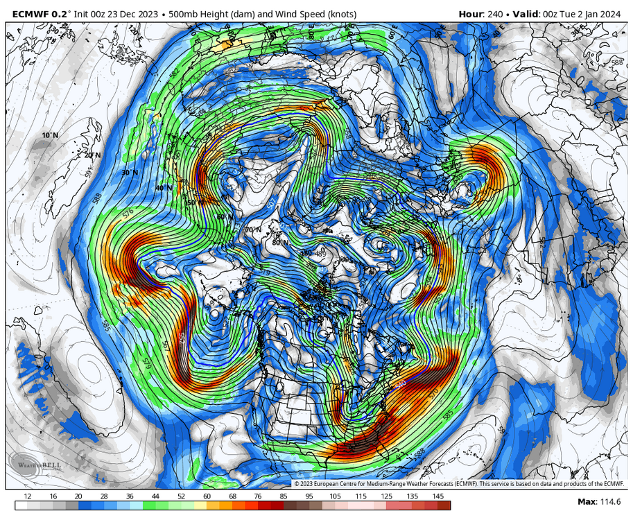
Getting beyond the MJO, SSW and Pac jet... We are likely to see a fairly consistent flow of waves/disturbances/troughs enter the CONUS along the West Coast, originating from the deep/mean trough from the Aleutians down into the Northeast Pacific. This is characterized by the lower-height anomalies from the Northeast Pacific and then across the southern 2/3rds or so of the CONUS. Additionally, with the Pacific jet breaking down and the retrograding ridging in Canada, this will lead to generally cooler/colder conditions overall than have been seen, with an airmass origin more often than not from the Northeast Pacific to Pole regions.
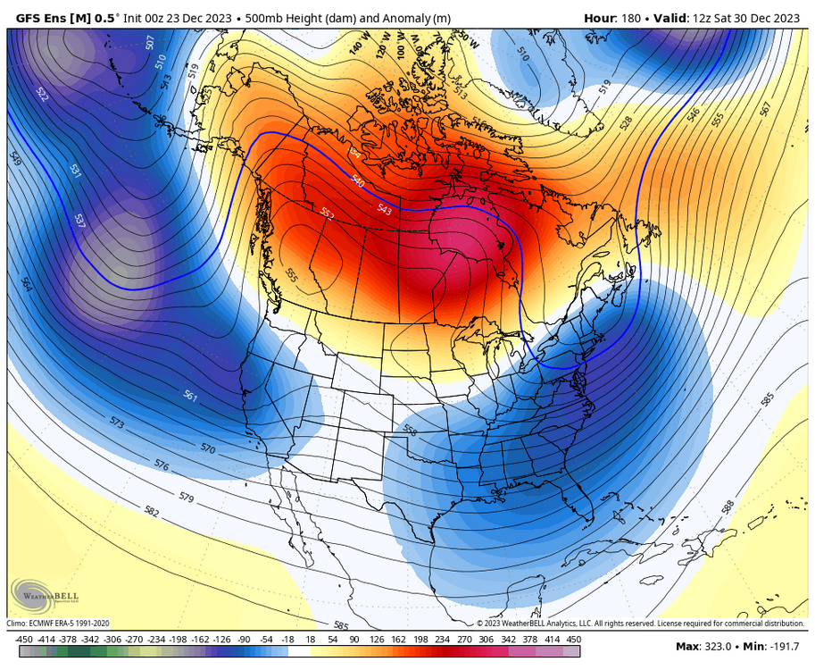
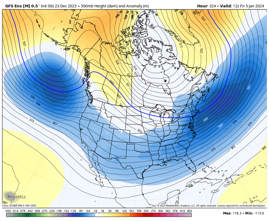
All in all, with this pattern change...
-While it may not be super/hyper active, there will be a steady stream of disturbances that traverse the CONUS. Will they all turn into something interesting? No. But having a feed is a start.
-It is very clearly not going to be as significantly/consistently as mild as it has been. That's not to say there won't be any bouts of mild temperatures, but what we have been seeing will be in the past for now.
-The chances for wintry storm potential are not amazing, but definitely an improvement compared to much of the past 1-2 months.Top notch. Appreciate the insight as always. Nice break to the “warm” and “ban him” bickering.
-
4
-
-
Made it down to 12 last night. With the recent "warmth" the air had a bit more bite than expected when I walked outside today.
-
1
-
-
7 minutes ago, Frog Town said:
If my memory serves me correctly, wasn't 2015-16 a Winter where the cold was always two weeks away but ended up staying on the other side of globe all winter?? I also remember a constant modeled SSWE that always threatened but never really materialized. Am I getting the right Winter??
This one is starting to feel a lot like that one...
2015-2016 was abysmal if I recall correctly. Was the first of 2 back to back sub-20" winters, and I don't think I got my first inch of snow until late January.
-
1 hour ago, RogueWaves said:
NYE and ongoing across the lower lakes..
Phantasy storms can happen. Can't they?
No, they died in 2015
-
3
-
-
33 minutes ago, sbnwx85 said:
This was my favorite winter storm of all time. I was 13, living in Elkhart, IN and vividly remember watching the snow pile up throughout the day. It was incredible. A sea of white. There was so much snow the plastic roof over the backyard patio caved in.
Then I got one of the worst stomach bugs I've ever had and watched the Packers lose to the Niners in the playoffs.
Minus the stomach bug, this sounds glorious. Tons of snow, packers losing
-
5
-
-
1 hour ago, hardypalmguy said:
I know with winter days like this spring will be here before we know it.No... When we are ready for Spring to arrive we will get stuck with an extra month of shitty winter weather. April snowiest month incoming.
-
1
-
1
-
-
3 hours ago, Cary67 said:
Initial thread to RIP in 30hrs. But not close to one of the great model collapses.

The rug pull of all rug pulls.
Models are seemingly worse at 120 hrs than they were a few years ago. GFS "improvements" have really turned it into a steaming shit pile.
-
2
-
4
-
-
Already up to 10” of GFS imaginary snow.
-
1
-
-
-
-
2 minutes ago, RCNYILWX said:
Still too early to lock in a certain scenario, but the 12z guidance consensus suggests less of a snow threat for the LOT CWA and a severe threat potentially extending into a portion of the CWA on Saturday PM.
Seems like both the GFS and Euro are wanting to take the low right over the CWA. Cold air ends up late to the party. Ensembles are still all over the freaking place with some well north and some well south. Could be in worse positioning as this one gets dialed in.
-
1
-
-
41 minutes ago, sbnwx85 said:
Eff it. It's too beautiful.

You know, a casual 250 mile shift between runs. I wouldn't get too excited about anything...
And until I see something that changes it, I am riding the "weaker, south, strung out" multi-year trend.
-
2
-
1
-
-
7 hours ago, Chicago Storm said:
I wouldn't get too caught up in the potential revolving around next weekend for several more days.
We're shifting into a fairly progressive pattern, and there are several pieces that need to be well placed for things to work out.
Guidance is a go for now...We'll see how things look come Wednesday/Thursday.
Yeah the 00z Euro was pretty wild locally, GFS well east with the system.
-
1
-
-
Ready for my 217” of fantasy GFS snow this season
-
1
-
-
23 hours ago, A-L-E-K said:
lock it in

Creeping northward…

-
The “storm” Saturday night into Sunday looks a bit juicier than I was expecting. With nowhere to go this weekend will be nice to see some flakes.
-
5
-
-
35 minutes ago, Cary67 said:
Let WAD with small intervals of CAD commence. Consider core of winter from February 1st-March 10th for our area.
FYP.
-
1
-
3
-
1
-
-
14 minutes ago, andyhb said:
10 years since 11/17/2013 today.
ILX with a fantastic write up
https://storymaps.arcgis.com/stories/b13d60d65c434d63a915cc7a88afa6fd
-
3
-


1/8-1/10 Potential Winter Storm
in Lakes/Ohio Valley
Posted
00z euro going to be a Chicago crush job. Man hope one of these stronger solutions plays out for someone