CoolHandMike
-
Posts
1,561 -
Joined
-
Last visited
Content Type
Profiles
Blogs
Forums
American Weather
Media Demo
Store
Gallery
Posts posted by CoolHandMike
-
-
Looking forward to wxsim saying 4-6 feet of snow next weekend.
")
-
 1
1
-
 6
6
-
-
What a lovely day of tracking foul weather with you lot. Here's hoping for many more opportunities to do the same before spring!
-
Looks like all ZR here, too. Now with a little bit of wind mixing in.
-
6 minutes ago, Hurricane Agnes said:
Just came in from measuring and all the snow has stopped here (and there's no precip at the moment so overcast). Got 1.2" total so far. Temp is 25 with dp up to 19. Not sure what is coming next but something is!
After a lull, I'm hearing the sleet picking up again.
-
Pingers here. Temp back up to 30.
-
Temps peaked at around 30 here but now it's back down to 28 or so. Snowing steadily again, roads were clear but now are covered again.
-
Looks like it's stopped here. Sky is considerably brighter.
-
Just now, penndotguy said:
yup brine only helps to keep the snow from binding to the road surface, keep from packing
That makes sense. Guess I'm just used to our usual, borderline 32° snow-to-rain events. This is a nice change from that.
-
Roads don't look to have been treated too well. I think they brined too soon? (saw the brining on the roads on Thursday) I mean, I know it didn't wash off but still. Picture outside my office looking down at a fairly major 2-lane road:

-
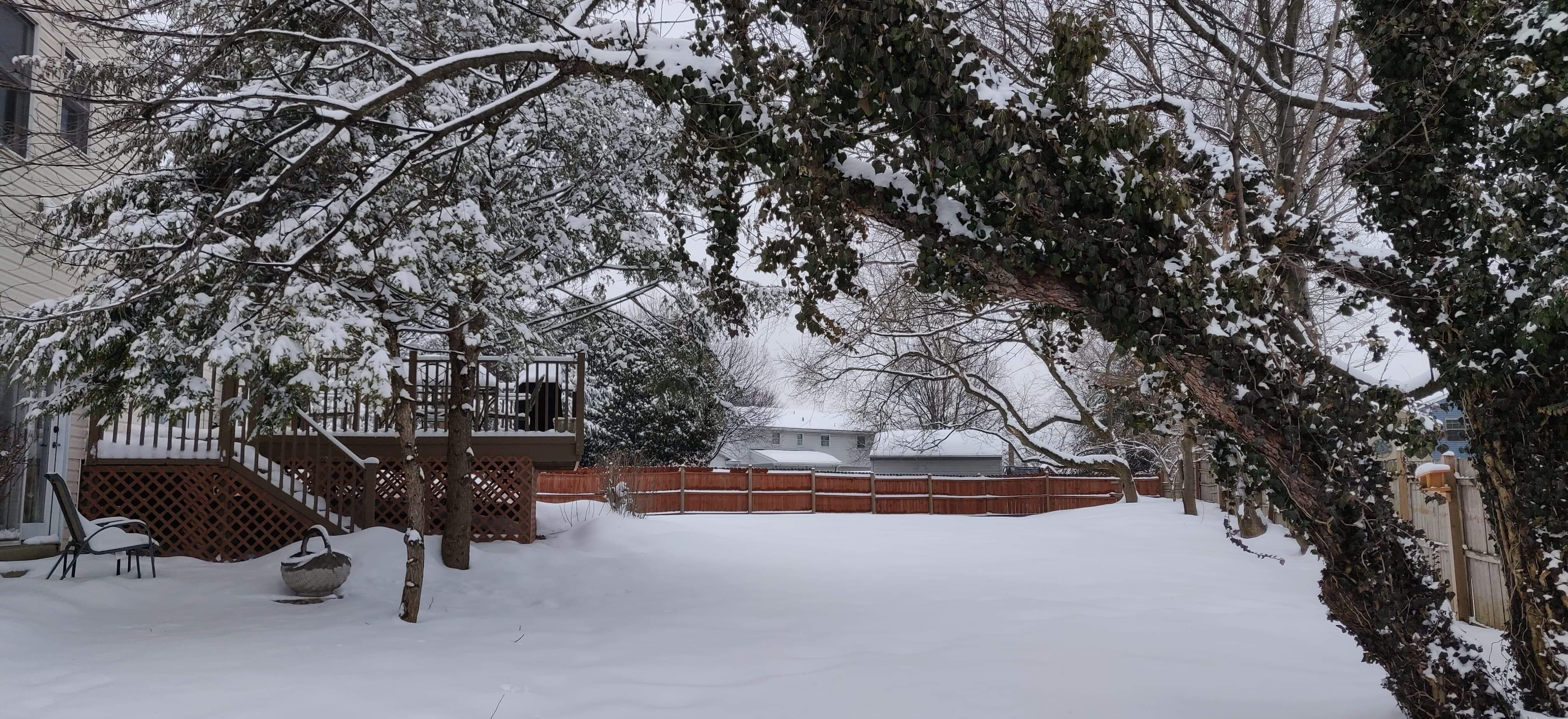
Untreated surfaces covered. Didn't take long. Small flakes. Temp 26°F and dewpoint 7°F, nice to have snow with temps well below freezing and low dewpoints.
-
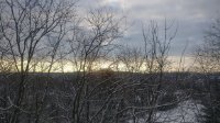
Dark band right over me and few few flakes making it to the ground.
-
Sky looks menacingly dark to the west. Doesn't have that "snow sky" look to it; more like a spring-time storm front.
-
21 minutes ago, ChescoPaWxman said:
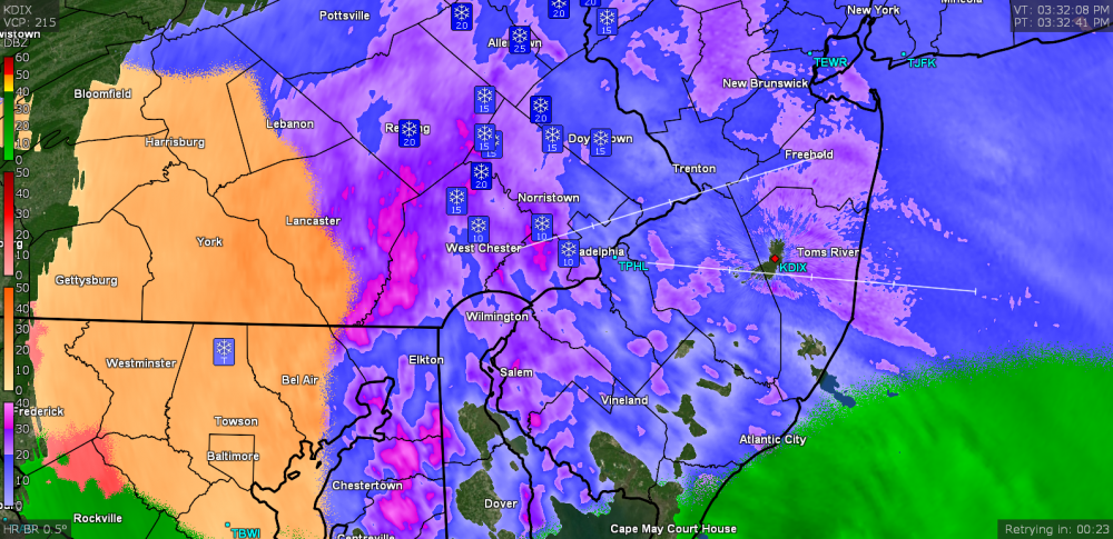
Latest WXSIM with 6z - looks like WXSIM is winning for now the great battle vs NWS temp wise....NWS has now moved my P&C to 32 degree high - WXSIM still colder.
Today: Dense overcast. A slight chance of a mix of snow and sleet in the
morning, then sleet likely in the afternoon. High 27. Wind south near calm in
the morning, becoming 6 mph in the afternoon. Chance of precipitation 70
percent. Precipitation (liquid equivalent) mostly between a quarter and half an
inch. Snow or ice (on ground) accumulation about half an inch.
Tonight: Dense overcast in the evening, becoming cloudy after midnight, with
scattered light frost possible. A mix of snow and sleet likely in the evening,
then a slight chance of freezing rain after midnight. Low 25, but temperatures
rising after midnight. Wind chill ranging from 16 to 24. Wind south-southwest
around 9 mph. Chance of precipitation 80 percent. Precipitation (liquid
equivalent) mostly around half an inch. Snow or ice (on ground) accumulation 2
to 3 inches. Little if any freezing rain accumulation.Wasn't WXSIM calling for upwards of 12" several days ago? What is it's track record regarding forecasts? Seems foolhardy to me to give it any credence if it's that far off only a few days in advance. Not trolling, asking honestly. Obviously we all want more snow and we all want the medium- to long-range forecasts to be more accurate, but that seems kind of ridiculous to me.
-
3 minutes ago, Lady Di said:
I’ll take an hour of snow and like it!
Could always move to Newfoundland. LOL
21 degrees New Garden Twp.
25.5°F and 43% RH about 15 miles north of Avondale, give or take. I'm also at about 450' ASL. When I moved back here in '09 with my SoCal-raised wife, I told her that this is the type of winter we usually had growing up, and then we got hit with the epic '09 and '10 winters, so she didn't believe me. But now that we've had more than a few years of mediocre winters in a row, she gets it.
She got hooked on lots of snow during those years and now we ultimately want to move somewhere more north. Somewhere with a real, consistent winter. NFL sounds nice.
")
-
9 minutes ago, ChescoPaWxman said:
WXSIM with 12z data again ticked a bit colder and a little more snow/sleet accumulation with a bit earlier start time - total snow sleet 3.5" to 4.5"
Here is the rundown:
- 10am snow arrives temp (22.2)
- 1pm Moderate IP (23.6)
- 4pm Heavy IP (23.4)
- 7pm Heavy Snow (23.6)
- Snow ends around 8pm
So it's looking like we'll stay well below freezing for this entire event? Nice.
-
64°F and 82% humidity at midnight. I wonder if that line of storms will make it here.
-
15 minutes ago, anotherman said:
In February of ‘94 I was at Penn State Altoona. The entire state of Pennsylvania was under a state of emergency and Penn State closed (that never used to happen). I will never forget I went to get gas and the pumps didn’t work. It was -20.
I remember there was a massive, pitched snowball battle on main campus. I also remember all the cars being completely buried. It was epic.
-
11 minutes ago, Birds~69 said:
Sticking to cartops/grass/rooftops....mod snow. No stickage on roads.
Same. 35.6°F here.
-
Had some brief flurries here, too. Super nice to wake up to on New Year's.
-
Just cold and rain here, no glazing at all. 34°F.
-
Drove through some super light sleet and drizzle from Thorndale to West Chester and back just now. Not much of anything happening... yet? I dunno, NWS backed off our snow total potentials from 2" to <1". I will say, however, regardless of how this all shakes out, that I'm super glad to be having wintry weather at least.
-
It's currently 5°F warmer than the IMBY forecast from weather.com, wunderground and accuweather. MOS forecast is only a degree cooler with temps never approaching zero today/tomorrow. It was supposed to have been snowing for several hours by now already, but there's pretty much nothing on radar north of the Mason Dixon line. I'd say this forecast is a bust for us.
-
The wife and her friends were planning on attending an event at Mt. Hope tomorrow night. I told her she's gonna have to play it by ear. I don't want here going anywhere near the turnpike in icy conditions. Looks like it'll be a now-casting event...
-
1
-
-
4 minutes ago, C.A.P.E. said:
Eagles need to dig in here. Its the freaking Redskins FFS. Cant have Dallas winning that division.
Rooting for the Eagles is like Yay! Oh. Yay! Oh. Oh. Oh... Yay? For instance, see last week's Giant's game. They almost lost to a 2 and 10 team ffs.


Winter 2019-2020 Banter Thread
in Philadelphia Region
Posted
Spent the morning clearing brush from the horse trail behind my parents' house with a tractor and chainsaw. Don't know about you guys, but I am absolutely loving this cold and grey weather. Could be snowier, but I'll take this over any summer day, period.