coastalplainsnowman
-
Posts
977 -
Joined
-
Last visited
Content Type
Profiles
Blogs
Forums
American Weather
Media Demo
Store
Gallery
Everything posted by coastalplainsnowman
-
I'm always surprised that a lot of posters here have the preference that if it's not going to snow that they prefer it to be mild. I admit that as I get older I like the idea of the cold more in theory than in actual practice, but still I'll take the cold over mild in January and February, whether its accompanied by snow or not. This goes double for the Thanksgiving to New Year's timeframe. Love the idea of seeing the lakes freeze over, and walking on a frozen lawn. Why? Who knows. But I think part of it is that surprise 60s once March gets here feel 10x better when they follow a cold winter. When the winter is full of damp 55s, March 60s don't hit the same way. Ok, I could have started this thing Dear Diary lol but anyway that's my take.
-
Check this out. I get the gist of it but not well enough to articulate it (even though most here would probably consider this to be written at a first grade reading level), so here's the link: BTW, I bet if you ask 100 people on the street on what day is the latest sunrise and earliest sunset, 99 out of 100 will say the first day of winter.
-
I really like that 'snow triangle' that someone's been sharing on here with cold, moisture (I think) and luck, but for significant storms, for those of us near the coast, the triangle should be seriously obtuse (like me sometimes?) with the 'luck' side being the long side. It's always been this way. This is why I don't get when I read things (not yours, just in general) like 'throw in the towel it's so hard to get snow here anymore' (especially when we see places *south* of us jackpotting now and then.) The 'luck' side of that triangle is so big for us in any given year, that even if temps are averaging noticeably higher than 30 years ago, I don't think the impact on getting big storms here is so great, especially when you look at how warm some of those winters were in the 2000-2018 snowy era. Could it mean a megasnowstorm every 20 years instead of every 15? Maybe, but that just means that you went from a 6.7% chance in a given year to a 5% chance. The odds are already very much against it around here, and part of what makes it 93.3% frustrating and 6.7% fun.
-
Jan 11th-12th Super Bomb or Super Bummed?
coastalplainsnowman replied to Rjay's topic in New York City Metro
Question for @MJO812: You are visited by a genie who offers you back to back 2025 and 2026 Mets World Series championships, but only mild winter rainstorms for 8 consecutive years, OR a 50" blizzard with a two month snowpack, but Mets losing seasons for 8 straight years. Which do you choose?- 993 replies
-
- 2
-

-
- metsfan vs snowman
- bomb
- (and 2 more)
-
Jan 11th-12th Super Bomb or Super Bummed?
coastalplainsnowman replied to Rjay's topic in New York City Metro
This is a very good point. I'm not amped up over the topic one way or the other, however thanks to the bountiful storms of the last 20 years, 40" isn't high enough to be an obvious joke. As we all know, we've had actual maps from not too long ago with 24-36" which verified and/or were on the *low* side. If you said 40" in 1990, it would have been an obvious joke. You might as well have said 50 bajiliion inches. -
Jan 11th-12th Super Bomb or Super Bummed?
coastalplainsnowman replied to Rjay's topic in New York City Metro
I guess the undermeasurement of snow in Manhattan is not a new phenomenon. Apparently it's been a problem for at least 137 years.- 993 replies
-
- 4
-
-
- metsfan vs snowman
- bomb
- (and 2 more)
-
Snowfall NYC subforum Jan 6 and OBS if needed
coastalplainsnowman replied to wdrag's topic in New York City Metro
I thought the Upton forecasts for this event were/are noteworthy for the fact that even the 10% chance "high end" forecasts were <1" for all locations in Nassau and Suffolk. I mention it because usually those high end forecast numbers will have some higher 'so you're tellin' me there's a chance' values that the snow optimist can hang their wishes on, but in this case even those weren't hopeful. -
Snowfall NYC subforum Jan 6 and OBS if needed
coastalplainsnowman replied to wdrag's topic in New York City Metro
Son of a gun, looks like the usual favored spot in Suffolk is making the most of this. -
Snowfall NYC subforum Jan 6 and OBS if needed
coastalplainsnowman replied to wdrag's topic in New York City Metro
We must have, because I can remember the running "How much for Philly?" joke to this day, though that might go all the way back to the ne.weather days. -
Snowfall NYC subforum Jan 6 and OBS if needed
coastalplainsnowman replied to wdrag's topic in New York City Metro
If we're being honest, that goes for 100% of the forum to some extent. You're telling me that Walt and Don haven't ever gone back to take a peek after throwing in the towel?* Look where we are people! *You guys are the best, just having some fun lol -
It amazes me too. Their whole brand is weather, yet when the most interesting and impactful weather is happening, in prime time no less, they air something else. And not something else that's bound to draw a lot of eyeballs mind you, but "highway through hell." It's like ESPN being one of three networks with rights to air the NFL playoffs and deciding that precisely when those games are live that they'll air re-runs of their 30 for 30 documentaries instead.
-
E LI seems a bit underdone IMHO.
-
Shoot, yes, Daily Bugle! I stepped on my punchline.
-
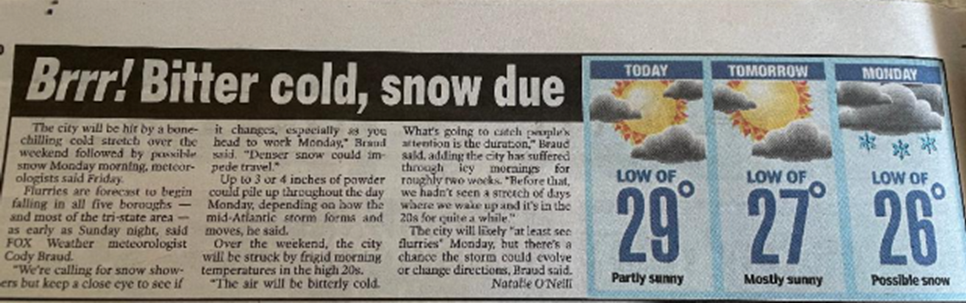
Thought this group would enjoy this, going back to our topic on regular media looking silly re the weather. From the Post this morning. "Brrr!", "bone-chilling cold", "bitterly cold." You see, it's going to be so cold that they had to show the *lows* rather than the highs for each day. 20s I tell ya! I can almost hear the editor from the Daily Planet in the Spiderman movies shouting "Show the low tempeartures! Say Brrr Bitter cold!" And I *like* the Post lol.
-
I wonder if we all feel the same way about climate change posts which have been proven wildly incorrect, as evidenced by me being on Long Island and not under 30 feet of ocean. Should we ban those too? Or keep them because after all they are 'directionally correct' and well-meaning?
-
Old ladies don't see that map. They do see the WABC/WNBC/News 12/etc reporters standing in the DOT yards beside the salt trucks talking to the drivers, obliged to say "I guess this could be a rough one" when its snaining out, and know they better rush out to get the proverbial bread and milk, even if they doubt what they're hearing, because they know the shelves will be bare soon.
-
Fair enough calling out irresponsible claims or hyping events, but who wants to bet that if we look in the archives for this NBC affiliate we'll see that they've done the same thing a zillion times in the past decade, just with a slightly higher standard? STORM CENTER 7 HAS BEEN ACTIVATED! WE HAVE FULL TEAM COVERAGE ON THIS IMPENDING 2 INCH WET ROADS STORM. STAY TUNED! What the hyperbolic outlets on social media do about megastorms which never materialize, many local affiliates often do with puny nuisance storms as they are happening, which is arguably worse.
-
Site is unusable on mobile because of ads
coastalplainsnowman replied to Nash_LSU's topic in Forum Information & Help
I'll just add that I am having the same issue. I first had it years ago and mentioned it here and was responded to, but the problem vanished after a few weeks. I'm experiencing the same thing as this poster. In my case I get what the poster shows but even if I can manage to see the Google Web Browser option, it is greyed out. It's tough to get that far anyway though because there are recurring postage stamp video ads with an unclickable X. BTW I've been free riding here for too long and am going to donate this month. -
A beautiful storm which to me marked the start of the great snowy era which seems to have wrapped up a few years ago. Man, talk about smelling the rain to get the best snow. The rain/snow line was maybe two miles S/E of me here in SE Nassau. Best rates I ever saw. Lowest visibility I ever saw. I have pre-digital pics in which I can't see much further than two houses down my suburban block. Just incredible, and it was at a time before 12' storms were the norm, having only a fuzzy 78, and 83 and 96 in the memory banks.
-
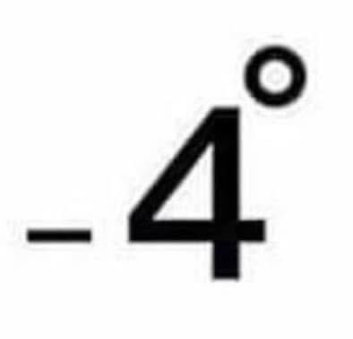
I was waiting for this opening. Saw this on Twitter the other day. -4 degrees looks like a person sitting on the toilet. That is all.
-
What do we consider the 'official' definition of a White Christmas? Would it be defined as any December 25th in which the official snowcover is measured at greater than 0?
-
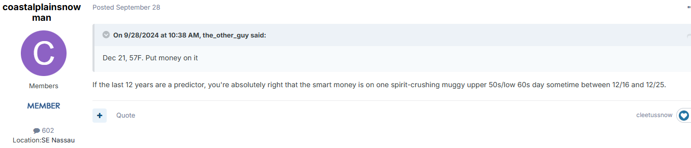
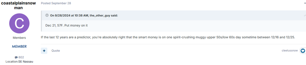
I see Nassau is forecast to hit 58 on the 17th. And there it is, the obligatory soul crushing upper 50s/low 60s day within one week of Christmas. @the_other_guy, if it holds up that'll be a not bad call by you 3 months out. The sad part is that it's 57 and rainy as I'm typing this.
-
Can Accuweather stop it already with the commentary in their forecasts? "Cloudy and increasingly windy; heavy rain and a thunderstorm late; rain will be welcome due to drought Lo: 49"
-
This morning I am witnessing odd grey, vaporous, almost 'puffy' formations overhead, obscuring my view of the sun and the sky. Has anyone ever seen these before?
-
Aurora in Queens sounds like the title of a movie that gets an Oscar nomination.