frd
-
Posts
7,008 -
Joined
-
Last visited
About frd

Recent Profile Visitors
11,898 profile views


-
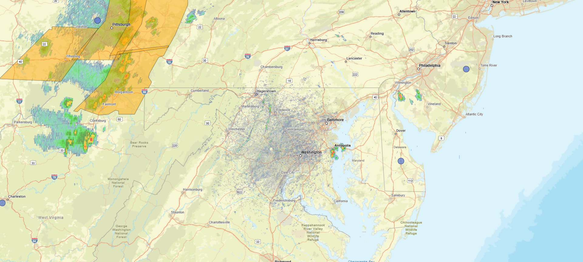
Several cells pivoting East of DC moving NE.
-
Quick moving small storm hit here .14 At least it cooled off the garden.
-
Several cells popping up already.

-
https://x.com/RyanWeather/status/2064837035706163334
-
Middle of next week has potential.
- 156 replies
-
- 2
-

-

-
- we got burned
- rugpull central
- (and 1 more)
-
True, but hopefully things start to change as we exit August. We have seen rapid improvements in as little as 90 days during previous Fall seasons leading into Winter.
-
Stilling raining lightly here on the back edge. .50 so far, was not really expecting that much.
-
Storm seem to be intensifying as they near the Aberdeen proving ground. Will be interesting to see how the Upper Bay affects direction.
-
Well the line on the upper eastern shore looks legit the question is will it hold together as it moves East into my area near the c&d canal
-
Raining going poof here as it moves East.
-
Does it take it all the way East, even if it were to happen?
-
I hope machine learning ( which is very bullish) regarding severe weather is somewhat accurate. See below: Upper level ridging is expected to build overhead on Thursday, with several models also showing a shortwave disturbance passing through the top of the ridge. How this disturbance evolves will have a large impact on our forecast locally. If the disturbance passes through early in the day, we could have large scale subsidence and relatively low coverage of showers and thunderstorms. If it were to approach at peak heating, we could have a much greater coverage of thunderstorms. Upstream convection will likely have a large impact on how that disturbance evolves, so confidence in the forecast details on Thursday is lower than normal. What models are in good agreement about, is that the background environment will be highly unstable (CAPE values likely in excess of 3000 J/kg). There will also be enough dry air in the mid-levels to support strong downdrafts (DCAPE in excess of 1000 J/kg), and just enough shear (around 20 kt) to give storms some weak organization. Such an environmental setup is common in many of our more impactful summer severe thunderstorm events. As a result, there appears to be a conditional threat for severe thunderstorms on Thursday. That threat for severe thunderstorms may continue on Friday as a shortwave disturbance passes to our northwest through the Great Lakes causing the upper ridge to break down and a surface cold front to approach from the northwest. With greater synoptic scale forcing, confidence in the occurrence of storms is higher on Friday, but instability might be slightly lesser. Machine learning guidance is very bullish on the severe thunderstorms threat for both Thursday and Friday. We will continue to monitor this potential threat over the upcoming days.
- 749 replies
-
- 2
-
-
- severe
- thunderstorms
- (and 7 more)
-
Later this week, and next week appears to get more active as the general pattern begins to change. Increasing chances of storms every couple days once we get to this Wednesday.
- 156 replies
-
- 2
-
-
- we got burned
- rugpull central
- (and 1 more)
-
Huge dive in the SOI Date Tahiti (hPa) Darwin (hPa) Daily Contribution 30 day Av. SOI 90 day Av. SOI 7 Jun 2026 1014.05 1017.70 -34.73 -19.19 -9.71 6 Jun 2026 1013.94 1016.55 -27.42 -18.06 -9.05 5 Jun 2026 1012.20 1015.15 -29.81 -17.33 -8.44 4 Jun 2026 1010.52 1014.25 -35.29 -16.43 -7.77 3 Jun 2026 1010.14 1013.80 -34.80 -15.47 -7.10 2 Jun 2026 1012.48 1015.05 -27.13 -14.79 -6.56 1 Jun 2026 1013.74 1014.85 -16.87 -14.14 -6.04 31 May 2026 1013.79 1014.20 -14.84 -13.58 -5.64 30 May 2026 1012.24 1014.15 -26.33 -13.17 -5.29 29 May 2026 1011.31 1014.15 -33.46 -12.63 -4.77
- 156 replies
-
- 1
-
-
- we got burned
- rugpull central
- (and 1 more)
-
Clouds dropping SE