Rjay
-
Posts
28,356 -
Joined
-
Last visited
Content Type
Profiles
Blogs
Forums
American Weather
Media Demo
Store
Gallery
Everything posted by Rjay
-
OBS and nowcast 9 AM today - Noon Valentines Day Feb 13-14, 2021
Rjay replied to wdrag's topic in New York City Metro
Had some flurries then light sleet then some frz drizzle. Temps steady in the upper 20s in Holbrook. -
The algo is counting all frozen precip as snow. So if the snow map is showing 9", it's not showing 9" of sleet, it's showing 9" of snow. Don't use snow maps in these types of setups (or ever). Go back to the basics to figure out precip type.
-
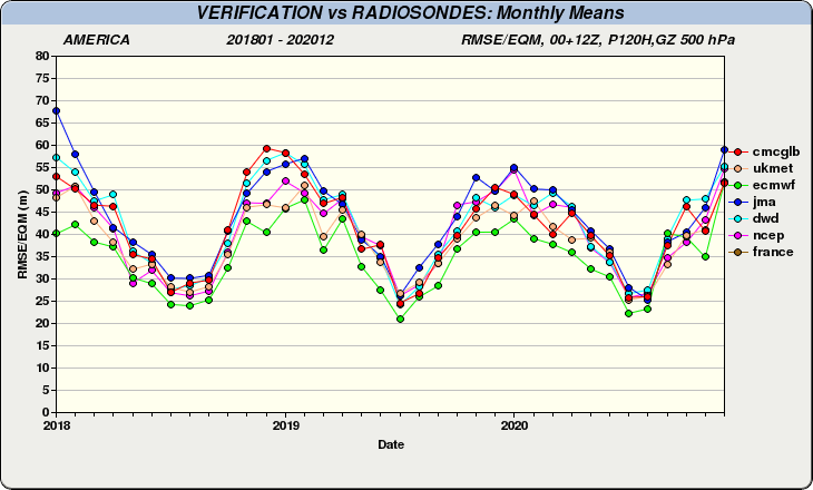
Apparently already had it bookmarked but completely missed it. https://weather.gc.ca/verification/monthly_ts_e.html Thanks @forkyfork ***dwd
-
It's been a year since I've seen a graphic with the icon rated but it's a trash model that the NWS never mentions. Hopefully someome can find it. I still use this link and it doesn't have the icon. https://www.emc.ncep.noaa.gov/gmb/STATS_vsdb/
-
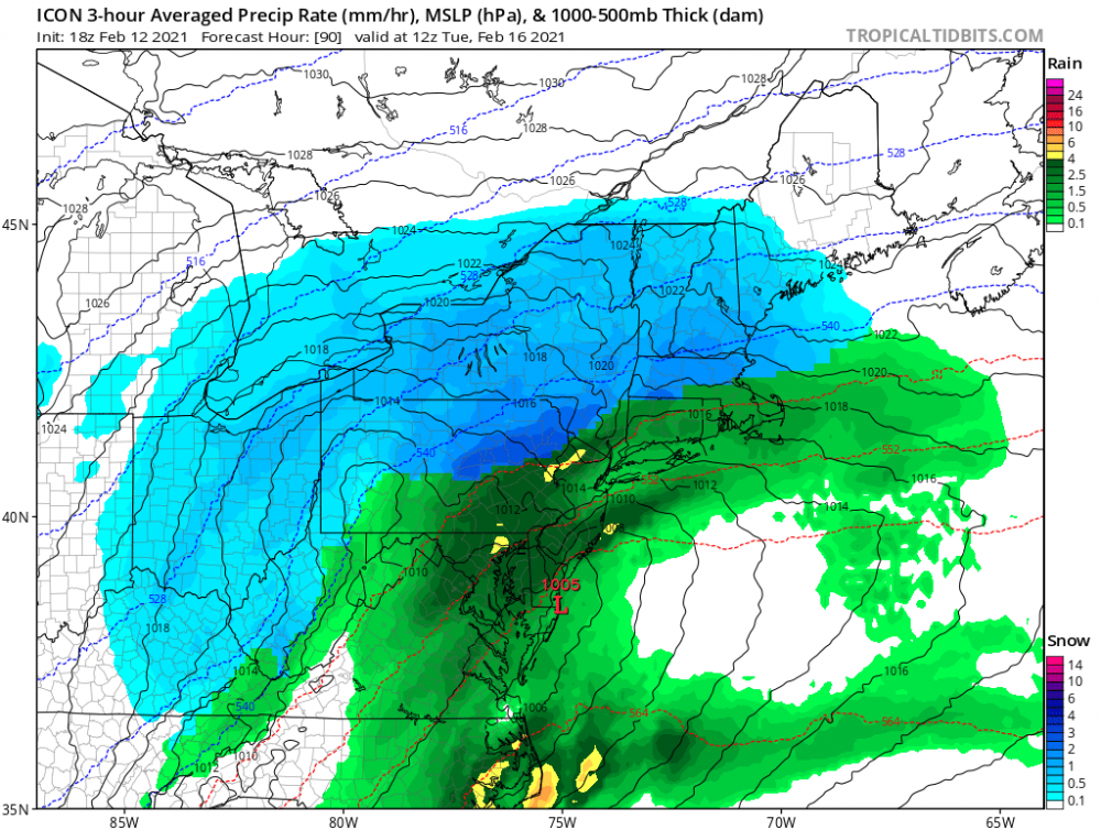
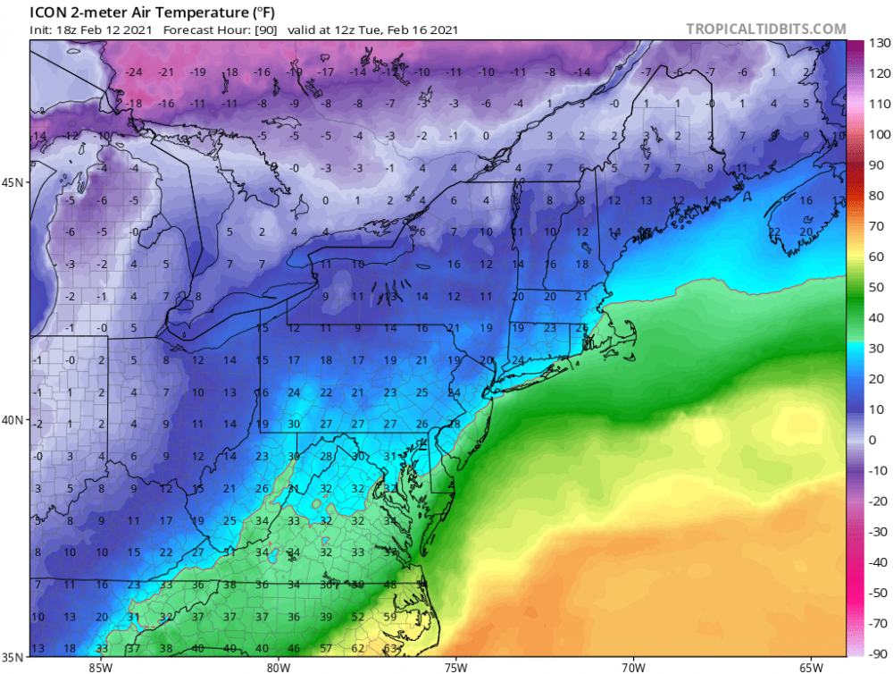
The icon on tidbits doesn't have sleet or freezing rain in their algo. They also don't have soundings or mid-level temps as a parameter to look at but what they do have is surface temps so you can see some of that green is not plain rain. Oh and the icon is trash so I'd never give it much thought.
-
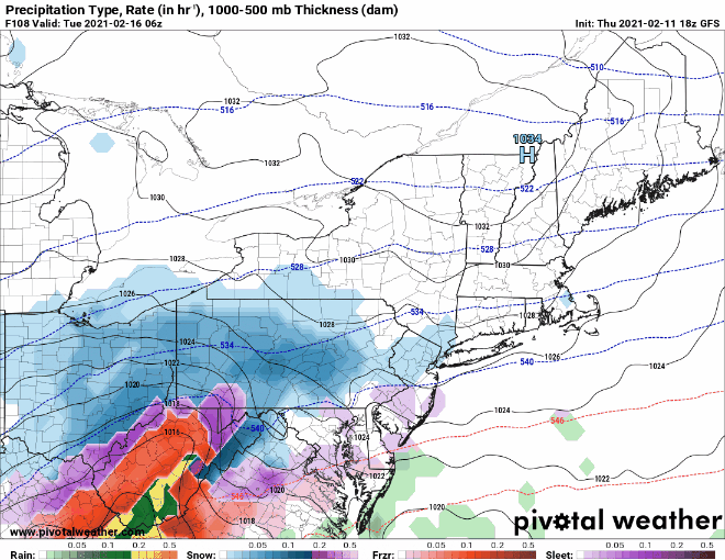
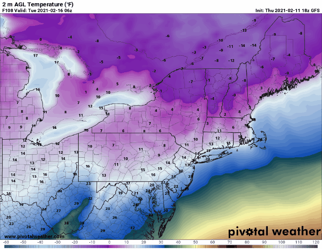
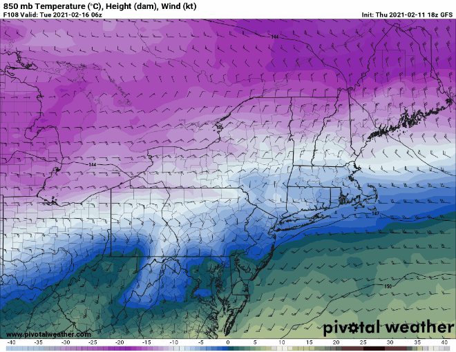
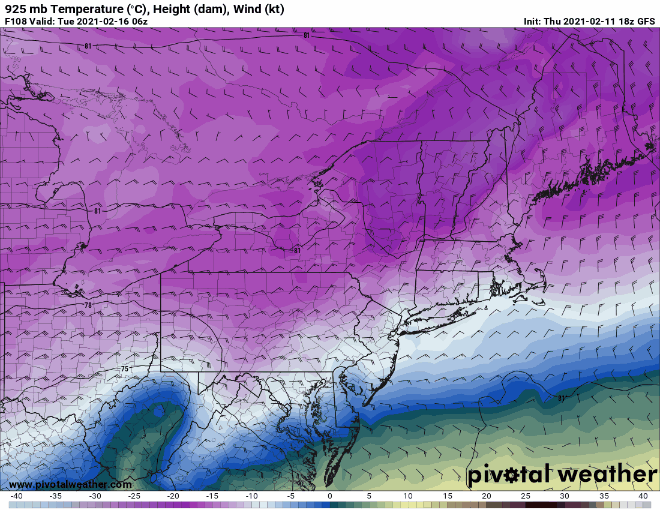
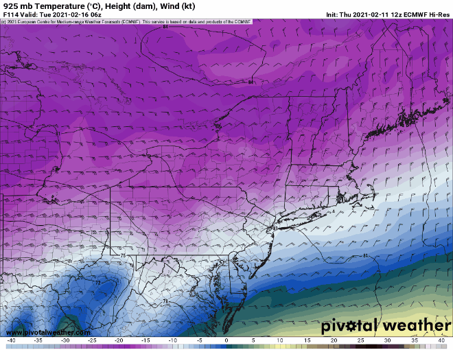
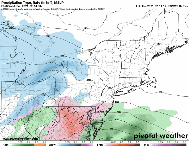
Anyway, here's the 12z Euro precip, surface temps, 850 temps, 925 temps
.gif.98030e3da5d66db9e6dcdc815ea05ba1.gif)
.gif.63ec359ede65f2cd20632c731ff444d1.gif)
-
No thanks on a major ice storm. Snow or rain please. Rain seems very unlikely though with such a cold airmass.
-
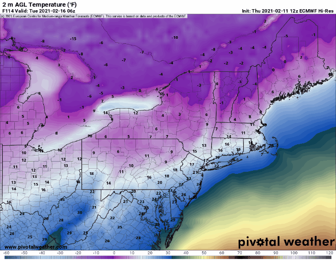
12z Euro fwiw
-
@wdrag. We've actually never had the issue of having too many threats in such a short period of time before in this subforum. I had to edit a couple of the topic dates to make it less confusing to the observers/posters. It doesn't feel good to edit or touch your work but I did the best I could. Make a February 18th storm thread when you feel it's time.
-
Have at it folks.
-
@wdrag. I need to split to the topics bc it is a bit confusing. We will keep this thread for the 16th threat. I will create a new one for the Valentine's day threat. Any of threat after that, do what you do. You can start an Feb 18th thread if you want. Thanks for everything.
-
OBS and nowcast mainly midnight - Noon Thursday Feb 11
Rjay replied to wdrag's topic in New York City Metro
Had 1.5" new otg when I woke up this morning. -
It's not like he doesn't know what he's looking at. He's just a stubborn mofo.
-
Obs and nowcast Super Bowl Sunday 4A-6P Feb 7, 2021
Rjay replied to wdrag's topic in New York City Metro
4.5 -6.5" . Good range over a short distance. *shrug* -
Obs and nowcast Super Bowl Sunday 4A-6P Feb 7, 2021
Rjay replied to wdrag's topic in New York City Metro
. Awesome -
Obs and nowcast Super Bowl Sunday 4A-6P Feb 7, 2021
Rjay replied to wdrag's topic in New York City Metro
Lol you're fine. Who's to say you're wrong anyway. -
Clearly #2
-
Game over
-
Obs and nowcast Super Bowl Sunday 4A-6P Feb 7, 2021
Rjay replied to wdrag's topic in New York City Metro
Lol. You said 5.5" i measured ~6". It's all the same to me. -
Snowman19 is our good luck charm. He's never to be banned. I hope he trolls all of you every season.
-
Bx says I'm old bc I have no idea who the f**k these dudes performing during halftime are...But seriously though, who the hell are they?
-
Additional 1-5" snow mostly North of I80 Tuesday Feb 9
Rjay replied to wdrag's topic in New York City Metro
And the beat goes on.