WxUSAF
-
Posts
28,777 -
Joined
-
Last visited
Content Type
Profiles
Blogs
Forums
American Weather
Media Demo
Store
Gallery
Everything posted by WxUSAF
-
Got to pass 01-02 before moving onto bigger and better things!
-
Yeah, airmass is rough. Euro has a workable airmass coming in as the storm develops. GGEM looks like April at 850mb.
-
Euro, GGEM, and GEFS all have a pretty similar look D8-9 with a developing storm in the Plains, brief PNA spike, and “some” high pressure nosing into the Lakes and northeast. This is the time period that has been advertised for several days already.
-
Euro going the extra mile to piss us off. Better cold push, so shred that wave to nothing and wait for the cold to retreat before bringing in the precipitation.
-
Rather large changes for the weekend event on the euro. We’ll see where it goes.
-
Ah, didn’t realize that.
-
We have something. Not sure how much of a thing, but better than D15 longwave pattern chat.
-
Above freezing layer is extremely shallow though which is good news.
-
Blue on blue
-
Ravens had virtually no chance at the division anyway. The game means the most for the bills I think.
-
Little bit stronger low and a smidge farther south to blunt that weak southerly flow @tombo82685 pointed out yesterday. Plus anything we can do to mitigate that brutal mid January sun angle!
-
I think even in the olden days we didn’t get a lot of snow with maritime polar air masses. That’s my intuition though, without stats to back it up. I’d guess that a lot of the vanishing marginal events @psuhoffman has been mentioning are with modified continental polar airmasses. That’s probably our most common type of airmass in winter (and much of the year). Now we seem to need fresher continental polar air masses or even modified continental arctic. Simply because that modification makes the continental polar airmass too warm for snow.
-
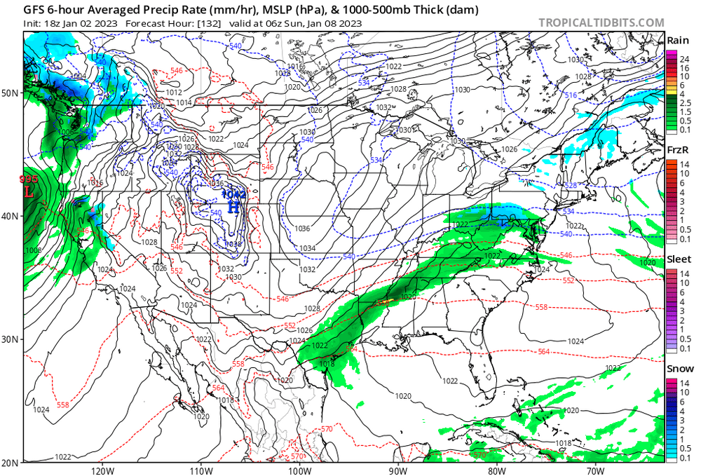
1030mb high in the lakes, weak sauce low passing to our south in mid January, 534dm heights, precip falling at night…and rain. Hoffman making notes.
-
JB still searching for his underwater volcanoes
-
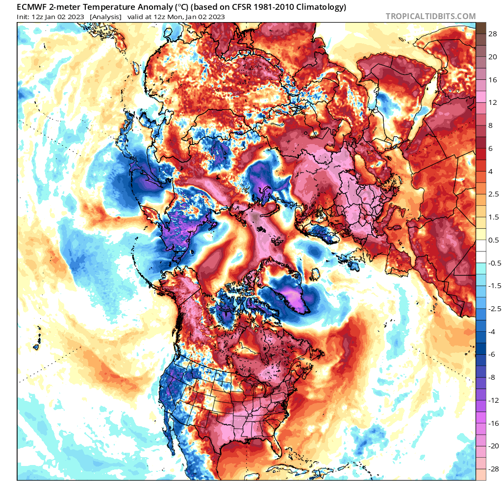
Seems like a lot of red and pink
-
End of this Tulane-USC game is wild
-
It’s not perfect, but for now it seems like the best window for frozen precip that we can see.
-
Surface pressure and H5 looking pretty good on the GEFS for the window around the 13-15th. But the airmass…
-
There’s no sign of a SSW anytime this month and even if there was one around Feb 1, it would be late Feb before any possible impacts occur. Plus Niña SSWs favor Europe for impacts.
-
Ravens have yet to see a lead this season they didn’t want to give up. If they play Jacksonville or Tennessee in 2 weeks, they probably have a chance. But they’re going to be embarrassed by a high quality opponent.
-
I think that wave is more interesting than this Friday chance. Fresh HP over the top with a wave running to our south. Euro gave us a little mixed precipitation with it overnight. GGEM redevelops it offshore and gives us some snow.
-
Analogs are certainly useful and are the first order seasonal or monthly forecast. The last 2 months have shown 2 trends to me though: 1. Periodic high latitude blocking despite the strat PV 2. Changeable conditions with no pattern locking in for more than 10-15 days. Past events are no guarantee of the future though, so maybe those 2 trends break down, but I wouldn’t bet against it yet. What that means for our snow chances though is that we have to “hit” quickly. I don’t think we’ll get some 4 week long highly favorable pattern.
-
For this Friday thing to have any chance, we need the ULL to dig south of us and develop the coastal there so we can get any scrap of coldish air. GFS is moving the wrong way, but 12z euro wasn’t too far off.
-
Friday. GGEM amplifies the follow up wave and gives us some digital blue (and green) next weekend. Seems like lots of chances coming up. Marginal cold air, but hopefully “enough” with the right storm track.
-
That trailing trough is getting more robust, but seems like just more 38F rain for most of us. Maybe mashed potatoes for @psuhoffman and @mappy.