WxUSAF
-
Posts
28,702 -
Joined
-
Last visited
Content Type
Profiles
Blogs
Forums
American Weather
Media Demo
Store
Gallery
Everything posted by WxUSAF
-
Great night for baseball! I’ll be the guy in the orioles shirt and hat if anyone wants to say hi!
-
Shocker…most of the overnight runs dialed back precip for this weekend. Euro basically has rain for 2-3 hours with the frontal passage. Low of 37 this morning
-
Thought I recall Ava saying 63 for a high and 10F warmer than that
-
I didn’t pay close attention but isn’t it much warmer than forecast today?
-
Not even sure I got a trace overnight. Ground is dry.
-
Not nothing, but only like 0.02”
-
Ground is wet but these showers keep dying on my doorstep
-
Thunder with rain on the west side of Columbia. Just thunder at my house. Hopefully those cells rotate through.
-
Pretty foggy now. Under 1/4mi vis I’d say
-
Had thunder twice overnight.
-
May and June are our wettest months and developing Nino can’t hurt that. So we could fill that deficit in a hurry if things align. But if not, will be a crispy July-August.
-
Saturday looking like it could be the bulk of the rain? Rain with the front seems to be petering out.
-
Just want to say that when I got home from work I put on my Ryan Mountcastle shirsey. So yeah, you’re welcome!
-
19 yards!?! I think I have a pretty big yard and most I’ve ever done is 6.
-
Forecast remains pretty dry going forward. Maybe 0.2-0.6” late weekend early next week?
-
Only 34 for the low IMBY
-
33.3 for the low
-

2023 Mid-Atlantic Severe Wx Thread (General Discussion)
WxUSAF replied to Kmlwx's topic in Mid Atlantic
0.1”. That’ll bust the drought! -
Iceland is beautiful, but it has one of the worlds highest rates of mental healthy problems for a reason. Makes Seattle in winter seem positively sunny.
-
After today’s showers and storms it looks like 7-10 days or more of big SE ridge with warm temps and absolutely zero rain. Going to need a switch flip soon or going to be a very crispy summer.
-
O’s have preemptively postponed tomorrows home opener to Friday.
-
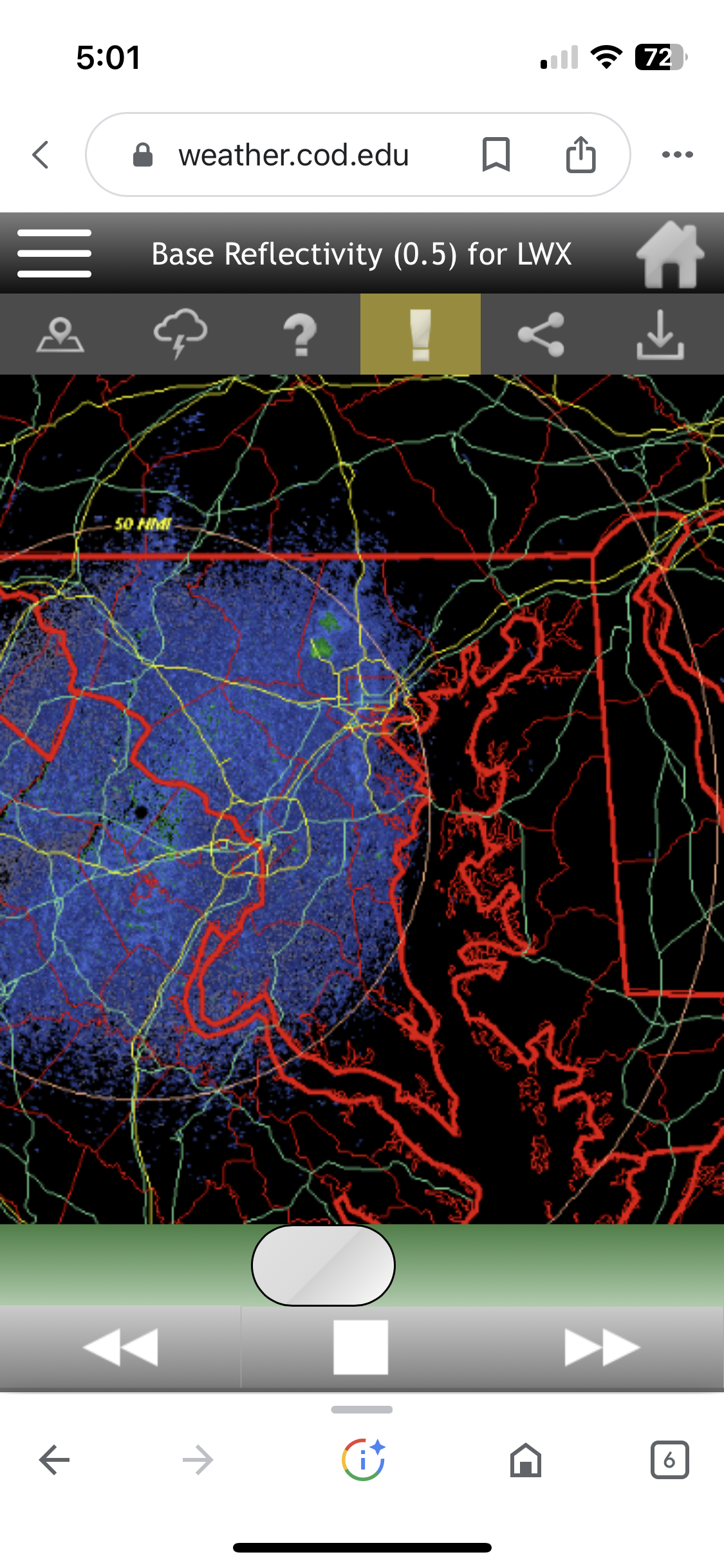
Large drought-fueled wildfire at Soldiers Delight in Baltimore county with smoke showing up on radar.