

Jackstraw
-
Posts
2,268 -
Joined
-
Last visited
Content Type
Profiles
Blogs
Forums
American Weather
Media Demo
Store
Gallery
Posts posted by Jackstraw
-
-
KOKK Kokomo airport been reporting -SN for a couple hours now. Temps here have been a steady 35 for the last 6 hours after dropping from 48 around 2am. Kinda stalled at the moment. Per meso that weak shortwave traversing far southern IN/OH river seems to have pumped a bit of a pesky warm nose up through SE/EC IN. Hopefully as it passes NE the next hour or 2 we can start to transition. Think I'm going to need at least 3 or 4 inches from this first part to get above 12. Anything less than 12 is a bit of a disappointment.


-
 1
1
-
-
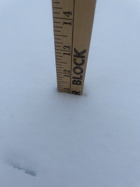
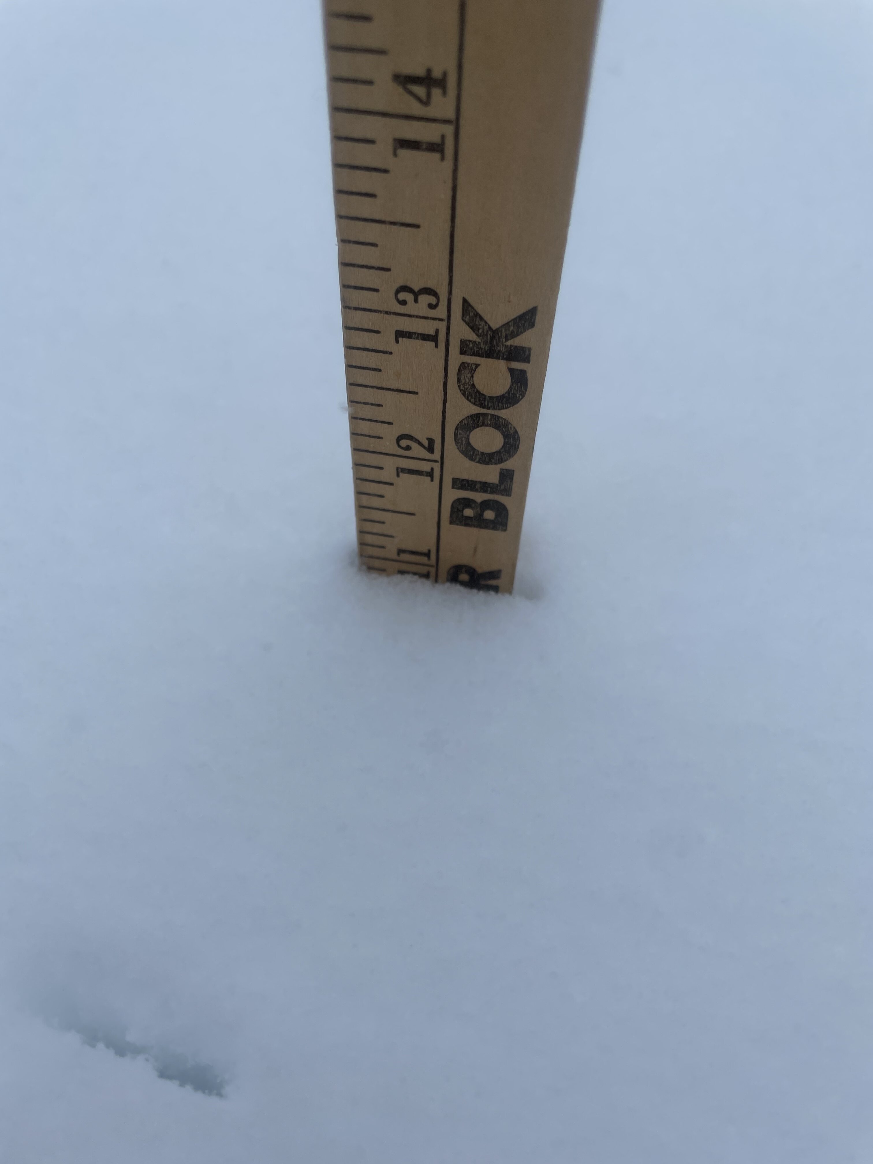
For you younger members, that's a yardstick lol.
 25 minutes ago, NEILwxbo said:
10.1” here in extreme SE Grundy. Last night I put 2 snow boards out, one of which I cleared at 2:30 when I measured 2.3”. At 8:30, it had 7.8”. The one I didn’t clear off is pictured

-
This is just down right scary

-
Overnight AFDs gonna be interesting
-
00Z Euro keeps getting drier. Its not a lack of overlapping. Im wondering where these 2-3 in Pwats that forecasters were worried about a couple days ago are. There was strong wording about potential flooding to our south. I know its a bit early but meso is barely showing 1 in coming in from the gulf. The upslope moisture occurring seems to be from tapping into the Pac jet, 700mb quite saturated. I get a weaker surface reflection in part 2 but complete fizzle? Im probably wrong but something fishy seems to be going on lol.
-
14 minutes ago, Hoosier said:
Changeover taking a little longer to happen than most models indicated around here.
maybe due to open lake water? points E and SE are turning faster than the timeline LOT posted.
-
00Z Canuk didnt really benefit anyone to the N but it chopped the legs out from underneath us in the south

-
1 minute ago, NTXYankee said:
For the same reason anyone outside of Chicago cares in this storm discussion about only Chicago.
Ohhhh, no you didunt! lol
-
 2
2
-
-
850 freezing line is outrunning the surface freezing level fairly quickly, been posted and some AFD's commenting on that. Surface VTM for what its worth is setting up pretty much where most models have been forecasting highest totals for the last 36 hours. Think part 1 could overperform if it can hold on to the 700mb moisture for any length of time. Part 2 is beginning to somewhat amp up with >1 PWATS finally moving N of TN valley.
Just my armchair take. I used to get chastised for posting HRRR and RAP snow maps but they seem to be all the rage now lol.
-
 3
3
-
-
03Z RAP cracking me up lol
-
18Z RAP soundings now have me under 6 hours of pingers and FZ. Better not have to give up a foot of snow for that just so the folks on Northern edge can get 3 or 4 more inches. Thats meltdown criteria lol.
-
1
-
4
-
-
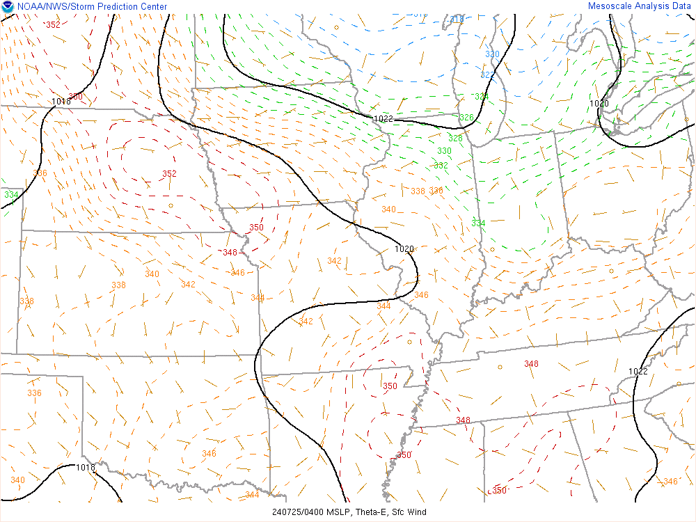
Never seen a mesoscale surface pressure map like this. Its almost symmetrical lol. Can definitely see the area where the clash will begin.
-
KIND has slowed the onset of liquid here by 6 hours
-
10 minutes ago, michsnowfreak said:
I've been so busy focusing on my backyard but I just compared the GFS and GEM and those are absolutely incredible differences for snow amounts in Southern Ohio, Indiana and eastward for only being a few days out
Looks like the GFS has a stronger upper trough over Hudson bay reinforcing the southerly cold air push suppressing the surface wave. GDPS has that trough weaker and flatter allowing the surface wave to hook a little longer before shunting east.
Maybe


-
I sure hope the ice totals on the far south edge are way overdone. I wouldn't wish 2 inches of FZ on anyone. Those totals could be pretty devastating across 8 states.

-
KIND mets tired? lol
.LONG TERM...(Wednesday through Monday)
Issued at 259 AM EST Tue Feb 1 2022

Dry but cold weather will follow Friday into early next week.
Temperatures should stay below normal with little if any snow.
-
1
-
-
7 minutes ago, Harry Perry said:
Currently sitting at a strip club drinking a Michelob Ultra waiting to see the next model suite.. literally.

so who u buck tucking the most? Sugar Icon? (bringin back the dancin 'mater lol)
-
1
-
-
10 minutes ago, Hoosier said:
This is largely due to the change in the handling of the main system. Not quite as good of an overlap on recent runs.
True but youd think alot of it would be shunted south and east. Theres been an overall drying trend. Total QPF has come down fairly significantly across the globals in the last 24hrs
-
3
-
1
-
-
Models are slowly waking up from their crack party when it comes to totals.
-
1
-
1
-
-
Think this 00Z GFS initiation at the surface has a lot to say generally

-
1 minute ago, ILSNOW said:
Need confirmation from the RAP
Just received

-
2
-
-
We are now into the 3 dimensional Pachinko phase of the game lol.
-
2
-
-
Subtle differences in the way the models are handling that cutoff off the mid-atalantic. seems the ones with a more N bias have it stronger pumping the mid level ridge some
-
14 minutes ago, Powerball said:
One trend that seems to be legit is that the models are getting beefier with the amounts from that first round. The 00z NAM continues that trend.
Thats actually a bit of hope where we're at here. At least with a fully phased system its like a hooker, you pretty much know what your gonna get. These quasi phased half slop messes more often than not with the second part we get bent over like the last goat in a herd in the desert whithout a courtesy reach around.
-
2
-
Feb 1-3rd GHD III Part 3
in Lakes/Ohio Valley
Posted
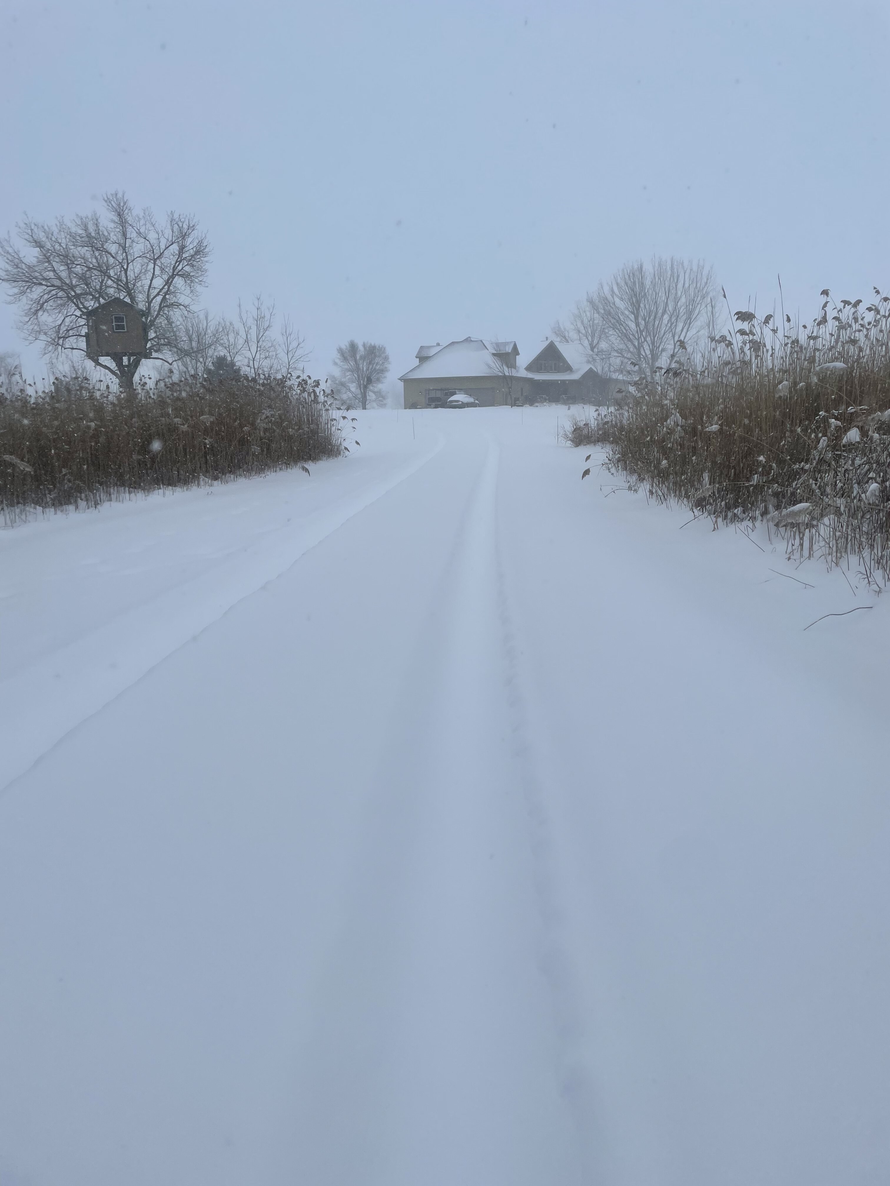
Pingertown beginning. Drove about 10 miles to the NW and the snow was kicking in. It was sticking quick should have no problem quickly accumulating once it gets here.