

moneypitmike
-
Posts
31,737 -
Joined
-
Last visited
About moneypitmike

- Birthday March 15
Recent Profile Visitors
17,035 profile views


.thumb.jpg.aec747d13df1d95d5fed34574f74d4fd.jpg)

-
 The season is not record hot/cold until it's over. Let's' see how the remainder plays out.
 -
Woke up to 53* here in Mattapoisett. Progged hights for Pit2 this week: Today 80 Tues 76 Wed 79 with showers. Thurs 80 Fri 71 Sat 72 Sun 73 All in all, I'd call that that COC.
-
Lots of thunder last night though none of it particularly close. Ended up with some solid rains. Looks like a beaut shaping up for today. Moving into the rapid-shortening of days with sunlight losses hitting 2-minutes plus per day at Pit2 this week.
-
Looks like I'm getting steined today. Hopefully tonight will do a little better.
-
Sounds like I might not need to water our new plantings tomorrow. Glass half full.
-
What a great cool north wind. COC day at Pit2.
-
Hoisting the Sultan Signal: Heavy Rain Event July 5-7
moneypitmike replied to WxWatcher007's topic in New England
pics? -
Hoisting the Sultan Signal: Heavy Rain Event July 5-7
moneypitmike replied to WxWatcher007's topic in New England
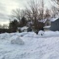
At least it will be easy to shovel. -
It appears any lingering questions some may have had of where the the heavy rain would set up has been answered.. Looks like we've got ourselves at CT/RI/coastal SE Mass deluge situation.
-
Nah......
-
Do it right.
-
I think I was east of most of the storms last night, though had some good flashes and distant thunder while going to bed. Based on the puddles outside, we managed at least a decent drink.
-
Bone dry at Pit 2. Hopefuilly it'll be nice up there for family visiting next weekend.
-
Today looks pretty meh in the heat department. Progged SW will keep it comfy. Maybe I can convince my wife to open the windows.
-
Winds have veered to the SW FTW. 86.


