
snowlover2
-
Posts
2,731 -
Joined
-
Last visited
Content Type
Profiles
Blogs
Forums
American Weather
Media Demo
Store
Gallery
Posts posted by snowlover2
-
-
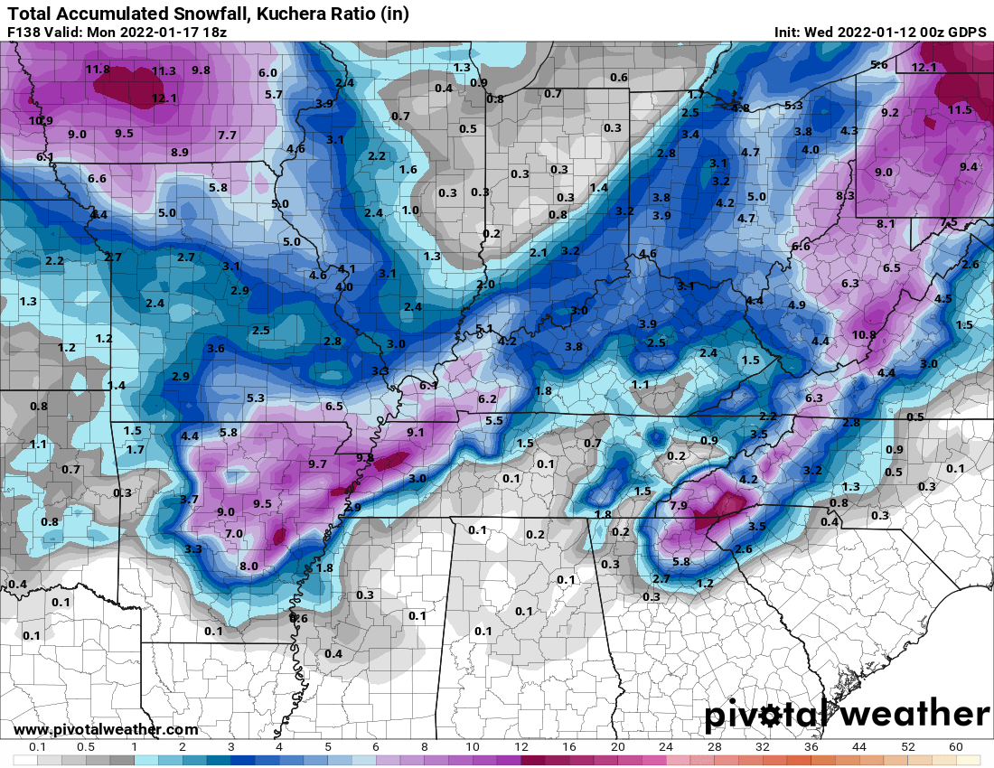
12z GGEM finally loading and it looks very similar to the GFS.
-
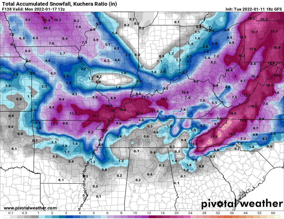
12z Ukie took a nice jump NW. Has snowfall east of I-71 where the 0z was in VA/Carolinas.
-
-
0z Ukie not buying any of this yet.
-
-
-
18z GFS is not terrible.

-
Euro joins in with the GFS trying to pull this sucker NW on the curve around.
-
 1
1
-
-
12z GGEM also appears to have comeback NW some on the swing around.
-
Very lightly snowing here in Dayton.
-
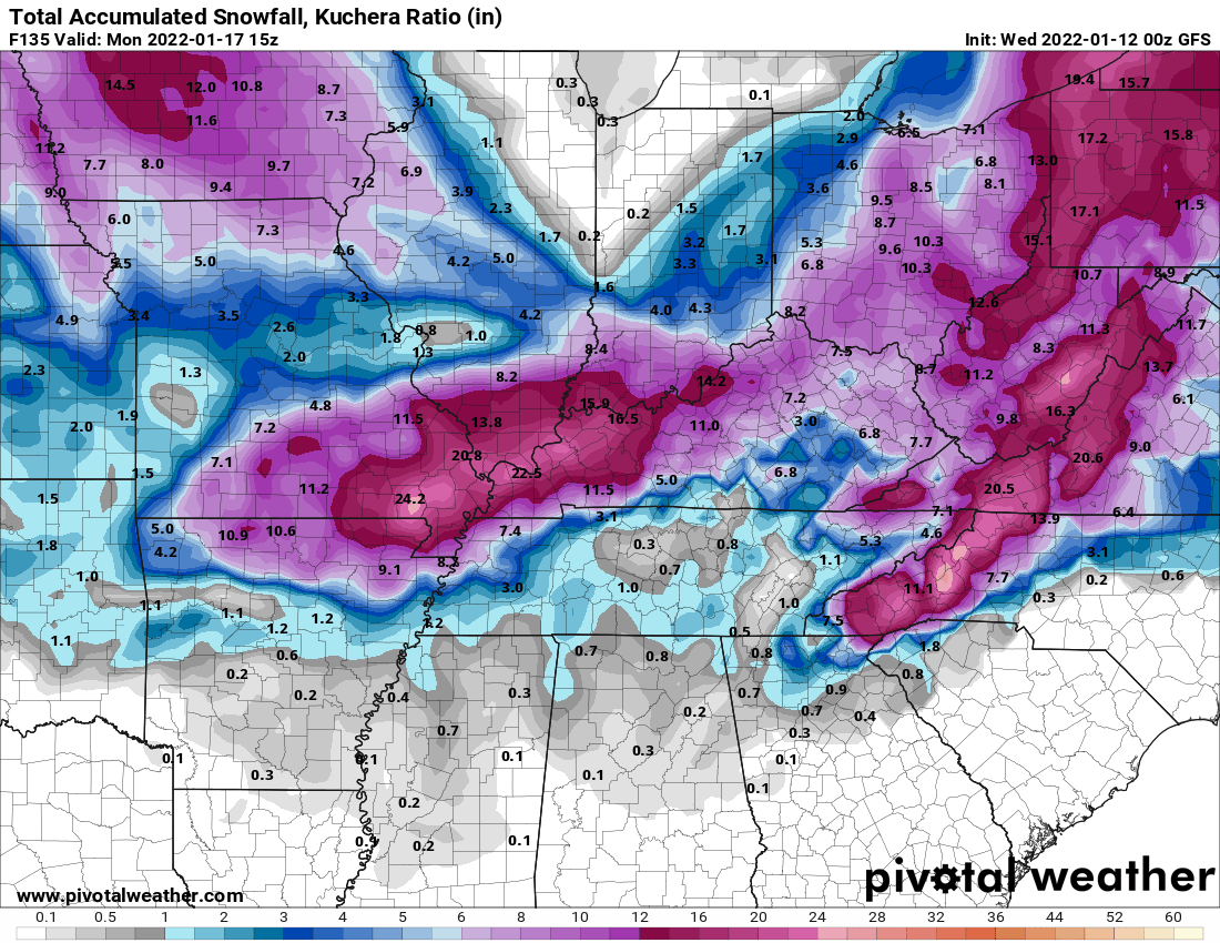
0z GFS finally has a storm giving SE parts of Ohio a couple inches.
-
0z off to a good start. 0z NAM is much better.

-
43 minutes ago, buckeye said:
I suspect the NAM is going to double down on it's 12z. Looking at the 18z sref it actually has the greatest precip amount to our nw

18z NAM looked pretty crappy.
-
Got the NAM on board now too making GFS look like even more of an outlier.
-
For comparison to its 12z.
-
12 minutes ago, Gino27 said:
Euro coming in with more of the same. Getting closer folks.
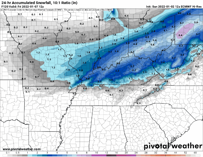
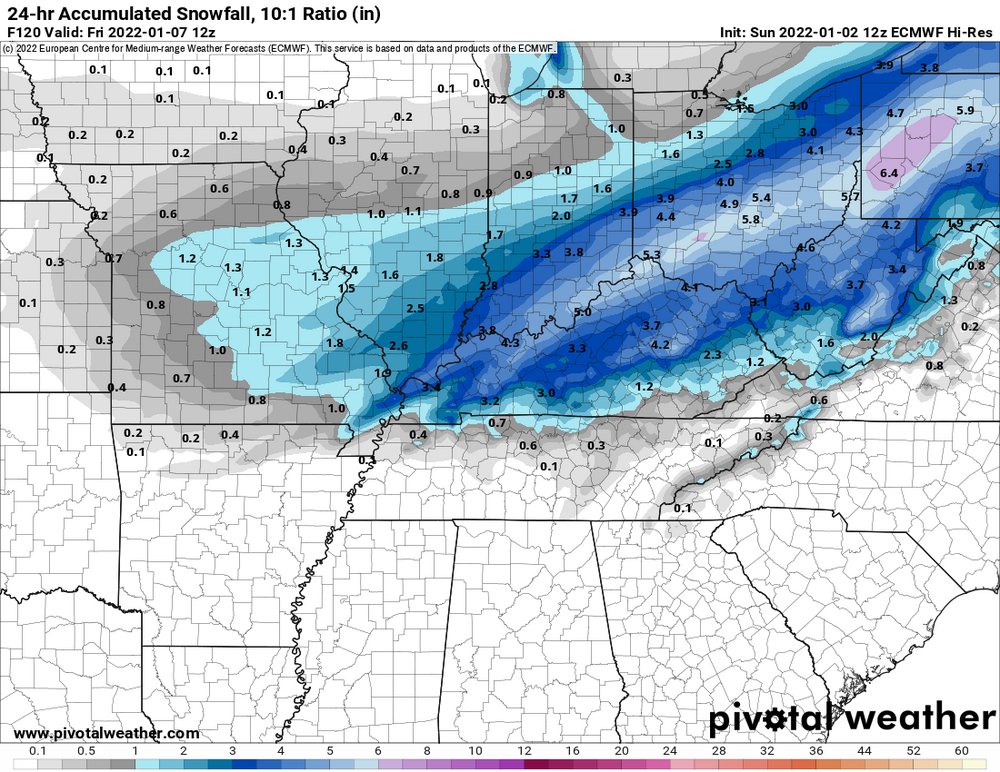
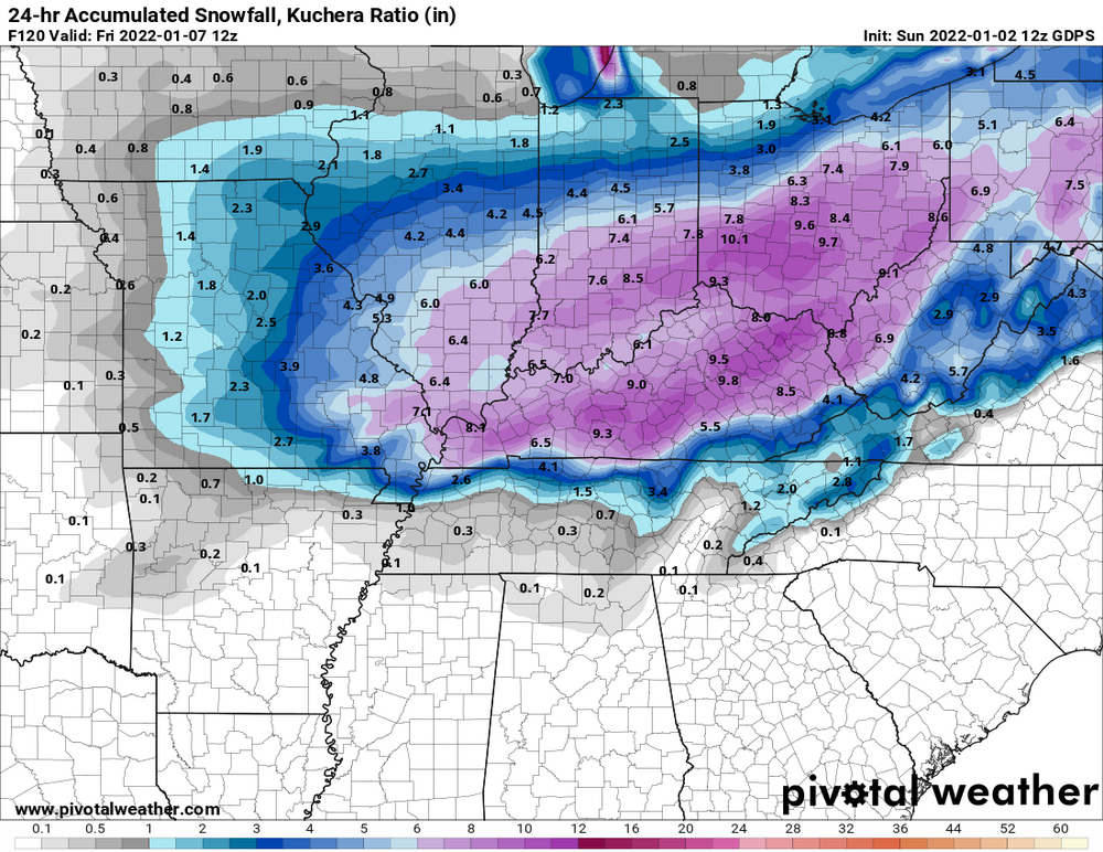
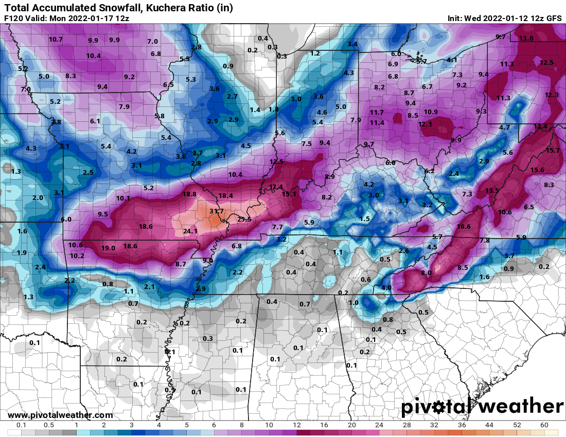
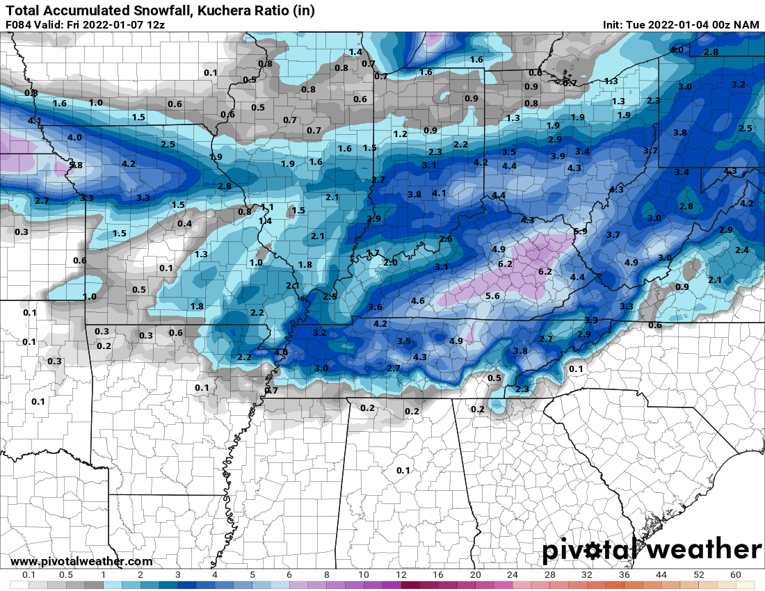
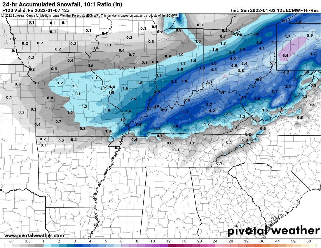
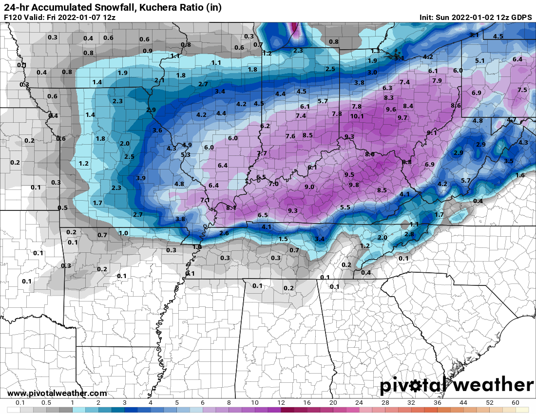
Actually west a bit. Kuchera maps probably would show some 8-12" totals.

-
-
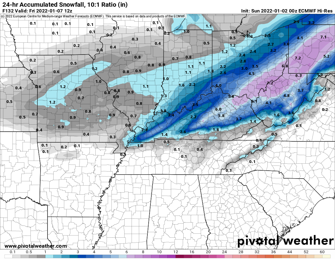
0z GFS still not playing ball but was a touch better.
-
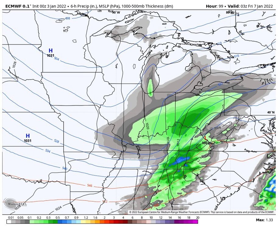
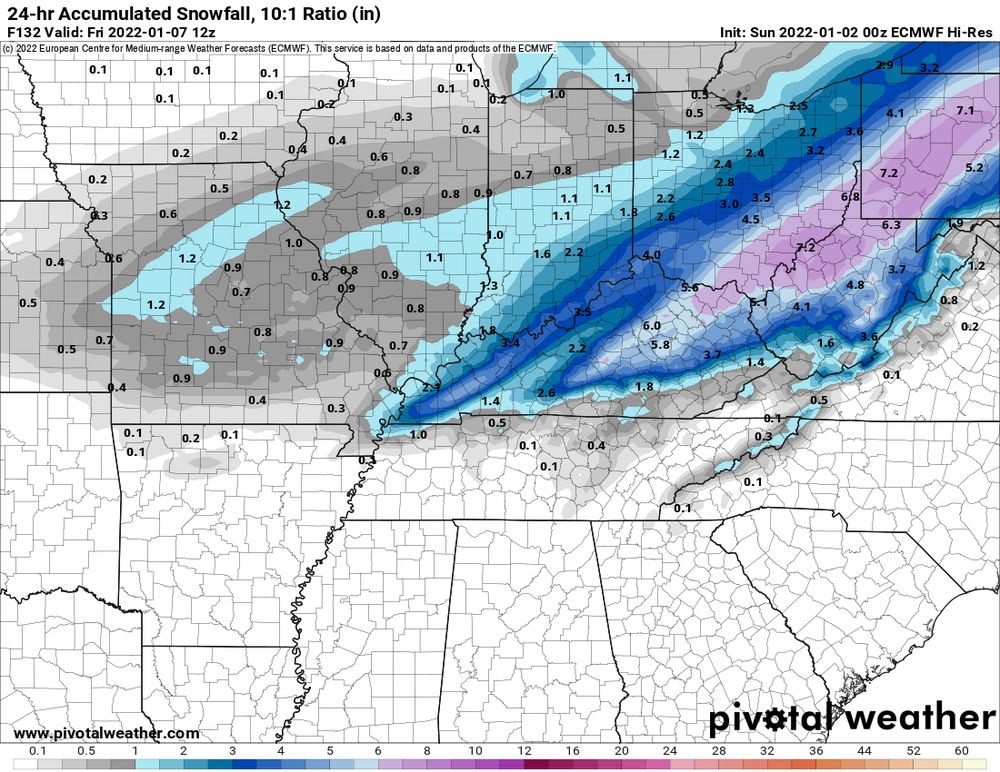
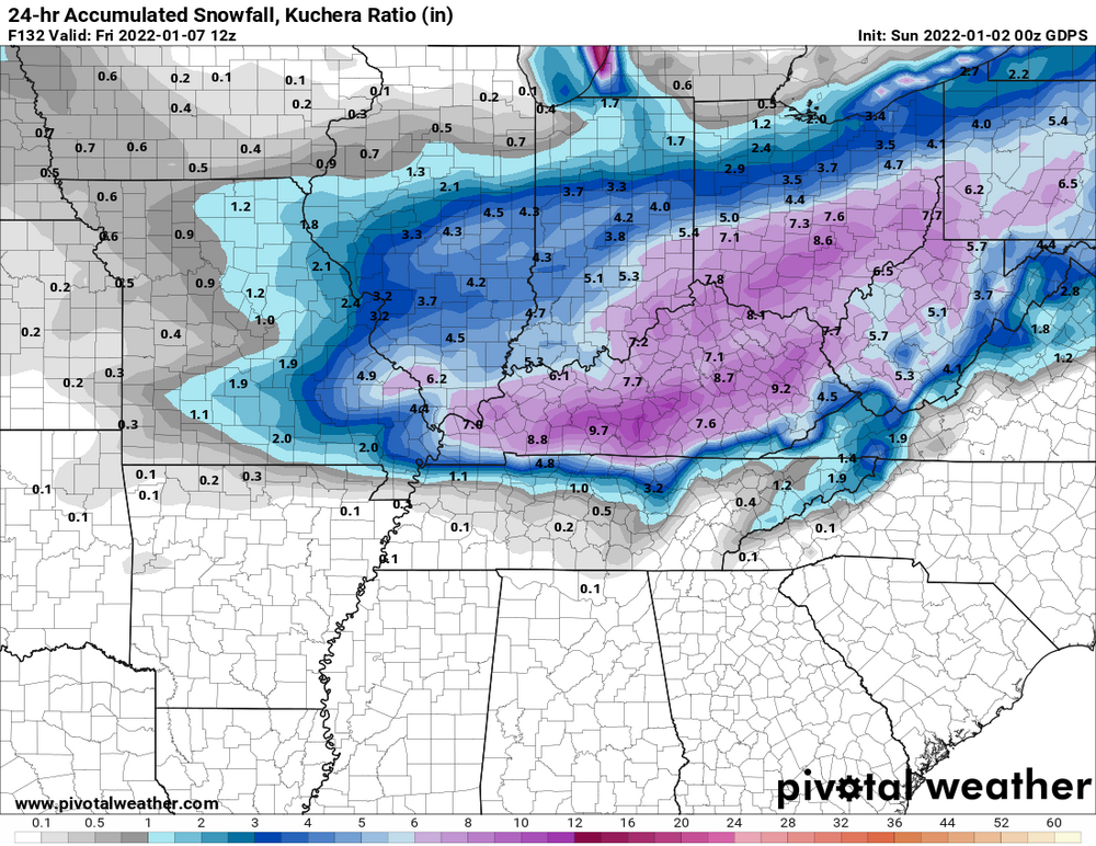
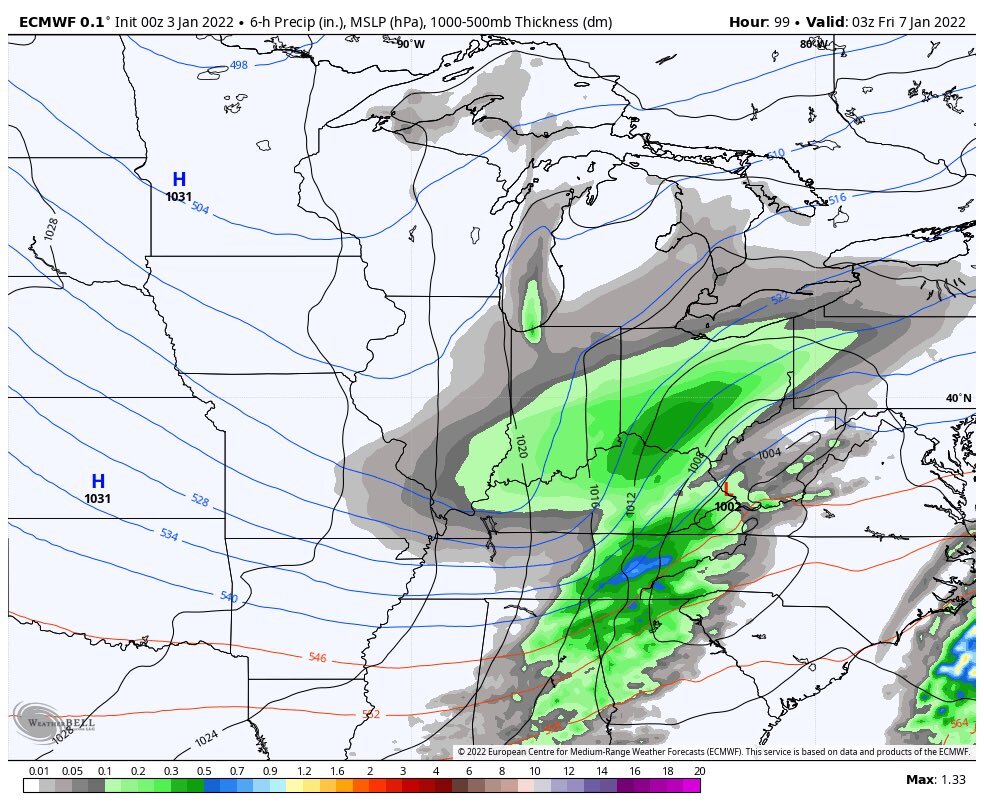
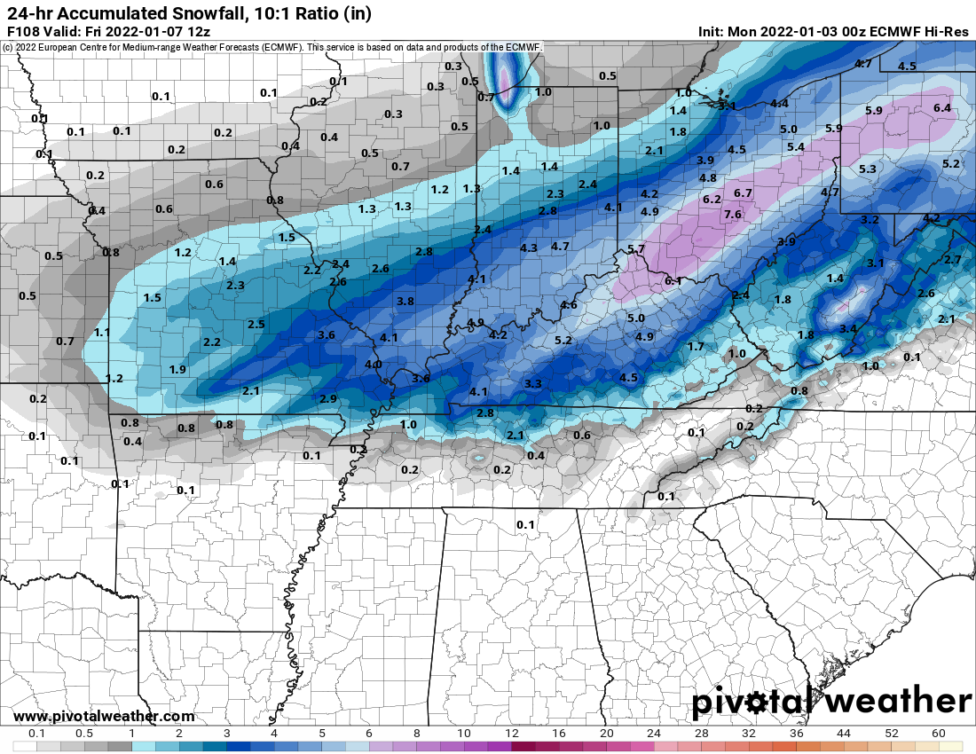
Euro still good.
-
2
-
-
Ukie is weaker and suppressed.
-
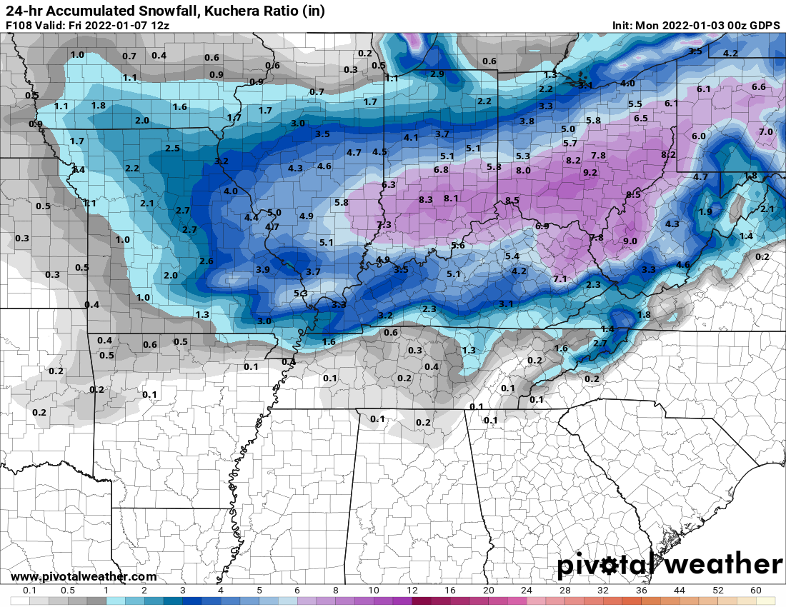
GGEM still very much on board.
-
GFS still looking like hot garbage.
-
Euro was better too.
-
Temps stay in the teens the whole time in Ohio.
-
 1
1
-

“Let’s Talk Winter”
in Lakes/Ohio Valley
Posted
From ILN