
snowlover2
-
Posts
2,731 -
Joined
-
Last visited
Content Type
Profiles
Blogs
Forums
American Weather
Media Demo
Store
Gallery
Posts posted by snowlover2
-
-
18z GFS tries to get interesting with the storm next weekend for the southern sub and then lake effect cranks up for a day or 2 as the storm moves east.
-
 1
1
-
-
12 minutes ago, HillsdaleMIWeather said:
0Z GFS hinting at a system towards the end of the month
Not everyday you see a storm transfer from NW IL to just SE of Cincy.
-
 1
1
-
-
0z GFS with another teaser.

-
1
-
-
22 minutes ago, OHweather said:
That's definitely possible. Some 36F waters showing up near the coast out west, and even if that added just a degree or two to the temps that may have made the difference.
It looks like two more time periods to watch coming up with relatively deep/slow moving troughs across the east...Wednesday-Friday of this upcoming week and then around the 12th-13th. Maybe some sort of lake effect potential along with non-zero synoptic snow potential. A lot of ensemble members are uninteresting with only light amounts of snow, but enough have something more substantial with each period that it's worth keeping an eye on.
You should look at the 0z GGEM.

Winter 2019-20 Medium/Long Range Discussion
in Lakes/Ohio Valley
Posted
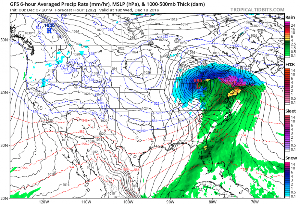
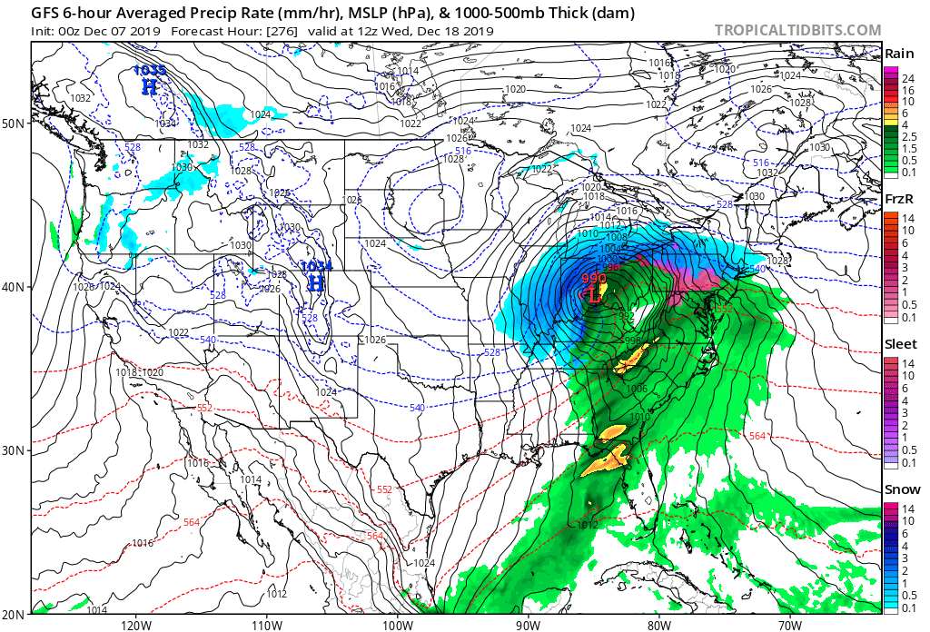
0z GFS providing some fantasy eye candy.