weatherwiz
-
Posts
79,817 -
Joined
-
Last visited
Content Type
Profiles
Blogs
Forums
American Weather
Media Demo
Store
Gallery
Everything posted by weatherwiz
-
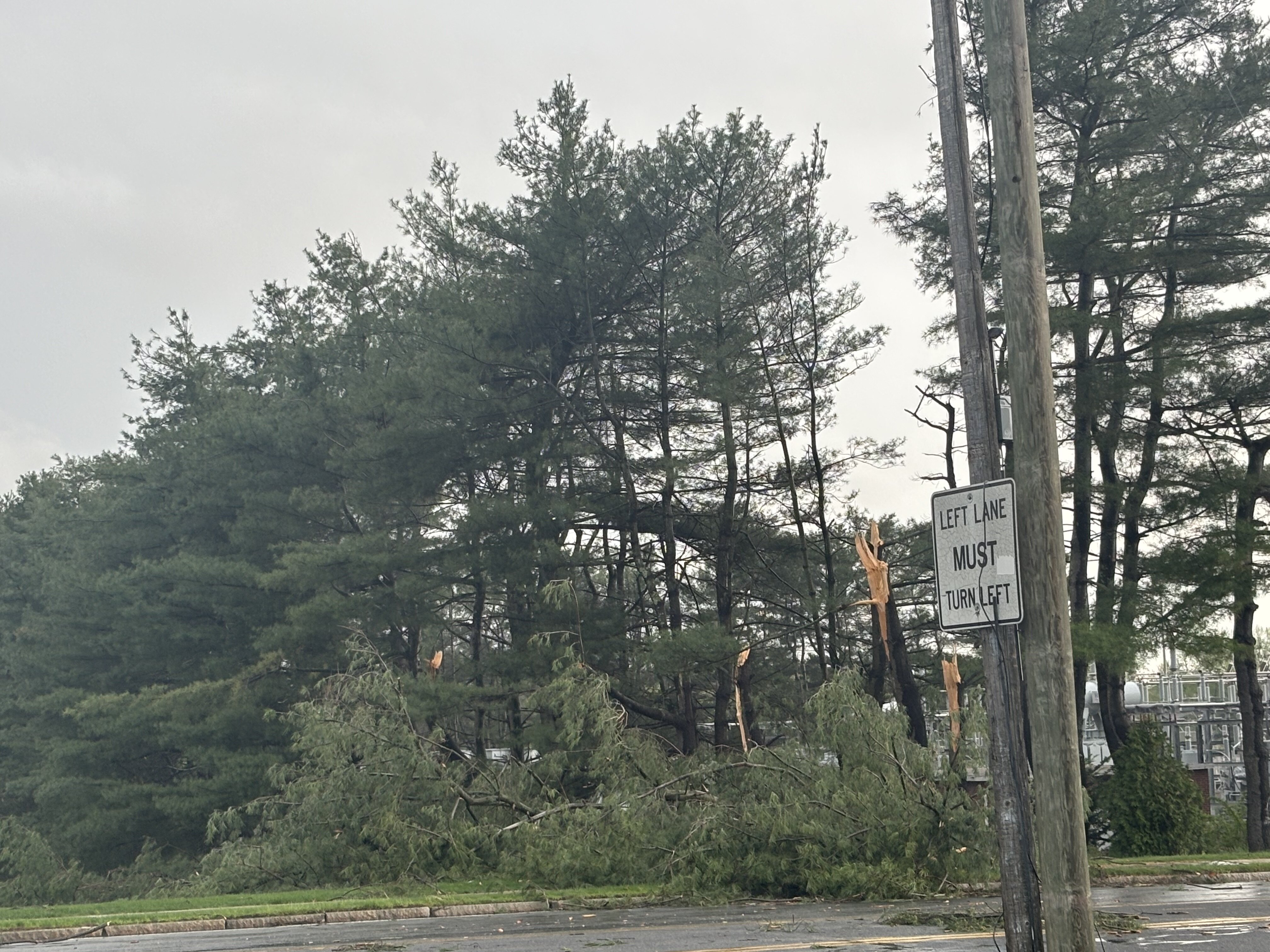
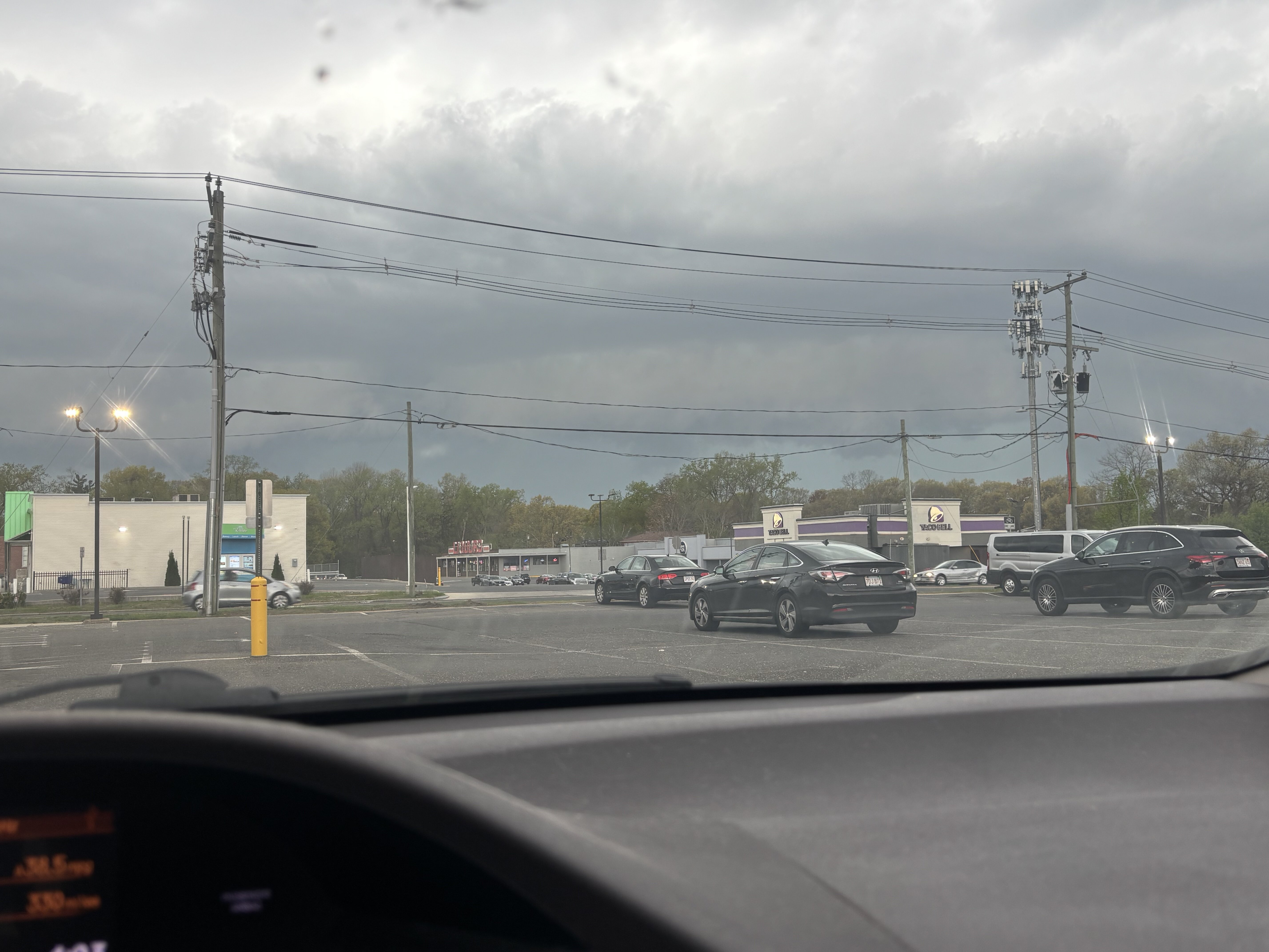
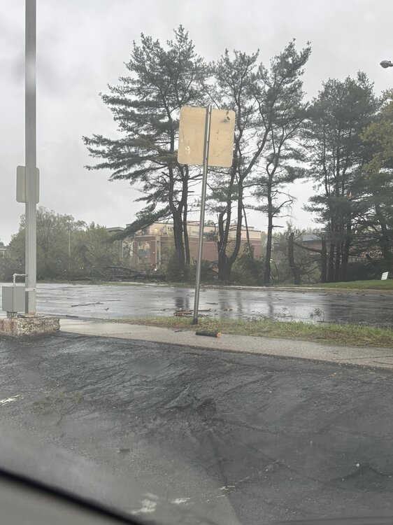
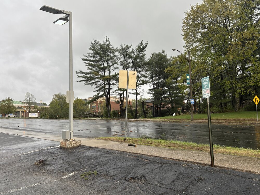
Here's the real thing which is better than what the video provides. I put an arrow in the spot I was in which points in the direction I'm facing. The bottom view is looking over to my left. So where those trees snapped was JUST out of my view. And actually...in the second pic if you see where those cars are parked, I was contemplating parking in those spots...I would have backed in and not be facing the trees but the circulation could have directly passed over my car...I also would have seen it coming from a farther distance because I would have had me head facing that direction. I could have gotten out of the car and film
-
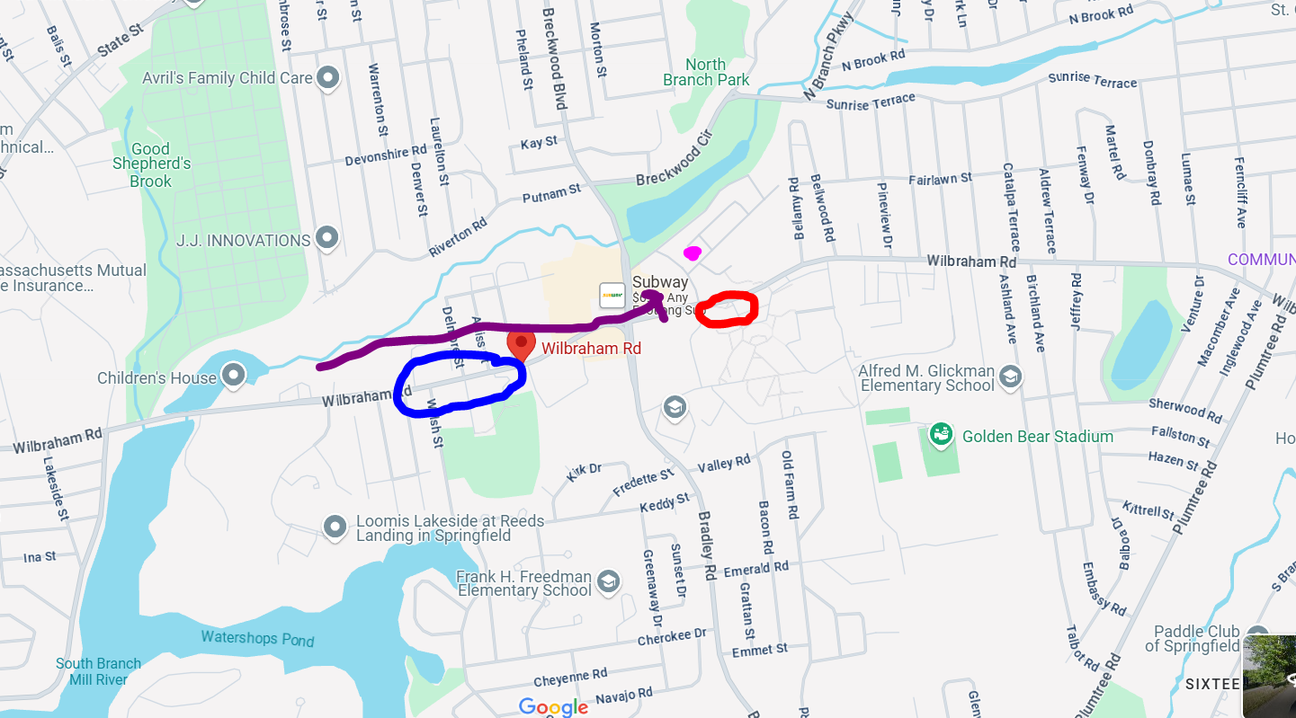
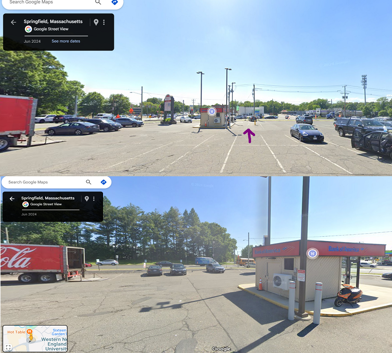
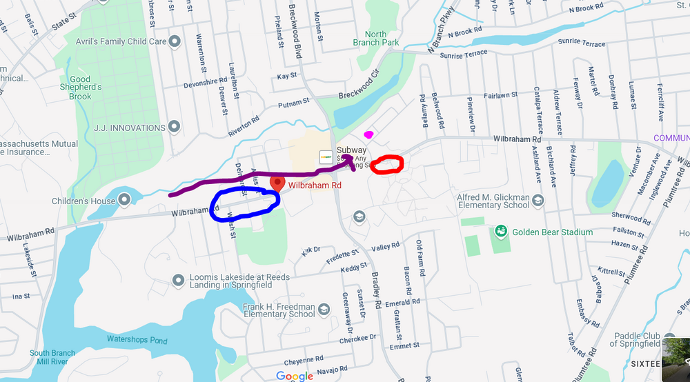
I suck at drawing but I did this. First off, I am not sure why google maps has the BoA ATM where it shows it but its where that gray box is. The trees snapped/damaged in the pic were at the end of the row so I wonder if the circulation ended up going diagonally? But I drew it from where I first saw it...probably once it passed my peripheral it slanted in track. But it definitely came straight down Wilbraham Rd because when I drove about 1/4 mile up the road, I couldn't go anymore because it was closed and I could see something on fire about another 1/4 up the road.

-
Thank you! Been a long time coming and perfect too…a weak tornado super close and there were no injuries!!
-
Thanks for the feedback, much appreciated. Here is a bit of a closer look from the damage which was where I was at. This marked the end of the damage too. but I don’t believe the circulation crossed on that side of the street…it crossed right in the parking lot I was in or maybe on the sidewalk. I can see if I can do a street view on google maps

-
I've been going back and forth with one of the skywarn guys and he's also gotten several other accounts from the area and said this also produced some damage in Ware. Unfortunately, due to the limited staffing there probably won't be any surveying and I'm not sure what exactly goes into the process to verify outside of a survey. But based on everything presented so far, this certainly could be classified as an EF0 tornado.
-
I think it was like 4:10-4:12
-
I only got to see it for seconds. I saw it coming from over the bank and then pass me. But if I was several parking spots to the right I wouldn't have had the bank obstructing that direction and I probably would have been able to see it come from up the road.
-
I wish now I was parked several spots over to my right...I wouldn't have had the building obstructing me, I could have maybe seen it coming from farther away. I still can't believe it...the lights flickering too just before it approached...very movie like.
-
This is great, thank you!
-
Just saw this. Where I was at the time is probably just a bit in the northwestern side of the location market
-
I wish I was able to go down the entire road to see where the damage began but it was closed off. The purple dot was where I was and the red circle is where there were pines down. The arrow shows the track. The blue circle is where the road was closed...I could see something on fire so it had started at least a good 1/2 mile up the road...but not sure what it was like going farther down
-
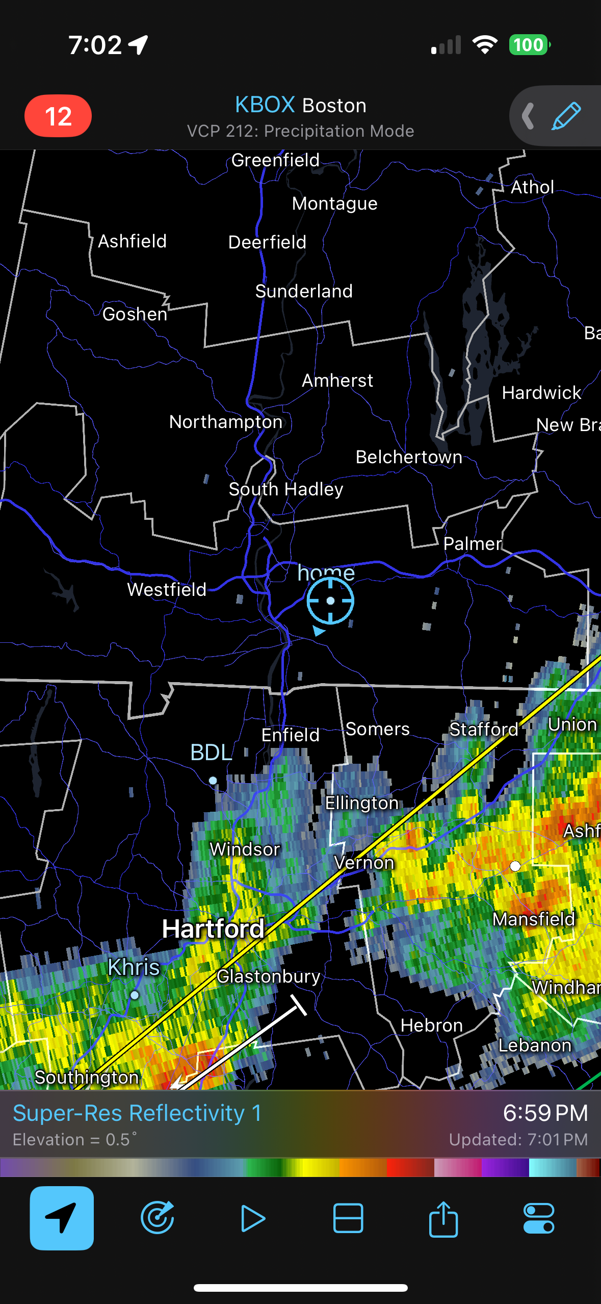
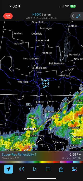
I still get torn because it happened just as the gust front is going through but it had to be just behind the gust front because precip had started. I'll have to pull back radar archives.
-
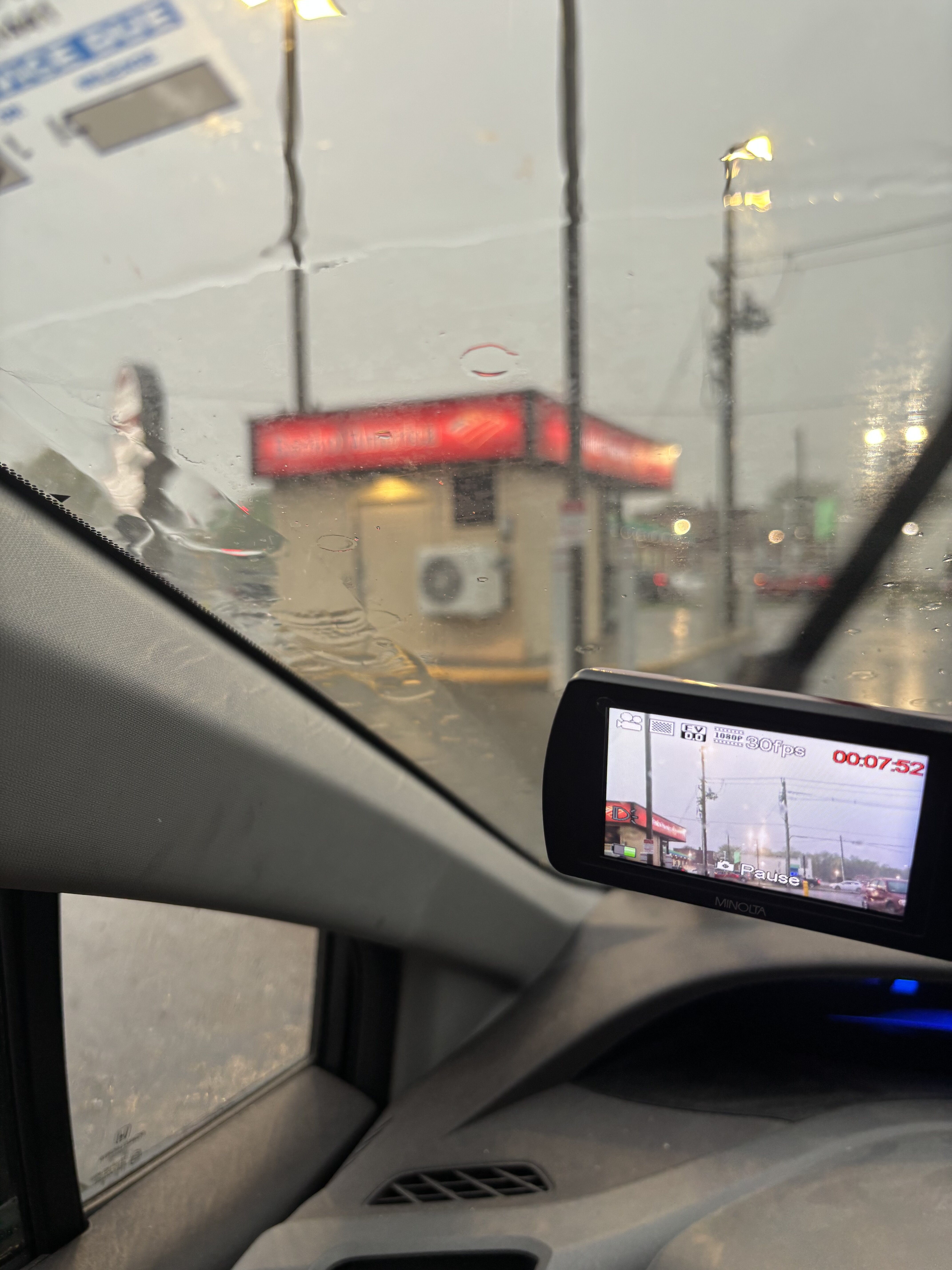
Trimmed the video. It happens about 40 seconds in. Like I said, I apologize for the camera disruptions early, I was relocating the camera. Still not sure if this is a gustnado or actual tornado. But whatever it was, I was at the end of its life as where I was at ended the damage.
-
ughh I hate YouTube. They always changing stuff. Video was not processing for some reason…or taking forever so I deleted and am trying again
-
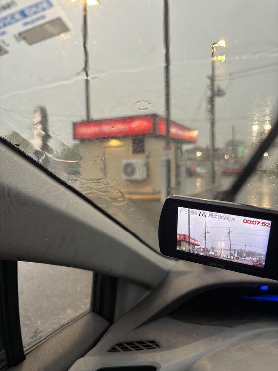
I DID GET IT ON VIDEO!!!!! Uploading now. The entire video is like 15 minutes long but thankfully it happens within the first few minutes. Please excise some of the shakiness early on, I was relocating the camera and holding with one hand because my other hand was using phone for radar.
-
This is right next to me, just a bit behind me so I didn’t see it
-
Damage…and right next to me
-
EMS/police out now…wonder if something happened. Going to check around once rain stops
-
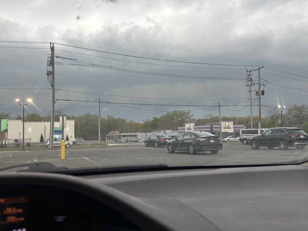
I’m shaking in excitement right now…I’ve never seen anything like that. I thought it was going to pass across my car. It came from behind the Bank of America. I look and there is this massive swirling brown and the lights were flickering and the wind went crazy. I thought the pine trees were going to snap.
-
I am pretty sure I got it on video. I will post when I get home. My heart is racing. It went right next to me.
-
Springfield. The lights were flickering and I’m looking in front of me and there was this rotating column coming across the street and it came with an insane busty of wind. Went dead quiet behind it. I think it was a gustnado
-
Holy shit that was insanee
-
I tornado just went across the parking lot…
-
Weak rotation over south Hadley
-
Come to papa