

weatherwiz
-
Posts
76,560 -
Joined
-
Last visited
Content Type
Profiles
Blogs
Forums
American Weather
Media Demo
Store
Gallery
Posts posted by weatherwiz
-
-
3 minutes ago, CoastalWx said:
What’s this shit moving in
Is this like a weak pre-frontal trough or something? Looks like it on WV or some weak embedded shortwave trough ahead of the larger s/w trough
-
I wonder if we get a bit of shortwave subsidence? Maybe thats why some of these HRRR runs and latest 3km are meh.
-
 1
1
-
-
4 minutes ago, WxWatcher007 said:
Still skeptical of anything meaningful up this way.
I'd watch closely. It looks like there is some sort of boundary across Connecticut...south-central Connecticut
-
Anyone think Costco's will be open tomorrow? Want to try and go chasing after work but I need to go to Costco
-
3 minutes ago, Chrisrotary12 said:
HRRR says YES!
Think its safe to toss the HRRR

-
55 minutes ago, jbenedet said:
The mandarin off the southeast coast looks important to closely watch. At this moment still early but not for Cape and Islands. Some indirect impacts potentially as early as Sunday and —at risk of stating the obvious here— it’s a big beach/vacation weekend….
Both euro and GFS develop a weak tropical system within 72 hrs. Big ridge in the western Atlantic will preclude a quick escape east, so it will be close to the mid Atlantic/northeast coast at least through 120 hrs.We watch.
This could also scale back the upper end of heat potential Monday
-
5 minutes ago, Chrisrotary12 said:
HRRR says NO!
HRRR seems wonky with the dews...wonder if thats why?
-
Connecticut (particularly along and southeast of 84) and Rhode Island should be prime today
-
20 minutes ago, FXWX said:
SPC has decided to tease the setup a bit more!
Not entirely shocked at the slight risk designation. We've had some worse setups get a slight risk designation
That is a really well-defined s/w trough moving into the region with good height fields and increasing dynamics with cooling aloft. I would be shocked if storms aren't numerous tomorrow and evolve into multiple short-line segments or clusters
-
 1
1
-
-
11 minutes ago, kdxken said:
Any severe?
maybe!
-
3
-
-
the is one strong shortwave digging through tomorrow for early July. Convection (CONVECTION NOT SEVERE) should overperform. Thought maybe convergence could be a little meh but it doesn't seem bad. What we really need to watch are dews...if we can pool dews another 3-4F that would make things a bit more interesting for some localized severe weather.
-
 1
1
-
 1
1
-
-
2 minutes ago, Chrisrotary12 said:
Very west Texas-esq where CF meets dry line. You can see outflow surging SE and there’s a remnant boundary of some kind just sitting there.
Yup…don’t see that too terribly often here. Cool to see
-
-
Brother lives in new Britain and lighting hit something about 1/10th of a mile from his house
-
1
-
-
Those storms exploded along the outflow
-
1
-
-
2 minutes ago, radarman said:
God I love this location for severe
")
* At 547 PM EDT, a severe thunderstorm was located over Belchertown, or 8 miles southeast of Amherst
But seriously though I doubt this one verifies. Classic SPS event IMO
Surprised at the 1” hail tag. Tough to get 1” hail in this setup. Poor lapse rates and very warm aloft. Would need a monster updraft to achieve that.
-
4 minutes ago, radarman said:
No peas here but quite a bit of lightning, a good amount of rain, and a nice change to the airmass.
Stein, we hardly knew ye
And it gets warned
-
Quite breezy out ahead of this
-
Also looks like some dewpoint pooling ongoing with a theta-e ridge overhead. MLCAPE ~2000 not bad given the poor mid-level lapse rates. Any severe risk though should be extremely localized. DCAPE is meh with pretty poor 2-6km lapse rates and llvl shear is not much. So just going to be some torrential rain (poor drainage flooding risk) and maybe some good CGs
-
1 minute ago, Damage In Tolland said:
Please make this happen
It is! Seems to be evolving nicely. Satellite shows great upscale growth with cooling cloud tops. Might even be a weak sea breeze front which aids in development within south-central CT.
-
1
-
-
Not saying we see much severe but we may see a pretty solid line of torrential rain and thunderstorms evolve right along the 84 corridor.
-
1
-
-
short term trends looking favorable from about MA Pike into norther CT in a few hours
-
1
-
-
8 minutes ago, Typhoon Tip said:
I edited that
My sense is that's got a fair shot at being an upgrader
Only limiting factors I see towards greater coverage are the "lower dewpoints" - 60's aren't bad but would like to see like 68-70+ and llvl convergence looks a little weak. Anyways, steep lapse rates aloft and good height falls so can't sleep on it
-
2
-
-
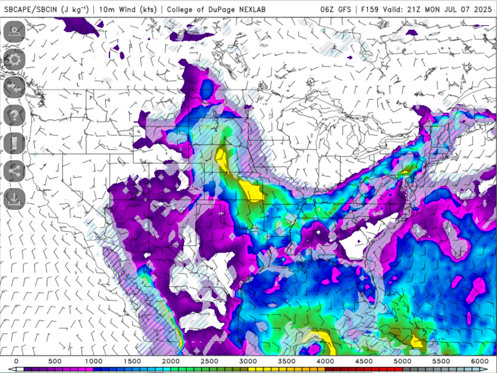
30 minutes ago, 40/70 Benchmark said:
Sorry for the OT....I'll let Wiz discuss CAPE for next Monday...I'm sure that will get everyone's rocks off-
Good call
-
2
-

July 2025 Obs/Disco ... possible historic month for heat
in New England
Posted
what a supercell in far northwestern Maine