

weatherwiz
-
Posts
76,507 -
Joined
-
Last visited
Content Type
Profiles
Blogs
Forums
American Weather
Media Demo
Store
Gallery
Posts posted by weatherwiz
-
-
3 minutes ago, kdxken said:
Dews up here lolz...

It seems like its been quite the stretch of hot weather across central Florida these last few weeks...really doing a number of SSTs. TPA has had many nights where they only drop into the upper 70's and I think even 80/81 at times...seems quite early for them.
-
 1
1
-
-
Just now, ineedsnow said:
I see mid to upper 70s most days with a couple 80 degree days nothing like it was showing.. 12z EPS is cooler
925/850 support 80's, especially farther north into the region. Some of the torch NNE locations probably get 90
-
1
-
-
If there euro is right there could be a severe threat end of next week
-
euro doesn't look bad at all for next week, especially as the week progresses but there is something lurking off SE which could impede things a bit but it could be quite warm
-
3 minutes ago, CoastalWx said:
I see 65-70 or a bit higher with dews I-95 east.
agreed for there...was mostly focusing 84 corridor. But we'll see what happens...if we can get a track like the NAM, even slight west then more of the region may end up dry slotting and the afternoon could end up decent.
-
3 minutes ago, CoastalWx said:
Might include you. This time of year east of the low track probably isn't bad. Maybe a few showers to dodge near you? Cutting it close there.
eh I mean upper 50's to lower 60's with thick overcast for May 31 flat out sucks lol...especially for a weekend. Could be quite breezy too far SE areas with the LLJ passing overhead. But I guess that is better than upper 40s/lower 50's and a heavy rain
-
1
-
-
what a beautiful, clean phase too...can't buy those in winter
-
1
-
-
But there is a risk for a rogue strong storm or two
-
Saturday looks horrid
-
 2
2
-
-
1 hour ago, CoastalWx said:
If that’s the case then we’d see the same for other models I would guess. Not sure what’s going on.
That is a thought I had too.
But something is going on, I mean we can even extend what seems to be poor skill back 3-4 years now, especially in winter. There have been some extremely large jumps within guidance inside of 72 hours and it seems just about every major model has had its share of failures.
Part of me wonders if its just related to how complex the weather patterns have been or if its more human related. There is just so much garbage thrown around on social media for storm potentials several days out (sometimes even 10+) and there is so much focus on just one or two graphics, and forecasts start getting chucked out 4 days in advance.
There is too much with taking a model at face value and very little critical thinking or skill applied. Its just take the model which shows what the user wants and then try to spin it into a forecast. Then when the forecast doesn't pan out, the models get blamed.
At the TriState Weather Conference in October, a person asked a question relating why it seems like models were doing worse. I believe it was Dr. Tuell who responded, but he essentially said one problem is there is lack of responsibility taken and models are essentially used as a crutch as to why a forecast is wrong. I wish his answer was recorded, I thought it was a great statement.
-
3 minutes ago, CoastalWx said:
It’s unusable. Don’t do it.
It's been horrific, I barely even look out much past 5 days right now. Friend of mine told me he came across something where the score of the GFS has been abysmal...and model scores overall may be down. Have to wonder how much the reduced balloon launches are factoring in?
-
2
-
-
I really hope the GFS is onto something with some EML potential moving into the second half of next week.
-
1
-
-
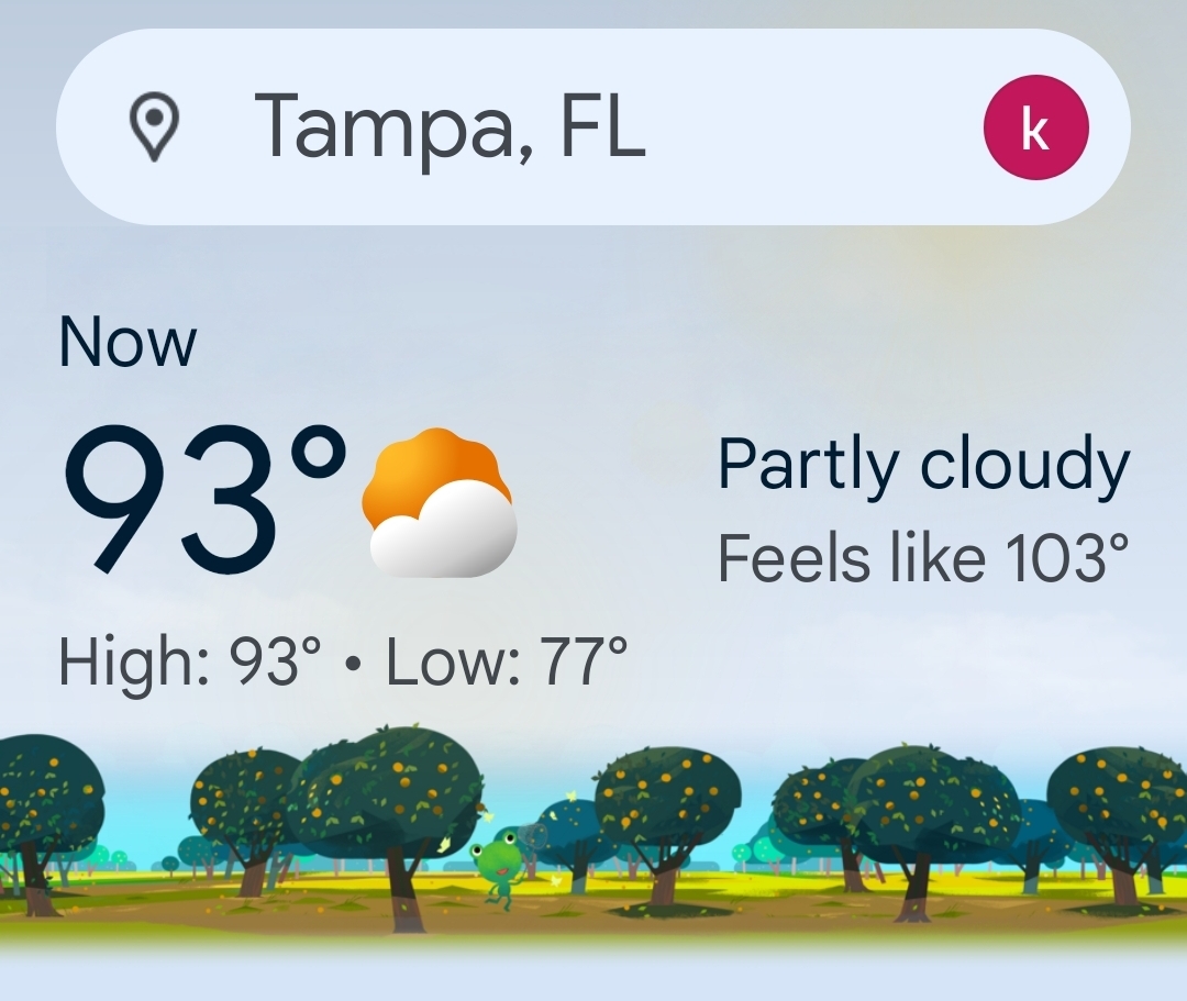
I can't wait for the heat/humidity. It's wild how different it is in the sun versus the shade. It's my belief that people should sweat and still be stifled, even in the shade.
-
 1
1
-
 1
1
-
 1
1
-
-
1 hour ago, Sey-Mour Snow said:
Training showers over the area.. so much for 75 and sunny today
Yeah just got a notification on my phone saying “intermittent rain will begin in 15 min” and I was like wtf and checked radar

-
 1
1
-
-
40 minutes ago, Sey-Mour Snow said:
Disaster on GFS below normal and another Nor’Easter.
going to have to wait until post June 1.
Hopefully that will be the last of it. The first week of June right now is a big tossup...it's either going to be warm and humid or another disaster. There are signals for each side of the spectrum here but I am very nervous about the signals for crap given that is the theme we're in.
-
Looks like another lovely weekend upcoming
-
1
-
-
2 minutes ago, Great Snow 1717 said:
Sort of like someone insisting November is a winter month...
Not even sure if people in Alaska consider November a winter month
-
6 minutes ago, Great Snow 1717 said:
Some people here seem to have convinced themselves that SNE is in northern Florida...
Part of me gets it...we've had plenty of May's before and Memorial Day Weekends where we're basking in the 80's but we've also had our share of crappy ones. But with many longing for consistently warmer and nicer weather by now we expect the anomalous warmth to be the rule versus the exception.
-
May had some nice days mixed in but overall it wasn't anything to write home about. Kind of sucked actually but its still a spring month in New England so expecting stretches of upper 70's and 80's is just unrealistic.
-
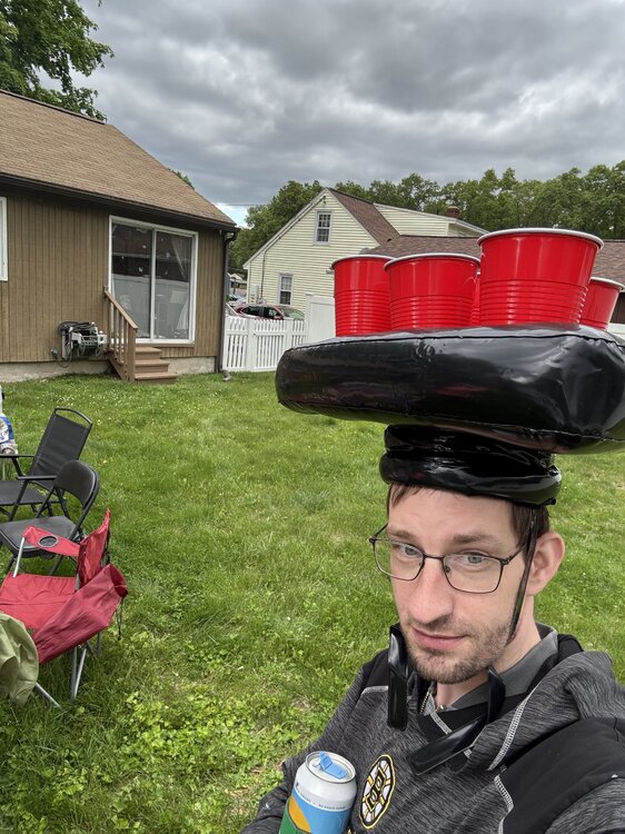
13 minutes ago, powderfreak said:
Beer.
Lots of it
-
2
-
 1
1
-
-
-
2
-
10
-
1
-
 1
1
-
-
1 minute ago, kdxken said:
Probably not far from you. Somers Connecticut. First of the day.
Wish it would stay out for a good 30-45 minutes even. Feels worlds different when sun is poking out
-
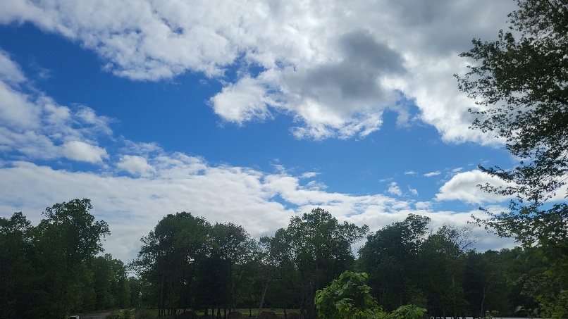
Sun finally starting to peak out
-
1
-
-
Kind of meh with all these clouds. Figured the clouds would win today but was hoping it would be more of a mix

May 2025 Obs/Discussion
in New England
Posted
A Tolland cocktail