

weatherwiz
-
Posts
70,747 -
Joined
-
Last visited
Content Type
Profiles
Blogs
Forums
American Weather
Media Demo
Store
Gallery
Posts posted by weatherwiz
-
-
I feel like an idiot

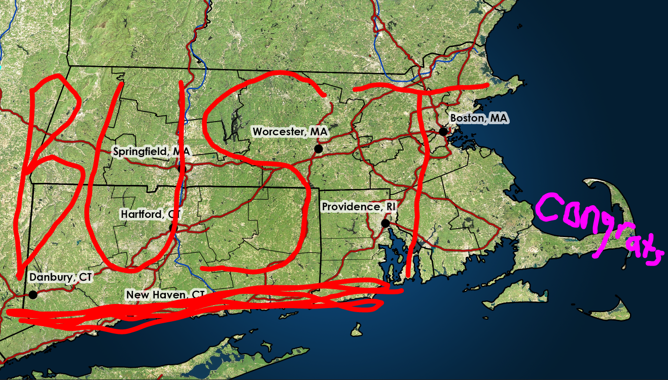
Screamed bust on fb for my snowfall forecast for Connecticut and some friends are sending me pics, "what bust"
What a 24 hours. I may need a 40 for the Bruins game tonight.
I'm hoping I can at least pull off 3'' here.
-
 1
1
-
 1
1
-
-
Maybe 1/2'' here in Springfield or so. Coming down nicely.
Looking at radar this AM I am just stunned. These past 24 hours have me speechless.
-
finally got around to making an updated forecast

-
1
-
1
-
 8
8
-
 2
2
-
-
1 minute ago, Brian5671 said:
still the same here b/w Fairfield And Bridgeport....
The gun shell casings scattered around Bridgeport probably screw up the plows.
-
4
-
-
2 minutes ago, RUNNAWAYICEBERG said:
3/01?
That sounds about right.
1 minute ago, ineedsnow said:I remember waking up early in the early 90's and watching the bottom of the screen hoping to see Agawam closed lol
Yup...those were good times. My mom used to listen to the radio in the morning so I would lay in bed and listen to the them go down the list. It used to piss me off so much because Hartford used to close constantly and West Hartford wouldn't. Granted though...back then West Hartford did a helluva job cleaning roads. Hartford sucked. You would tell what streets separated Hartford from West Hartford because you would go from perfectly clear road to can't see pavement in the span of 5 feet
-
1
-
-
2 minutes ago, The 4 Seasons said:
I was just thinking about that today, i could have swore when i was in school in the late 90s and early 2000s we never saw cancellations until the morning of, like 5AM. Almost never. Cancelling the day before a storm seemed like it was recent thing to me.
Yup. I grew up in West Hartford and went to school in the 90's and 2000's.
1. West Hartford hardly ever cancelled...I mean ever. Hell, it was a blessing if we either had a delay or an early dismissal.
2. There is only one time I distinctly remember it happening. I was in middle school (so sometime between 1999-2002) and we had two days cancelled in a row. Its funny because it was supposed to be a very large storm (I think a two part) and it kind of busted. I think in total we got around 8'' or something...maybe it was 10.
-
Just now, HIPPYVALLEY said:
I can see stars through broken clouds here in Greenfield. Is that a good sign for snow tomorrow?

maybe we can just radiate tonight and get a heavy frost and it will look like it snowed.
-
3
-
-
1 minute ago, Sey-Mour Snow said:
Best part is I may owe @qg_omega $25 while he's sitting there smiling when no one sees 3" tomorrow
That amounts to about $5 per daily post
-
9
-
-
I'm just going to constantly slam F5 on my keyboard when the NAM is rolling out in hopes NCEP will ban my IP address and I can never look at models again
-
16
-
-
1 minute ago, ORH_wxman said:
Dude, it’s on this part of the menu…it’s been out for like 5 min
It's not loading for me. I've even refreshed several times
-
I really have to get weatherbell. weathermodels sucks. still waiting for the 18z euro to roll out
-
1
-
-
18z euro about to roll out soon, right? Going to set the toaster oven up next to the bathtub and fill it with just enough water to cover my scrawny little body
-
9
-
1
-
-
Just now, CoastalWx said:
I thought verbatim mid levels were decent.BOS-HFD.
Yeah when I looked at that I got a bit excited.
I just have no clue what to think. This jump south today is mind boggling. If we see a jump back north on 0z guidance I may just quit. There is clearly something the models are really struggling to resolve. Just going to have to nowcast the next several hours.
-
1
-
-
Just now, ORH_wxman said:
I actually thought the 18z RGEM would be a lot worse....
Haven't seen any major moves on the 20z HRRR/RAP. 19z looked a little better than 18z, but 20z is pretty much the same...might have been just a shade better on the HRRR but we're talking such small differences.
Those are my thoughts exactly.
Definite a shift on the 18z GFS but man with how H7 evolves you would expect heavier precip farther north and west
-
4 minutes ago, bristolri_wx said:
Out of personal curiosity, I would love to know what data that got ingested in the last 12-18 hours that caused this much of a hiccup. I see the reasons for the change, but man, what a huge swing right before go time. And before you say the Ukie was on this the entire time, the reason why the Ukie didn't like this storm on earlier runs does not seem to match the trends on the other models in the last 12 hours. I guess the models were threading the needle the last few days with a perfect setup of chaos that didn't actually occur?
My guess it's just moreso the initialization of the features and how they're evolving in real time. Just going through quickly but between some guidance and today, the differences between the evolution of the northern/southern streams don't seem too significant but certainly enough to result in larger differences at the surface.
-
2
-
-
Well I guess there is some solace in that the 20z HRRR doesn't look any worse than 18z. This should still be solid across much of Connecticut though the max totals probably have to be dropped.
-
1
-
-
Well time to just start preparing for May and severe season. At least we don't see these epic model fails happen leading up to severe events. Awful
-
 1
1
-
 1
1
-
-
4 minutes ago, ORH_wxman said:
If you want to follow something definitive upstream that will tell us whether the latest southern guidance is more correct, look at the radar along the Ohio River in SE Ohio tonight between 8pm-midnight....almost all of the guidance that crushes SNE gets good precip just over the Ohio river into the border counties of SE Ohio....the crappy runs keep it in West Virginia and basically completely whiff those Ohio counties. It ends up making a big difference downstream later on for us as the difference gets magnified....
I know they had some WWA in southern Indiana that ended up being dropped.
-
I'm not even sure what I want to see from the 18z NAM. I'm wondering if its just better off to have it join the Euro/Ukie and other 1z guidance versus holding steady. If the NAM holds serve...and lets say the GFS does too then WTF. It's probably doubtful that happens though.
-
Is it really farther south though or just slower?
-
Just now, ma blizzard said:
If the 18z HRRR follows suit, it would be concerning ..
was just thinking that too. Holding firm though until the 18z NAM.
-
If the 18z NAM doesn't even make a tickle towards the Euro I'm not going to buy the Euro much. If that ends up biting me in the fanny, well I'll enjoy the nibble. If the 18z NAM though does make any strides towards the Euro my level of concern will do a 180 real quickly.
-
1 minute ago, mahk_webstah said:
Gonna be both a lot of tossing, and maybe not so much tossing going on later if you know what I mean
The only tossing I want to be seeing right now is long tossing between Red Sox pitchers and catchers when they report.
-
1
-
-
Just now, Patrick-02540 said:
It jumps 120 miles due east right towards the convection.
It can't be discounted, I mean we've been screwed before in these scenarios. I wonder if there is literature out there on these situations. Someone's had to do extensive research into this. Would be great to have an understanding of when this situation does occur versus when it doesn't. Maybe there is no clear cut signal, models still really struggle with resolving convection, especially in these highly dynamic situations.
-
1
-

Following a Miller A/B hybrid type coastal potential, Feb 13th ... As yet untapped potential and a higher ceiling with this one
in New England
Posted
Well said, it is situations like this which really drive me to love the weather event more and want to learn. As mentally exhausting as it can be sometimes, the only way to further understand and learn is to understand these situations. I think these situation also tell us how difficult communication can be to the public, especially communicating uncertainty.