danstorm
-
Posts
2,364 -
Joined
-
Last visited
Content Type
Profiles
Blogs
Forums
American Weather
Media Demo
Store
Gallery
Everything posted by danstorm
-
Friday February 6 FROPA / WINDEX small event
danstorm replied to HoarfrostHubb's topic in New England
What a fascinating event up there for you guys! -
Extreme Cold, Snow & Sleet: SECS 1/24 - 1/26
danstorm replied to TriPol's topic in New York City Metro
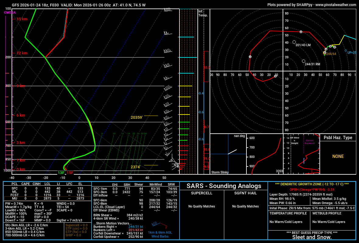
I’m at 7” - thinking my high end will be reached and maybe busted Nearly placed that Kalshi bet on CPK but had a bad feeling and didn’t want to be rooting against snow -
6.5” and ripping, will see 10 pretty easily
-
4” new Montclair and moderate
-
Extreme Cold, Snow & Sleet: SECS 1/24 - 1/26
danstorm replied to TriPol's topic in New York City Metro
I like this call and I think the risk is to the upside, personally. I expect 8-9" where I live but would be less shocked by 12 than I would 6 (including IP). The initial 700 mb forcing is classic and the airmass couldn't be better for isentropic upglide. I also think areas around I-80ish may not flip completely to snow if rates remain heavy. -
Extreme Cold, Snow & Sleet: SECS 1/24 - 1/26
danstorm replied to TriPol's topic in New York City Metro
This is BARELY sleet (GFS sounding near me) and likely snow/sleet… with heavy rates it’s probably snow This is not the kind of storm that flips to sleet and done, that’s why I think my 8” call here may be low… I had 4/5 inches after mixing with sleet in Mar 2017 and this could be similar
-
Extreme Cold, Snow & Sleet: SECS 1/24 - 1/26
danstorm replied to TriPol's topic in New York City Metro
That is the prior run - he posted 12z -
Extreme Cold, Snow & Sleet: SECS 1/24 - 1/26
danstorm replied to TriPol's topic in New York City Metro
yes but coastal reflection is a bit more pronounced and a bit further south - I think it'll be a wash -
NYC: 7 Boston: 18 Philly: 5 DC: 4 Hartford: 14 Albany: 15 Me (Montclair, NJ): 8
-
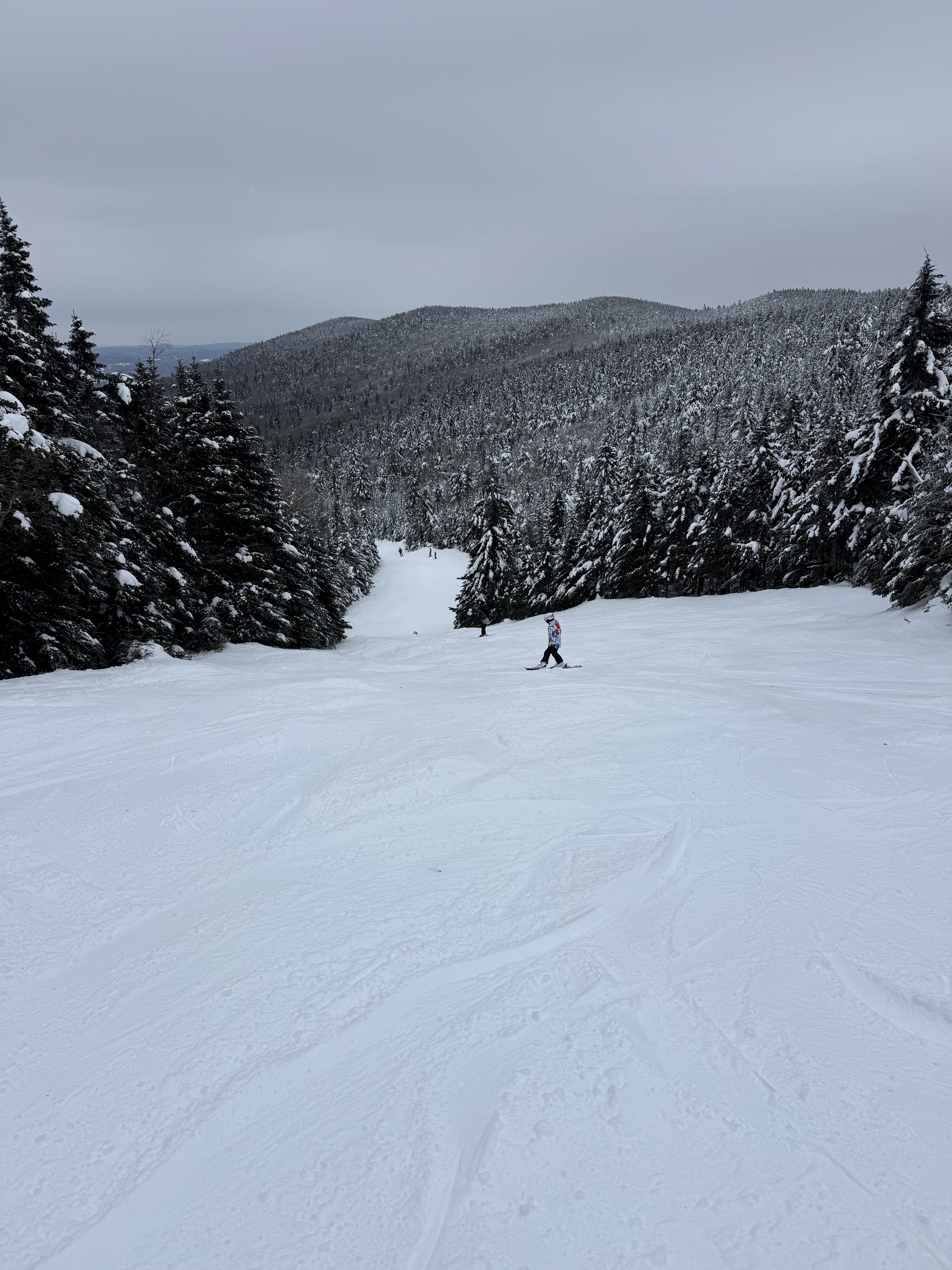
I'll be pushing 80 down here 10 miles WNW of Manhattan, meanwhile Stowe gets 6-8"+ Can't recall ever seeing that
-
So sick... I've been jealous all winter, despite spending two long weekends in Southern Vt. this winter
-
I'm trying to convince the family for one last trip up to Stowe... And want to play hookey and get one final big ski day for myself
-
12z GFS extends ski season in a big way
-
Winds really kicking up the last hour here... with mod snow falling - this is the most exciting part of this multifaceted event. Great snow growth and likely 2.5-3" since the flip a few hours ago. We had 16 hours of light snow adding up to 4" then an inch and a half of sleet of varying intensity (mixed with some zr) over 12 hours adding up to 1.5, then a dramatic flip to S/S+. New England at its finest
-
I'd call this a pretty big synoptic storm
-
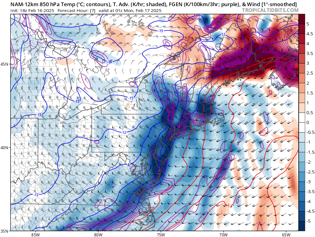
Turning to snow now as 850 low clears our longitude Fgen enhancing a bit We may get 2-3" on the back end after a messy 5-6
-
So sick
-
Most sleet I've seen since VD 2007 while living in Boston Literally 12 hours straight in S VT (Wilmington) Shut out of skiing for faux icing threat - closed all the summit lifts at Mt Snow while we got slotted this morning and had freezing drizzle Yesterday was awesome though up here
-
Looks to wrap with a few hours of decent snow as the 850 mb low clears out longitude and a spoke of fgen swings through.

-
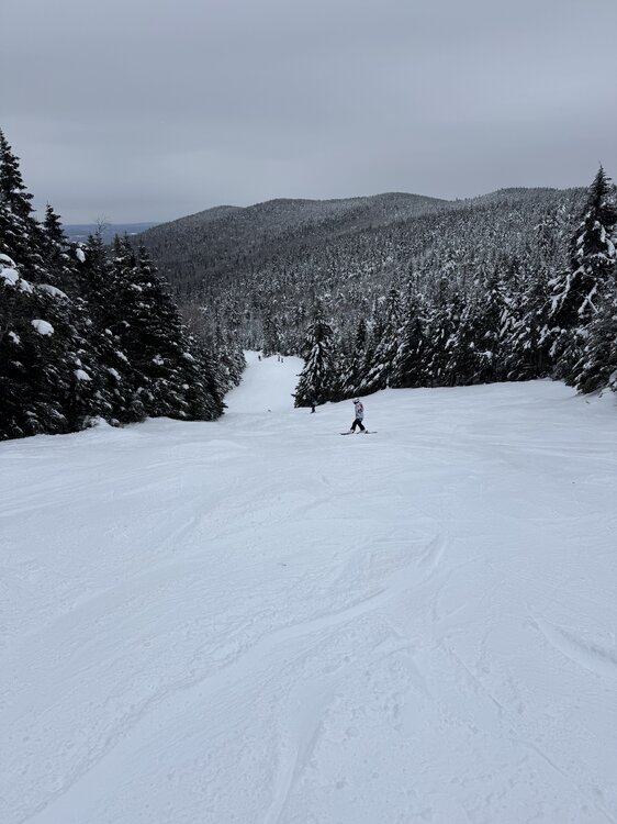
5" snow/sleet here in S VT (Wilmington) We got about 4 overnight, then mod sleet then it largely shut off for a while. Unfortunately, the dry slot resulted in a bit of FZDZ mixing with the light sleet (and needles, it really was a kitchen sink situation) around 930-11 am - we arrived at the slopes around 10 just as they closed all express lifts because of ice So we turned around and left (the line for the non-bunny lift was easily 90 min). The Moover bus took about 40 min to get us back and around 1230, I heard they re-opened several good lifts. Worst part is there was very little icing at all. May try to get a few runs tomorrow but it will be 7 degrees with high wind. Frustrating!
-
Wow, after putting down 6-8" of snow, RGEM drops 0.5-0.75" of QPF as sleet for portions of CNE. That is a high impact event!
-
Well, it seems like the slopes did not get completely hammered yesterday. Looks fast, smooth, and not too slick on the Mt. Snow cams. Tomorrow looks to be a pretty good day, if crowded. Storm now looks like 5-7" of snow then a lot of sleet ending as FZDZ/FZRA. Hopefully lift operations are not disrupted, conditions should be great. Monday will be absolutely frigid, we'll see if we make it out at all!
-
Well said and agree
-
Will, mind posting a map?
-
Looks reasonable