.jpg.82995912781a8a839ab578c3b293f48f.jpg)

weatherbo
-
Posts
6,475 -
Joined
Content Type
Profiles
Blogs
Forums
American Weather
Media Demo
Store
Gallery
Everything posted by weatherbo
-
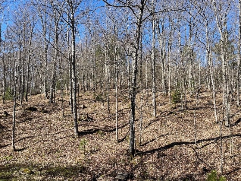
These are maple but there's plenty of ash and they're leafing out as well but well behind, maybe 20% leaf out. Two weeks earlier than last year.
-
1.2" of much needed rain, everything is lush and green. Looks like some snow could skirt the northern portion of L Superior tonight. Looking off my backyard deck, 17 days ago vs today. 60 to 75% leaf out.
.jpg.45b0b95d846f959c0bd90156d686f790.jpg)
-
68, sunny with a light breeze. Should reach low 70's today. Yesterday hit 82 for the high and it felt too warm. I have zero tolerance for heat anymore. After the warm day yesterday the mosquitos and the noseeums are out in full force. The noseeums are the worst, they aim for the eyes and ears and bite like a mf'r. They'll peak in 2-3 weeks and last about 6 weeks. Too early for the black flies and deer flies, maybe another few weeks.
-
Sunny and 70 today gonna feel really nice after the past few days in the low to mid 50's. Point has 82 tomorrow which will be the first 80 of the season and about as warm as I like it to be.
-
I do mostly veggies but also do a few flowers on the porch and deck. The deer are not shy and will walk right up to the front door, so I don't spend too much on flowers, my garden is more protected. I've learned the hard way to not plant anything outside before June here. I have however already planted potatoes, but I do them in buckets and they haven't sprouted yet and can easily bring them in if need be. I'm close enough to the lake for the cooling but also far enough away to experience the chillier temps at night... will eventually plant peppers, toms, cucs, some zucchini, broccoli (does well here) and some herbs as well. Growing wild on my property are raspberries and blueberries, which surprisingly are very sweet and plentiful. Gotta fight the deer for the raspberries tho. Anyway, short growing season here in the north so gotta make the most of it. Cool again tonight with a low around 37 but a warming trend follows. Would like to be more excited about rain chances, but it doesn't look very promising. It's pretty surface dry... 49 degrees at 8:30.
-
Low of 31 this morning, cold spot again is Baraga Plains at 22. One more night in the 30's then a bit of unsettled weather and milder. Of the 15 days this month, 10 have been in the 30's at night, the coolest being this morning and the warmest 45 on the 7th. Should be able to start planting in 2 weeks.
-
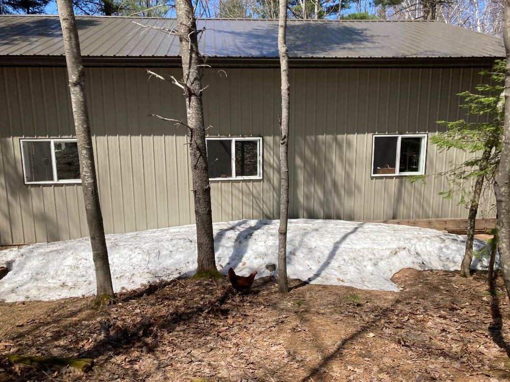
Oh, that's baldy. If you look closely, she has no feathers on her her head. They all pick on her, she's an outcast and is always where she shouldn't be but never learns.... has her own private digs and follows me like a dog.
-
Down to 39 at 9:30, a freeze looks in the books. This time last year I still had piles of snow in the yard. May14th, 2023
-
Cool day here as well. 48 at 1 pm. Had frost to scrape on my truck this morning and saw some on the roof of the house as well but none on the ground. On more chilly night before things rebound into the 40’s at night.
-
Smoke cleared here by early afternoon, and it was a cool breezy day with north winds. Only managed 51 for the high and already down to 43 this evening. Point has 33 for the low with some upper 20's in the interior cool spots. I don't believe MQT is issuing frost/freeze products just yet. Cool again tomorrow in the low-50's with another chilly night in the low 30's Tuesday. Could use some rain.
-
Clouds started to break here around 3 am. It was a little surreal to see the lights mixed in with low clouds. Looked like a scene out of a horror movie. Should be decent viewing early on tonight before clouds move back in. N lights are pretty common up this way but last nights were very nice. Have only seen them encompass the entire sky one other time a year or so ago.
-
Low of 31 this morning. No surprise Baraga Plains was the cold spot at 21. Should reach upper 50's to near 60 today before afternoon lake breeze. Too bad clouds increase for the light show tonight. Probably will still see the brightness behind the clouds and showers.
-
Yeah... Living near the shore of Superior in the Spring is nothing to brag about but come mid June through early Sept it's endless days of sun, 70's, low humidity and cool, crisp nights. Then, when everyone's sick of Summer and complaining about the heat and humidity, it's Autumn here, so it's worth it.
-
46 at 3 pm under full Sun. Doesn’t feel bad as I’m working in the yard, but sit still for a few minutes and it’s chilly. Point has 33 tonight with frost.
-
Rain was a bust here with up to 3/4's forecast but ended up with less than a tenth. Cooler today in the low-50's with a northerly wind. Frost potential the next couple nights.
-
A tad cool this morning at 34 but will end up another beautiful day with a high in the mid-60's. Northern lights were visible for a second night in a row last night although not as vivid as Saturday night. Another shot at rain starting late tomorrow.
-
Gorgeous sunny day should top out in the upper 50's. Heading out to wander the woods. Sure sign of Spring, the daffodils.
.jpg.f187d783ab28b310aba7098c5be927c0.jpg)
.jpg.6c41ea562370fdf117fc51dc4cdaec3c.jpg)
-
Made it to 67 earlier today before thicker clouds arrived. Spotty rain is moving through with barely a trace so far, temp down to 47... house is chilly, debating a fire.
-
MQT: We officially hit 70° today for the first time this spring at our office in Negaunee Township! Our average first 70° is April 25th, the earliest being 3/08/2000 and latest occurring 5/25/2019. We hope you're enjoying the nice weather today! Indeed.
-
Sunny, windy and 72 for the high. Felt wonderful.
-
46 this morning. After clouds clear should see the warmest day of the season so far with 67 forecast.
-
Cool day in the 40's with another shot of rain moving in. Nice active pattern continues although bit milder going forward. Was probably the nicest April I've experienced in the last decade.
-
Rain will move in this evening, until then a cloudy, cool, breezy day. Will only manage mid/upper 30's for a high. Reached mid-60's yesterday with a few showers.
-
Similar weather on tap over this way. At least it’s warm today, mid 60's. Tomorrow will be 17 years since my Grandpa died. He was more like a Dad tho.
-
19 this morning. Should be a fairly nice day topping out in the mid-50's.


