.jpg.82995912781a8a839ab578c3b293f48f.jpg)
weatherbo
-
Posts
6,546 -
Joined
Content Type
Profiles
Blogs
Forums
American Weather
Media Demo
Store
Gallery
Everything posted by weatherbo
-
Nice day albeit a bit breezy, 49 for the high. Snow cover becoming patchy. Should hear the swamp peepers any day now.
.thumb.jpg.55858c44e57974b3aab1b63c44bfd38a.jpg)
-

Spring/Summer '24 Banter and Complaint Thread
weatherbo replied to IWXwx's topic in Lakes/Ohio Valley
A chicken needs two things to be happy, food and water. A rooster needs three. -
2023-2024 Fall/Winter Mountain Thread
weatherbo replied to The Alchemist's topic in Southeastern States
How much did you receive vs your average? -
Spring/Summer '24 Banter and Complaint Thread
weatherbo replied to IWXwx's topic in Lakes/Ohio Valley
I'll go with a D+. cons: 100" below avg brown Christmas persistent thaws pros: 30+ inch storm in January which had a blizzard warning (55 inches for the month) Blizzard a few days ago -
Sunny with a forecast high of 50 today should accelerate the melt, still a dense 14 inches otg. Interesting to see most lakes in the UP are ice free with the exception of Marquette County and the tip of the Keweenaw. That could change today.
-
4/2-4/3 Significant Late-Season Snowstorm (WI/MI)
weatherbo replied to Geoboy645's topic in Lakes/Ohio Valley
31 inches during that 2 week stretch of winter in mid January. -
4/2-4/3 Significant Late-Season Snowstorm (WI/MI)
weatherbo replied to Geoboy645's topic in Lakes/Ohio Valley
Here's some bigger totals I've been able to find so far. I'm sure MQT will post event totals later today. Eagle Mine co-op 9sw Big bay- 33" My house- 28" Herman co-op- 28" (2.10 LE- average ratio 13:1) a little sus with that ratio. Ishpeming NWS employee 24" Nat'l Mine NWS employee 24" MQT office 19" (3.25" LE- average ratio 5.8:1) Champion co-op- 17.5" (3.27 LE- average ratio 5.3:1) -
4/2-4/3 Significant Late-Season Snowstorm (WI/MI)
weatherbo replied to Geoboy645's topic in Lakes/Ohio Valley
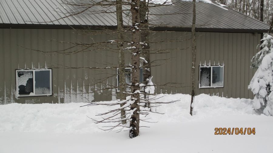
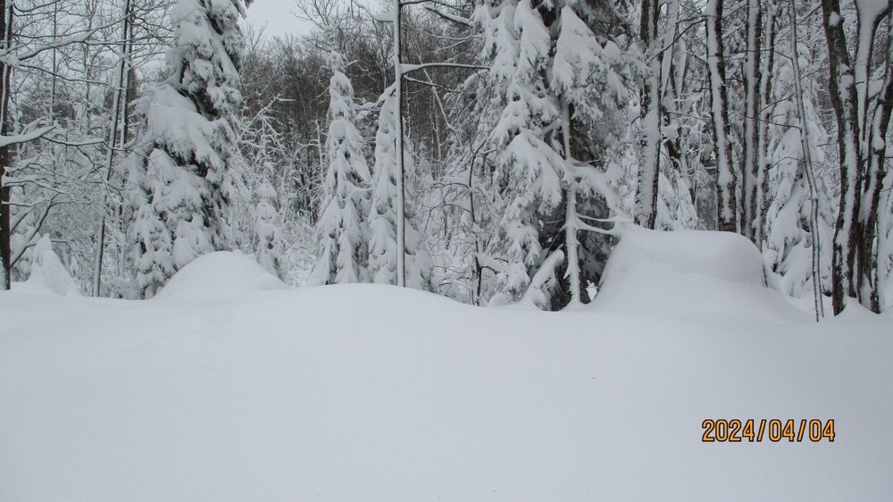
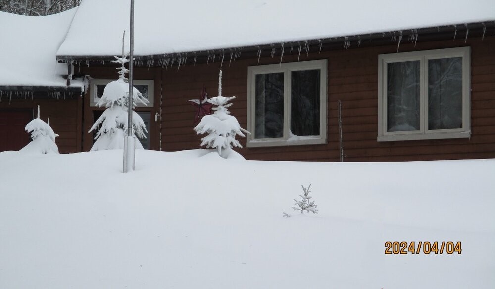
- 81 replies
-
- 16
-

-
4/2-4/3 Significant Late-Season Snowstorm (WI/MI)
weatherbo replied to Geoboy645's topic in Lakes/Ohio Valley
Snug as a bug. -
4/2-4/3 Significant Late-Season Snowstorm (WI/MI)
weatherbo replied to Geoboy645's topic in Lakes/Ohio Valley
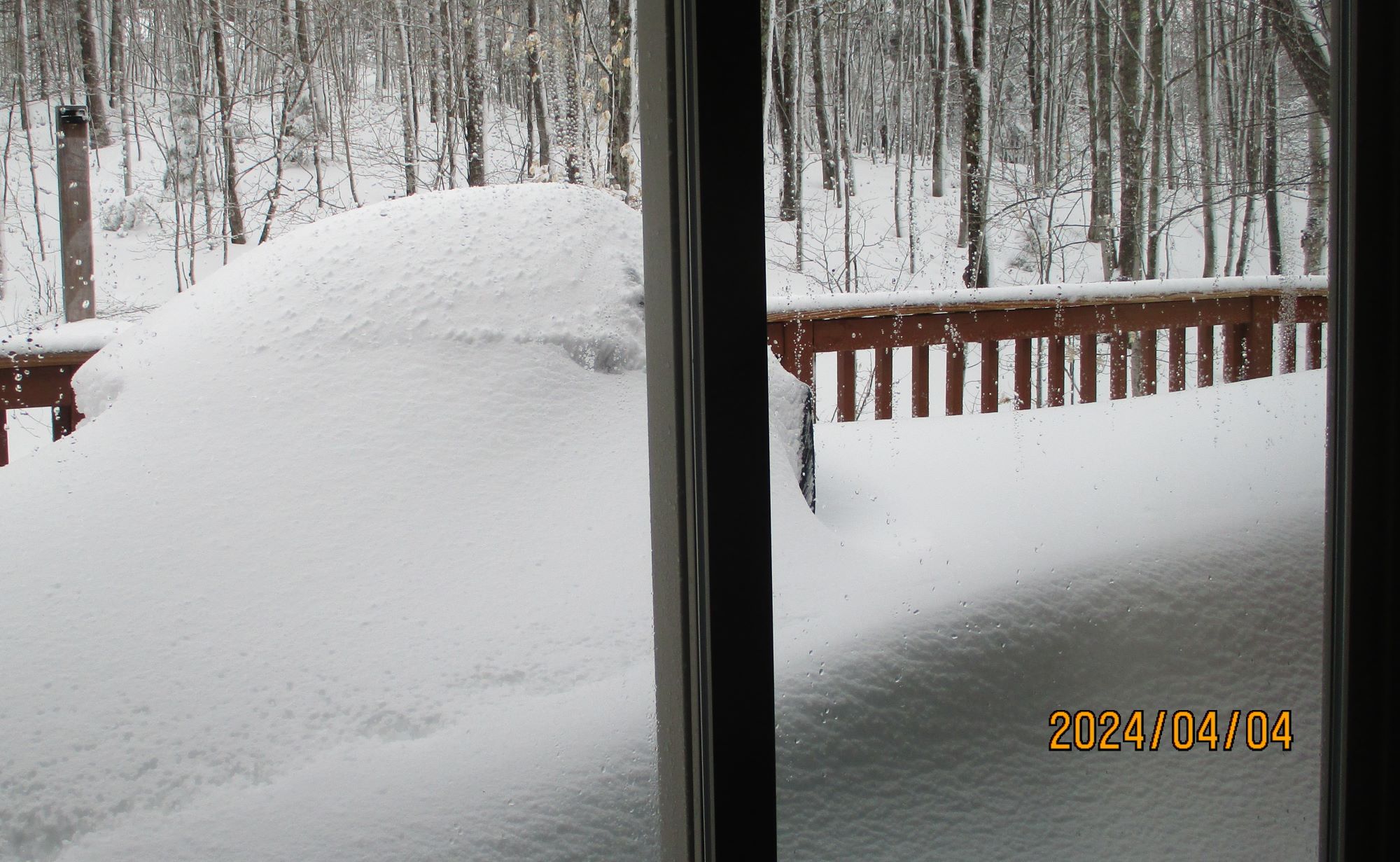
MQT's total as of this morning 7 am 19" 3.25 LE Got dumped on here last night. Haven't been out yet but getting ready to start clearing snow. Just looking out, it's deep. Snowed all night.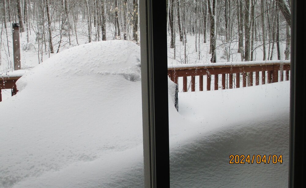
-
4/2-4/3 Significant Late-Season Snowstorm (WI/MI)
weatherbo replied to Geoboy645's topic in Lakes/Ohio Valley
Solid band of snow has been parked here along the higher terrain ridge for a few hours now. Should do well tonight. I do notice it’s a bit west of the weather office so idk how they’ll fare. -
4/2-4/3 Significant Late-Season Snowstorm (WI/MI)
weatherbo replied to Geoboy645's topic in Lakes/Ohio Valley
For sure. Herman over to Eagle Mine to my area received a foot overnight, with me seeing another 8 today. Herman and Eagle mine will report in the morning their totals for today. South east of here Mqt received 8.3 overnight and 6.1 today with a LE of 2.5”. if in fact I see 6-8 tonight I will exceed the 2 foot mark so still a great late season storm. MQT might break 20” as well. Had ratios been the 10:1 expected, the bigger totals would have panned out here in the higher terrain. Marquette the city was just a bust all together. -
4/2-4/3 Significant Late-Season Snowstorm (WI/MI)
weatherbo replied to Geoboy645's topic in Lakes/Ohio Valley
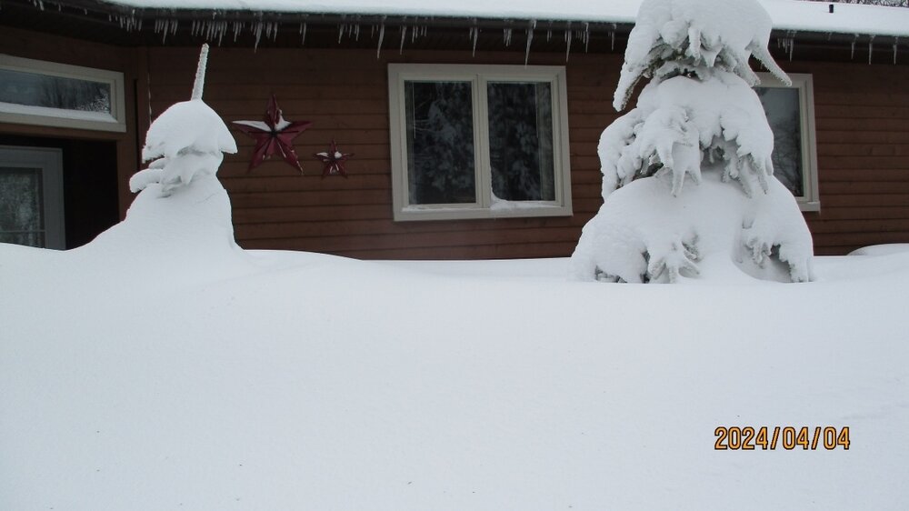
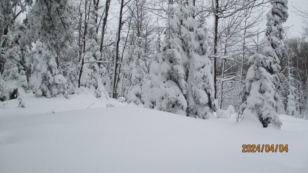
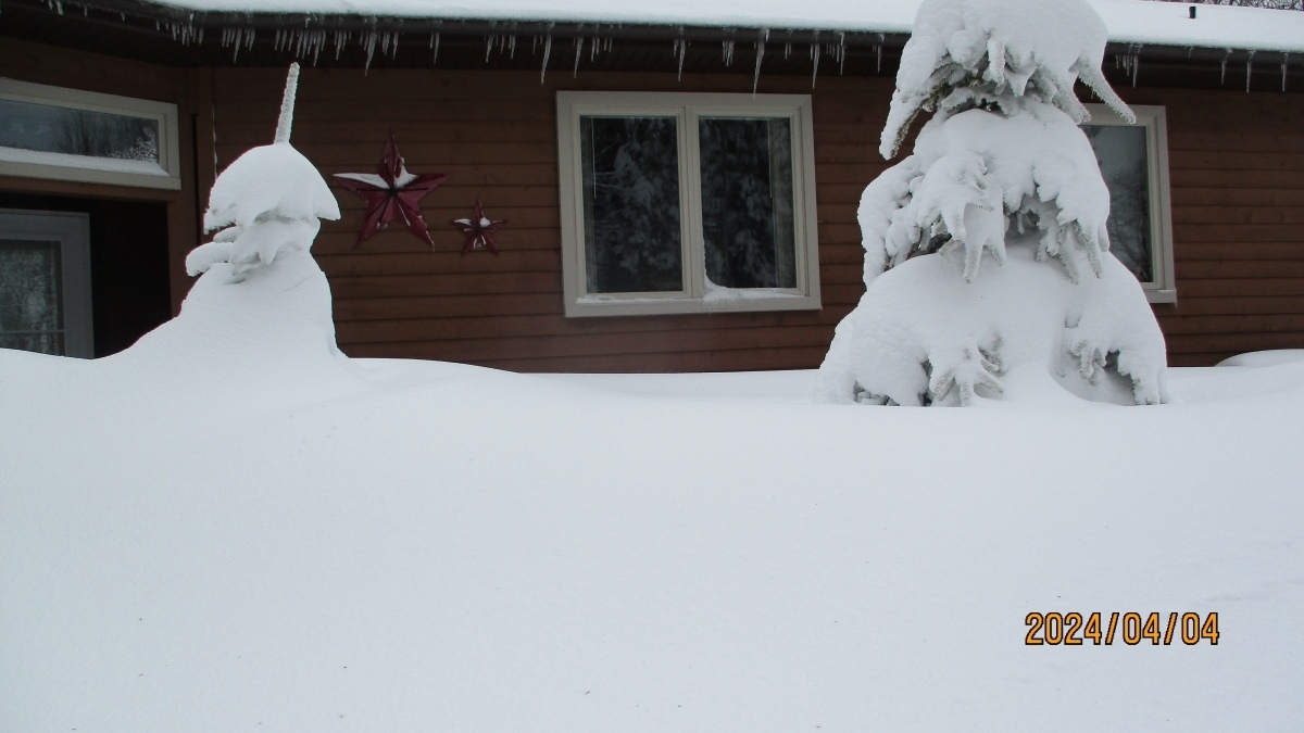
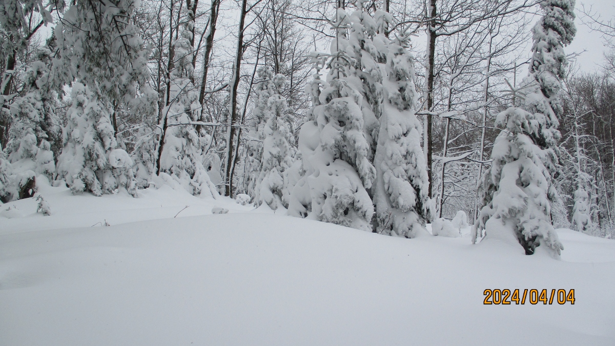
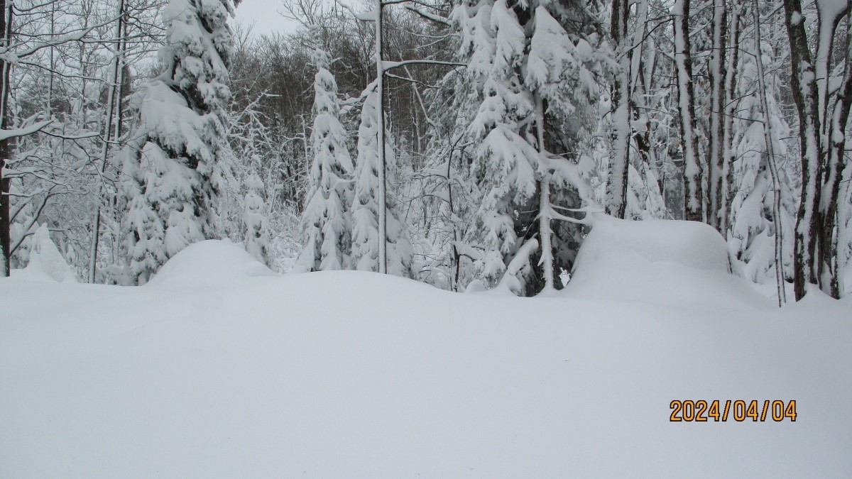
Blizzard warning replaced this afternoon with a wsw for 6-8 inches tonight as snow has picked back up the past couple hours after a lull this afternoon. Ratios today were closer to 6-7:1 so totals will be much lower than forecast but the snow is extremely dense. A couple pics from earlier today..thumb.jpg.09f00fa9657a460194b3be927aadf206.jpg)
.thumb.jpg.75736cfc507dd220624fab2b43bbe21c.jpg)
- 81 replies
-
- 13
-
-
4/2-4/3 Significant Late-Season Snowstorm (WI/MI)
weatherbo replied to Geoboy645's topic in Lakes/Ohio Valley
Went out for a quick measure on the drive. Most models have another 15-18". Looking at webcams down in Marquette, there's little to no accumulation. Same from talking to a friend in Big Bay. Snowbelt here getting hammered. -
4/2-4/3 Significant Late-Season Snowstorm (WI/MI)
weatherbo replied to Geoboy645's topic in Lakes/Ohio Valley
Yes, May 2nd and 3rd just under 3 feet fell. It was a very damaging storm tree wise. Been coming down heavy all night. Just glancing out, from what I can see looks like at least 10 inches has fallen. Point has up to 24 more in total with the morning AFD stating another 10-12 possible by early afternoon. Winds have been gusty but nothing out of hand, at least here. Stoked the fire, gonna go back to bed for a while lol -
4/2-4/3 Significant Late-Season Snowstorm (WI/MI)
weatherbo replied to Geoboy645's topic in Lakes/Ohio Valley
There’s several in Marquette, use to be one in Big Bay at the motel but none that I’m aware of up this way. This area and the area where the heaviest snow will fall is pretty remote -
4/2-4/3 Significant Late-Season Snowstorm (WI/MI)
weatherbo replied to Geoboy645's topic in Lakes/Ohio Valley
Somewhere in northern Marquette County is probably going to see 4 feet of snow. Latest NAM isn't backing down on the insane totals like you'd normally see as an event gets closer. 12z to 18z upped my total from 44 to 50 inches with pretty much 10:1 ratios. I'm as prepared as I can be. Going to be an interesting 36 hours. -
4/2-4/3 Significant Late-Season Snowstorm (WI/MI)
weatherbo replied to Geoboy645's topic in Lakes/Ohio Valley
I've had around 125 inches. My area averages around 250+ inches maxing out just northwest of here around Eagle Mine near 300 inches. Winds on the increase but that's about it right now. -
4/2-4/3 Significant Late-Season Snowstorm (WI/MI)
weatherbo replied to Geoboy645's topic in Lakes/Ohio Valley
Marquette and Baraga counties upgraded to a blizzard warning before it's even started. -
4/2-4/3 Significant Late-Season Snowstorm (WI/MI)
weatherbo replied to Geoboy645's topic in Lakes/Ohio Valley
12z NAM has 44 inches here. Geni ready to go, tractor gassed up, firewood stocked, roast cooking. Still need to run to town for a few things as I imagine roads out this way will be impassible for a couple days with tree damage. -
4/2-4/3 Significant Late-Season Snowstorm (WI/MI)
weatherbo replied to Geoboy645's topic in Lakes/Ohio Valley
NAM and FV3 caved and are def juiced. 40 and 51 inches verbatim with 4 to 5 inches LE. If this even comes close to verifying, with the expected wind, it will be a crippling storm. -
4/2-4/3 Significant Late-Season Snowstorm (WI/MI)
weatherbo replied to Geoboy645's topic in Lakes/Ohio Valley
Every time there's a big late season snow, the "Mother's Day" storm of 1990 always comes up. I believe Negaunee received 24 inches and apparently was all melted by late afternoon the following day. -
4/2-4/3 Significant Late-Season Snowstorm (WI/MI)
weatherbo replied to Geoboy645's topic in Lakes/Ohio Valley
A good chunk of models have 2-3 feet of snow by Thursday noon. RAP pretty aggressive with 3 feet at the end of its run and still snowing. Seem to get these high qpf/wet snows every April. Last year nearly 3 feet fell May 2nd and 3rd. If all goes according, this will push me over the 150 inch mark. Still around 100 inches below average however. -
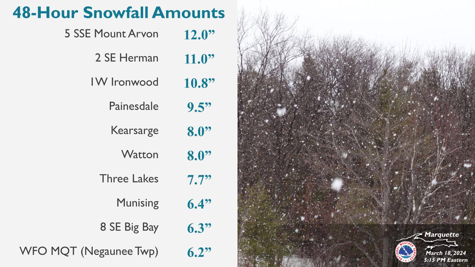
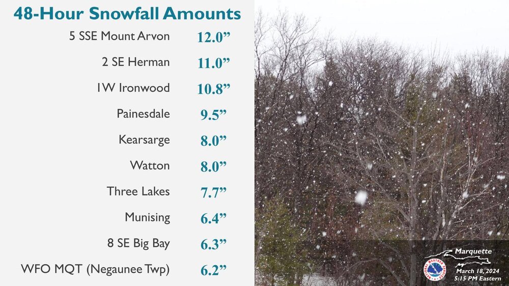
Got pretty nasty here last night between 8 and midnight. Had a two day total of 8".
-
20 with snow showers, heavy at times since yesterday. Several inches have fallen here, up to around AAA road and over to Eagle Mine. Point has upwards of 7 more inches by morning. 20's for highs today and tomorrow, bumping up to low 30's Tuesday before falling to the upper teens and low 20's Wednesday and Thursday. A wintry week for sure but nothing shocking as March is usually the 5th month of winter in the n woods.
.jpg.aeaa332f93c224d4211367b89ebb0658.jpg)


.jpg.1be70e9f96b412e1338ba23e2ebe267e.jpg)
.jpg.a84d358e31a4e174c0900d607c49d91b.jpg)