CT Rain
-
Posts
26,264 -
Joined
-
Last visited
Content Type
Profiles
Blogs
Forums
American Weather
Media Demo
Store
Gallery
Everything posted by CT Rain
-

"Don’t do it" 2026 Blizzard obs, updates and pictures.
CT Rain replied to Ginx snewx's topic in New England
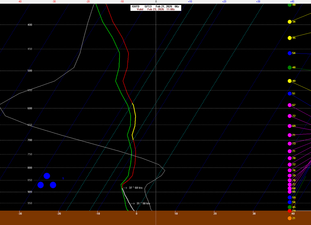
67 knots ACK -
"Don’t do it" 2026 Blizzard obs, updates and pictures.
CT Rain replied to Ginx snewx's topic in New England
This is awesome -
"Don’t do it" 2026 Blizzard obs, updates and pictures.
CT Rain replied to Ginx snewx's topic in New England
Well the whole system is a bit too far southeast for my liking. Would have preferred a bump north. The evolution on the mesos is sort of funky so I'm honestly not quite sure. Thinking 10"-12" or so here. -
"Don’t do it" 2026 Blizzard obs, updates and pictures.
CT Rain replied to Ginx snewx's topic in New England
Ehhhhh, 00z HRRR/RAP/NAM all a decent chop with QPF and a trend east. We'll see what happens though. -
"Don’t do it" 2026 Blizzard obs, updates and pictures.
CT Rain replied to Ginx snewx's topic in New England
Yeah definitely a jump east with everything from 18z. -
"Don’t do it" 2026 Blizzard obs, updates and pictures.
CT Rain replied to Ginx snewx's topic in New England
Sort of hoping the tick east just brings the deform goodies into central CT. -
"Don’t do it" 2026 Blizzard obs, updates and pictures.
CT Rain replied to Ginx snewx's topic in New England
I still don't quite know what to expect. Feel more uneasy than usual as the thing is underway. -
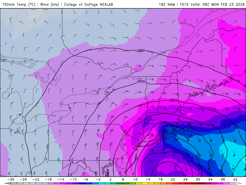
Love that back bent warm front .
-
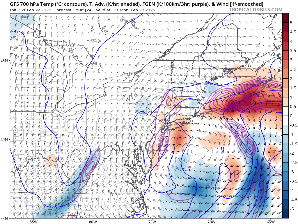
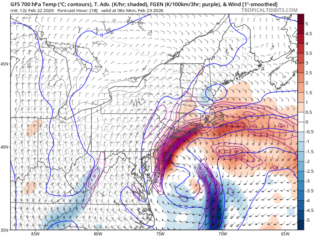
Interesting how the GFS just collapses the frontogenesis Monday morning. Sort of weird.

-
Wow - GFS is a toaster bath.
-
I was thinking about that as well this morning. Disappointing to see the 12z NAM back down a bit around here but the storm still looks great overall.
-
Draw the shades.
-
Yeah though they had watches until noon. Seems like everyone is a bit hesitant to ramp up because of how this looked 36 hours ago.
-
We pray.
-
It’s a bad habit for sure.
-
As a QPF queen i want all models to have 2.50” for KHFD.
-
Euro sort of meh. That H7 low is awfully far southeast. Not much change from 00z/06z tho.
-
Tossed a few in this video: https://www.youtube.com/watch?v=3qBy6wSFRxU
-
Man that was the best
-
If this verifies I may never wear clothes again.
-
Fuck yes.
-
meh. next.
-
GEFS look better 00z to 18z at least in terms of QPF.
-
Jesus. LFG.
-
lol amazing