WeatherNC
-
Posts
3,564 -
Joined
About WeatherNC

- Birthday 09/28/1980
-
Verbatim that hooks inside 40/70, dabenchmark 40/70 is grammar school for DCA - BOS with a bombing cyclone in the mid latitudes. Occlusion in southern NE (Long Island Sound) is high school
-
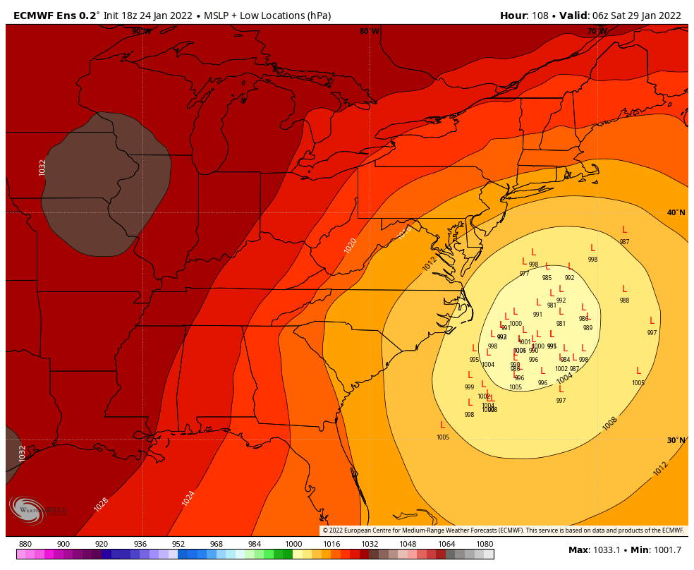
Pretty classic look for the MA crew at day 4, I would be prepping the clearing equipment 95 north of Richmond to NYC, particularly areas east of the Interstate. While we (SE) like Central FL or even GA, this is textbook with near term correction for your areas. Inside the benchmark with occlusion still on the table. Chase watch hoisted.
-
Does this count as a lollipop? Code on a hydrant is 18” above grade center cap.

-
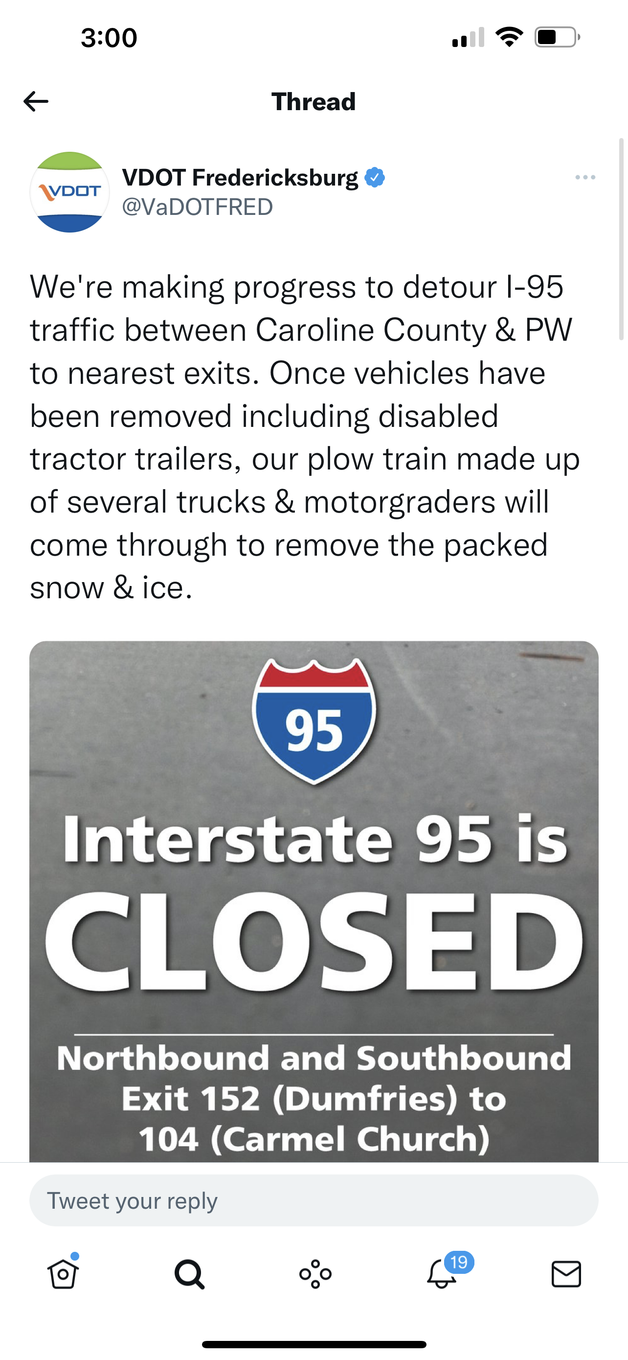
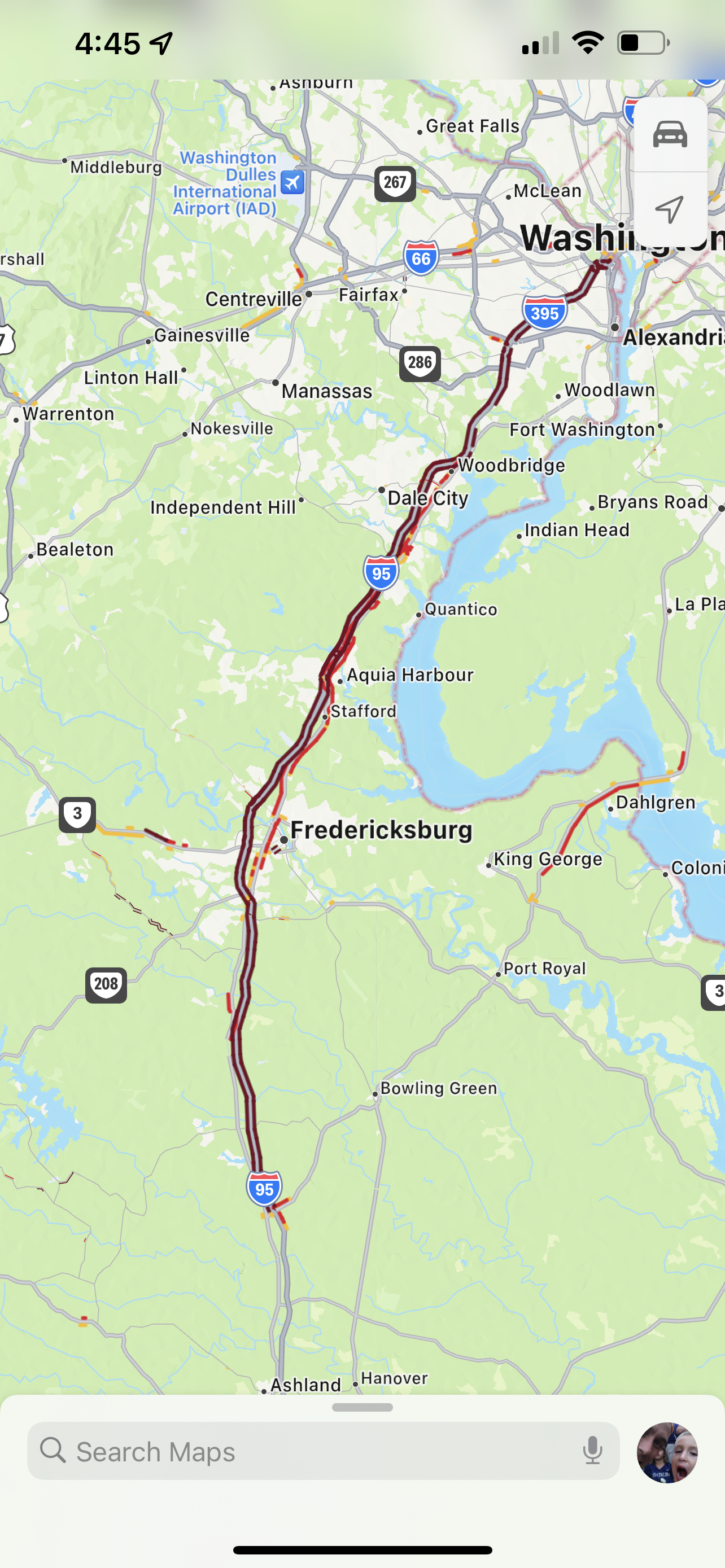
Ended up being a 27hr chase gate to gate from Greenville NC, required application of knowledge learned both in the mid Atlantic over the past 10-15 years punching some of the larger events on record and new things learned out in the PAC NW over the past two years, specifically wheel chains which I purchased for required areas out there and used on the rear for our drive down 1 to Ladysmith, we left about 430pm yesterday. VA law notes tire studs, chain info seems to be prohibited per law unless conditions warrant them in season but still unsure. And that’s with a 4x4 truck, it was rough. 9am 12pm 3pm ~14” with >1.5” liquid equivalent, heavy and wet with the pivot main deform supporting improved ratios after 11am

-
SNOW SQUALL WARNING NWS CHARLESTON WV 351 PM EST SUN FEB 10 2019
-
FYP...
-
Congrats guys, indecisive motion ftw... .
-
Drove from Boone to Greenville today, coverage was total to around Zebulon. Takes a rare bird to lay down that areal extent in NC, even areas to the east saw cover yesterday before it melted. 40 north, solid A.
-
In Wilkesboro, about to make the final call of Blowing Rock or Sparta, I don’t want to enitely discount the RGEM and NAM for 2” of QPF with little mixing around Sparta.
-
30" around Lake James this run on pivotal.
-
Leaving for Blowing Rock in the am, considered going further south to Black Mountain but am really worried about pingers cutting back on totals. Also considered Spruce Pine but the roads may be sketch coming back on Tuesday especially if there is a lot of sleet.
-
He lives in Wake Forest vs SE Wake County, with the advances in computer simulations over the past 5-10 years, local hasn't changed.
-
Agreed, primary go to when the NAM looks off, difference usually verifies somewhere in the middle.
-
How is that a SN & IP best guess, unless I forgot to read Skew-T's that's SN, likely heavy.
-
Pivotal is 29" from Morganton to Lenoir to Hickory, 28" in Blowing Rock. As things stand now, Blowing Rock is where I will be Saturday afternoon - Tuesday. I like the elevation (wind potential), eastern side of the escarpment, 321 should be plowed with a backdoor through Boone and 421 if needed. Not ready to commit further south than there at the moment, SW VA appears to be safely out of play. Slower timing will allow ingest of the 12z run on Saturday for any last minute adjustments as I am on the road.