

eaglesin2011
-
Posts
989 -
Joined
-
Last visited
Content Type
Profiles
Blogs
Forums
American Weather
Media Demo
Store
Gallery
Everything posted by eaglesin2011
-
You may get to that myself and the city will be lucky to make 3 inches. I doubt I'm much more then an inch here in glen Allen
-
Finally decent enough rates to start accumulating again .
-
Yep definitely some nice rates look to to about 20mins away per radar
-
Probably will happen now that the weather channel people are here
-
RamCam - Student Commons - Virginia Commonwealth University https://ramcam.vcu.edu/student-commons.html Here are the vcu cams again... RamCam - Virginia Commonwealth University https://ramcam.vcu.edu/
-
Your Prob right about that the radar isnt picking up as well near the mountains.. hopefully we can stay in the heavier precp
-
Snow starting to mix in 295/Glen Allen
-
Helpful hint just screen shot whatever u try to post
-
Backfill . Hurrrrrr y up
-
Watch us go from snow to dry slot..lol
-
Mostly all sleet here Glen Allen/295
-
You'll know before most in this section...Your in Ashland right? I'm in Glen Allen just a cold light rain here at the moment ..
-
Would be nice if we can get an early flip but still looking a few hours away IMO
-
So when we get 6 plus inches does that make all the early calls right ? Lol
-
Change over on the modles still showing about sunset /5pm timeframe?
-
Isn't that a total from all the upcoming storms together?
-
Step away from the models... step away from the models. Lol
-
Gonna be pretty hard to get shut out for this event in the Ric area. Imo . But prob will be another frustrating event, waiting for the changeover starting mid/late afternoon Thursday. Dry air & rates are going to the key again, if we can go from low end 1-3 to the high end 3 to 6 once the changeover...
-
Almost 60 here now wow.
-
Cool ,another 1 to 5 inch storm on the way for most of this area...
-
Knowing this area..A combo of both is likely...
-
Hopefully we can get some more cold air in faster, definitely could be a nasty ice storm over the weekend... The line normally sets up pretty much like this IMO east to west..To bad it wasnt 2 degrees colder/sooner could of had a nice storm. At least it looks like we will now have snow tv, instead of rain for the rest of this storm . Prob over about 2pm.
-
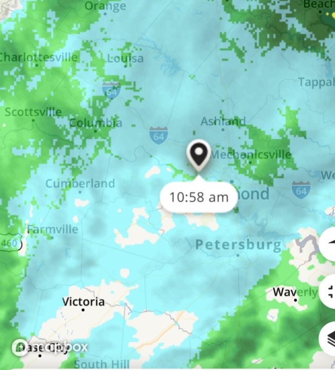
Rates obviously make a difference in these marginal temp storms..Basically been snow TV here for awhile now but check this radar out.
-
In a nice little mod/snow band coming through now just when it looked like it was going to turn over. Prob about 15 mins or so then we will be back to the light stuff or possible turn over
-
Yeah snow is so wet, not really accumulating as much now on all surfaces .

