OSUmetstud
-
Posts
16,521 -
Joined
-
Last visited
Content Type
Profiles
Blogs
Forums
American Weather
Media Demo
Store
Gallery
Everything posted by OSUmetstud
-
As do I. But seasonal forecasting is still a budding field with low confidence so I'm not sure if there's much difference in skill between a forecaster's forecast and a model forecast.
-
Jma looks okay to start December too for what it's worth.
-
The seasonal didn't show a torchy December.
-
It probably wasn't there lol. There has been problems this morning.
-
Yeah we got 45" that month. I think there 2 other decent events beyond the big storm on November 20th. Must have just been cold and dry there, interesting.
-
Interesting, thanks. I figured bigger storms are harder to come by, but maybe a smattering of minor to moderate events could be done? How about something like November 2000?
-
Growing up in the lakes November can be very kind, even epic, but I wouldn't think a wintry November in New England is too unusual.
-
fake news!
-
I'd go for suppression and sheared mess to the southeast over cutter. The cold air dump from the -epo block and fast flow and mean trough position are decidely against a great lakes track.
-
The gdps has the same sfc cold bias but it more properly diagnoses warm noses in the 850 to 700mb layer.
-
The thing with the gfs that bothers me is its inability to see the warm nose. It's useless for mixed precip but that was a thing before and after the fv3 upgrade. It's cold bias is through the whole lower atmosphere.
-
If a winter storm warm sectors St. John's, lock it in.
-
Upstate/Eastern New York
OSUmetstud replied to BuffaloWeather's topic in Upstate New York/Pennsylvania
https://montrealgazette.com/news/local-news/high-winds-leave-thousands-of-montrealers-in-the-dark/amp?__twitter_impression=true Wow -
Upstate/Eastern New York
OSUmetstud replied to BuffaloWeather's topic in Upstate New York/Pennsylvania
Strongest winds were on the canadian side as the low took a while to get going. Kingston to 107 km/h (66 mph) and Montreal to 105 km/h (65 mph) is not too shabby. Im still a bit suspicious of port colburne obs. I know its on the pier but the ob of 102g130 km/h is super intense and seemingly out of whack compared to other sites and the synoptics. -
Upstate/Eastern New York
OSUmetstud replied to BuffaloWeather's topic in Upstate New York/Pennsylvania
The wind was a medium type high wind event. Nothing particularly special. It was early in the year with leaves still on trees and saturated unfrozen ground That makes a big difference with re: damage and outages. The sieche was solid and i believe highest in a while (10 ft 6") but some of that is due to the very high antecedent lake levels (running 4 ft over low water datum). -
Upstate/Eastern New York
OSUmetstud replied to BuffaloWeather's topic in Upstate New York/Pennsylvania
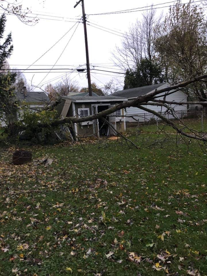
My mom had a tree fall on the shed last night (West Seneca).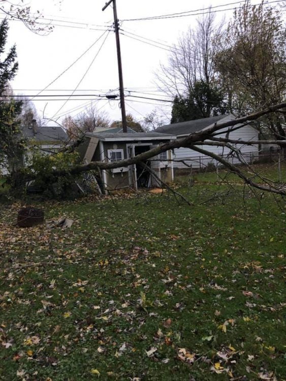
-
Yes, I remember that study. I don't believe the new FV3 has changed much, the GFS and GEM have been running toe to toe and considerably behind the ECMWF and UKMET for some time.
-
You breathlessly posted about the canadian in the three separate threads in the middle of the night last night.
-
Who is we?
-
00z Ukmet has the a strong storm out about 100 NM west of Bermuda at t+144.
-
Congrats bermuda
-
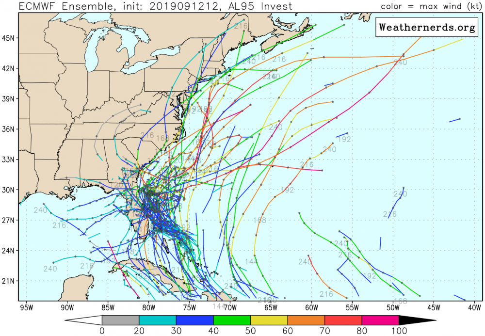
Meh. Some of these tracks appear to be from a different disturbance, too.
-
Yeah, development is more likely than not
-
Yeah, I'd say the chances are "elevated" re: climatology, but still very unlikely overall.
-
Boring. Most likely scenario.