TheManWithNoFace
-
Posts
463 -
Joined
Content Type
Profiles
Blogs
Forums
American Weather
Media Demo
Store
Gallery
Everything posted by TheManWithNoFace
-
Globals have shown this too though. I think there's going to be some competing interests in the low/midlevels that could spoil forcing from consolidating and delivering the big numbers.
-
I don't think we've discussed much the elongated, lobed depiction of the surface low along the coastal front much. It's been shown this way in various solutions. The 12z RGEM takes this to the extreme, with meso lows chasing convection east of the benchmark, competing for supremacy with the sfc low trying to establish east of the VA capes with where there's better UL support for sfc low development. The result is the forcing is strung out and discombobulated and steadier snows do not advance into NNJ or SNY. I don't see why this isn't just as plausible as anything else.
-
With you. Think there's a strong cutoff, but those that get "in it" are going to realize some of the heftier totals. I like Monmouth County for a 12+ jackpot.
- 2,426 replies
-
- 1
-

-
- heavy snow
- ice pellets
- (and 3 more)
-
We've had a lot of discussion, rightly so, on the western Atlantic and it's potential to squash things. I haven't seen the PAC mentioned as much which is trending more favorably, with better wave spacing all the way into the north central Pacific resulting in improved ridging over the western US.
.thumb.gif.f72f586fc52d7449336085cc337e2dba.gif)
- 2,426 replies
-
- 2
-
-
- heavy snow
- ice pellets
- (and 3 more)
-
I feel like the wind today was undersold. Nws point and click had gusts to 35 for most of NJ, seeing widespread 40-55 gusts. Cold is legit.
-
That's my point. Upton is the plumb job of the weather planet right? How can anyone in that office be talking about surface winds/temps when half the hobbyists understand that it's about what's aloft?
-
I don't understand. It's not about cold air wrapping around the sfc low. It's about resaturating the column and mid level lift.
-
HRRR gives north/Central NJ another 4-8". Column is unsaturated, wind is ripping up ratios, this will underperform totals.
-
I'd take Drags anecdotes over Bernie Rayo using a low sfc dewpoint as reasoning as to why it won't change to sleet in NYC.
-
If you're going to play a "whoops" card, at least take advantage! :-)
-
Saw that and it still looks over done.
-
I wasn't speaking to his forecast at this moment, more his predictable tendencies. He's like JB, easy to guess what they're going to say. Now as for his current forecast...significant snow event for the NYC metro? Significant ice event for the Philly metro? SouthernNJ changes to plain rain by NINE AM? we should never judge a forecast until its fallen, but he is still presenting the wintriest forecast you can find out there.
-
Steve D is insufferable and predictable. He is always on the cold/snow side of things, and when models trend against him, he "takes a break" or "takes a nap" for a cycle so he can see if things came back into his favor. Now today he needs a reason to go missing for a but because he is still forecasting a more wintry scenario, so he tweets that he is "receiving violent threats" and needs to protect his family. So dramatic.
-
Looks like News12 is trying out the probabilistic approach. Don't think people are going to go with it.
-
Dave Curren Dan Skeldon
-
-
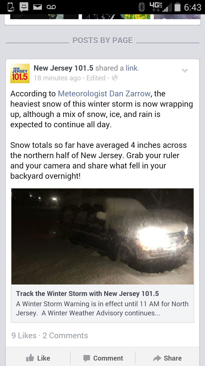
Pretty shameful spin job by 101.5. I heard a dreadful forecast with Dan Zarrow's name on it last night around 8pm for "4inches north and west of the turnpike." This morning they try to play it off like that was a good call. Average of 4" in north NJ? Must have missed the NWS p.I.s. Pretty sure snow fell south of the turnpike too.

.gif.8873b916025e73fd81deaeaf3f8e2599.gif)