

batmanbrad
-
Posts
185 -
Joined
-
Last visited
Content Type
Profiles
Blogs
Forums
American Weather
Media Demo
Store
Gallery
Posts posted by batmanbrad
-
-
1 minute ago, Eskimo Joe said:
Well that was a real disappointment.
yeah, typical - but there could be some training/backbuilding going on to the SW so we might not be done yet... more room for further disappointments?
-
3 minutes ago, Eskimo Joe said:
Constant thunder in Gaithersburg and it's getting legit dark.
yes, lightningmaps.org confirms increasing activity still west of I270 between Germantown and Potomac...
-
watching radar, I have a cell to my north (I'm near Laytonsville) and one approaching from my SW that seems to be gaining size/strength, gonna to be hard to avoid me completely at this rate.
-
STW just issued for central MoCo for the storm near Lowes Island/Great Falls area, moving NE at 25mph
-
watching the cell that was in Damascus (warned) approaching me from the north, may need a bit of a right turn to avoid missing me to the east (I'm just west of Laytonsville)
-
3 minutes ago, mappy said:
hail spike on radar. wouldn't be surprised to see some big hail reports out of it.
yes can see some purple on the COD radar from that cell, quite impressive for that area - looks like it will stay south of the NYC area if it stays on its East heading...
-
7 minutes ago, mappy said:
also, what did i say earlier? Allentown.
TOR warning issued for that cell about 5 min. ago - also mentions 2" hail possible
-
you don't often see potential for baseball size hail in this part of the country... this warning's got TOR potential included in it as well.
Severe Thunderstorm Warning PAC005-019-031-121-281945- /O.NEW.KPBZ.SV.W.0071.190528T1854Z-190528T1945Z/ BULLETIN - EAS ACTIVATION REQUESTED Severe Thunderstorm Warning National Weather Service Pittsburgh PA 254 PM EDT Tue May 28 2019 The National Weather Service in Pittsburgh has issued a * Severe Thunderstorm Warning for... Southwestern Venango County in northwestern Pennsylvania... Northeastern Butler County in west central Pennsylvania... Northwestern Armstrong County in west central Pennsylvania... Southwestern Clarion County in west central Pennsylvania... * Until 345 PM EDT. * At 253 PM EDT, a severe thunderstorm was located 9 miles southwest of Sugarcreek, or 9 miles southwest of Franklin, moving southeast at 35 mph. This is a very dangerous storm. HAZARD...Destructive, baseball-size hail and wind gusts to 70 mph. SOURCE...Radar. IMPACT...People and animals outdoors will be severely injured. Expect shattered windows, extensive damage to roofs, siding, and vehicles. * Locations impacted include... Knox... Parker... Sligo... Emlenton... Clintonville... St. Petersburg... Eau Claire... Kennerdell... Callensburg... Foxburg... Cherry Valley... Cranberry Township... This includes Interstate 80 in Pennsylvania between mile markers 34 and 57. PRECAUTIONARY/PREPAREDNESS ACTIONS... Tornadoes can develop unexpectedly from severe thunderstorms. If a tornado is reported, move to a basement or small, central room in a sturdy structure. Large hail has been reported! Seek shelter indoors immediately and stay away from windows! This storm has a history of producing damaging wind gusts. Move indoors immediately and stay away from windows! Please report severe weather by calling 412-262-1988, posting to the NWS Pittsburgh Facebook page, or using Twitter @NWSPITTSBURGH. && A Tornado Watch remains in effect until 1000 PM EDT for northwestern and west central Pennsylvania. LAT...LON 4130 7948 4111 7947 4103 7957 4124 7997 4129 8000 4133 8000 4135 7998 TIME...MOT...LOC 1853Z 301DEG 31KT 4130 7996 TORNADO...POSSIBLE HAIL...2.75IN WIND...70MPH $$-
 1
1
-
-
looking at lightningmaps.org, plenty of activity especially around the Urbana area and west of Clarksburg just now...
-
no more TOR in MoCo:
Severe Weather Statement
National Weather Service Baltimore MD/Washington DC
258 PM EDT Fri Apr 26 2019

MDC031-261908-
/O.CAN.KLWX.TO.W.0016.000000T0000Z-190426T1915Z/
Montgomery MD-
258 PM EDT Fri Apr 26 2019

...THE TORNADO WARNING FOR SOUTHEASTERN MONTGOMERY COUNTY IS
CANCELLED...

The storm which prompted the warning has weakened below severe
limits, and no longer appears capable of producing a tornado.
Therefore, the warning has been cancelled.

A Tornado Watch remains in effect until 900 PM EDT for central
Maryland.

LAT...LON 3911 7697 3902 7720 3906 7723 3923 7711
TIME...MOT...LOC 1855Z 237DEG 33KT 3910 7711

$$

SMZ
-
Looks like Sterling's MIC did this update...


BULLETIN - IMMEDIATE BROADCAST REQUESTED
Severe Thunderstorm Warning
National Weather Service Baltimore MD/Washington DC
841 PM EDT Fri Apr 19 2019

The National Weather Service in Sterling Virginia has issued a

* Severe Thunderstorm Warning for...
  Western Montgomery County in central Maryland...
  South central Frederick County in north central Maryland...
  Eastern Loudoun County in northern Virginia...
  The City of Fairfax in northern Virginia...
  Northwestern Fairfax County in northern Virginia...
  Northeastern Prince William County in northern Virginia...

* Until 915 PM EDT.

* At 840 PM EDT, severe thunderstorms were located along a line
  extending from near Arcola to 6 miles northwest of Dale City,
  moving north at 45 mph.

  HAZARD...60 mph wind gusts.

  SOURCE...Radar indicated.

  IMPACT...Damaging winds will cause some trees and large branches
           to fall. This could injure those outdoors, as well as
           damage homes and vehicles. Roadways may become blocked by
           downed trees. Localized power outages are possible.
           Unsecured light objects may become projectiles.

* Locations impacted include...
  Germantown, Centreville, Rockville, Gaithersburg, Reston, Leesburg,
  South Riding, Herndon, Fairfax, Vienna, Broadlands, Lansdowne,
  Lowes Island, Brambleton, Poolesville, Dulles International
  Airport, Potomac, Ashburn, Oakton and Montgomery Village.

PRECAUTIONARY/PREPAREDNESS ACTIONS...

A Tornado Watch remains in effect until midnight EDT for central and
north central Maryland...and northern Virginia.

Remain alert for a possible tornado! Tornadoes can develop quickly
from severe thunderstorms. If you spot a tornado go at once into the
basement or small central room in a sturdy structure.

&&

LAT...LON 3931 7745 3916 7711 3872 7735 3895 7763
TIME...MOT...LOC 0040Z 200DEG 41KT 3893 7758 3872 7742

TORNADO...POSSIBLE
HAIL...<.75IN
WIND...60MPH

$$

LEE
-
looks like a bit of a bow echo signature down to the southwest... could get interesting here in MoCo pretty soon - severe thunderstorm warning just went up according to my phone
-
Just now, das said:
+1. I've experienced it twice this winter in upstate NY a couple of times I've driven instead of flying to VT. First time(s) for me. They are remarkable and worth the trip.
I remember going to the Buffalo area in 1976, I think. They'd just gotten hammered (one of the biggest years for lake effect ever there?) - recall seeing homes where there were drifts so high, owners were tunneling UNDER them to get their cars in/out of their garages! Dump trucks everywhere hauling away snow since plows didn't have enough room to open up the (local) roads. Then it warmed in February and there were flooding issues...
-
does kind of look like lower MoCo and DC won't get too much from this band, and it's booking east so won't last long in any one area. But I'll take what I can get!
-
squall has just arrived here in northeast Montgomery Village, I'm just west of Laytonsville and a couple of miles north of the MoCo muni airport.
-
a few scattered snowflakes just started to fall here in Montgomery Village (near Laytonsville)
-
16 minutes ago, das said:
First bluebird sky starting to peek out. Can't wait to get home this evening.


Will we get to see that time-lapse footage you mentioned you'd set up for this storm? That'll be cool to watch with such a long duration but placid (wind-wise) storm...
-
good discussion of how this storm formed/evolved by CWG:
-
1
-
-
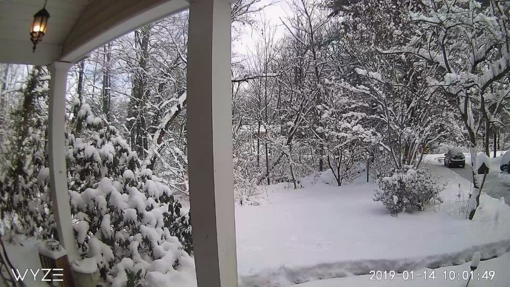
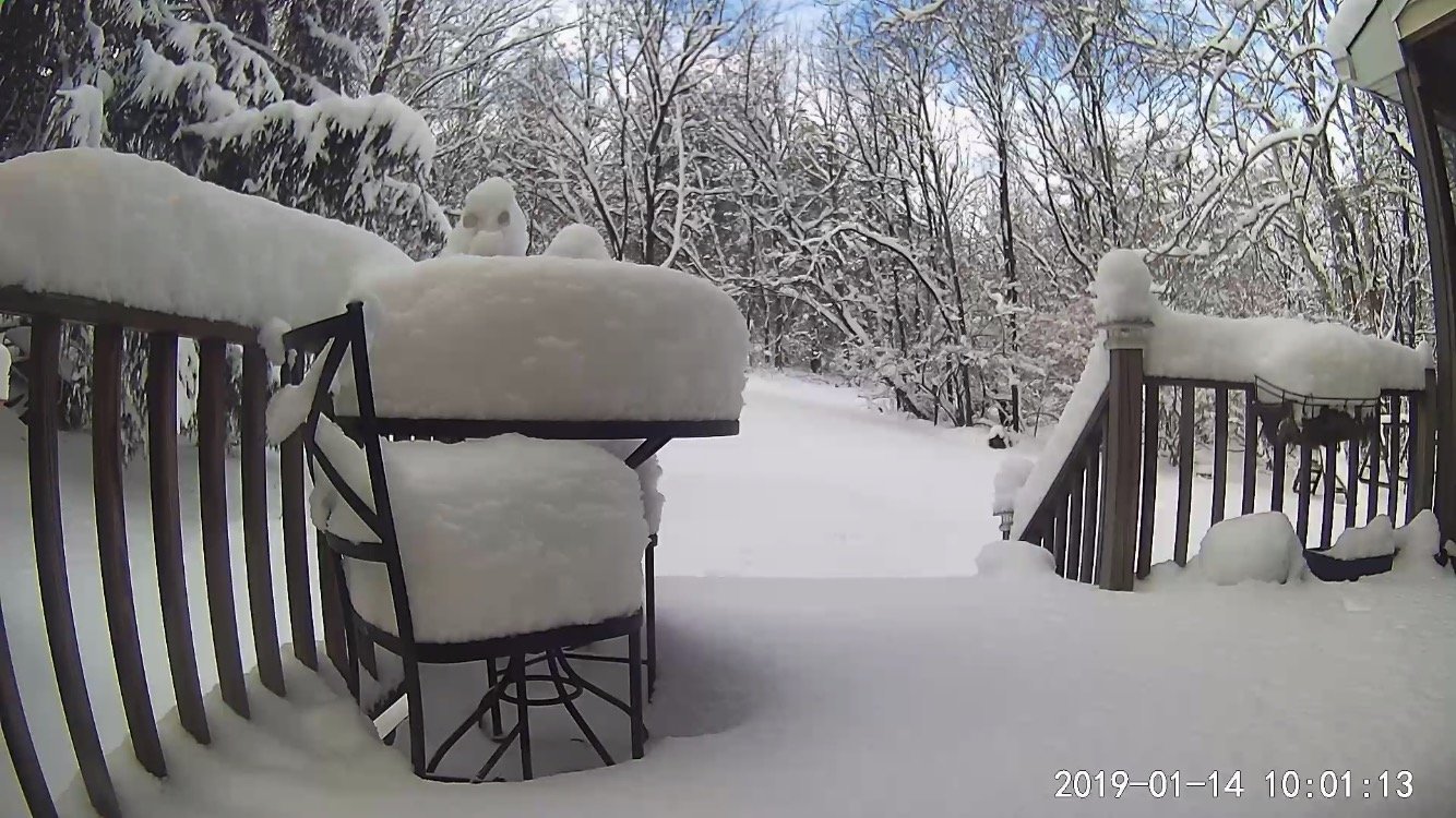
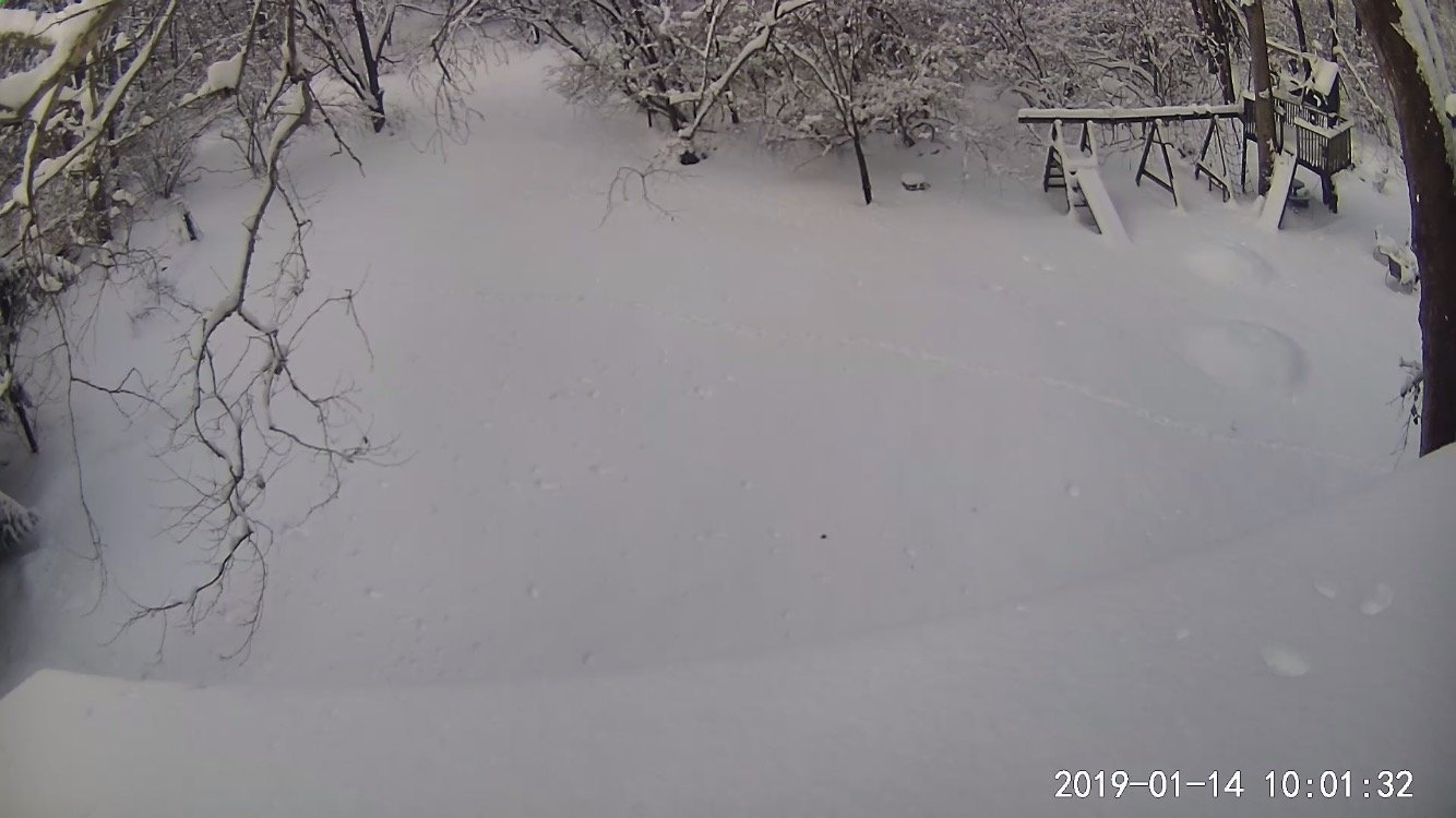
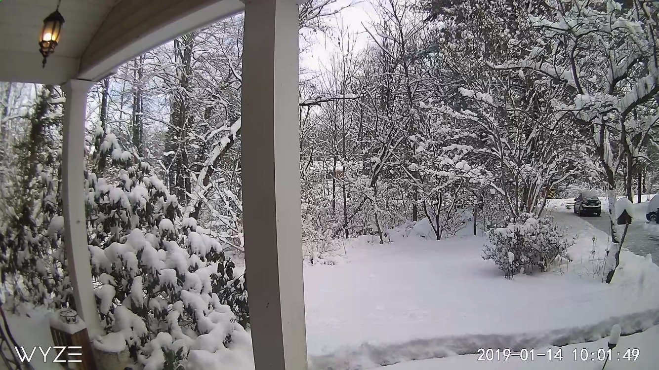
unfortunately no board to take good measurements with, but I did find somewhere between 5-6" for the first wave and 7+ inches just now with snow nearly stopped here in Gaithersburg (NE side, near Laytonsville). So, around a foot, probably with some compaction especially with wave 1. Sure was easy to shovel the 2nd wave, SO light and fluffy! Now will wait for my cul-de-sac to be plowed out...
-
1 minute ago, Bob Chill said:
What? They've been posting all day
I thought differently than Bob... I saw some nice big flakes this morning... but they were in a bowl, had corn in them and made by Kelloggs! #belongsinbanter
-
2 minutes ago, PhineasC said:
Worries of mixing down south is great news. Keep them coming!
Indeed! After all, they had their big snow back there in December... time for the northern/central areas of the forum to cash in big this time!
-
1
-
-
3 minutes ago, Eskimo Joe said:
LWX snow map gets updated at 3:30 pm I believe.
looks like they were updated within the last 1/2 hour (about when the watches/warnings/advisories were updated) by Sterling:
-
at least for me in central MoCo, the CMC more than doubled the snowfall (7", vs. 3") from its 0z run. Yes it's the Canadian, but we can hope...
-
kinda looks like the line weakened some as it got towards I-270, there were some lightning strikes down towards Lowes Island on the Va. side of the Potomac, but little after that. Also it's very fast moving and not "training" so it'll be a quick shot of heavy rain and then outta here.

August Discobs 2019
in Mid Atlantic
Posted
Yup, now central Moco under a flood warning. Soon we will be "flooded with warnings" (if we haven't been already)