mattskiva
-
Posts
498 -
Joined
-
Last visited
Content Type
Profiles
Blogs
Forums
American Weather
Media Demo
Store
Gallery
Everything posted by mattskiva
-
The models never show the mountain effects properly at this range - maybe not enough resolution? Any of the recent runs, with this track, are easily 20"+ in Garrett, probably more in Tucker.
-
I'm 30+ miles NW of DC - I would rather see a stronger coastal with mixing along 95 - pretty sure every really big storm we've had here had mixing near 95, while we remained all snow.
-
I hope we didn't bullseye too early. Def don't need a north trend here
-
The Euro (which has verified the most this year) is consistently showing a big hit, and even the GFS showed significant snow at 18z. What are you talking about?
-
This is probably the most consecutive big hits we have had in this time range since 2016, yes?
-
Still not a flake here in Loudoun, but a ton of mod-heavy sleet the last hour,
-
It's juicy with sleet, yeah. It's snowing to the southeast but this storm hates NoVA.
-
Mod to heavy sleet/rain mix, holding at 32.5F
-
How is it reportedly snowing in Bowie and a sleet-rain mix in Loudoun County? Pretty sure that has never happened before.
-
32.7F, moderate rain/sleet mix
-
It is funny - several different radars I have checked all show me well inside the blue, but it definitely ain't snow out there.
-
Frontend thump ... of rain mixed with sleet.
-
Sleetfest here in eastern Loudoun. Moderate rate now.
-
LOL at the Allegheny Plateau totals there
-
Mountain forecasting is hard, no matter where you are. The models generally don't account for upslope and local terrain effects well, and often underestimate precip and snow. I have spent a lot of time in mountains from Virginia to Maine and from Colorado to the Cascades, and the NWS zone forecasts are never very good. That said, NWS PIT handled this event well - they issued a WSW for Tucker yesterday for 5-9" and were right on the mark. Most people here probably know about it, but for those who don't, http://data.canaanmtnsnow.com/ is a great local resource for Davis/Canaan.
-
Yep. I drove out for the storm in Jan 2016, was there the first day skiing at Timberline in an absolute whiteout, snow continued overnight, and woke up to almost 30" total. I drove from the lodge at Canaan to Timberline the next morning with no problems whatsoever. Roads were completely plowed and easy 3-4 hours after a 30" storm. They know what they are doing.
-
December 16-17, 2020 Winter Storm Obs/Nowcasting
mattskiva replied to WxUSAF's topic in Mid Atlantic
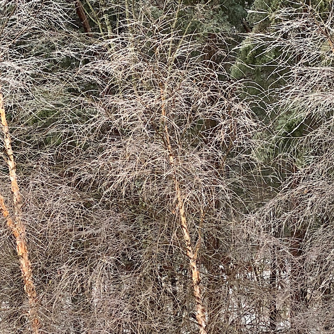
I was, actually, and I remember it well. We get some glaze on trees every year, but this is the most I have seen in 10 years in this location. It is hard to tell from the photo but it is well over a quarter inch on trees, mailbox, etc. -
December 16-17, 2020 Winter Storm Obs/Nowcasting
mattskiva replied to WxUSAF's topic in Mid Atlantic
3" here in eastern Loudoun followed by sleet, sone rain, then about 8 hours of freezing rain/drizzle resulting in 2 inches of compacted cement and this. To whoever said something yesterday about ice storms never verifying here...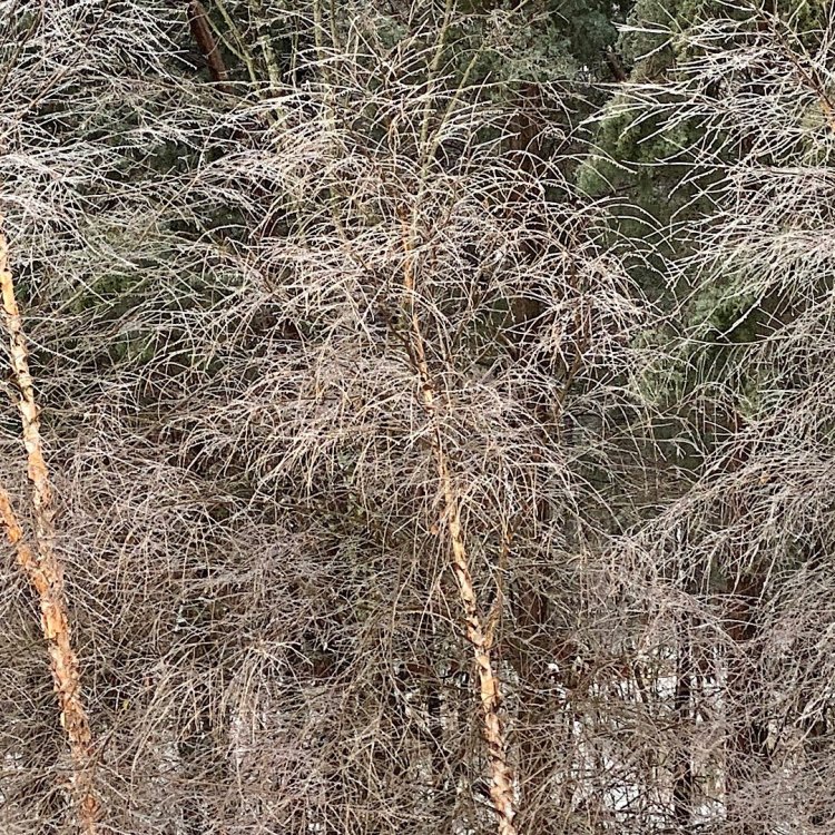
-
December 16-17, 2020 Winter Storm Obs/Nowcasting
mattskiva replied to WxUSAF's topic in Mid Atlantic
2.5" here but turned over to sleet. Heavy ZR for the last 15 minutes or so. Hoping it is a temporary change. -
December 16-17, 2020 Winter Storm Obs/Nowcasting
mattskiva replied to WxUSAF's topic in Mid Atlantic
Crazy big flakes here, must be 2" or more across. About 2.5" accumulation so far in Aldie -
December 16-17, 2020 Winter Storm Obs/Nowcasting
mattskiva replied to WxUSAF's topic in Mid Atlantic
I'm about 15mi due south of Leesburg - pouring fatties right now, hope we get in on the fun here too -
December 16-17, 2020 Winter Storm Obs/Nowcasting
mattskiva replied to WxUSAF's topic in Mid Atlantic
SN/+SN now in Aldie, VA. Grass and elevated surfaces have caved. -
December 16-17, 2020 Winter Storm Obs/Nowcasting
mattskiva replied to WxUSAF's topic in Mid Atlantic
Snow picking up here in eastern Loudoun. Roofs and sidewalks accumulating. -SN/SN -
December 16-17, 2020 Winter Storm Obs/Nowcasting
mattskiva replied to WxUSAF's topic in Mid Atlantic
30/25 and -SN in Aldie, VA. Family in Charlottesville reporting heavy IP/ZR -
December 16-17, 2020 Winter Storm Obs/Nowcasting
mattskiva replied to WxUSAF's topic in Mid Atlantic
I've never seen it this bad in the decade or so I've been here. Not sure why mods aren't stepping in in some of these posters who just keep posting the same stuff over and over. The model thread yesterday was a joke.