CoastalWx
-
Posts
176,166 -
Joined
-
Last visited
Content Type
Profiles
Blogs
Forums
American Weather
Media Demo
Store
Gallery
Everything posted by CoastalWx
-
Maybe he meant the ones last week?
-
MJO has been propagating, but the colder phases have been associated with our warmer interludes. P 3-4-5 has been more on the colder side.
-
I saw that. I remember when that happened too. And yeah, those kids and the coaches. Incredible.
-
EPS would work, but already a red flag with the GEFS look.
-
GEFs suck.
-
Gfs trying for rain to snow Friday
-
50/50 low gone wild on EPS. Would be nice to get that.
-
I’m ready to sacrifice right now.
-
I mean it’s certainly warm, but this pattern would suck in 1620 as well. You can debate if the marginal events would produce, but a low tracking over Buffalo has been rain since the dawn of time.
-
Check those guys out. https://www.facebook.com/UCB.CSSL?mibextid=LQQJ4d
-
Talk about a cool place to work. Not sure if anybody follows them, but those guys get to weenie out and do all bunch of stuff, but for science.
-
And to clarify, they are 110% for the year!! Not just up to now. They said that typically happens in late March.
-
Yeah that will change after the snow melts. The central Sierra snow lab is already 110% of SWE climo.
-
Man this just gave me movement. Juicy srn system with my high moving in.
-
It’s not CC lol.
-
But that also is not true.
-
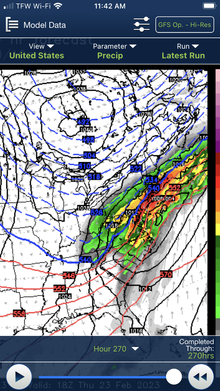
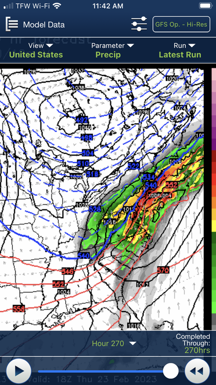
Just an example and I know it’s a snap shot but I’ve seen this all winter. Despite colder thicknesses, same look. High to the south and low in the plains. Verbatim probably snow to mix, but this period is one to watch if we are to try and enter something wintry or just same stuff over and over. Can we try and break the spell and somehow have this favorable or will it trend to a cutter?

-
We all see it. We’ve been seeing colder 11-15 days for weeks on models. But how or will it change? So roll that forward until it’s a week out and we’ll talk. The pacific isn’t changing.
-
There’s evidence for a couple of weeks that March could produce. My point is that I want to see those changes roll forward and not get pushed back. Models sometime rush changes because of those CCKWs. Sometimes the overriding background of whatever is happening in the tropics causes those changes to never occur. So my comments are not just emotions like some have here, my point is based on science too. Hopefully those changes on the Atlantic side come to fruition.
-
GEFs weeklies looked lousy. Euro weeklies looked nice.
-
I also don’t see March 2012. That’s not happening.
-
I see the same thing that you see. I also see the same persistence and model fantasy that we’ve seen for weeks. So until whatever changes are modeled two weeks out come into the 7 day period, I have my reservations.
-
These aren’t chickadees or cardinals which hang around. I was shocked the other morning when I heard them near dawn. I actually went out and bought some more seed thinking whatever is here, is early so they’ll need some food. Not sure what type though.
-
You’re missing my point. Pacific continues to reload into the west. Until we see any help in the Atlantic side into Canada continue to be modeled for days on end, that won’t change. I’m sure it will cool off late month into March, but that’s when you’ll start needing some help if we want to make any run on winter.
-
Dude I have song birds out like it’s April.