

CoastalWx
-
Posts
177,325 -
Joined
-
Last visited
Content Type
Profiles
Blogs
Forums
American Weather
Media Demo
Store
Gallery
Everything posted by CoastalWx
-
The thought did cross my mind.
-
Did your neighbors or the previous owners have any pics of winter up there? Just curious.
-
Anybody who knows that area knows how well they do. Just a wee bit more patience that's all.
-
Wow. We take.
-
Phin Piggy Pile.
-
That hasn't changed luckily.
-
57 here and decreasing steadily now. Windy too. We CAA.
-
Anger
-
-
-
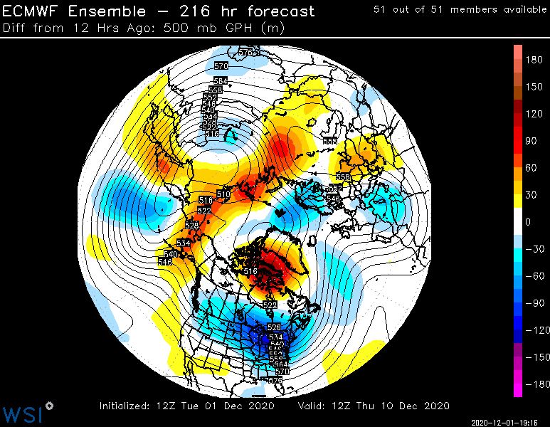
It does seem like the storm has brought some ridging into the NAO region of the Davis Straits based on height changes, so that's good.
-
LL is very concerned for Kevin.
-
He got excommunicated.
-
Yep for sure.
-
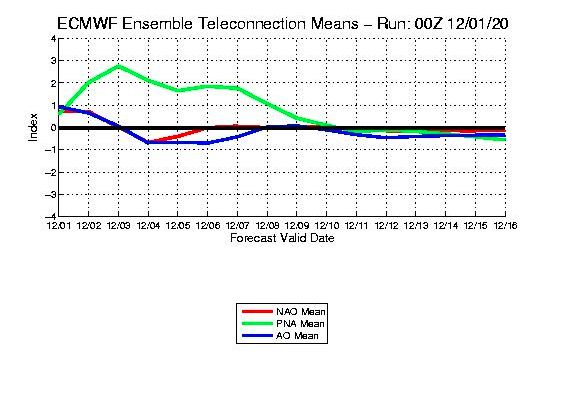
Well as some surmised, EPS is not amped like the op. Not good for SNE, but would help prevent our fellow NNErs from cliff diving.
-
As soon as the DIT oscillation went positive for winter, this happened. Need a negative DIT.
-
For these parts, everything was garbage no mater the track really. We second week.
-
Shut em down.
-
Throw another 1-3" of rain there.
-
-
BGM blaster. At least the meth labs in the srn tier are snow covered.
-
Rains to Randolph.
-
3.5 days out, and it's made changes like it's the JMA.
-
Looks like wherever it tracks, will be a biggie.
-
Euro op is going to inject more srn stream energy. Shocker.


