CoastalWx
-
Posts
176,938 -
Joined
-
Last visited
Content Type
Profiles
Blogs
Forums
American Weather
Media Demo
Store
Gallery
Everything posted by CoastalWx
-
Hopefully this pattern suppresses NNE since he clearly does not need or want the snow.
-
How was skiing today? Go out in the local pond? Hope you got to enjoy this deep winter day in the hills.
-
Did you not understand what I was trying to convey?
-
Unless your hands feel like two balloons, I'll welcome it when there is no snow.
-
12z Canadian shows why you want a block. Check out the S/W in the Plains at hr 198. At first you think cutter, but watch it get shunted south.
-
Nice and sunny. GWDLT.
-
I keep wondering why everyone is talking clouds until I look at satellite. Sunny and Stein here.
-
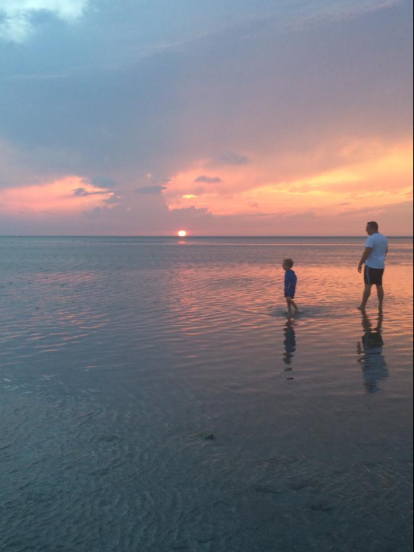
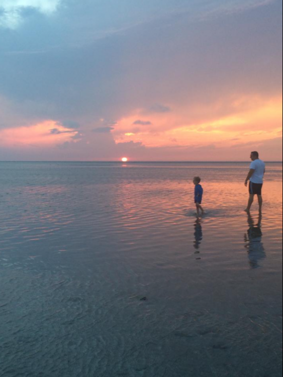
The thing I love about the outer Cape, is how warm the water is on the bayside. From about Brewster (perhaps just west of there too) to Wellfleet has some of the warmest near shore water you can imagine. It's so shallow there, so it bakes in the sun. Plus there are tons of little lazy river features where you can plop your float in one of the marsh rivers and gently flow in and out depending on the tide. You have the amazing bike trails too for biking, running etc. Lots of various outdoor activities other than the beach and obviously the seafood. Epic sunsets there. It took me until 2016 to appreciate this. This was back in 2016. Just incredible sunsets and to me, something so close that seems so far.
-
A lot of fentanyl being shipped from Moosup, CT.
-
I feel like you'll get cold. Be careful what you wish for....it gets freaking cold up there..lol. I was up there cross country skiing in 1994 when it was like -35F at night. At some point, the cold becomes stupid.
-
LOL you'll be fine I think. I could see a good Feb and Mar there.
-
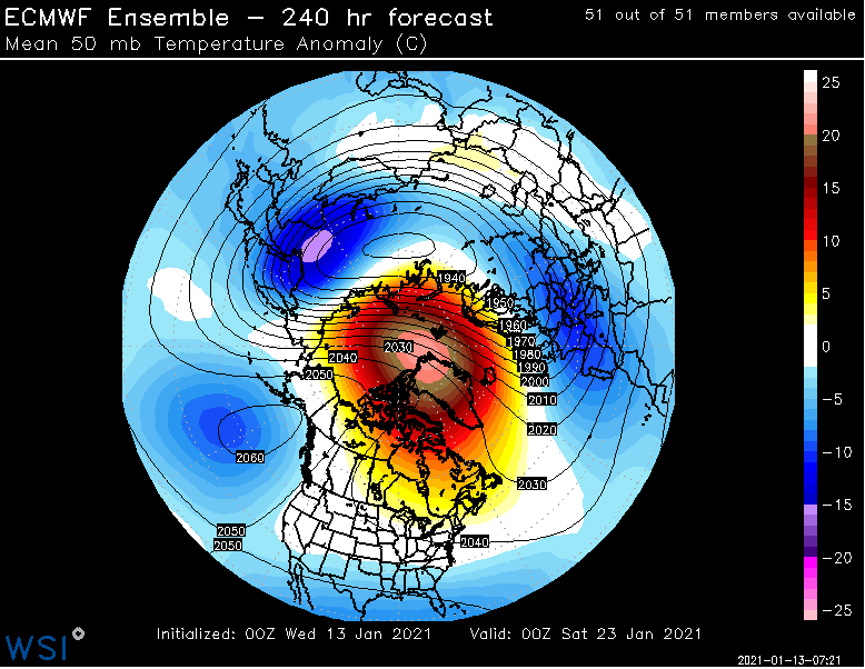
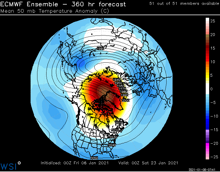
For example. You can see the current day 10 image from what the forecast was 5 days ago.
-
Yeah I think we were saying mid month when the Pacific gets better and overall better airmass, but we did have some chances on guidance before that. Some of the srn storms were brought up here on the models, but alas to no avail.
-
Warmest and least snowiest on record for Randolph from May '20 to May '21?
-
The other thing that makes me hopeful for the first half of Feb, is the tendency for models to break down the warming at 50mb. I'm comparing EPS forecasts and they overall are showing the tendency for this warm node to be broken down too quickly. IOW, I would think an overall -AO or -NAO regime probably persists a little longer than the weeklies show. The fact that guidance sort of latches on to another -NAO by the Davis Straits might be a sign of that.
-
Could see an uplsope component too on the E and SE slopes locally cooling it there for a time.
-
What about 36F rain?
-
That depiction as shown looks awfully optimistic.
-
Well GFS op runs show you what can go right anyways.
-
Ha, GFS is east with most of the precip Saturday. Nice agreement.
-
Hope that is not the euro.
-
LOL, JMHO, but I feel like 1st half of Feb may not be so bad as some seem to imply. Who knows though, this whole season has been strange.
-
It's not ending late Jan. If anything the rush to a more Nina Feb is just that...rushed.
-
Well we definitely know this is porn to Steve. Only to Steve would water vapor imagery of a 500mb low going over Nova Scotia, be akin to scoring with 1995 Carmen Electra.
-
Yeah. Don’t let the fake facade of bread and butter, wintry appeal etc. fool you. He’s at the verge of breaking down. He’s at the point of staring out the slider and watching the backyard creek ice up. Hate to see it.