CoastalWx
-
Posts
176,996 -
Joined
-
Last visited
Content Type
Profiles
Blogs
Forums
American Weather
Media Demo
Store
Gallery
Everything posted by CoastalWx
-
Yeah not bad. Some members showing this. Maybe something to watch.
-
Oh oh. Here comes euro for Monday.
-
I explained why a bit further back yesterday morning. I think maybe some of that ridging was a bit of voodoo in the PNA area, but anyways, I think it gets better after that.
-
It's poop until after first week of December.
-
December 2021 Obs/Disco...Dreaming of a White-Weenie Xmas
CoastalWx replied to 40/70 Benchmark's topic in New England
The GEFs and EPS I thought looked decent. They try for a little ridge bridging and keep the PV on our side. That’s a good thing. If anything the dateline ridge signal has gotten stronger. Again look beyond first week of December. That week is gone.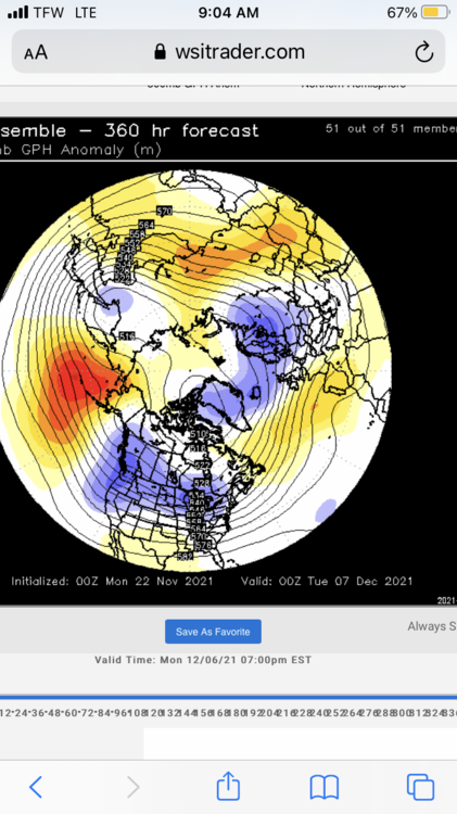
-
Finally
-
It looked like there was a lowering of CC that was just NW of rotation, but followed it. It didn’t look quite close enough to the rotation, but that also was looking at my phone. Maybe someone else with GR can look.
-
Mom’s spaghetti?
-
Bags and bags of leaves today.
-
I don’t know why, but I can’t stop laughing at an image of Ginxy in my head just gyrating and swinging is booty to that song. Just picture him with a broom swinging around the bucket and pretending the broom is a stripper pole.
-
LOL. In case you all didn’t know, myself, NHdryslot (red tag him) and Wx2fish all worked together. We’re all good friends and big weenies. And good at giving each other crap. NHdryslot loves it when I rain, so he and @40/70 Benchmark will have fun pig pilling on me.
-
We have a new weenie, I mean met. @NHDrySlot might be a little bashful, but one of the top mets I know. Welcome to the jungle. We’ve got fun and games.
-
2pm Saturday, 11/20 @ Funky Murphy's ORH
CoastalWx replied to 40/70 Benchmark's topic in New England
What a bunch of creeps. -
That might be the closest to fruition lol. We’ve been rocked by decent storms in October. tober
-
Yep. Canes in the summer, blizzards in winter. All at day 15+.
-
Yeah I mean I look ahead, but 10 years ago I was all into what the indices mean, mtn torque, GLAAM.....all that voodoo.
-
Or I could be totally wrong lol. I don’t really get into the long range voodoo much anymore. Just care more about the here and now.
-
2pm Saturday, 11/20 @ Funky Murphy's ORH
CoastalWx replied to 40/70 Benchmark's topic in New England
Looked like fun. Hopefully will make the next one. -
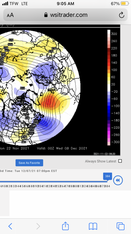
Here is an example. This is current day 10 prog vs day 15 valid for December 1. It’s not totally far off, but look how potent the trough is near AK and into GOAK. It’s a bit further east too. Yeah day 10 looks chilly, but that’s about to be booted out of here right after day 10. To me the current prog looks more realistic for that timeframe. I do think it changes after first week.
-
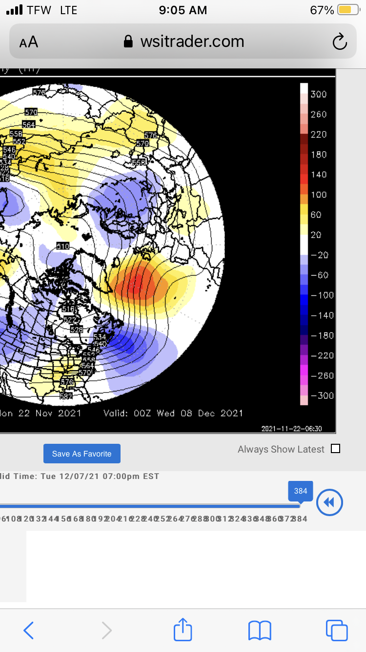
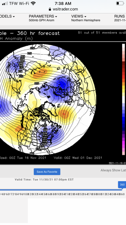
It’s keeping the low around the AK area more persistent. Probably due to Pacific reshuffle and in tandem with Nina base state. So in other words, there probably wasn’t much going for some of those model solutions of western NAMR ridging being persistent? That’s my guess. There is a lot of volatility in the pattern. For instance guidance looks much better in the Pacific compared to yesterday, but now more of a positive NAO. I just think we are seeing things shuffle around and people are just going to have to be patient. It’s going to be awhile for snow chances outside of maybe NNE.
-
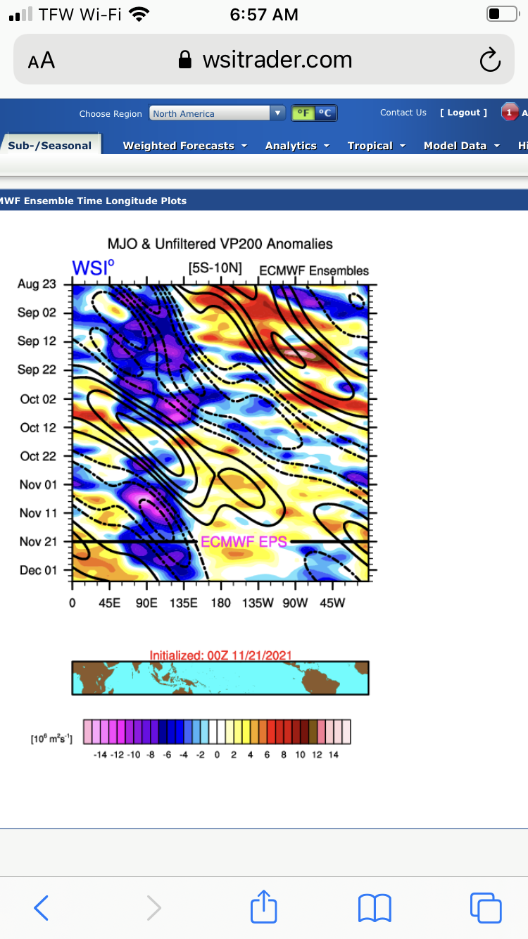
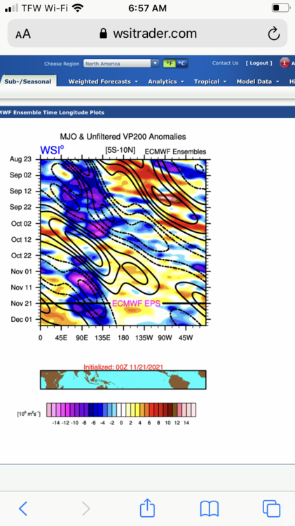
One thing I noticed this morning is that the tropical convection forecast on the EPS does finally try to nudge east. I think some of those PNA forecasts going boom was due to convection more closer to Nina climo. The nudge east supports more of a dateline ridge probably after first week of December. EPS tries to show that. In that graphic below, look how far west the convection is. That’s probably not supportive of a -EPO to +PNA ridge for more than a few transient days despite what the models showed last week and the week before. But, it finally shows signs of moving east which supports more dateline ridging. Now to make sure we are on the good side of the gradient.
-
How many deep?
-
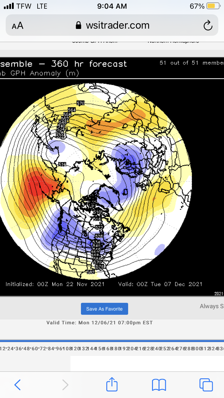
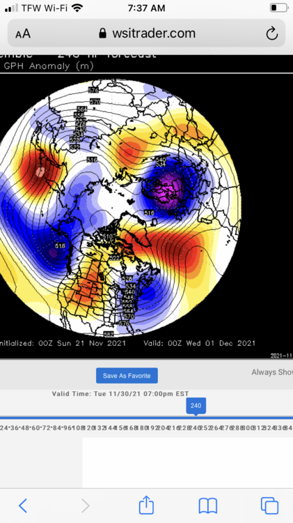
It’s not terrible, but a change for a few days as mentioned earlier in here. Looks more nina like with dateline Ridging at the end.
-
Man EPS lost that EPO ridge. What a change in two days. Hit the snooze button for awhile.
-
2pm Saturday, 11/20 @ Funky Murphy's ORH
CoastalWx replied to 40/70 Benchmark's topic in New England
You’re not even married yet. Don’t be a puss.