CoastalWx
-
Posts
177,020 -
Joined
-
Last visited
Content Type
Profiles
Blogs
Forums
American Weather
Media Demo
Store
Gallery
Everything posted by CoastalWx
-
December 2021 Obs/Disco...Dreaming of a White-Weenie Xmas
CoastalWx replied to 40/70 Benchmark's topic in New England
I like the Euro 20C at 850 near Chicago next week. WTF. -
December 2021 Obs/Disco...Dreaming of a White-Weenie Xmas
CoastalWx replied to 40/70 Benchmark's topic in New England
Yeah I noticed that too. Th GEFS look much more interesting the week prior to Christmas vs EPS. -
December 2021 Obs/Disco...Dreaming of a White-Weenie Xmas
CoastalWx replied to 40/70 Benchmark's topic in New England
That would be great here too. -
December 2021 Obs/Disco...Dreaming of a White-Weenie Xmas
CoastalWx replied to 40/70 Benchmark's topic in New England
Yeah I could see Atlantic city and srn NJ area as the Mid Atlantic if you want to divide NJ....but how they NY end up on that one? -
December 2021 Obs/Disco...Dreaming of a White-Weenie Xmas
CoastalWx replied to 40/70 Benchmark's topic in New England
I'm going down to the Mid Atlantic to visit Lake Placid. -
December 2021 Obs/Disco...Dreaming of a White-Weenie Xmas
CoastalWx replied to 40/70 Benchmark's topic in New England
I consider NJ more the northeast from a geo point of view. -
December 2021 Obs/Disco...Dreaming of a White-Weenie Xmas
CoastalWx replied to 40/70 Benchmark's topic in New England
What? LOL. Who made the map. Tossed. -
Wednesday 12/8 Possible Snow/Ice/Rain? Discussion
CoastalWx replied to Torch Tiger's topic in New England
LOL, same. Both out at first only in PJs trying to shovel and throw snow balls. I'm sure the neighbors were thrilled with me telling them in a rather loud voice to come back in and put coats on. -
Wednesday 12/8 Possible Snow/Ice/Rain? Discussion
CoastalWx replied to Torch Tiger's topic in New England
After midnight. Band rolled through. It briefly got heavy here at 2:40am. -
December 2021 Obs/Disco...Dreaming of a White-Weenie Xmas
CoastalWx replied to 40/70 Benchmark's topic in New England
I think post Christmas has a much better shot of winter weather. For SNE anyways. -
December 2021 Obs/Disco...Dreaming of a White-Weenie Xmas
CoastalWx replied to 40/70 Benchmark's topic in New England
The EPO ridge is great. The problem is that it has a EP Oh-no look too with a massive -PNA. Maybe we can hope that if we do get storms trying to run west, it's a mix bag or better yet...SWFE. But it is also a cutter risk. -
December 2021 Obs/Disco...Dreaming of a White-Weenie Xmas
CoastalWx replied to 40/70 Benchmark's topic in New England
It could. I'd rather the GEFS look, especially 6z. -
December 2021 Obs/Disco...Dreaming of a White-Weenie Xmas
CoastalWx replied to 40/70 Benchmark's topic in New England
It’s still dicey to me. Better than the week prior, but I’d like to see more improvement. I’m not looking for a classic look either. -
December 2021 Obs/Disco...Dreaming of a White-Weenie Xmas
CoastalWx replied to 40/70 Benchmark's topic in New England
How about the 500 anomalies instead of a chart. -
December 2021 Obs/Disco...Dreaming of a White-Weenie Xmas
CoastalWx replied to 40/70 Benchmark's topic in New England
Might be a brief spike after fropa? The LLJ ahead of it is stronger than last time. -
December 2021 Obs/Disco...Dreaming of a White-Weenie Xmas
CoastalWx replied to 40/70 Benchmark's topic in New England
Just like last time? -
December 2021 Obs/Disco...Dreaming of a White-Weenie Xmas
CoastalWx replied to 40/70 Benchmark's topic in New England
Yeah still dicey into Christmas on the EPS. -
Wednesday 12/8 Possible Snow/Ice/Rain? Discussion
CoastalWx replied to Torch Tiger's topic in New England
23 for low. Coldest yet which is lame. -
Wednesday 12/8 Possible Snow/Ice/Rain? Discussion
CoastalWx replied to Torch Tiger's topic in New England

-
Wednesday 12/8 Possible Snow/Ice/Rain? Discussion
CoastalWx replied to Torch Tiger's topic in New England
Kids outside playing in it and waking neighbors up. -
Wednesday 12/8 Possible Snow/Ice/Rain? Discussion
CoastalWx replied to Torch Tiger's topic in New England
You hate to see it. -
Wednesday 12/8 Possible Snow/Ice/Rain? Discussion
CoastalWx replied to Torch Tiger's topic in New England
3/4” -
Wednesday 12/8 Possible Snow/Ice/Rain? Discussion
CoastalWx replied to Torch Tiger's topic in New England
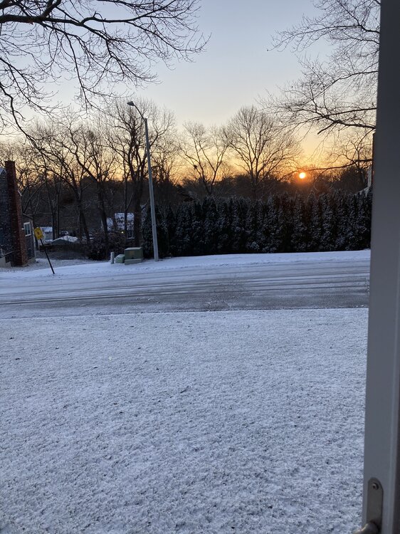
Looks pretty out. All a dream soon. -
Wednesday 12/8 Possible Snow/Ice/Rain? Discussion
CoastalWx replied to Torch Tiger's topic in New England
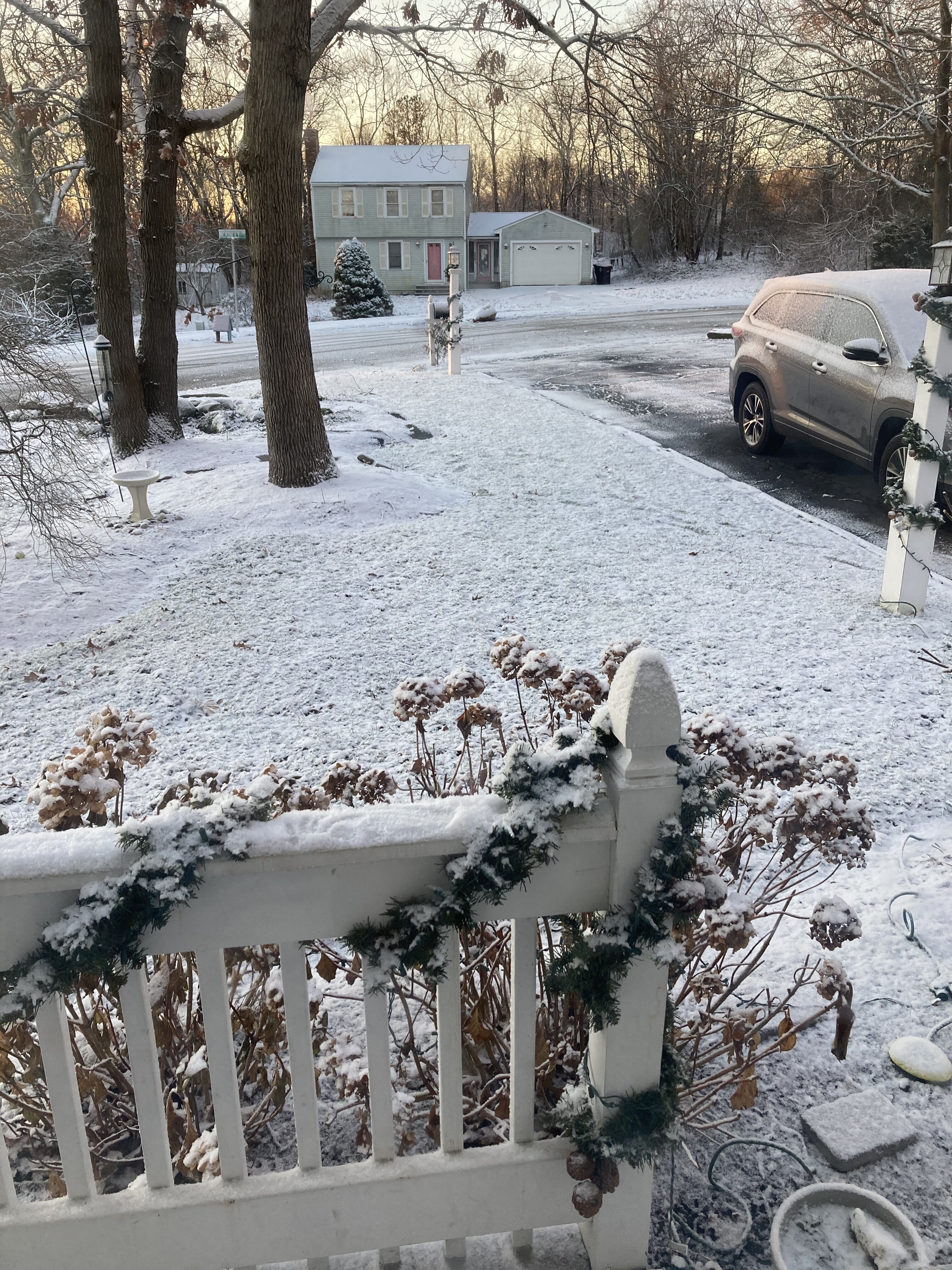
Woke up to a heavy burst. Under an inch but looks pretty. Maybe 0.7” or so. -
Wednesday 12/8 Possible Snow/Ice/Rain? Discussion
CoastalWx replied to Torch Tiger's topic in New England
Dry air ftl. You may coat as this final stuff moves in.