

CoastalWx
-
Posts
176,078 -
Joined
-
Last visited
Content Type
Profiles
Blogs
Forums
American Weather
Media Demo
Store
Gallery
Everything posted by CoastalWx
-
March 12 Rain to…more rain? Maybe some snow
CoastalWx replied to HoarfrostHubb's topic in New England
I like the weenie band on the Cape on the NAM. LOL. -
March 12 Rain to…more rain? Maybe some snow
CoastalWx replied to HoarfrostHubb's topic in New England
I'll just continue to be negative since it works. -
March 12 Rain to…more rain? Maybe some snow
CoastalWx replied to HoarfrostHubb's topic in New England
3K is very violent. -
March 12 Rain to…more rain? Maybe some snow
CoastalWx replied to HoarfrostHubb's topic in New England
HA, we all change over. -
March 12 Rain to…more rain? Maybe some snow
CoastalWx replied to HoarfrostHubb's topic in New England
NAM likes you. -
March 12 Rain to…more rain? Maybe some snow
CoastalWx replied to HoarfrostHubb's topic in New England
NAM is gonna be violent. -
March 12 Rain to…more rain? Maybe some snow
CoastalWx replied to HoarfrostHubb's topic in New England
Kind of cool to see the Deep South getting snow. Somewhere down there Winter Wolf's relatives are saying it's not over. -
March 12 Rain to…more rain? Maybe some snow
CoastalWx replied to HoarfrostHubb's topic in New England
12z NAM looks flatter too. -
March 12 Rain to…more rain? Maybe some snow
CoastalWx replied to HoarfrostHubb's topic in New England
Metfan Blutarski? -
March 12 Rain to…more rain? Maybe some snow
CoastalWx replied to HoarfrostHubb's topic in New England
Sure maybe we get a couple inches here or there but for the most part it’s over that’s what I mean. I’m sure they’ll be a rogue storm that melts in a day and people will be like see it’s not over! -
March 12 Rain to…more rain? Maybe some snow
CoastalWx replied to HoarfrostHubb's topic in New England
It probably is over for most. -
March 9: Little Critter that could part 2.
CoastalWx replied to Sey-Mour Snow's topic in New England
And now chunks of snow raining down. Watch your heads lol. -
March 12 Rain to…more rain? Maybe some snow
CoastalWx replied to HoarfrostHubb's topic in New England
Ahh the SREFs. -
March 9: Little Critter that could part 2.
CoastalWx replied to Sey-Mour Snow's topic in New England
I missed the sunrise at the gym, but had that epic orange glow before it came up.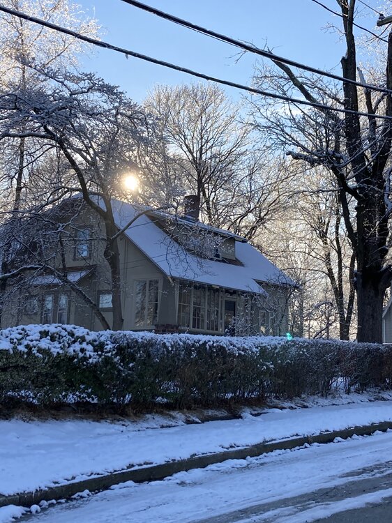
-
March 12 Rain to…more rain? Maybe some snow
CoastalWx replied to HoarfrostHubb's topic in New England
Ukie and Canadian still kind of amped. I could see that sharpening up more too. We'll see what 12z says. -
March 12 Rain to…more rain? Maybe some snow
CoastalWx replied to HoarfrostHubb's topic in New England
Just saw. Hmm. -
March 12 Rain to…more rain? Maybe some snow
CoastalWx replied to HoarfrostHubb's topic in New England
I guess we can let you have some fun now that the season is over. -
March 12 Rain to…more rain? Maybe some snow
CoastalWx replied to HoarfrostHubb's topic in New England
Snooze fest except for Vermont over to northern New Hampshire northern Maine. -
March 9: Little Critter that could part 2.
CoastalWx replied to Sey-Mour Snow's topic in New England
Beautiful morning but we icy. -
March 12 Rain to…more rain? Maybe some snow
CoastalWx replied to HoarfrostHubb's topic in New England
It’s over . -
March 9: Little Critter that could part 2.
CoastalWx replied to Sey-Mour Snow's topic in New England
Grass is 2.7”. -
March 9: Little Critter that could part 2.
CoastalWx replied to Sey-Mour Snow's topic in New England
2.2” -
March 9: Little Critter that could part 2.
CoastalWx replied to Sey-Mour Snow's topic in New England
Coming from someone who does not know where I Live. -
March 9: Little Critter that could part 2.
CoastalWx replied to Sey-Mour Snow's topic in New England
We’ll probably less but..... -
March 9: Little Critter that could part 2.
CoastalWx replied to Sey-Mour Snow's topic in New England
WTTTE


