CoastalWx
-
Posts
176,083 -
Joined
-
Last visited
Content Type
Profiles
Blogs
Forums
American Weather
Media Demo
Store
Gallery
Everything posted by CoastalWx
-
Talk about a toss lol.
-
Actually that late Jan storm sort of reminded me of the Feb 06 storm in that we didn’t quite have the CCB. It was a lot of mid level magic, but east of that slotted pretty good. The classic ones like Feb 2013 and Jan 2015 had great CCB action east of the mid level goodies. That’s why you had widespread 24-36+”.
-
That was gone two days ago.
-
Next week 80s to near 90 later in week with dews.
-
And fireworks
-
Booby lows probably not due to Nina. Hell sometimes getting a coastal In Nina is tough, so chalk it up to nuances in the flow.
-
Fireworks rule
-
It cooled off to upper 70s late aftn. Beautiful aftn and evening.
-
Dews way down.
-
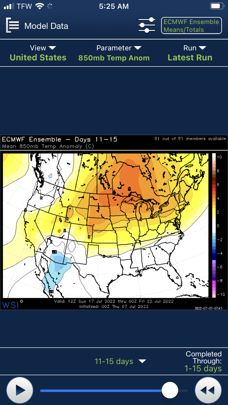
Long term finally shows signs of some change. It’s not a big heat pattern, but mean trough sets up over the Great Lakes on EPS. So that means deep srly flow, but also some shwrs/storms chances. Definitely a dewy look after day 7.
-
I was mowing quite a bit but not much since Fathers Day. I’ve been a little too far north of the good stuff and Bob south of it.
-
Friday went as well.
-
Steiner here. At least I don’t have to mow.
-
Haven’t mowed in 3 weeks.
-
Lawns be burning for sure.
-
Lame
-
Chances for more this aftn
-
LOL Looks like they just missed us.
-
Another big boy by Cohasset.
-
Nasty storms in SE Ma.
-
What 70 dews lol.
-
I think upper 60s near 70 maybe? Way cooler than even last year with all that rain.
-
It’s great for hiking. Meh for swimming.
-
Yeah I wish it was warmer lol. But helping my folks out with some work and built up a sweat to take a dip. These lake temps remind me of yore.